|
River Harbourne
The Harbourne River is a river in Devon in England. Its estuary is known as Bow Creek, and flows into the River Dart near Stoke Gabriel. The river rises on the slopes of Gripper's Hill on Dean Moor on Dartmoor. From the source it flows generally south east, under the A38 road, to the village of Harberton. There it turns south, then east through Harbertonford to the hamlet of Bow near Ashprington. Below Bow the river is tidal, and becomes Bow Creek. Two miles below Bow, the estuary joins the Dart. The hamlet of Tuckenhay lies on the south bank of Bow Creek. There was a history of milling on the river. From the late 18th century there was a woollen mill at Harbertonford, fed by a leat A leat (; also lete or leet, or millstream) is the name, common in the south and west of England and in Wales, for an artificial watercourse or aqueduct dug into the ground, especially one supplying water to a watermill or its mill pond. Othe ... from a weir upstream of the village. Un ... [...More Info...] [...Related Items...] OR: [Wikipedia] [Google] [Baidu] |
England
England is a country that is part of the United Kingdom. It shares land borders with Wales to its west and Scotland to its north. The Irish Sea lies northwest and the Celtic Sea to the southwest. It is separated from continental Europe by the North Sea to the east and the English Channel to the south. The country covers five-eighths of the island of Great Britain, which lies in the North Atlantic, and includes over 100 smaller islands, such as the Isles of Scilly and the Isle of Wight. The area now called England was first inhabited by modern humans during the Upper Paleolithic period, but takes its name from the Angles, a Germanic tribe deriving its name from the Anglia peninsula, who settled during the 5th and 6th centuries. England became a unified state in the 10th century and has had a significant cultural and legal impact on the wider world since the Age of Discovery, which began during the 15th century. The English language, the Anglican Church, and Engli ... [...More Info...] [...Related Items...] OR: [Wikipedia] [Google] [Baidu] |
Devon
Devon ( , historically known as Devonshire , ) is a ceremonial and non-metropolitan county in South West England. The most populous settlement in Devon is the city of Plymouth, followed by Devon's county town, the city of Exeter. Devon is a coastal county with cliffs and sandy beaches. Home to the largest open space in southern England, Dartmoor (), the county is predominately rural and has a relatively low population density for an English county. The county is bordered by Somerset to the north east, Dorset to the east, and Cornwall to the west. The county is split into the non-metropolitan districts of East Devon, Mid Devon, North Devon, South Hams, Teignbridge, Torridge, West Devon, Exeter, and the unitary authority areas of Plymouth, and Torbay. Combined as a ceremonial county, Devon's area is and its population is about 1.2 million. Devon derives its name from Dumnonia (the shift from ''m'' to ''v'' is a typical Celtic consonant shift). During the Briti ... [...More Info...] [...Related Items...] OR: [Wikipedia] [Google] [Baidu] |
River Dart
The River Dart is a river in Devon, England, that rises high on Dartmoor and flows for to the sea at Dartmouth. Name Most hydronyms in England derive from the Brythonic language (from which the river's subsequent names ultimately derive from an original Celtic etymology. As the lower stretches of the river are still covered in ancient oak woodlands, it is accepted that the first element derives from *Dar-, meaning oak (derow'', Welsh ''derw''). However the second element (evident in the hard consonantal termination of ''Dar-t'') is less certain, with postulated etymologies from ''Darwent'' / ''Derventio'' (Sacred place of Oak) or ''Darnant'' / ''Darant'' (Oak stream). The Ravenna Cosmography records a number of Latinised names for the area, ''Devionisso Statio'' and ''Deventiasteno'' may represent corrupted doublets of a ''Statio'' (Station) on a river named ''Derventio''. Although the name ''Derventio'' is otherwise unattested for the river, it is an established etymology ... [...More Info...] [...Related Items...] OR: [Wikipedia] [Google] [Baidu] |
Stoke Gabriel
Stoke Gabriel is a village and parish in Devon, England, situated on a creek of the River Dart. The village is a popular tourist destination in the South Hams and is famous for its mill pond and crab fishing (known colloquially as ''crabbing''). It is equidistant from Paignton, Dartmouth and Totnes, and has a population of approximately 1,200, reducing slightly to 1,107 at the 2011 census, of which, uniquely, The village is the major part of the electoral ward of East Dart. The ward population at the abovementioned census was 1,877. Fisherman probably first came to Stoke Gabriel to fish salmon and gain access to the River Dart. The village has an approximately 1,000-year-old yew tree in the churchyard of The Church of St Mary and St Gabriel, a church which has stood since Norman times. Legend has it that if you walk backwards seven times round the yew's main stem you will be granted a wish. Stoke Gabriel was the birthplace of the Great Western Railway's Chief Mechanical ... [...More Info...] [...Related Items...] OR: [Wikipedia] [Google] [Baidu] |
Dartmoor
Dartmoor is an upland area in southern Devon, England. The moorland and surrounding land has been protected by National Park status since 1951. Dartmoor National Park covers . The granite which forms the uplands dates from the Carboniferous Period of geological history. The landscape consists of moorland capped with many exposed granite hilltops known as tors, providing habitats for Dartmoor wildlife. The highest point is High Willhays, above sea level. The entire area is rich in antiquities and archaeology. Dartmoor National Park is managed by the Dartmoor National Park Authority, whose 22 members are drawn from Devon County Council, local district councils and Government. Parts of Dartmoor have been used as military firing ranges for over 200 years. The public is granted extensive land access rights on Dartmoor (including restricted access to the firing ranges) and it is a popular tourist destination. Physical geography Geology Dartmoor includes the largest area of ... [...More Info...] [...Related Items...] OR: [Wikipedia] [Google] [Baidu] |
A38 Road
The A38, parts of which are known as Devon Expressway, Bristol Road and Gloucester Road, Bristol, Gloucester Road, is a major A-class trunk road in England. The road runs from Bodmin in Cornwall to Mansfield in Nottinghamshire. It is long, making it the longest two-digit A road in England. It was formerly known as the ''Leeds–Exeter Trunk Road'', when this description also included the A61 road (Great Britain), A61. Before the opening of the M5 motorway in the 1960s and 1970s, the A38 formed the main "holiday route" from the Midlands to Somerset, Devon and Cornwall. Considerable lengths of the road in the West Midlands (region), West Midlands closely follow Roman roads, including part of Icknield Street. Between Worcester, England, Worcester and Birmingham the current A38 follows the line of a Saxon salt road; For most of the length of the M5 motorway, the A38 road runs alongside it as a single carriageway road. Route description Bodmin to Birmingham The road starts on t ... [...More Info...] [...Related Items...] OR: [Wikipedia] [Google] [Baidu] |
Harberton
Harberton is a village, civil parish and former manor 3 miles south west of Totnes, in the South Hams District of Devon, England. The parish includes the village of Harbertonford situated on the main A381 road. In the 2001 census the parish had a population of 1,285. The village is a major part of the electoral ward of Avon and Harbourne. At the 2011 census the ward population was 2,217. Etymology The village takes its name from the River Harbourne, which flows through the parish. Church of St Andrew The Parish Church of St Andrew is a fine building of the 14th to 15th centuries with a handsome tower. The late medieval rood screen is a notable example with richly carved cornice and vaulting. The font is a very fine piece of Norman work and the pulpit is 15th century. Harberton Croquet and Social Club (HCSC) Harberton is home to the Harberton Croquet and Social Club, which was founded in 2002 and hosts the popular Summer Cup. This is the only club in the country that plays b ... [...More Info...] [...Related Items...] OR: [Wikipedia] [Google] [Baidu] |
Harbertonford
Harberton is a village, civil parish and former manor 3 miles south west of Totnes, in the South Hams District of Devon, England. The parish includes the village of Harbertonford situated on the main A381 road. In the 2001 census the parish had a population of 1,285. The village is a major part of the electoral ward of Avon and Harbourne. At the United Kingdom Census 2011, 2011 census the ward population was 2,217. Etymology The village takes its name from the River Harbourne, which flows through the parish. Church of St Andrew The Parish Church of St Andrew is a fine building of the 14th to 15th centuries with a handsome tower. The late medieval rood screen is a notable example with richly carved cornice and vaulting. The font is a very fine piece of Norman work and the pulpit is 15th century. Harberton Croquet and Social Club (HCSC) Harberton is home to the Harberton Croquet and Social Club, which was founded in 2002 and hosts the popular Summer Cup. This is the only club ... [...More Info...] [...Related Items...] OR: [Wikipedia] [Google] [Baidu] |
Ashprington
Ashprington is a village and civil parish in the South Hams district of Devon, England. The village is not far from the River Dart, but high above it, and is about three miles south of Totnes. There is a local pub, hotel and phonebox. The civil parish includes the hamlets of Bow, Painsford and Tuckenhay. Sharpham House is also within the parish and includes Sharpham Vineyard which produces good quality wines. According to the 2001 census the parish had a population of 428. Ashprington (AISBERTONE) is mentioned in the Domesday Book (1086) with four servants, seven villagers and eight smallholders, a total of 19 people. The church of St David is fifteenth century, although the font is Norman. There are many carvings within. The communion chalice is pre-Reformation (13th century). The west tower is earlier than the rest of the church; it is tall and of four stages. The south aisle, south porch and the north side of the church are all battlemented. There are monuments to Sir ... [...More Info...] [...Related Items...] OR: [Wikipedia] [Google] [Baidu] |
Tuckenhay
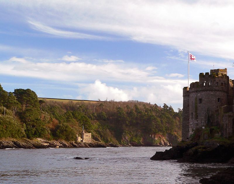
Tuckenhay is a hamlet in the South Hams in Devon, England, south of Totnes. It lies on the south bank of Bow Creek, the estuary of the Harbourne River, which flows into the River Dart. The name is first recorded only from 1550, and possibly means "at the oak enclosure" (Middle English ''atte oken hay''). The village has an industrial past. A paper mill opened in 1829, and produced high quality hand-made paper until the late 20th century. An extension was opened in 1889, and has now been converted into holiday accommodation. Nearby on the quay is a restaurant-pub, the Maltsters Arms, once owned by the TV chef Keith Floyd Keith Floyd (28 December 1943 – 14 September 2009) was a British celebrity Chef, cook, restaurateur, television personality and Gastronomy, "gastronaut" who hosted cooking shows for the BBC and published many books combining cookery and t .... References External links {{commonscat inline, Tuckenhay Hamlets in Devon Villages in South Hams [...More Info...] [...Related Items...] OR: [Wikipedia] [Google] [Baidu] |
Woollen Mill
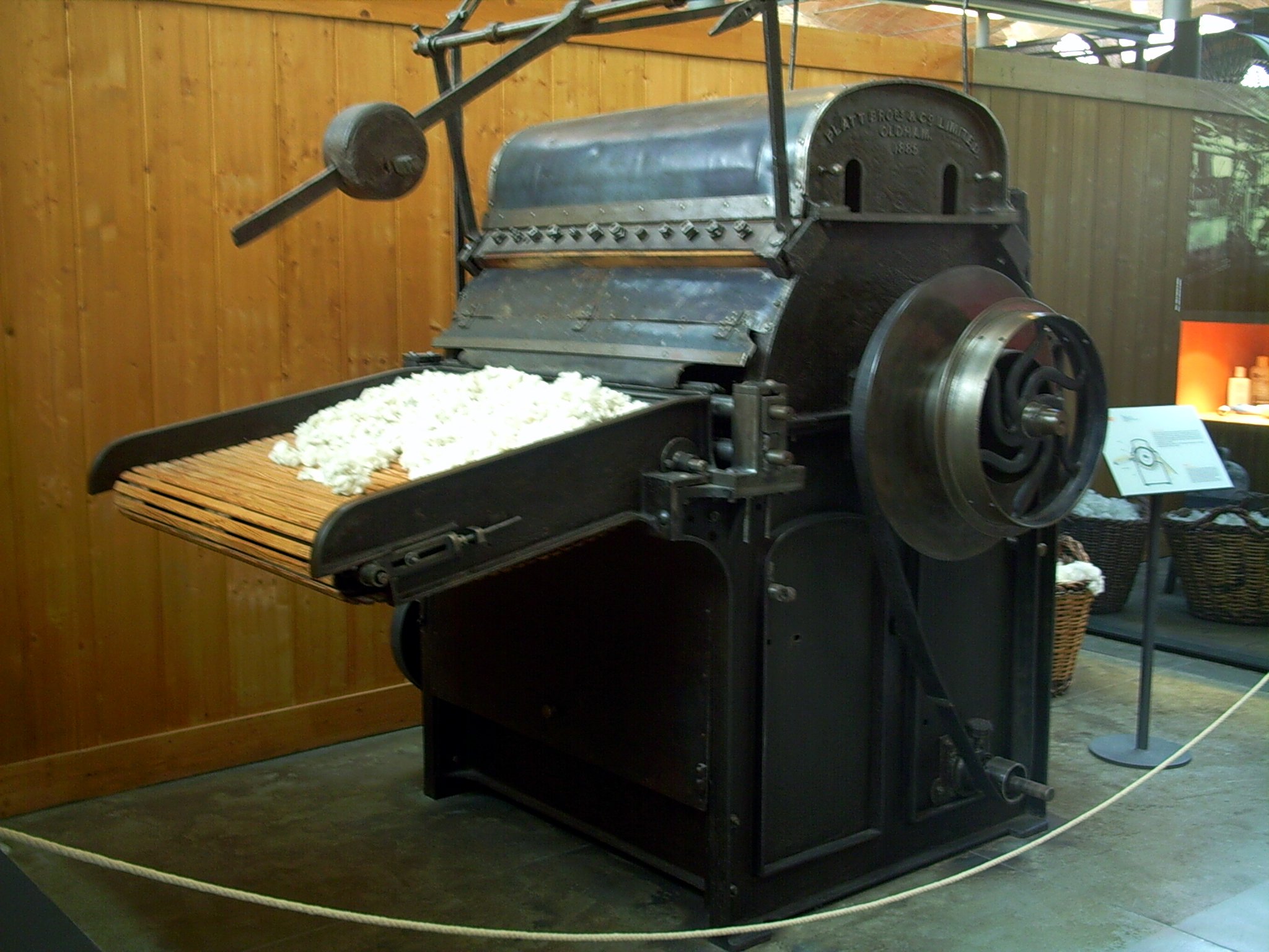
Textile Manufacturing or Textile Engineering is a major industry. It is largely based on the conversion of fibre into yarn, then yarn into fabric. These are then dyed or printed, fabricated into cloth which is then converted into useful goods such as clothing, household items, upholstery and various industrial products. Different types of fibres are used to produce yarn. Cotton remains the most widely used and common natural fiber making up 90% of all-natural fibers used in the textile industry. People often use cotton clothing and accessories because of comfort, not limited to different weathers. There are many variable processes available at the spinning and fabric-forming stages coupled with the complexities of the finishing and colouration processes to the production of a wide range of products. History Textile manufacturing in the modern era is an evolved form of the art and craft industries. Until the 18th and 19th centuries, the textile industry was a household work. ... [...More Info...] [...Related Items...] OR: [Wikipedia] [Google] [Baidu] |
Leat
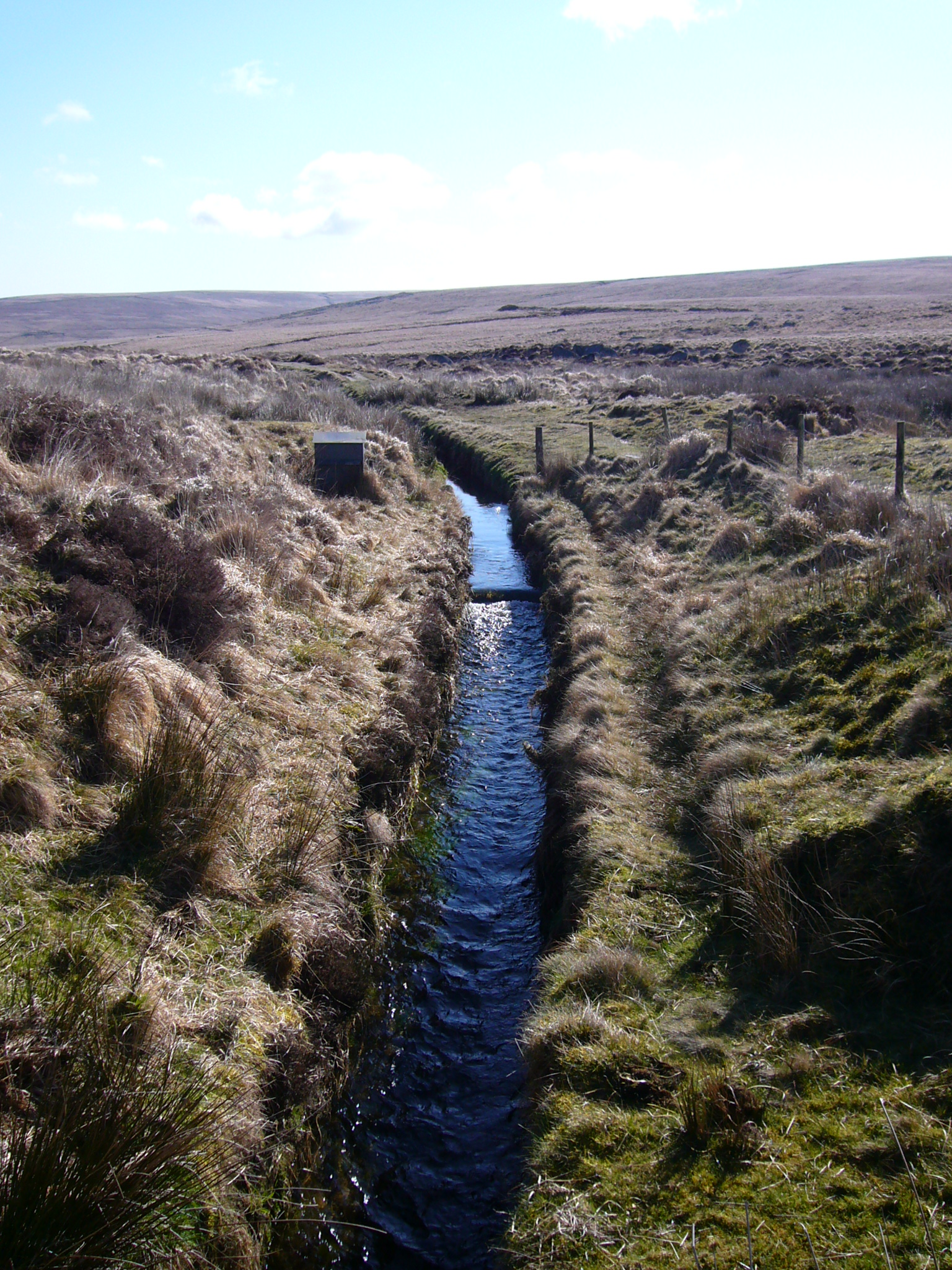
A leat (; also lete or leet, or millstream) is the name, common in the south and west of England and in Wales, for an artificial watercourse or aqueduct dug into the ground, especially one supplying water to a watermill or its mill pond. Other common uses for leats include delivery of water for hydraulic mining and mineral concentration, for irrigation, to serve a dye works or other industrial plant, and provision of drinking water to a farm or household or as a catchment cut-off to improve the yield of a reservoir. According to the ''Oxford English Dictionary'', ''leat'' is cognate with ''let'' in the sense of "allow to pass through". Other names for the same thing include ''fleam'' (probably a leat supplying water to a mill that did not have a millpool). In parts of northern England, for example around Sheffield, the equivalent word is ''goit''. In southern England, a leat used to supply water for water-meadow irrigation is often called a ''carrier'', ''top carrier'', or ' ... [...More Info...] [...Related Items...] OR: [Wikipedia] [Google] [Baidu] |


