|
River Gairn
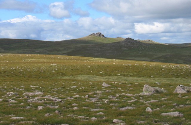
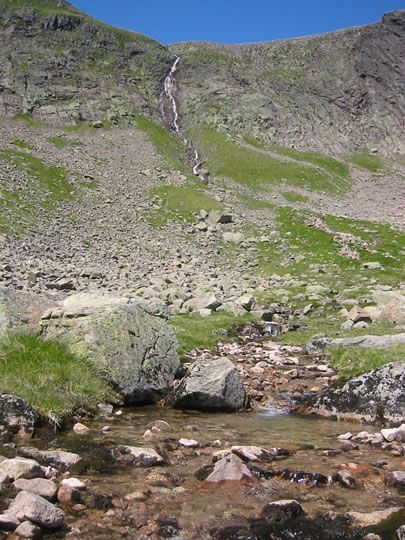
Gairn Water (also known as the River Gairn), situated in the Cairngorms National Park, is a river in Scotland with an elevation of 899 feet and a length of 4.75 kilometres. Course The Gairn's source stems from a number of tributaries on the slopes of Carn Eas and Ben Avon in the Grampian Mountains of Aberdeenshire in Scotland. The river moves East South East for its entire course, passing through/near: * Daldownie * Rinloan * Dalfad * Torbeg * Lary * Candacraig * Bridge of Gairn before finally leading into the River Dee, near Ballater Ballater (, gd, Bealadair) is a village in Aberdeenshire, Scotland, on the River Dee, immediately east of the Cairngorm Mountains. Situated at an elevation of , Ballater is a centre for hikers and known for its spring water, once said to cure .... Tributaries The River Gairn has many unnamed tributaries leading into it, but the named ones are as follows, from source to mouth: * Wester Kim * Wester Shenalt * Eastercon * Easter Shenalt * Corn ... [...More Info...] [...Related Items...] OR: [Wikipedia] [Google] [Baidu] |
Cairngorms National Park
Cairngorms National Park ( gd, Pàirc Nàiseanta a' Mhonaidh Ruaidh) is a national park in northeast Scotland, established in 2003. It was the second of two national parks established by the Scottish Parliament, after Loch Lomond and The Trossachs National Park, which was set up in 2002. The park covers the Cairngorms range of mountains, and surrounding hills. Already the largest national park in the United Kingdom, in 2010 it was expanded into Perth and Kinross. Roughly 18,000 people reside within the 4,528 square kilometre national park. The largest communities are Aviemore, Ballater, Braemar, Grantown-on-Spey, Kingussie, Newtonmore, and Tomintoul. Tourism makes up about 80% of the economy. In 2018, 1.9 million tourism visits were recorded. The majority of visitors are domestic, with 25 per cent coming from elsewhere in the UK, and 21 per cent being from other countries. Geography The Cairngorms National Park covers an area of in the council areas of Aberdeenshire, Mo ... [...More Info...] [...Related Items...] OR: [Wikipedia] [Google] [Baidu] |
Tributary
A tributary, or affluent, is a stream or river that flows into a larger stream or main stem (or parent) river or a lake. A tributary does not flow directly into a sea or ocean. Tributaries and the main stem river drain the surrounding drainage basin of its surface water and groundwater, leading the water out into an ocean. The Irtysh is a chief tributary of the Ob river and is also the longest tributary river in the world with a length of . The Madeira River is the largest tributary river by volume in the world with an average discharge of . A confluence, where two or more bodies of water meet, usually refers to the joining of tributaries. The opposite to a tributary is a distributary, a river or stream that branches off from and flows away from the main stream. PhysicalGeography.net, Michael Pidwirny & S ... [...More Info...] [...Related Items...] OR: [Wikipedia] [Google] [Baidu] |
Ben Avon
Ben Avon ( gd, Beinn Athfhinn, 'mountain of the Avon') is a mountain in the Cairngorms of Scotland. It is a sprawling mountain with a broad summit plateau dotted with granite tors. One of these marks the summit, called ''Leabaidh an Daimh Bhuidhe'' ("bed of the yellow stag") or ''Stob Easaidh Mòr'', which stands at a height of . It is classified as both a Munro and a Marilyn. From the broad summit plateau ridges lead in almost every direction, allowing access from Glen Avon to the north, from Beinn a' Bhùird to the west and from Gleann an t-Slugain in the south. To the west of the summit lies the massive corrie, Slochd Mòr, with its rocky cliffs, and the approaches from the south and west take you close to the corrie rim. The most common ascent route is via the path in the deep glen that separates Ben Avon and Beinn a' Bhùird, or from Beinn a' Bhùird itself. The summit tor itself must be climbed in order to " bag" the mountain, though it is an easy scramble. See als ... [...More Info...] [...Related Items...] OR: [Wikipedia] [Google] [Baidu] |
Grampian Mountains
The Grampian Mountains (''Am Monadh'' in Scottish Gaelic, Gaelic) is one of the three major mountain ranges in Scotland, that together occupy about half of Scotland. The other two ranges are the Northwest Highlands and the Southern Uplands. The Grampian range extends southwest to northeast between the Highland Boundary Fault and the Great Glen. The range includes many of the highest mountains in the British Isles, including Ben Nevis (whose peak contains the highest point in the British Isles at above sea level) and Ben Macdhui (Scotland), Ben Macdui (whose peak contains second-highest at ). A number of rivers and streams rise in the Grampians, including the River Tay, Tay, River Spey, Spey, Cowie Water, Burn of Muchalls, Burn of Pheppie, Burn of Elsick, Cairnie Burn, River Don, Aberdeenshire, Don, River Dee, Aberdeenshire, Dee and River South Esk, Esk. The area is generally sparsely populated. There is some ambiguity about the extent of the range, and until the nineteenth c ... [...More Info...] [...Related Items...] OR: [Wikipedia] [Google] [Baidu] |
Aberdeenshire
Aberdeenshire ( sco, Aiberdeenshire; gd, Siorrachd Obar Dheathain) is one of the 32 Subdivisions of Scotland#council areas of Scotland, council areas of Scotland. It takes its name from the County of Aberdeen which has substantially different boundaries. The Aberdeenshire Council area includes all of the area of the Counties of Scotland, historic counties of Aberdeenshire and Kincardineshire (except the area making up the City of Aberdeen), as well as part of Banffshire. The county boundaries are officially used for a few purposes, namely land registration and Lieutenancy areas of Scotland, lieutenancy. Aberdeenshire Council is headquartered at Woodhill House, in Aberdeen, making it the only Scottish council whose headquarters are located outside its jurisdiction. Aberdeen itself forms a different council area (Aberdeen City). Aberdeenshire borders onto Angus, Scotland, Angus and Perth and Kinross to the south, Highland (council area), Highland and Moray to the west and Aber ... [...More Info...] [...Related Items...] OR: [Wikipedia] [Google] [Baidu] |
Scotland
Scotland (, ) is a country that is part of the United Kingdom. Covering the northern third of the island of Great Britain, mainland Scotland has a border with England to the southeast and is otherwise surrounded by the Atlantic Ocean to the north and west, the North Sea to the northeast and east, and the Irish Sea to the south. It also contains more than 790 islands, principally in the archipelagos of the Hebrides and the Northern Isles. Most of the population, including the capital Edinburgh, is concentrated in the Central Belt—the plain between the Scottish Highlands and the Southern Uplands—in the Scottish Lowlands. Scotland is divided into 32 administrative subdivisions or local authorities, known as council areas. Glasgow City is the largest council area in terms of population, with Highland being the largest in terms of area. Limited self-governing power, covering matters such as education, social services and roads and transportation, is devolved from the Scott ... [...More Info...] [...Related Items...] OR: [Wikipedia] [Google] [Baidu] |
River Dee, Aberdeenshire
The River Dee ( gd, Uisge Dhè) is a river in Aberdeenshire, Scotland. It rises in the Cairngorms and flows through southern Aberdeenshire to reach the North Sea at Aberdeen. The area it passes through is known as Deeside, or Royal Deeside in the region between Braemar and Banchory because Queen Victoria came for a visit there in 1848 and greatly enjoyed herself. She and her husband, Prince Albert, built Balmoral Castle there which replaced an older castle. Deeside is a popular area for tourists, due to the combination of scenic beauty and historic and royal associations. It is part of the Cairngorms National Park, and the Deeside and Lochnagar National Scenic Area. The Dee is popular with anglers and is one of the most famous salmon fishing rivers in the world. The New Statistical Account of Scotland attributed the name Dee as having been used as early as the second century AD in the work of the Alexandrian geographer Claudius Ptolemy, as ''Δηοῦα'' (=Deva), meaning ... [...More Info...] [...Related Items...] OR: [Wikipedia] [Google] [Baidu] |
Ballater
Ballater (, gd, Bealadair) is a village in Aberdeenshire, Scotland, on the River Dee, immediately east of the Cairngorm Mountains. Situated at an elevation of , Ballater is a centre for hikers and known for its spring water, once said to cure scrofula. It is home to more than 1400 inhabitants and has had a long connection with the British Royal Family. History The medieval pattern of development along this reach of the River Dee was influenced by the ancient trackways across the Grampian Mounth, which determined strategic locations of castles and other Deeside settlements of the Middle Ages. In the early 14th century, the area was part of the estates of the Knights of St John, but the settlement did not develop until around 1770; first as a spa resort to accommodate visitors to the Pannanich Mineral Well, then later upon the arrival of the railway in 1866 it was visited by many tourists taking advantage of the easier access thus afforded. The Victoria and Albert Halls, ... [...More Info...] [...Related Items...] OR: [Wikipedia] [Google] [Baidu] |


_Named_(HR).png)


