|
Ravensden
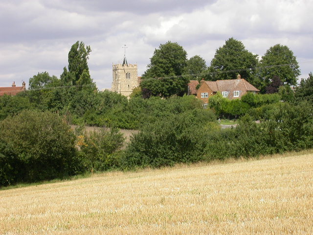
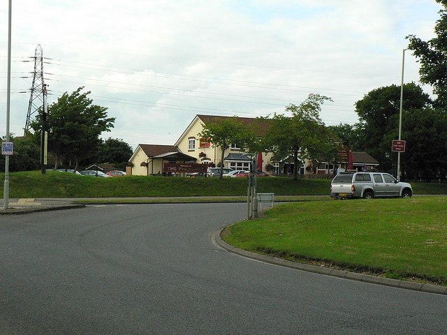
Ravensden is a village and civil parish located in the Borough of Bedford in Bedfordshire, England. The parish borders the town of Bedford, with Mowsbury Park, farmland and Freeman's Common acting as a buffer between the two settlements. The village hosts a primary school (Ravensden CofE Primary Academy), and a pub called ''The Horse and Jockey'', as well as All Saints Church, dating to the 12th century. There is also a village hall. For elections to Bedford Borough Council, Ravensden is part of Great Barford ward, and for national elections it is part of the North East Bedfordshire parliamentary constituency. A housing estate A housing estate (or sometimes housing complex or housing development) is a group of homes and other buildings built together as a single development. The exact form may vary from country to country. Popular throughout the United States a ... called Woodlands Park was established in the southern part of Ravensden parish in the late 2000s. T ... [...More Info...] [...Related Items...] OR: [Wikipedia] [Google] [Baidu] |
Church Of All Saints, Ravensden
Church of All Saints is a Grade I listed church in Ravensden, Bedfordshire, England. It became a listed building on 13 July 1964. See also *Grade I listed buildings in Bedfordshire There are approximately 372,905 listed buildings in England and 2.5% of these are Grade I. This page is a list of these buildings in the county of Bedfordshire,http://www.heritagegateway.org.uk/Gateway/Advanced_Search.aspx?reset=true Englis ...All Saints Church Ravensden Website References Church of England church buildings in Bedfordshire Grade I listed churches in Bedfordshire {{England-church-stub ... [...More Info...] [...Related Items...] OR: [Wikipedia] [Google] [Baidu] |
Freeman's Common
Freeman's Common is a 12.5 hectare area of land situated to the north of Bedford, in the parish of Ravensden. It was created in 1858. Over many years it has been the focus of local dispute as to whether the site should be developed. Despite the name, it is not in fact registered as common land. History On 12 June 1797, an inclosure award created the Bedford Freeman's Common charity, following a 1795 Act of Parliament (35 Geo. III c.87) which covered "Parishes of St. Paul, St. Peter and St. Cuthbert, Bedford". This charity held land which in 1858 was sold to the Midland Railway to build Bedford railway station. A new Freeman's Common was purchased near Ravensden to replace the original. In 1867 Freemen's Common formed part of the course for the Grand National Hunt Steeplechases, which ran from close to Clapham Wood across to Kimbolton Road. The Prince of Wales (later Edward VII) attended the steeplechases on the second day, arriving in Bedford via the Midlands Railway. It a ... [...More Info...] [...Related Items...] OR: [Wikipedia] [Google] [Baidu] |
Brickhill
Brickhill is a civil parish and electoral ward within northern Bedford in Bedfordshire, England. The boundaries of Brickhill are approximately Kimbolton Road to the east, Bedford Park and the old Bedford cemetery to the south, with Cemetery Hill and the Manton Heights Industrial Estate to the west. The Woodlands Park housing estate (off Tyne Crescent) became part of Brickhill parish in 2015. History The name 'Brickhill' derives from 'Brickhill Farm' which occupied the land before the area was developed. 'Brickhill' may have been a reference to brick-making in the area, as the neighbourhood has a high clay content in its soils. Brick-making used to be a major industry in Bedfordshire (See Stewartby). The name may also derive from a compound of Brythonic and Anglo Saxon origins, which is a common occurrence in this part of the country. The Brythonic ''breg'' means 'hill', and the Anglo Saxon ''hyll'' also means 'hill'. Brickhill Farm was the location of Brickhill House, a 17th ... [...More Info...] [...Related Items...] OR: [Wikipedia] [Google] [Baidu] |
Civil Parishes In Bedfordshire
A civil parish is a country subdivision, forming the lowest unit of local government in England. There are 125 civil parishes in the ceremonial county of Bedfordshire, most of the county being parished: Luton is completely unparished; Central Bedfordshire is entirely parished. At the 2001 census, there were 312,301 people living in the 125 parishes, which accounted for 55.2 per cent of the county's population. History Parishes arose from Church of England divisions, and were originally purely ecclesiastical divisions. Over time they acquired civil administration powers.Angus Winchester, 2000, ''Discovering Parish Boundaries''. Shire Publications. Princes Risborough, 96 pages The Highways Act 1555 made parishes responsible for the upkeep of roads. Every adult inhabitant of the parish was obliged to work four days a year on the roads, providing their own tools, carts and horses; the work was overseen by an unpaid local appointee, the ''Surveyor of Highways''. The poor were loo ... [...More Info...] [...Related Items...] OR: [Wikipedia] [Google] [Baidu] |
Borough Of Bedford
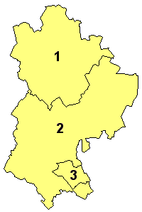
The Borough of Bedford is a unitary authority area with borough status in the ceremonial county of Bedfordshire, England. Its council is based in Bedford, its namesake and principal settlement, which is the county town of Bedfordshire. The borough contains one large urban area, the 71st largest in the United Kingdom that comprises Bedford and the adjacent town of Kempston, surrounded by a rural area with many villages. 75% of the borough's population live in the Bedford Urban Area and the five large villages which surround it, which makes up slightly less than 6% of the total land area of the Borough. The borough is also the location of the Wixams new town development, which received its first residents in 2009. Formation The ancient borough of Bedford was a borough by prescription, with its original date of incorporation unknown. The earliest surviving charter was issued c. 1166 by Henry II, confirming to the borough the liberties and customs which it had held in the reig ... [...More Info...] [...Related Items...] OR: [Wikipedia] [Google] [Baidu] |
Bedfordshire
Bedfordshire (; abbreviated Beds) is a ceremonial county in the East of England. The county has been administered by three unitary authorities, Borough of Bedford, Central Bedfordshire and Borough of Luton, since Bedfordshire County Council was abolished in 2009. Bedfordshire is bordered by Cambridgeshire to the east and north-east, Northamptonshire to the north, Buckinghamshire to the west and Hertfordshire to the south-east and south. It is the fourteenth most densely populated county of England, with over half the population of the county living in the two largest built-up areas: Luton (258,018) and Bedford (106,940). The highest elevation point is on Dunstable Downs in the Chilterns. History The first recorded use of the name in 1011 was "Bedanfordscir," meaning the shire or county of Bedford, which itself means "Beda's ford" (river crossing). Bedfordshire was historically divided into nine hundreds: Barford, Biggleswade, Clifton, Flitt, Manshead, Redborne ... [...More Info...] [...Related Items...] OR: [Wikipedia] [Google] [Baidu] |
North East Bedfordshire (UK Parliament Constituency)
North East Bedfordshire is a constituency represented in the House of Commons of the Parliament of the United Kingdom since 2019 by Richard Fuller, of the Conservative Party. Constituency profile This is a mainly rural, professional area, with medium level incomes, low unemployment and a low proportion of social housing. The East Coast Main Line The East Coast Main Line (ECML) is a electrified railway between London and Edinburgh via Peterborough, Doncaster, York, Darlington, Durham and Newcastle. The line is a key transport artery on the eastern side of Great Britain runni ... runs through the east part of the seat, with several stations connecting to Central London. Boundaries and boundary changes 1997–2010: The District of Mid Bedfordshire wards of Arlesey, Biggleswade Ivel, Biggleswade Stratton, Blunham, Langford, Northill, Old Warden and Southill, Potton, Sandy All Saints, Sandy St Swithun's, Stotfold, and Wensley; and the Borough of Bedford ward ... [...More Info...] [...Related Items...] OR: [Wikipedia] [Google] [Baidu] |
Civil Parishes In England
In England, a civil parish is a type of Parish (administrative division), administrative parish used for Local government in England, local government. It is a territorial designation which is the lowest tier of local government below districts of England, districts and metropolitan and non-metropolitan counties of England, counties, or their combined form, the Unitary authorities of England, unitary authority. Civil parishes can trace their origin to the ancient system of Parish (Church of England), ecclesiastical parishes, which historically played a role in both secular and religious administration. Civil and religious parishes were formally differentiated in the 19th century and are now entirely separate. Civil parishes in their modern form came into being through the Local Government Act 1894, which established elected Parish councils in England, parish councils to take on the secular functions of the vestry, parish vestry. A civil parish can range in size from a sparsely ... [...More Info...] [...Related Items...] OR: [Wikipedia] [Google] [Baidu] |
Primary School
A primary school (in Ireland, the United Kingdom, Australia, Trinidad and Tobago, Jamaica, and South Africa), junior school (in Australia), elementary school or grade school (in North America and the Philippines) is a school for primary education of children who are four to eleven years of age. Primary schooling follows pre-school and precedes secondary schooling. The International Standard Classification of Education considers primary education as a single phase where programmes are typically designed to provide fundamental skills in reading, writing, and mathematics and to establish a solid foundation for learning. This is ISCED Level 1: Primary education or first stage of basic education.Annex III in the ISCED 2011 English.pdf Navigate to International Standard Classification of Educati ... [...More Info...] [...Related Items...] OR: [Wikipedia] [Google] [Baidu] |
Village Hall
A village hall is a public building in a village used for various things such as: United Kingdom In the United Kingdom, a village hall is usually a building which contains at least one large room (plus kitchen and toilets), is owned by a local government council or independent trustees, and is run for the benefit of the local community. It is estimated that there are over 10,000 such village halls. Such a hall is typically used for a variety of public and private functions, such as: * Parish council meetings *Polling station for local and national elections *Sports club functions * Local drama productions *Dances * Jumble sales *Private parties such as birthdays or wedding receptions Village halls are generally run by committees, and if not already part of a local government body such as a parish council, then such committees are eligible for charitable status. They may have other names such as a Village Institute or Memorial Hall. In some localities a church hall or commun ... [...More Info...] [...Related Items...] OR: [Wikipedia] [Google] [Baidu] |
Bedford Borough Council
Bedford Borough Council is the local authority of the Borough of Bedford in Bedfordshire, England. It is a unitary authority, having the powers of a non-metropolitan county and district council combined. The executive of the council is the directly elected mayor of Bedford. It is a member of the East of England Local Government Association. The council was founded in 1974 as Bedford District Council, being renamed North Bedfordshire Borough Council in 1975. In 1992 it changed its name again to become Bedford Borough Council. Until 2009 it was a lower-tier district council, with county-level services provided by Bedfordshire County Council. On 1 April 2009, the Bedfordshire County Council Bedfordshire County Council was the county council of the non-metropolitan county of Bedfordshire in England. It was established on 24 January 1889 and was abolished on 1 April 2009. The county council was based in Bedford. In 1997 Luton Boroug ... ceased to exist, at which point Bedford Bo ... [...More Info...] [...Related Items...] OR: [Wikipedia] [Google] [Baidu] |
Great Barford
Great Barford is a village and civil parish in Bedfordshire, England, a few miles north-east of Bedford. It lies on the River Great Ouse at . It is twinned with Wöllstein, Germany. The village is bypassed by the busy A421 road on the way between Bedford and St Neots in Cambridgeshire, the bypass opening on 24 August 2006. The village is known for its All Saints Church, with a 15th-century tower, and its similarly ancient bridge . The surroundings and historic buildings make it a favoured destination for canoeing, angling and picnics. Nearby places include Renhold and Blunham. History Great Barford was mentioned in the Domesday Book as an important site, probably as a means of crossing the river that skirts the village. Although the area of the original ford was dug up in 1973, the bridge has existed since at least the 15th century. The village itself is large and scattered but the majority of the houses are in the south-east of the parish. Throughout the village there ar ... [...More Info...] [...Related Items...] OR: [Wikipedia] [Google] [Baidu] |


