|
River Meden
The River Meden is a river in Nottinghamshire, England. Its source lies just north of Huthwaite, near the Derbyshire border, and from there it flows north east through Pleasley and Warsop before merging temporarily with the River Maun near Bothamsall. The rivers divide after a short distance and go on separately to a point near Markham Moor where they once more combine to form the River Idle. The river was a source of water power for mills in Pleasley Vale from the 1760s until the 1980s. Three huge cotton mills and their associated mill ponds still dominate the Vale. The buildings were bought by Bolsover District Council in 1992, and have become a centre for light industry. On a much smaller scale was the water mill at Warsop, which still retains much of its internal machinery. Route The river rises as two main streams to the north of Huthwaite, above the contour,Ordnance Survey, 1:25,000 map on the coal measures that run along the western edge of Nottinghamshire. Both are ... [...More Info...] [...Related Items...] OR: [Wikipedia] [Google] [Baidu] |
Warsop
Warsop is a town and civil parish in the Mansfield district, Nottinghamshire, England, on the outskirts of the remnants of Sherwood Forest.OS Explorer Map 270: Sherwood Forest: (1:25 000): At the 2001 census it had a population of 12,365, reducing to 11,999 at the 2011 Census including Church Warsop, Meden Vale and Spion Kop. Governance The parish was an urban district in Nottinghamshire until 1974, when it joined with Mansfield Borough and Woodhouse Urban District Council to form Mansfield District Council. Warsop retains a council, as a successor parish, including the localities of Market Warsop, Church Warsop, Meden Vale, Warsop Vale and Spion Kop. The council is based at Warsop Town Hall. After re-alignment of local wards within Mansfield District Council before the 2011 local elections to achieve a standard format of one councillor-per-ward, Warsop has four designated areas named as Warsop Carrs, Netherfield, Market Warsop and Meden. Warsop is a part of the Mansfield Pa ... [...More Info...] [...Related Items...] OR: [Wikipedia] [Google] [Baidu] |
Robin Hood Line
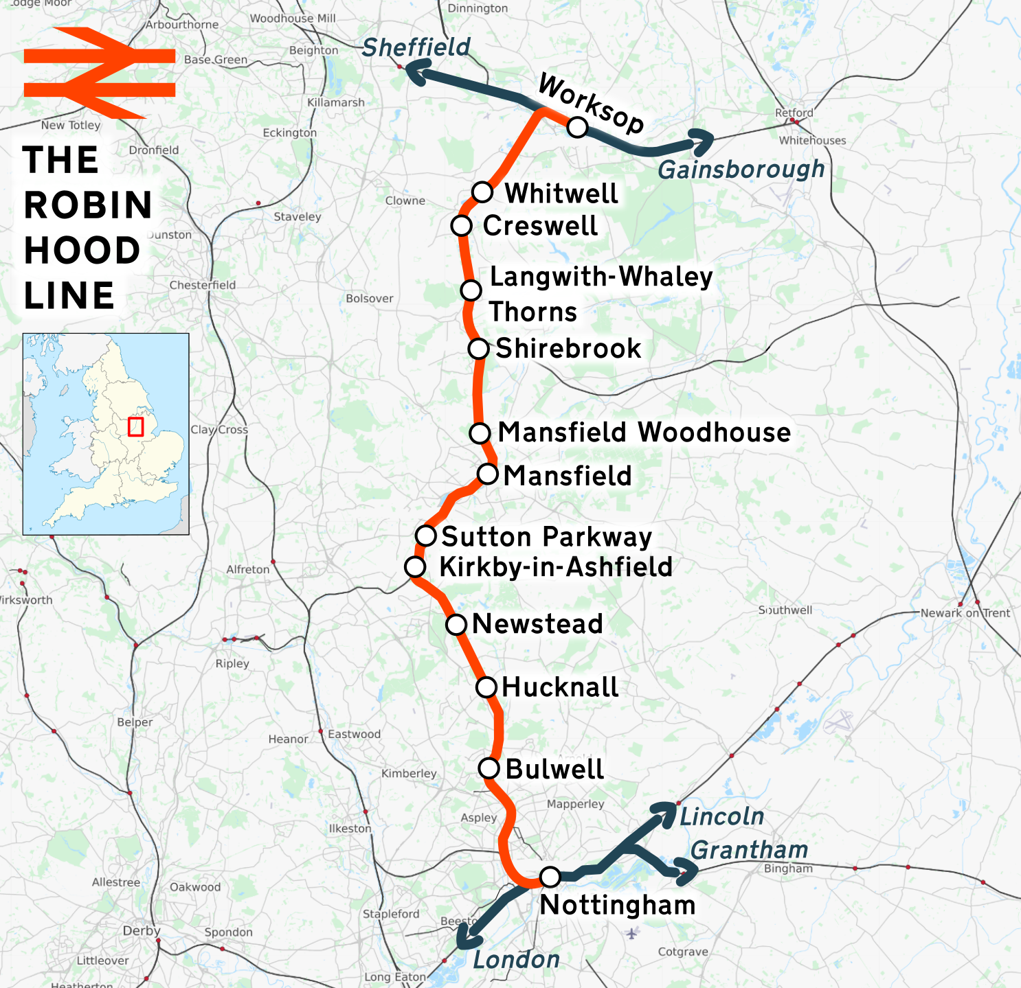
The Robin Hood Line is a railway line running from Nottingham to Worksop, Nottinghamshire, in the United Kingdom. The stations between Shirebrook and Whitwell (inclusive) are in Derbyshire. Passenger services are operated by East Midlands Railway. The line in its present form opened to passengers in stages between 1993 and 1998. Following the Beeching cuts of the 1960s, the line had been freight-only. The cuts had left Mansfield as one of the largest towns in Britain without a railway station. History The majority of the current Robin Hood Line re-uses the former Midland Railway (MR) route from Nottingham to Worksop. However, due to rationalisation leading to track removal in order to save the costs of maintaining the tunnel north of Annesley, the through route was severed in the 1970s. Northwards from Nottingham, the freight-only line remained intact as far as Newstead, where it had served the now closed Newstead Colliery. Southwards from Worksop, the line followed the ... [...More Info...] [...Related Items...] OR: [Wikipedia] [Google] [Baidu] |
Mansfield
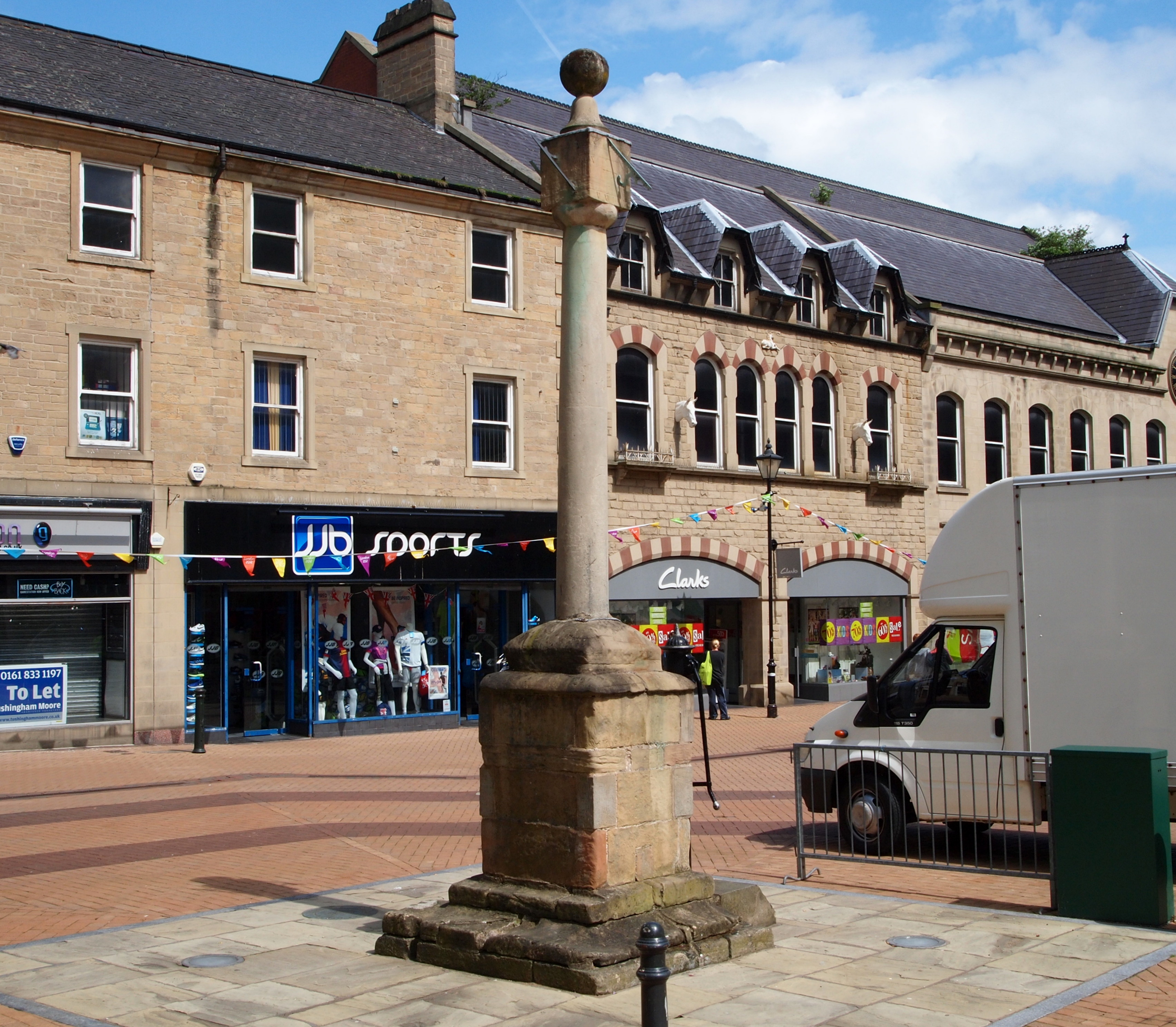
Mansfield is a market town and the administrative centre of Mansfield District in Nottinghamshire, England. It is the largest town in the wider Mansfield Urban Area (followed by Sutton-in-Ashfield). It gained the Royal Charter of a market town in 1227. The town lies in the Maun Valley, north of Nottingham and near Sutton-in-Ashfield. Most of the 109,000 population live in the town itself (including Mansfield Woodhouse), with Warsop as a secondary centre. Mansfield is the one local authority in Nottinghamshire with a publicly elected mayor. History Roman to Mediaeval Period Settlement dates to the Roman period. Major Hayman Rooke in 1787 discovered a villa between Mansfield Woodhouse and Pleasley; a cache of denarii was found near King's Mill in 1849. Early English royalty stayed there; Mercian Kings used it as a base to hunt in Sherwood Forest. The Royal Manor of Mansfield was held by the King. In 1042 Edward the Confessor possessed a manor in Mansfield. William the Conqu ... [...More Info...] [...Related Items...] OR: [Wikipedia] [Google] [Baidu] |
Drapery
Drapery is a general word referring to cloths or textiles (Old French , from Late Latin ). It may refer to cloth used for decorative purposes – such as around windows – or to the trade of retailing cloth, originally mostly for clothing, formerly conducted by drapers. Drape Drape (draping or fabric drape) is the property of different textile materials how they fold, fall, or hang over a three-dimensional body. Draping depends upon the fiber characteristics and the flexibility, looseness, and softness of the material. Draped garments follow the form of the human body beneath them. Art In art history, drapery refers to any cloth or textile depicted, which is usually clothing. The schematic depiction of the folds and woven patterns of loose-hanging clothing on the human form, with ancient prototypes, was reimagined as an adjunct to the female form by Greek vase-painters and sculptors of the earliest fifth century and has remained a major source of stylistic formulas ... [...More Info...] [...Related Items...] OR: [Wikipedia] [Google] [Baidu] |
River Poulter
The River Poulter which rises near Scarcliffe in Derbyshire, England is a tributary river of the River Idle in Nottinghamshire. It supplied power to mills along its route, most of which are now gone, although their mill ponds remain. Cuckney mill building is used as a primary school. The river has been dammed to create several lakes in the Dukeries estates of Welbeck Abbey and Clumber House now the National Trust property of Clumber Park. The ornamental Gouldsmeadow Lake, Shrubbery Lake and Great Lake on the Welbeck estate are supplied by a tributary of the Poulter, while Carburton Forge Dam and Carburton Dam were built to power a forge and a mill. Clumber Lake, consisting of an upper and lower lake, which is spanned by a Grade II* listed ornamental bridge, is part of the Clumber estate, and has suffered from subsidence. Beyond the parklands, the river flows eastwards past Elkesley, to join the River Idle just outside the village close to the A1 road. The river's water quality i ... [...More Info...] [...Related Items...] OR: [Wikipedia] [Google] [Baidu] |
A1 Road (Great Britain)
The A1 is the longest numbered road in the UK, at . It connects Greater London, London, the capital of England, with Edinburgh, the capital of Scotland. It passes through or near North London, Hatfield, Hertfordshire, Hatfield, Welwyn Garden City, Stevenage, Baldock, Letchworth, Letchworth Garden City, Biggleswade, St Neots, Huntingdon, Peterborough, Stamford, Lincolnshire, Stamford, Grantham, Newark-on-Trent, Retford, Doncaster, York, Pontefract, Wetherby, Ripon, Darlington, Durham, England, Durham, Sunderland, Tyne and Wear, Sunderland, Gateshead, Newcastle upon Tyne, Morpeth, Northumberland, Morpeth, Alnwick and Berwick-upon-Tweed. It was designated by the Department for Transport, Ministry of Transport in 1921, and for much of its route it followed various branches of the historic Great North Road (Great Britain), Great North Road, the main deviation being between Boroughbridge and Darlington. The course of the A1 has changed where towns or villages have been bypass (road), ... [...More Info...] [...Related Items...] OR: [Wikipedia] [Google] [Baidu] |
Robin Hood Way
The Robin Hood Way is a waymarked long-distance footpath in the Midlands of England. Length The Robin Hood Way runs for . Route The Robin Hood way commemorates the famous folklore figure Robin Hood and starts from Nottingham Castle running to Edwinstowe Its passes through Sherwood Forest taking in Clumber Park, Farnsfield, Greasley, Kimberley, Rainworth, Creswell Crags, Kirton and Bothamsall Bothamsall is a village and civil parish in the Bassetlaw district of Nottinghamshire, England. According to the United Kingdom Census 2001 it had a population of 185, increasing (with the inclusion of Bevercotes and Haughton) to 270 at the .... References External links Robin Hood Way website and all route details Long-distance f ... [...More Info...] [...Related Items...] OR: [Wikipedia] [Google] [Baidu] |
Perlethorpe
Perlethorpe is a small village in Nottinghamshire. It is located 3 miles north-west of Ollerton, and is in the civil parish of Perlethorpe cum Budby. According to the 2001 census the parish had a population in 2001 of 198. reducing to 183 at the 2011 Census. Nearby is Thoresby Hall, the former home of the Earl Manvers. Etymology Perlethorpe is from Old Norse ''thorp''/''þrop'' "village", a place-name element common in Nottinghamshire, and nearby Lincolnshire. The first element of the name, ''perle'' is unknown, and toponymists can only speculate as to its origin. However, there are three particularly popular suggestions. The first is "rush of water" from the Old English and Middle English ''perle''. The second is that it's a deviation from the possible original name Palethorpe, ''pale'' meaning "area enclosed by a boundary". Lastly it may have been a deviation from ''Peverelthorpe'' as William Peverel was a powerful landowner in the area during the reign of Henry II. Geogr ... [...More Info...] [...Related Items...] OR: [Wikipedia] [Google] [Baidu] |
Thoresby Hall
Thoresby Hall is a grade I listed 19th-century English country house, country house in Budby, Nottinghamshire, some 2 miles (4 km) north of Ollerton. It is one of four neighbouring country houses and estates in the Dukeries in north Nottinghamshire all occupied by dukes at one time during their history. The hall is constructed of rock-faced ashlar with ashlar dressings. It is built in four storeys with a square floor plan surrounding a central courtyard, nine bays wide and eight bays deep. History Robert Pierrepont, 1st Earl of Kingston-upon-Hull acquired the Thoresby lands in 1633, but was killed in the English Civil War, Civil War in 1643. His son Henry Pierrepont, Henry Pierrepont, 2nd Earl of Kingston-upon-Hull, the 2nd Earl, built the first grand house, attributed to the architect Talman, about 1670. The house was remodelled for William Pierrepont, William Pierrepont, 4th Earl of Kingston-upon-Hull, the 4th Earl, during 1685–87, probably by Benjamin Jackson, after the ... [...More Info...] [...Related Items...] OR: [Wikipedia] [Google] [Baidu] |
Budby
Budby is a small hamlet in the civil parish of Perlethorpe-cum-Budby, Nottinghamshire. Budby is about north of Edwinstowe. Nearby is Thoresby Hall, the former home of the Earl Manvers. Geography and history The hamlet itself is by the A616 road and the River Meden. Budby dates from at least 1662 when the area was part of Sherwood Forest then a Royal Forest A royal forest, occasionally known as a kingswood (), is an area of land with different definitions in England, Wales, Scotland and Ireland. The term ''forest'' in the ordinary modern understanding refers to an area of wooded land; however, the ..., though most of the forest has since been cleared for agriculture. It consists of two farms and 13 cottages built for farm workers some of which are still used by employees of the various farms in the area. Budby has a mid-Victorian Penfold-type post box. Hamlets in Nottinghamshire Sherwood Forest {{Nottinghamshire-geo-stub ... [...More Info...] [...Related Items...] OR: [Wikipedia] [Google] [Baidu] |
Grade II Listed
In the United Kingdom, a listed building or listed structure is one that has been placed on one of the four statutory lists maintained by Historic England in England, Historic Environment Scotland in Scotland, in Wales, and the Northern Ireland Environment Agency in Northern Ireland. The term has also been used in the Republic of Ireland, where buildings are protected under the Planning and Development Act 2000. The statutory term in Ireland is " protected structure". A listed building may not be demolished, extended, or altered without special permission from the local planning authority, which typically consults the relevant central government agency, particularly for significant alterations to the more notable listed buildings. In England and Wales, a national amenity society must be notified of any work to a listed building which involves any element of demolition. Exemption from secular listed building control is provided for some buildings in current use for worship, ... [...More Info...] [...Related Items...] OR: [Wikipedia] [Google] [Baidu] |
Warsop Vale
Warsop Vale is a small village in the Mansfield district of western Nottinghamshire, England. It is north west of London, north of the county town and city of Nottingham, and north of the town of Mansfield. It is in the civil parish of Warsop. Warsop Vale's heritage is primarily as a former mining village. It lies in the very picturesque area known as the Dukeries and is easily accessible to Clumber Park, Thoresby Park and hall, Rufford Park and the Earl of Portland estate of Welbeck, together all part of Sherwood Forest. Geography Location Warsop Vale is surrounded by the following local Nottinghamshire areas: * Nether Langwith and Cuckney to the north * Sookholme to the south * Church Warsop and Market Warsop to the east * Shirebrook in Derbyshire to the west This area lies in the north west of the district and west of Nottinghamshire county, as well as being close to the Derbyshire boundary. The core of the hamlet is accessed from the B6031 Church Warsop-Shirebr ... [...More Info...] [...Related Items...] OR: [Wikipedia] [Google] [Baidu] |


