|
Ribeira Julião
Ribeira Julião Instituto Nacional de Estatística, code 21103, p. 28 is a village in the central part of the island of Sao Vicente, . In 2010 its population was 611. It is situated in the valley of the stream |
Instituto Nacional De Estatística (Cape Verde)
The Instituto Nacional de Estatística (Portuguese for the ''National Statistics Institute'', abbreviated as INE) is the public statistics institute of Cape Verde. Its current president is Osvaldo Rui Monteiro dos Reis Borges. The population censuses are held every first year of a decade; the most recent was in 2010. Its main office is on 18 Rua da Caixa Económica in the capital city of Praia. History Until 1975, under Portuguese rule, statistics were done by the Provincial Statistics Bureau (''Repartição Provincial de Estatística''), part of the Instituto Nacional de Estatística of Portugal. When Cape Verde became independent, the ''Serviço Nacional de Estatística'' (SNE, Portuguese for the National Statistics Service) was established, part of the Ministry of Economy. Its first president was Edgard Chrysostome Pinto. At the end of 1985, the Directorate-General of Statistics was created. In 1996, the new law of the National Statistics System was approved, and the ''Istituto ... [...More Info...] [...Related Items...] OR: [Wikipedia] [Google] [Baidu] |
São Vicente, Cape Verde
São Vicente (Portuguese for " Saint Vincent") is one of the Barlavento Islands, the northern group within the Cape Verde archipelago in the Atlantic Ocean, off the West African coast. It is located between the islands of Santo Antão and Santa Luzia, with the Canal de São Vicente separating it from Santo Antão. Geography The island is roughly rectangular in shape with an area of . From east to west it measures and from north to south .Cabo Verde, Statistical Yearbook 2015 Instituto Nacional de Estatística The island, of |
Cape Verde
, national_anthem = () , official_languages = Portuguese , national_languages = Cape Verdean Creole , capital = Praia , coordinates = , largest_city = capital , demonym = Cape Verdean or Cabo Verdean , ethnic_groups_year = 2017 , government_type = Unitary semi-presidential republic , leader_title1 = President , leader_name1 = José Maria Neves , leader_title2 = Prime Minister , leader_name2 = Ulisses Correia e Silva , legislature = National Assembly , area_rank = 166th , area_km2 = 4033 , area_sq_mi = 1,557 , percent_water = negligible , population_census = 561,901 , population_census_rank = 172nd , population_census_year = 2021 , population_density_km2 = 123.7 , population_density_sq_mi = 325.0 , population_density_rank = 89th , GDP_PPP ... [...More Info...] [...Related Items...] OR: [Wikipedia] [Google] [Baidu] |
Ribeira De Julião
Ribeira de Julião is a seasonal stream in the central part of the island of São Vicente in Cape Verde.Inventário dos recursos turísticos do município de S. Vicente Direcção Geral do Turismo, p. 27 Its source is in the hills southeast of the island capital , and it empties into the , a bay of the , southwest of Mindelo. The village [...More Info...] [...Related Items...] OR: [Wikipedia] [Google] [Baidu] |
Mindelo
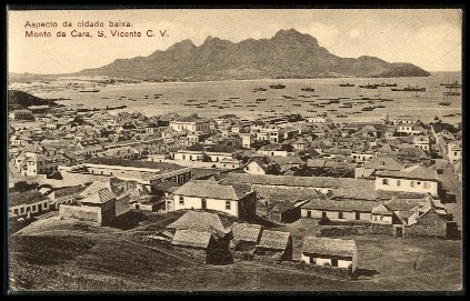
Mindelo is a port cityCabo Verde, Statistical Yearbook 2015 Instituto Nacional de Estatística, p. 32-33 in the northern part of the island of São Vicente in . Mindelo is also the seat of the parish of Nossa Senhora da Luz, and the municipality of São Vicente. The city is home to ... [...More Info...] [...Related Items...] OR: [Wikipedia] [Google] [Baidu] |

