|
Reculver
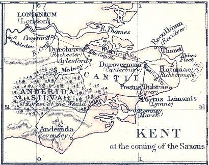
Reculver is a village and coastal resort about east of Herne Bay on the north coast of Kent in south-east England. It is in the ward of the same name, in the City of Canterbury district of Kent. Reculver once occupied a strategic location at the north-western end of the Wantsum Channel, a sea lane that separated the Isle of Thanet and the Kent mainland until the late Middle Ages. This led the Romans to build a small fort there at the time of their conquest of Britain in 43 AD, and, starting late in the 2nd century, they built a larger fort, or ''castrum'', called ''Regulbium'', which later became one of the chain of Saxon Shore forts. Following the withdrawal of the Western Roman Empire in ca. early C4th, the Brythons again took control of the lands until Anglo-Saxon invasions shortly afterward. By the 7th century Reculver had become a landed estate of the Anglo-Saxon kings of Kent. The site of the Roman fort was given over for the establishment of a monastery dedica ... [...More Info...] [...Related Items...] OR: [Wikipedia] [Google] [Baidu] |
St Mary's Church, Reculver
St Mary's Church, Reculver, was founded in the 7th century as either a minster or a monastery on the site of a Roman fort at Reculver, which was then at the north-eastern extremity of Kent in south-eastern England. In 669, the site of the fort was given for this purpose by King Ecgberht of Kent to a priest named Bassa, beginning a connection with Kentish kings that led to King Eadberht II of Kent being buried there in the 760s, and the church becoming very wealthy by the beginning of the 9th century. From the early 9th century to the 11th the church was treated as essentially a piece of property, with control passing between kings of Mercia, Wessex and England and the archbishops of Canterbury. Viking attacks may have extinguished the church's religious community in the 9th century, although an early 11th-century record indicates that the church was then in the hands of a dean accompanied by monks. By the time of Domesday Book, completed in 1086, St Mary's was serving as a pa ... [...More Info...] [...Related Items...] OR: [Wikipedia] [Google] [Baidu] |
Regulbium
Regulbium was the name of an ancient Roman fort of the Saxon Shore in the vicinity of the modern English resort of Reculver in Kent. Its name derives from the local Brythonic language, meaning "great headland" (*''Rogulbion''). History The first Roman military installation in the area was a small fort built directly after the invasion of Britain in the reign of Claudius, protected by earthworks. It was connected to Durovernum (Canterbury) by a road. The fort, strategically located at the entrance of the Wantsum Channel, possibly housed a signal tower, perhaps a lighthouse, and continued in operation at least until the late 60s, since coins dating to the reign of Nero were found on site. This structure lay within the bounds of the later, larger stone fort, which was built in the early 3rd century, probably in , since the sole stone inscription found at the fort (in 1960) mentions the then governor of Britain, Aulus Triarius Rufinus. This construction occurred at a time when ... [...More Info...] [...Related Items...] OR: [Wikipedia] [Google] [Baidu] |
Herne Bay
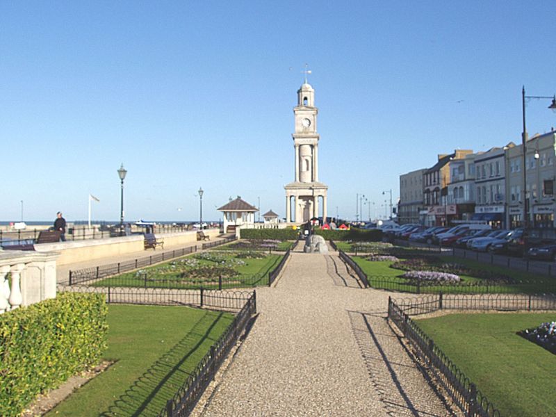
Herne Bay is a seaside town on the north coast of Kent in South East England. It is north of Canterbury and east of Whitstable. It neighbours the ancient villages of Herne and Reculver and is part of the City of Canterbury local government district, although it remains a separate town with countryside between it and Canterbury. Herne Bay's seafront is home to the world's first freestanding purpose-built Clock Tower, built in 1837. From the late Victorian period until 1978, the town had the second-longest pier in the United Kingdom.Herne Bay Pier at www.theheritagetrail.co.uk (accessed 7 July 2008) The town began as a small shipping community, receiving goods and passengers from London en route to Canterbury and Dover. The tow ... [...More Info...] [...Related Items...] OR: [Wikipedia] [Google] [Baidu] |
Wantsum Channel
The Wantsum Channel was a strait separating the Isle of Thanet from the north-eastern extremity of the English county of Kent and connecting the English Channel and the Thames Estuary. It was a major shipping route when Britain was part of the Roman Empire, and continued in use until it was closed by silting in the late Middle Ages. Its course is now represented by the River Stour, Kent, River Stour and the River Wantsum, which is little more than a drainage ditch lying between Reculver and St Nicholas-at-Wade and joins the Stour about south-east of Sarre, Kent, Sarre. Toponymy Eilert Ekwall, a 20th-century authority on English place-names, wrote that the name "Wantsum" derives from an Old English word "wandsum", meaning "winding". Bede, writing in or before 731, mentioned the Wantsum (''Vantsumu'') in describing the Isle of Thanet, but he also recorded an alternative name: he described the St Mary's Church, Reculver, church at Reculver as being ''juxta ostium aquilonale fluminis ... [...More Info...] [...Related Items...] OR: [Wikipedia] [Google] [Baidu] |
Saxon Shore
The Saxon Shore ( la, litus Saxonicum) was a military command of the late Roman Empire, consisting of a series of fortifications on both sides of the Channel. It was established in the late 3rd century and was led by the " Count of the Saxon Shore". In the late 4th century, his functions were limited to Britain, while the fortifications in Gaul were established as separate commands. Several Saxon Shore forts survive in east and south-east England. Background During the latter half of the 3rd century, the Roman Empire faced a grave crisis. Internally, it was weakened by civil wars, the violent succession of brief emperors, and secession in the provinces, while externally it faced a new wave of attacks by barbarian tribes. Most of Britain had been part of the empire since the mid-1st century. It was protected from raids in the north by the Hadrianic and Antonine Walls, while a fleet of some size was also available. However, as the frontiers came under increasing external pre ... [...More Info...] [...Related Items...] OR: [Wikipedia] [Google] [Baidu] |
Kingdom Of Kent
la, Regnum Cantuariorum , conventional_long_name = Kingdom of the Kentish , common_name = Kent , era = Heptarchy , status = vassal , status_text = , government_type = Monarchy , event_start = , date_start = , year_start = c. 455 , event_end = , date_end = , year_end = 871 , event1 = , date_event1 = , event2 = , date_event2 = , event3 = , date_event3 = , event4 = , date_event4 = , p1 = Sub-Roman Britain , flag_p1 = Vexilloid of the Roman Empire.svg , border_p1 = no , s1 = Kingdom of England , flag_s1 = Flag of Wessex.svg , border_s1 = no , image_coat = , symbol = , symbol_ty ... [...More Info...] [...Related Items...] OR: [Wikipedia] [Google] [Baidu] |
City Of Canterbury
The City of Canterbury () is a local government district with city status in Kent, England. As well as Canterbury itself, the district extends north to the coastal towns of Whistable and Herne Bay. History The district was formed on 1 April 1974 by the merger of the existing city of Canterbury with the Whitstable and Herne Bay Urban Districts, and Bridge-Blean Rural District. The latter district entirely surrounded the city; the urban districts occupied the coastal area to the north. Politics Elections for to all seats on the city council are held every four years. After being under no overall control for a number of years, the Conservative party gained a majority in 2005 following a by election and defection from the Liberal Democrats. Following the 2019 United Kingdom local elections the political composition of Canterbury council is as follows (2017 results follows by-elections): Meeting place After the Church of the Holy Cross, which was commissioned by Arch ... [...More Info...] [...Related Items...] OR: [Wikipedia] [Google] [Baidu] |
Bishopstone Cliffs
Bishopstone Cliffs is a Local Nature Reserve in Reculver on the eastern outskirts of Herne Bay, Kent. It is owned and managed by Canterbury City Council. It is part of Thanet Coast Site of Special Scientific Interest, and Thanet Coast and Sandwich Bay Ramsar site and Special Protection Area. This is a grassland site on the top of cliffs, and it has some rare insect species. Sand martins nest in holes in the cliffs, and other birds include skylarks, meadow pipits and corn bunting The corn bunting (''Emberiza calandra'') is a passerine bird in the bunting family Emberizidae, a group now separated by most modern authors from the finches, Fringillidae. This is a large bunting with heavily streaked buff-brown plumage. The se ...s. There is public access to the site, most of which is within Reculver Country Park. References {{Local Nature Reserves in Kent Local Nature Reserves in Kent ... [...More Info...] [...Related Items...] OR: [Wikipedia] [Google] [Baidu] |
Cinque Ports
The Confederation of Cinque Ports () is a historic group of coastal towns in south-east England – predominantly in Kent and Sussex, with one outlier ( Brightlingsea) in Essex. The name is Old French, meaning "five harbours", and alludes to the original five members (Hastings, New Romney, Hythe, Dover and Sandwich). At its peak in the late middle ages, the confederation included over 40 members. The confederation was originally formed for military and trade purposes, but is now entirely ceremonial. The ports lie on the western shore of the English Channel, where the crossing to the European continent is narrowest. Origins The origins of the confederation are obscure, but are believed to lie in the late Anglo-Saxon period, and specifically in the reign of Edward the Confessor (1042–1066). Certain south-east ports were granted the local profits of justice in return for providing ships. The ship service of Romney, Dover and Sandwich (but not the confederation itself) is not ... [...More Info...] [...Related Items...] OR: [Wikipedia] [Google] [Baidu] |
Isle Of Thanet
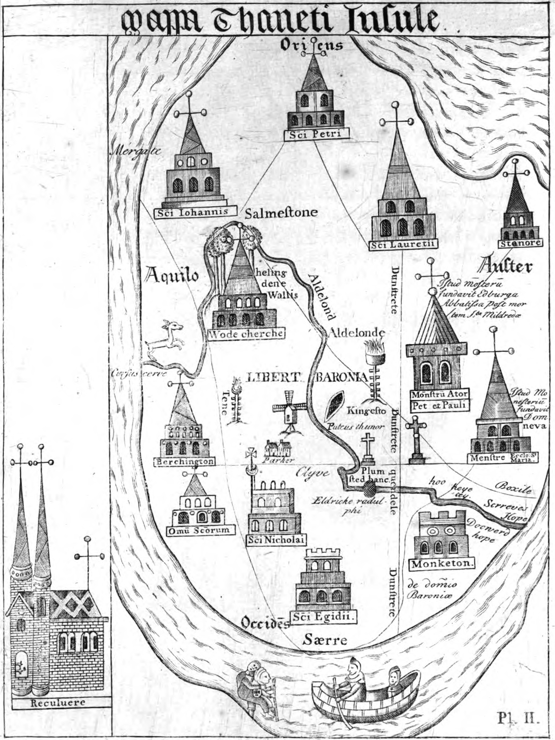
The Isle of Thanet () is a peninsula forming the easternmost part of Kent, England. While in the past it was separated from the mainland by the Wantsum Channel, it is no longer an island. Archaeological remains testify to its settlement in ancient times. Today, it is a tourist destination, and has an active agricultural base. Etymology The island of Thanet is mentioned as ''Tonetic'' (c. AD 150; the TON- of this form was misread as TOΛI-, hence it appears as ''Toliatis'' in the surviving manuscripts of Ptolemy); ''Tanat's'' (3rd C AD, Solinus); ''Tanatos'' (AD 731); ''Tenid'' in 679BEAUREPAIRE and ''Tenet'' (e.g. charters of AD 679, 689 and thereafter); and the Old Welsh forms ''Tanet'' and ''Danet'', found in the ''Historia Brittonum'' (c. AD 829/30) and Armes Prydein (c. AD 930). Standard reference works for English place-names (such as Eilert Ekwall's ''Concise Oxford Dictionary of English Place-Names'') state the name ''Tanet'' is known to be Brythonic in origin. Commonl ... [...More Info...] [...Related Items...] OR: [Wikipedia] [Google] [Baidu] |
Wards Of The United Kingdom
The wards and electoral divisions in the United Kingdom are electoral districts at sub-national level, represented by one or more councillors. The ward is the primary unit of English electoral geography for civil parishes and borough and district councils, the electoral ward is the unit used by Welsh principal councils, while the electoral division is the unit used by English county councils and some unitary authorities. Each ward/division has an average electorate of about 5,500 people, but ward population counts can vary substantially. As of 2021 there are 8,694 electoral wards/divisions in the UK. England The London boroughs, metropolitan boroughs and non-metropolitan districts (including most unitary authorities) are divided into wards for local elections. However, county council elections (as well as those for several unitary councils which were formerly county councils, such as the Isle of Wight and Shropshire Councils) instead use the term ''electoral division''. In ... [...More Info...] [...Related Items...] OR: [Wikipedia] [Google] [Baidu] |
Common Brittonic
Common Brittonic ( cy, Brythoneg; kw, Brythonek; br, Predeneg), also known as British, Common Brythonic, or Proto-Brittonic, was a Celtic language spoken in Britain and Brittany. It is a form of Insular Celtic, descended from Proto-Celtic, a theorized parent tongue that, by the first half of the first millennium BC, was diverging into separate dialects or languages. Pictish is linked, likely as a sister language or a descendant branch. Evidence from early and modern Welsh shows that Common Brittonic took a significant amount of influence from Latin during the Roman period, especially in terms related to the church and Christianity. By the sixth century AD, the tongues of the Celtic Britons were more rapidly splitting into Neo-Brittonic: Welsh, Cumbric, Cornish, Breton, and possibly the Pictish language. Over the next three centuries it was replaced in most of Scotland by Scottish Gaelic and by Old English (from which descend Modern English and Scots) throughout most ... [...More Info...] [...Related Items...] OR: [Wikipedia] [Google] [Baidu] |


