|
Dover
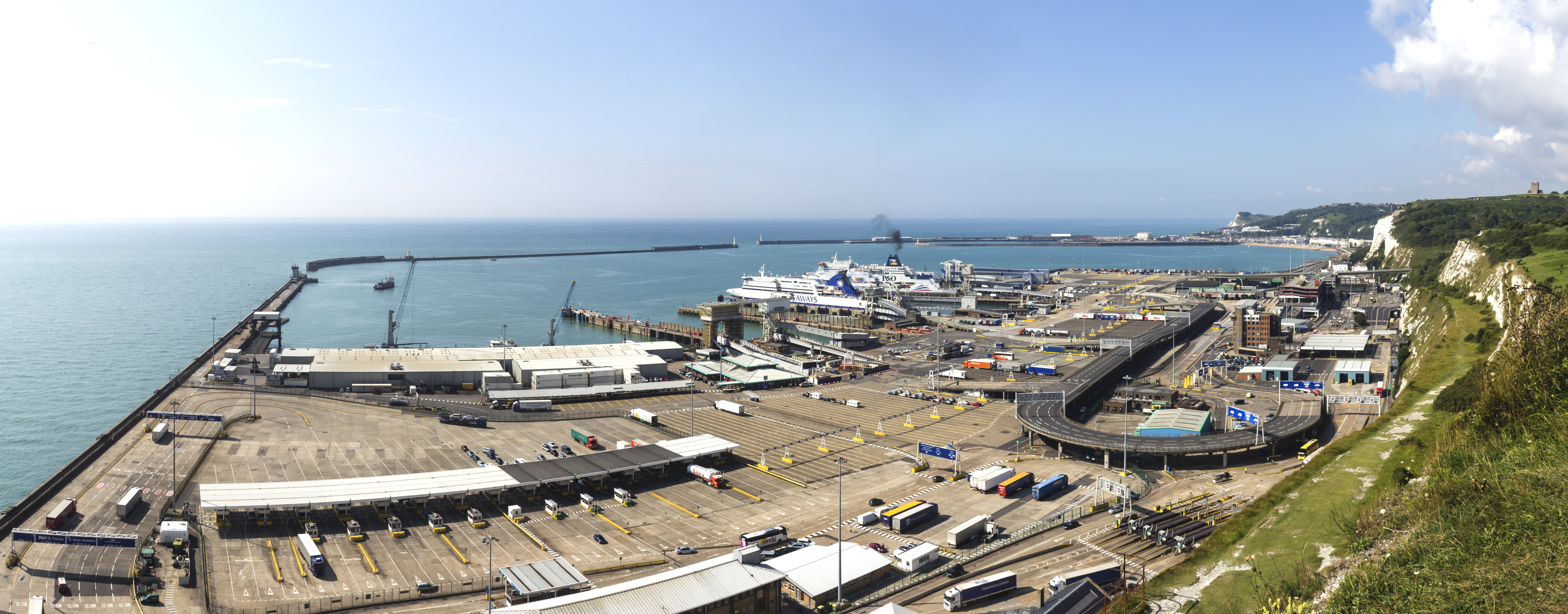
Dover () is a town and major ferry port in Kent, South East England. It faces France across the Strait of Dover, the narrowest part of the English Channel at from Cap Gris Nez in France. It lies south-east of Canterbury and east of Maidstone. The town is the administrative centre of the Dover District and home of the Port of Dover. Archaeological finds have revealed that the area has always been a focus for peoples entering and leaving Great Britain, Britain. The name derives from the River Dour that flows through it. In recent times the town has undergone transformations with a high-speed rail link to London, new retail in town with St James' area opened in 2018, and a revamped promenade and beachfront. This followed in 2019, with a new 500m Pier to the west of the Harbour, and new Marina unveiled as part of a £330m investment in the area. It has also been a point of destination for many illegal migrant crossings during the English Channel migrant crossings (2018-present) ... [...More Info...] [...Related Items...] OR: [Wikipedia] [Google] [Baidu] |
Dover (UK Parliament Constituency)
Dover is a constituency in Kent, England represented in the British House of Commons, House of Commons of the Parliament of the United Kingdom. Dover was considered a Cinque Ports Cinque ports parliament constituencies, constituency from 1386 to 1832. Constituency profile The seat includes most of Dover (district), Dover District. It comprises the towns of Deal, Kent, Deal, Dover, Walmer and surrounding villages in a productive chalkland, long-cultivated area adjoining the Strait of Dover. Since 1983 it has excluded the northern part of the District in and around the historically important Cinque Port of Sandwich, Kent, Sandwich with its golf links and accessible shore, which was then transferred to the South Thanet (UK Parliament constituency), South Thanet seat. Since 1945 Dover has been a Labour/Conservative swing seat. In local elections, most of its rural villages and the two small towns favour the Conservative Party (UK), Conservative Party, whereas Dover favours the Labo ... [...More Info...] [...Related Items...] OR: [Wikipedia] [Google] [Baidu] |
White Cliffs Of Dover
The White Cliffs of Dover is the region of English coastline facing the Strait of Dover and France. The cliff face, which reaches a height of , owes its striking appearance to its composition of chalk accented by streaks of black flint, deposited during the Late Cretaceous. The cliffs, on both sides of the town of Dover in Kent, stretch for eight miles (13 km). The White Cliffs of Dover form part of the North Downs. A section of coastline encompassing the cliffs was purchased by the National Trust in 2016. The cliffs are part of the Dover to Kingsdown Cliffs Site of Special Scientific Interest and Special Area of Conservation. The point where Great Britain is closest to continental Europe, on a clear day the cliffs are visible from France (approximately away). A celebrated UK landmark, the cliffs have featured on commemorative postage stamps issued by the Royal Mail, including in their British coastline series in 2002 and UK A-Z series in 2012. Location The cliff ... [...More Info...] [...Related Items...] OR: [Wikipedia] [Google] [Baidu] |
Port Of Dover
The Port of Dover is a cross-channel ferry, cruise terminal, maritime cargo and marina facility situated in Dover, Kent, south-east England. It is the nearest English port to France, at just away, and is one of the world's busiest maritime passenger ports, with 11.7 million passengers, 2.6 million lorries, 2.2 million cars and motorcycles and 80,000 coaches passing through it in 2017, and with an annual turnover of £58.5 million a year. This contrasts with the nearby Channel Tunnel, the only fixed link between the island of Great Britain and the European mainland, which now handles an estimated 20 million passengers and 1.6 million trucks per year. The modern port facility features a large artificial harbour constructed behind stone piers and a defensive concrete breakwater. The port is divided into two main sections: the Eastern Docks serve as the main cross-channel ferry terminal, while the Western Docks contain a cruise ship terminal and a yacht marina along with cargo fac ... [...More Info...] [...Related Items...] OR: [Wikipedia] [Google] [Baidu] |
Dover Castle (Castle Street)
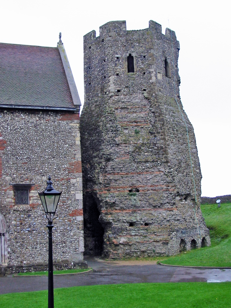
Dover Castle is a medieval castle in Dover, Kent, England and is Grade I listed. It was founded in the 11th century and has been described as the "Key to England" due to its defensive significance throughout history. Some sources say it is the largest castle in England, a title also claimed by Windsor Castle. History Iron age This site may have been fortified with earthworks in the Iron Age or earlier, before the Romans invaded in AD 43. This is suggested on the basis of the unusual pattern of the earthworks which does not seem to be a perfect fit for the medieval castle. Excavations have provided evidence of Iron Age occupation within the locality of the castle, but it is not certain whether this is associated with the hillfort. Roman era The site also contains one of Dover's two Roman lighthouses (or pharoses), one of only three surviving Roman-era lighthouses in the world, and the tallest and most complete standing Roman structure in England. It is also claimed to be B ... [...More Info...] [...Related Items...] OR: [Wikipedia] [Google] [Baidu] |
English Channel
The English Channel, "The Sleeve"; nrf, la Maunche, "The Sleeve" (Cotentinais) or ( Jèrriais), (Guernésiais), "The Channel"; br, Mor Breizh, "Sea of Brittany"; cy, Môr Udd, "Lord's Sea"; kw, Mor Bretannek, "British Sea"; nl, Het Kanaal, "The Channel"; german: Ärmelkanal, "Sleeve Channel" ( French: ''la Manche;'' also called the British Channel or simply the Channel) is an arm of the Atlantic Ocean that separates Southern England from northern France. It links to the southern part of the North Sea by the Strait of Dover at its northeastern end. It is the busiest shipping area in the world. It is about long and varies in width from at its widest to at its narrowest in the Strait of Dover."English Channel". ''The Columbia Encyclopedia'', 2004. It is the smallest of the shallow seas around the continental shelf of Europe, covering an area of some . The Channel was a key factor in Britain becoming a naval superpower and has been utilised by Britain as a natural def ... [...More Info...] [...Related Items...] OR: [Wikipedia] [Google] [Baidu] |
Kent
Kent is a county in South East England and one of the home counties. It borders Greater London to the north-west, Surrey to the west and East Sussex to the south-west, and Essex to the north across the estuary of the River Thames; it faces the French department of Pas-de-Calais across the Strait of Dover. The county town is Maidstone. It is the fifth most populous county in England, the most populous non-Metropolitan county and the most populous of the home counties. Kent was one of the first British territories to be settled by Germanic tribes, most notably the Jutes, following the withdrawal of the Romans. Canterbury Cathedral in Kent, the oldest cathedral in England, has been the seat of the Archbishops of Canterbury since the conversion of England to Christianity that began in the 6th century with Saint Augustine. Rochester Cathedral in Medway is England's second-oldest cathedral. Located between London and the Strait of Dover, which separates England from mainla ... [...More Info...] [...Related Items...] OR: [Wikipedia] [Google] [Baidu] |
Dover District
Dover is a local government district in Kent, England. The port town of Dover is its administrative centre. It was formed on 1 April 1974 by the merger of the boroughs of Deal, Dover, and Sandwich along with Dover Rural District and most of Eastry Rural District. Settlements There are three towns within the district: Deal, Dover and Sandwich; and the parishes below: * Alkham * Ash * Aylesham * Capel-le-Ferne * Denton with Wootton * Eastry * Eythorne * Goodnestone * Great Mongeham * Guston * Hougham Without * Langdon * Lydden * Nonington * Northbourne * Preston * Ringwould with Kingsdown * Ripple * River * Shepherdswell with Coldred * Sholden * St Margaret's at Cliffe * Staple * Stourmouth * Sutton * Temple Ewell * Tilmanstone * Walmer * Whitfield * Wingham * Woodnesborough * Worth The northern boundary of the district is the River Stour; on its western side is the district of Canterbury; to the south the parish of Capel-le-Ferne; and to the east the Straits of Dove ... [...More Info...] [...Related Items...] OR: [Wikipedia] [Google] [Baidu] |
Strait Of Dover
The Strait of Dover or Dover Strait (french: Pas de Calais - ''Strait of Calais''), is the strait at the narrowest part of the English Channel, marking the boundary between the Channel and the North Sea, separating Great Britain from continental Europe. The shortest distance across the strait, at approximately 20 miles (32 kilometres), is from the South Foreland, northeast of Dover in the English county of Kent, to Cap Gris Nez, a cape near to Calais in the French département of Pas-de-Calais. Between these points lies the most popular route for cross-channel swimmers. The entire strait is within the territorial waters of France and the United Kingdom, but a right of transit passage under the United Nations Convention on the Law of the Sea allows vessels of other nations to move freely through the strait. On a clear day, it is possible to see the opposite coastline of England from France and vice versa with the naked eye, with the most famous and obvious sight being the White ... [...More Info...] [...Related Items...] OR: [Wikipedia] [Google] [Baidu] |
Dubris
Dubris, also known as Portus Dubris and Dubrae, was a port in Roman Britain on the site of present-day Dover, Kent, England. As the closest point to continental Europe and the site of the estuary of the Dour, the site chosen for Dover was ideal for a cross-channel port. The Dour is now covered over for much of its course through the town. In the Roman era, it grew into an important military, mercantile and cross-channel harbour and – with Rutupiae (Richborough Roman fort) – one of the two starting points of the road later known as Watling Street. It was fortified and garrisoned initially by the Classis Britannica, and later by troops based in a Saxon Shore Fort. Julius Caesar At the start of his first attempt to conquer Britain in 55 BC Julius Caesar initially tried to land at Dubris, whose natural harbour had presumably been identified by Volusenus as a suitable landing place. However, when he came in sight of shore, the massed forces of the Britons gathered on the ov ... [...More Info...] [...Related Items...] OR: [Wikipedia] [Google] [Baidu] |
Cinque Ports
The Confederation of Cinque Ports () is a historic group of coastal towns in south-east England – predominantly in Kent and Sussex, with one outlier (Brightlingsea) in Essex. The name is Old French, meaning "five harbours", and alludes to the original five members (Hastings, New Romney, Hythe, Dover and Sandwich). At its peak in the late middle ages, the confederation included over 40 members. The confederation was originally formed for military and trade purposes, but is now entirely ceremonial. The ports lie on the western shore of the English Channel, where the crossing to the European continent is narrowest. Origins The origins of the confederation are obscure, but are believed to lie in the late Anglo-Saxon period, and specifically in the reign of Edward the Confessor (1042–1066). Certain south-east ports were granted the local profits of justice in return for providing ships. The ship service of Romney, Dover and Sandwich (but not the confederation itself) is note ... [...More Info...] [...Related Items...] OR: [Wikipedia] [Google] [Baidu] |
South East England
South East England is one of the nine official regions of England at the ITL 1 statistical regions of England, first level of International Territorial Level, ITL for Statistics, statistical purposes. It consists of the counties of england, counties of Buckinghamshire, East Sussex, Hampshire, the Isle of Wight, Kent, Oxfordshire, Berkshire, Surrey and West Sussex. Major towns and cities in the region include Brighton and Hove, Milton Keynes, Southampton, Portsmouth, Slough, Reading, Berkshire, Reading and Oxford. South East England is the third largest region of England, with an area of 19,096 km2 (7,373 sq mi), and is also the most populous with a total population of over eight and a half million (2011). The region contains seven legally city status in the United Kingdom, chartered cities: Brighton and Hove, Canterbury, Chichester, Oxford, Portsmouth, Southampton and Winchester. The region's close proximity to London and connections to several national motorways have le ... [...More Info...] [...Related Items...] OR: [Wikipedia] [Google] [Baidu] |
River Dour
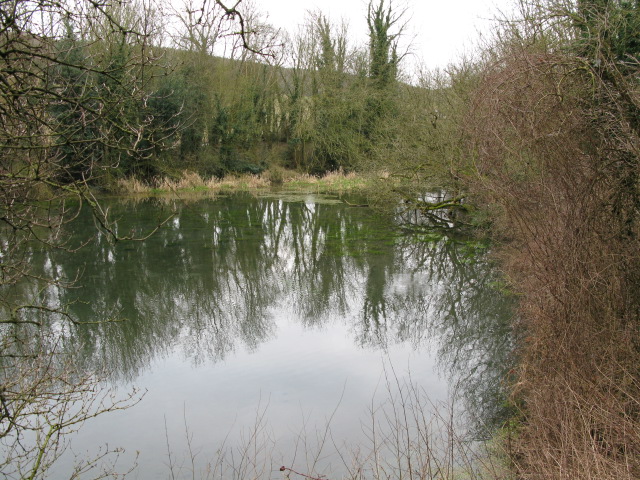
The River Dour is a chalk stream in the county of Kent, England. It flows from the villages of Temple Ewell and River between which is a neighbourhood served by a railway station, Kearsney. It is roughly long. It originally had a wide estuary on the site of modern Dover, although today it flows into the Dover Harbour through a culvert. The estuary was a natural harbour for the Bronze Age settlers and traders in the area. The remains of a Bronze Age seagoing boat (from 3,500 years ago), known as the Dover Bronze Age Boat, were found in 1992, and it can be seen in Dover Museum. The Dour Estuary was then used as a port for the Roman town, as a natural harbour for the Roman fleet. This silted up in the medieval period, necessitating the construction of various artificial harbours for Dover instead. The river has been used since AD 762 to power various watermills along its route. These included eight corn mills and five paper mills. Buckland Mill near Buckland Bridge was one ... [...More Info...] [...Related Items...] OR: [Wikipedia] [Google] [Baidu] |


