|
Radio Kantipur
Radio Kantipur () or Kantipur FM () is a Nepalese FM radio, FM radio station, established in October 1998. It currently operates in the eastern, central, western, mid-western and far-western development regions. It is most popular in eastern region and in Kathmandu. It provides news and entertainment programs 24 hours a day. In 2007 it started nationwide transmission on two frequencies – 96.1 MHz in the east and central regions and 101.8 MHz in the west. Additionally, it is available via the internet awww.radiokantipur.com/live Relay Stations * 96.1 in Kathmandu * 96.1 in Bhedetar Dhankuta district, Dhankuta * 96.1 in Birgunj, Birgunj, Parsa * 96.1 in Bharatpur, Nepal, Bharatpur, Chitwan * 96.1 in Bhairahawa, Bhairahawa, Rupandehi * 101.8 in Nepalgunj, Nepalgunj, Banke * 101.8 in Pokhara, Pokhara, Kaski * 101.8 in Dhangadhi, Dhangadi, Kailali Availability Kantipur FM programming is available online through these websites: Radio Kantipur LiveLiveFMs.com See also ... [...More Info...] [...Related Items...] OR: [Wikipedia] [Google] [Baidu] |
Kantipur Media Group
Kantipur Publications Pvt. Ltd. ( ne, कान्तिपुर पब्लिकेशन्स प्रा. लि.) is a media firm based in Kathmandu, Nepal. The company operates five widely circulated print publications. It is the first media organization in Nepal to gain membership to the World Association of Newspapers and News Publishers (WAN). It was founded by Shyam Goenka in 1993 AD. Mr. Kailash Sirohiya is the chairman of the company. History In February 1993, exactly two years after Nepal's constitution was amended to permit a free press, ''Kantipur'' and ''The Kathmandu Post'' were founded by Shyam Goenka, when he was 29 years old. In fact, he had taken the initiative to start the newspapers, with very limited resources, when just about everybody dismissed his efforts to start a private media house as a bad business move. However, Kantipur defied all naysayers and went on to write a history of its own – perhaps the greatest success story for a corporate in Ne ... [...More Info...] [...Related Items...] OR: [Wikipedia] [Google] [Baidu] |
Nepal
Nepal (; ne, नेपाल ), formerly the Federal Democratic Republic of Nepal ( ne, सङ्घीय लोकतान्त्रिक गणतन्त्र नेपाल ), is a landlocked country in South Asia. It is mainly situated in the Himalayas, but also includes parts of the Indo-Gangetic Plain, bordering the Tibet Autonomous Region of China to the north, and India in the south, east, and west, while it is narrowly separated from Bangladesh by the Siliguri Corridor, and from Bhutan by the Indian state of Sikkim. Nepal has a diverse geography, including fertile plains, subalpine forested hills, and eight of the world's ten tallest mountains, including Mount Everest, the highest point on Earth. Nepal is a multi-ethnic, multi-lingual, multi-religious and multi-cultural state, with Nepali as the official language. Kathmandu is the nation's capital and the largest city. The name "Nepal" is first recorded in texts from the Vedic period of the India ... [...More Info...] [...Related Items...] OR: [Wikipedia] [Google] [Baidu] |
FM Radio
FM broadcasting is a method of radio broadcasting using frequency modulation (FM). Invented in 1933 by American engineer Edwin Armstrong, wide-band FM is used worldwide to provide high fidelity sound over broadcast radio. FM broadcasting is capable of higher fidelity—that is, more accurate reproduction of the original program sound—than other broadcasting technologies, such as AM broadcasting. It is also less susceptible to common forms of interference, reducing static and popping sounds often heard on AM. Therefore, FM is used for most broadcasts of music or general audio (in the audio spectrum). FM radio stations use the very high frequency range of radio frequencies. Broadcast bands Throughout the world, the FM broadcast band falls within the VHF part of the radio spectrum. Usually 87.5 to 108.0 MHz is used, or some portion thereof, with few exceptions: * In the former Soviet republics, and some former Eastern Bloc countries, the older 65.8–74 MHz band ... [...More Info...] [...Related Items...] OR: [Wikipedia] [Google] [Baidu] |
Kathmandu
, pushpin_map = Nepal Bagmati Province#Nepal#Asia , coordinates = , subdivision_type = Country , subdivision_name = , subdivision_type1 = Province , subdivision_name1 = Bagmati Province , subdivision_type2 = District , subdivision_name2 = Kathmandu , established_title = , founder = Manjushri , parts_type = No. of Wards , parts = 32 , seat_type = , seat = , government_footnotes = , government_type = Mayor–council government , governing_body = Kathmandu Metropolitan Government, , leader_title = Mayor , leader_name = Balendra Shah ( Ind.) , leader_title1 = Deputy mayor , leader_name1 = Sunita Dangol (UML) , leader_title2 = Executive Officer , leader_name2 = Basanta Adhikari , unit_pref ... [...More Info...] [...Related Items...] OR: [Wikipedia] [Google] [Baidu] |
Bhedetar
Bhedetar (translation: Sheep's Butte) is a village development committee in Dhankuta District in the Koshi Zone of eastern Nepal. At the time of the 1991 Nepal census it had a population of 2643 people living in 513 individual households. It is 1,420 meters high from the sea level. It is actually the border line of Sunsari and Dhankuta district. Attractions Bhedetar is a developing tourist spot. It is a small hill station just 16 kilometers away from Dharan Sub-metropolis. It is famous for its unpredictable weather - a moment it hides itself in the blanket of thick fog and another moment it reveals itself as the crown of urban Dharan. it is also famous as the transit point to the namaste jharna,which is also one of the famous water fall of nepal. Nepal Television Nepal Television ( ne, नेपाल टेलिभिजन), shortened to NTV is the Nepalese national public state-controlled television broadcaster. It is the oldest and most watched television channel in ... [...More Info...] [...Related Items...] OR: [Wikipedia] [Google] [Baidu] |
Dhankuta District
Dhankuta District ( ne, धनकुटा जिल्ला) () is one of 14 districts of Province No. 1 of eastern Nepal. The district covers an area of and has a population (2011) of 163,412. Dhankuta is the district headquarters of Dhankuta District. History Dhankuta was a part of Kirat Region before unification of those parts into Kingdom of Nepal. After 1816 there were 10 districts in Nepal and Dhankuta-chainpur district was one of them. All land from east of Dudhkosi river to the Mechi river was one district Dhankuta-chainpur. From 1885 to 1962 Nepal remained divided into 32 districts and there were six districts in eastern-hill region: East No. 1, East No. 2, East No. 3, East No. 4, Ilam and Dhankuta. Dhankuta was center of these districts. That time also dhankuta was a large (by area) district. Current Sankhuwasabha, Tehrathum, Taplejung, Panchthar and Dhankuta districts were Incorporated under one district. The total area of the former Dhankuta district was ... [...More Info...] [...Related Items...] OR: [Wikipedia] [Google] [Baidu] |
Birgunj
Birgunj ( ne, वीरगञ्ज) is a metropolitan city in Parsa District in Madhesh Province of southern Nepal. It lies south of the capital Kathmandu, attached in the north to Raxaul in the border of the Indian state of Bihar. As an entry point to Nepal from Patna, Birgunj is known as the "Gateway of Nepal". It is also called "Commercial capital of Nepal". The town has significant economic importance for Nepal as most of the trade with India is via Birgunj and the Indian town of Raxaul. Tribhuvan Highway links Birgunj to Nepal's capital, Kathmandu. Birgunj was one of the first three municipalities formed during the rule of Prime Minister Mohan Shumsher Jang Bahadur Rana. It was declared a Metropolitan City on 22 May 2017 along with Biratnagar and Pokhara. Birgunj is one of the largest city in Nepal and largest in Madhesh Province. Birgunj is the fifth most populated metropolis of the nation. Etymology Birgunj was established as a conglomerate of several villages in ... [...More Info...] [...Related Items...] OR: [Wikipedia] [Google] [Baidu] |
Bharatpur, Nepal
Bharatpur (, ne, भरतपुर, ) is a city in southern central Nepal. It is the third most populous city of Nepal after Kathmandu and Pokhara with 369,377 inhabitants in 2021. It is also the second largest metropolitan city in Nepal by area. It is the district headquarter of the Chitwan District. Bharatpur is one of the fastest-growing cities in Nepal. It lies on the western bank of the Narayani River and serves as a commercial center of the Chitwan district and the central region of Nepal. Most of the shopping area lies in the area of Narayangadh, while government offices, hospitals and colleges are situated in other parts of the city, including Nepal's premier cancer hospital, B.P Koirala Memorial Cancer Hospital. In March 2017, Bharatpur was declared a metropolitan city after Narayani Municipality, Chitrawan Municipality and Kabilas Village were merged into it. Economy The economy of Bharatpur is traditionally based on agriculture. The city also holds a small-s ... [...More Info...] [...Related Items...] OR: [Wikipedia] [Google] [Baidu] |
Bhairahawa
Siddharthanagar ( ne, सिद्धार्थनगर), formerly and colloquially still called Bhairahawa ( ne, भैरहवा), is a municipality and the administrative headquarter of Rupandehi District in Lumbini Province of Nepal, west of Nepal's capital Kathmandu. It is the closest city to Lumbini, the birthplace of Gautama Buddha, which is located to the west. The city borders the Indian city of Sonauli in Maharajganj district of Uttar Pradesh. Although the current name was first used in 1977, many still refer to it as Bhairahawa. History and etymology The city was founded as ''Bhairahawa'' in 1967. The city's current name ''Siddharthanagar'' derives from Buddha's given name ''Siddhartha'', as the birthplace of Buddha is located only to the west. The name was changed to Siddhartanagar in 1977 by poet Komal Dutta Tiwari. Climate The highest temperature ever recorded in Siddharthanagar was on 7 June 1998, while the lowest temperature ever recorded was on 2 ... [...More Info...] [...Related Items...] OR: [Wikipedia] [Google] [Baidu] |
Nepalgunj
Nepalgunj (), also spelled Nepalganj, is a Sub-Metropolitan City in Banke District, Nepal. It lies on the Terai plains near the southern border with Bahraich district in Uttar Pradesh, India. Nepalgunj is 153 kilometers south-west of Ghorahi and 16 km south of Kohalpur. Former Village Development Committee: Udayapur, Bhawaniyapur, Piprahawa, Jaispur, Paraspur, Indrapur, Khaskarkado, Bashudevpur, Manikapur and Puraina were added to territory in order to make it Sub metropolitan city on 2071 Paush 28 and later Puraini was also added in list on 2072 Paush 21. Further, while restructuring of local levels nationwide, ward no. 23 (former Indrapur VDC) was taken out to Janaki Rural Municipality and ward no. 7 of Hirminiya VDC was added to Nepalgunj. Demographics The 2011 census counted 73,779 inhabitants with 20% growth since 2001. Currently it is estimated around 1,60,000 inhabitants in Nepalgunj city. Culture and religion Nepalgunj has a diverse culture with peo ... [...More Info...] [...Related Items...] OR: [Wikipedia] [Google] [Baidu] |
Pokhara
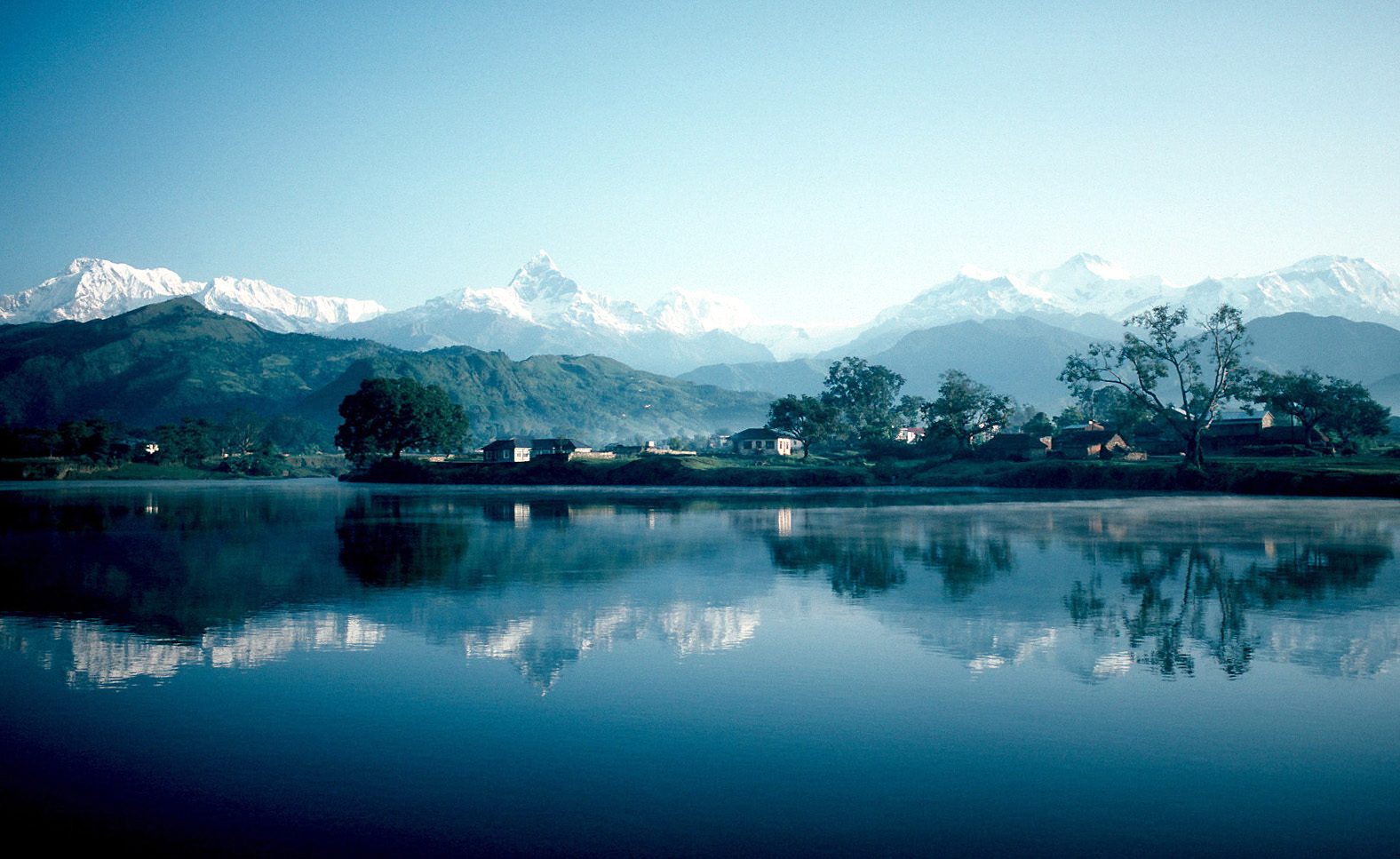
Pokhara ( ne, पोखरा, ) is a metropolis, metropolitan city in Nepal, which serves as the capital of Gandaki Province. It is the List of cities in Nepal, second most populous city of Nepal after Kathmandu, with 518,452 inhabitants living in 101,669 households in 2021 Nepal census, 2021. It is the country's largest metropolitan city in terms of area. The city also serves as the headquarters of Kaski District. Pokhara is located west of the capital, Kathmandu. The city is on the shore of Phewa Lake, and sits at an elevation of approximately 822m. The Annapurna Range, with three out of the ten highest peaks in the world—Dhaulagiri, Annapurna, Annapurna I and Manaslu—is within of the valley. Pokhara is considered the tourism capital of Nepal, being a base for trekkers undertaking the Annapurna Circuit through the Annapurna Conservation Area region of the Annapurna ranges in the Himalayas. The city is also home to many of the elite Gurkha soldiers, soldiers native to So ... [...More Info...] [...Related Items...] OR: [Wikipedia] [Google] [Baidu] |
Dhangadhi
Dhangadhi ( ne, धनगढी ) is a sub-metropolitan city and the district headquarters of Kailali District in Sudurpashchim Province of Nepal.Dhangadhi is also the temporary capital of Sudurpashchim Province. It shares a border with Uttar Pradesh, India in the south, Godawari and Gauriganga Municipality in the North, Kailari Rural Municipality in the east and Kanchanpur District in the west. Dhangadhi is a sub-metropolis divided into 19 wards. It has a population of about 147,181 and thus is the 10th biggest city of Nepal. It has an area of . It is one of the major cities of Far - West Province of Nepal along with Mahendranagar. Dhangadhi was established in 1976. It became the first sub-metropolitan city in the far-west after it was upgraded to a sub-metropolis from municipality status on 18 September 2015 as the village development committees Fulbari and Urma were merged into Dhangadhi. There is a fable. Rana Tharu of Dhangadhi used to bury their wealth in the ground du ... [...More Info...] [...Related Items...] OR: [Wikipedia] [Google] [Baidu] |


