|
Quetzaltenango (department)
Quetzaltenango is a department in the western highlands of Guatemala. The capital is the city of Quetzaltenango, the second largest city in Guatemala.Rouanet et al 1992, p.14. The department is divided up into 24 municipalities. The inhabitants include Spanish-speaking Ladinos and the K'iche' and Mam Maya groups, both with their own Maya language. The department consists of mountainous terrain, with its principal river being the Samalá River. the department is seismically active, suffering from both earthquakes and volcanic activity. Prior to the Spanish conquest the territory included in the modern department formed a part of the K'iche' Kingdom of Q'umarkaj. The kingdom was defeated by the Spanish under Pedro de Alvarado in a number of decisive battles fought near the city of Quetzaltenango, then known as Xelaju. In the 19th century the territory of the modern department was included in the short-lived Central American state of Los Altos. The department was created by decree ... [...More Info...] [...Related Items...] OR: [Wikipedia] [Google] [Baidu] |
Departments Of Guatemala
Guatemala is divided into 22 Department (country subdivision), departments (Spanish language, Spanish: ''departamentos'') which are in turn divided into 340 Municipalities of Guatemala, municipalities. In addition, Guatemala has claimed that all or part of the nation of Belize is a department of Guatemala, and this claim is sometimes reflected in maps of the region. Guatemala formally recognized Belize in 1991, but the Belizean–Guatemalan territorial dispute, border disputes between the two nations have not been resolved. Departments See also *ISO 3166-2:GT References External resources Interactive map of Guatemalan departments and municipalities {{Americas topic, Administrative divisions of Departments of Guatemala, Subdivisions of Guatemala Lists of administrative divisions, Guatemala, Departments Administrative divisions in North America, Guatemala 1 First-level admin ... [...More Info...] [...Related Items...] OR: [Wikipedia] [Google] [Baidu] |
Samalá River
The Samalá is a river in southwestern Guatemala. Its sources are in the Sierra Madre de Chiapas, Sierra Madre, San Carlos Sija, Valle De Écija range, in the departments of Quetzaltenango (department), Quetzaltenango and Totonicapán (department), Totonicapán. From there it flows down, past the towns San Carlos Sija in the San Carlos Sija, Valle De Écija, Quetzaltenango, San Cristóbal Totonicapán, Quetzaltenango, El Palmar, Quetzaltenango, El Palmar and Zunil, through the coastal plains of Retalhuleu (department), Retalhuleu into the Pacific Ocean. The Samalá river basin covers a territory of and has a population of around 400,000 people. Its proximity to the active Santamaria (volcano), Santa Maria and Santiaguito volcano complex, with its recurring lava and lahars flows, leads to a heightened risk of serious flooding. External links References Rivers of Guatemala Geography of the Totonicapán Department Geography of the Quetzaltenango Department Geography of t ... [...More Info...] [...Related Items...] OR: [Wikipedia] [Google] [Baidu] |
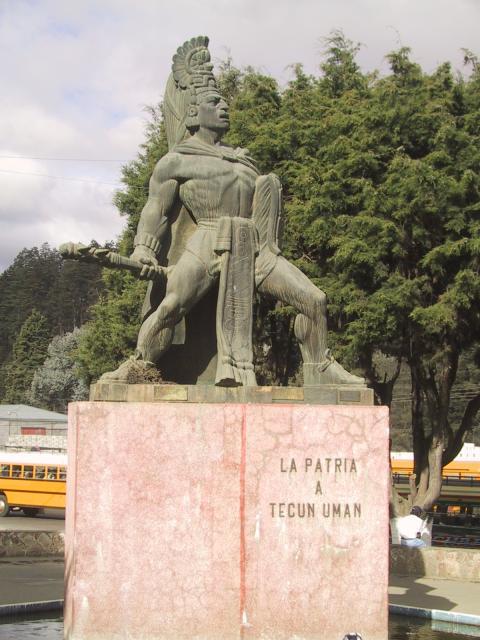
Tecún Umán
Tecun UmanAlternate transliterations include Tecún Umán, Tecúm Umán, Tecúm Umam, Tekun Umam, etc. (1500? – February 20, 1524) was one of the last rulers of the K'iche' Maya people, in the Highlands of what is now Guatemala. According to the Kaqchikel annals, he was slain by Spanish conquistador Pedro de Alvarado while waging battle against the Spanish and their allies on the approach to Quetzaltenango on 12 February 1524. Tecun Uman was declared Guatemala's official national hero on March 22, 1960 and is commemorated on February 20, the popular anniversary of his death. Tecun Uman has inspired a wide variety of activities ranging from the production of statues and poetry to the retelling of the legend in the form of folkloric dances to prayers. Despite this, Tecun Uman's existence is not well documented, and it has proven to be difficult to separate the man from the legend. Battle of El Pinar In 1522 Hernán Cortés sent Mexican allies to scout the Soconusco region of l ... [...More Info...] [...Related Items...] OR: [Wikipedia] [Google] [Baidu] |
Sierra Madre De Chiapas
The Sierra Madre de Chiapas is a major mountain range in Central America. It crosses El Salvador, Guatemala, Mexico and Honduras. The Sierra Madre de Chiapas is part of the American Cordillera, a chain of mountain ranges that consists of an almost continuous sequence of mountain ranges that form the western "backbone" of North America, Central America, and South America. Geography The range runs northwest–southeast from the state of Chiapas in Mexico, across western Guatemala, into El Salvador and Honduras. Most of the volcanoes of Guatemala, part of the Central America Volcanic Arc, are within the range. A narrow coastal plain lies south of the range, between the Sierra Madre and the Pacific Ocean. To the north lie a series of highlands and depressions, including the Chiapas Depression, which separates the Sierra Madre from the Chiapas Plateau, the Guatemalan Highlands, and Honduras' interior highlands. The range forms the main drainage divide between the Pacific and Atlanti ... [...More Info...] [...Related Items...] OR: [Wikipedia] [Google] [Baidu] |
Pacific Ocean
The Pacific Ocean is the largest and deepest of Earth's five oceanic divisions. It extends from the Arctic Ocean in the north to the Southern Ocean (or, depending on definition, to Antarctica) in the south, and is bounded by the continents of Asia and Oceania in the west and the Americas in the east. At in area (as defined with a southern Antarctic border), this largest division of the World Ocean—and, in turn, the hydrosphere—covers about 46% of Earth's water surface and about 32% of its total surface area, larger than Earth's entire land area combined .Pacific Ocean . '' Britannica Concise.'' 2008: Encyclopædia Britannica, Inc. The centers of both the |
Tecun Uman
Tecun UmanAlternate transliterations include Tecún Umán, Tecúm Umán, Tecúm Umam, Tekun Umam, etc. (1500? – February 20, 1524) was one of the last rulers of the K'iche' Maya people, in the Highlands of what is now Guatemala. According to the Kaqchikel annals, he was slain by Spanish conquistador Pedro de Alvarado while waging battle against the Spanish and their allies on the approach to Quetzaltenango on 12 February 1524. Tecun Uman was declared Guatemala's official national hero on March 22, 1960 and is commemorated on February 20, the popular anniversary of his death. Tecun Uman has inspired a wide variety of activities ranging from the production of statues and poetry to the retelling of the legend in the form of folkloric dances to prayers. Despite this, Tecun Uman's existence is not well documented, and it has proven to be difficult to separate the man from the legend. Battle of El Pinar In 1522 Hernán Cortés sent Mexican allies to scout the Soconusco region of l ... [...More Info...] [...Related Items...] OR: [Wikipedia] [Google] [Baidu] |
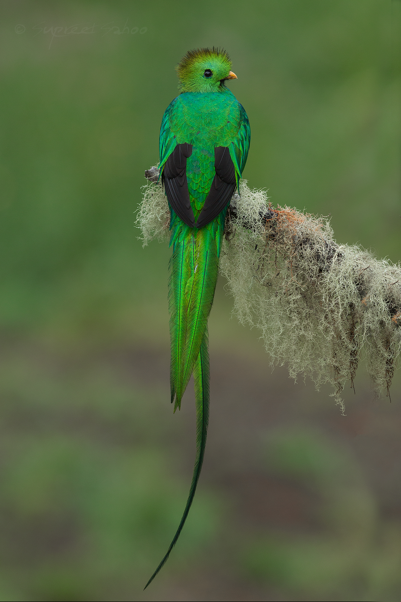
Resplendent Quetzal
The resplendent quetzal (''Pharomachrus mocinno'') is a small bird found in southern Mexico and Central America, with two recognized subspecies, ''P. m. mocinno'' and ''P. m. costaricensis''. These animals live in tropical forests, particularly montane cloud forests and they are part of the family Trogonidae. Like other quetzals, the resplendent is omnivorous; its diet mainly consists of fruits of plants in the laurel family, Lauraceae, but it occasionally also preys on insects, lizards, frogs and snails. The species is well known for its colorful and complex plumage that differs substantially between sexes. Males have iridescent green plumes, a red lower breast and belly, black innerwings and a white undertail, whilst females are duller and have a shorter tail. Grey lower breasts, bellies, and bills, along with bronze-green heads are characteristic of females. These birds hollow holes in decaying trees or use ones already made by woodpeckers as a nest site. They are known to ... [...More Info...] [...Related Items...] OR: [Wikipedia] [Google] [Baidu] |
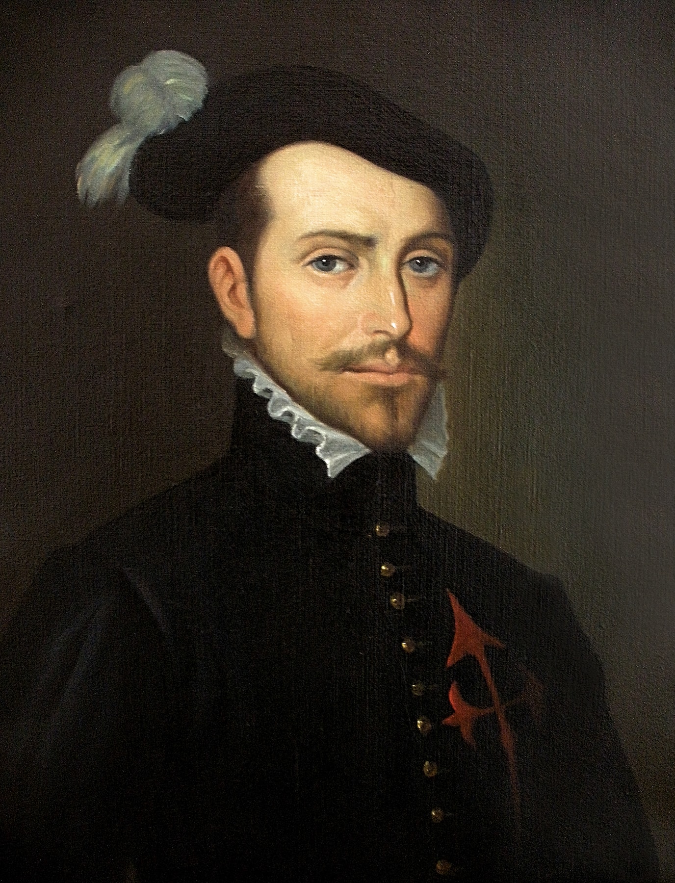
Conquistador
Conquistadors (, ) or conquistadores (, ; meaning 'conquerors') were the explorer-soldiers of the Spanish and Portuguese Empires of the 15th and 16th centuries. During the Age of Discovery, conquistadors sailed beyond Europe to the Americas, Oceania, Africa, and Asia, colonizing and opening trade routes. They brought much of the Americas under the dominion of Spain and Portugal. After arrival in the West Indies in 1492, the Spanish, usually led by hidalgos from the west and south of Spain, began building an American empire in the Caribbean using islands such as Hispaniola, Cuba, and Puerto Rico as bases. From 1519 to 1521, Hernán Cortés waged a campaign against the Aztec Empire, ruled by Moctezuma II. From the territories of the Aztec Empire, conquistadors expanded Spanish rule to northern Central America and parts of what is now the southern and western United States, and from Mexico sailing the Pacific Ocean to the Philippines. Other conquistadors took over the Inca ... [...More Info...] [...Related Items...] OR: [Wikipedia] [Google] [Baidu] |
Nahuatl
Nahuatl (; ), Aztec, or Mexicano is a language or, by some definitions, a group of languages of the Uto-Aztecan language family. Varieties of Nahuatl are spoken by about Nahua peoples, most of whom live mainly in Central Mexico and have smaller populations in the United States. Nahuatl has been spoken in central Mexico since at least the seventh century CE. It was the language of the Aztec/ Mexica, who dominated what is now central Mexico during the Late Postclassic period of Mesoamerican history. During the centuries preceding the Spanish and Tlaxcalan conquest of the Aztec Empire, the Aztecs had expanded to incorporate a large part of central Mexico. Their influence caused the variety of Nahuatl spoken by the residents of Tenochtitlan to become a prestige language in Mesoamerica. After the conquest, when Spanish colonists and missionaries introduced the Latin alphabet, Nahuatl also became a literary language. Many chronicles, grammars, works of poetry, administrative docu ... [...More Info...] [...Related Items...] OR: [Wikipedia] [Google] [Baidu] |
Rafael Carrera
José Rafael Carrera y Turcios (24 October 1814 – 14 April 1865) was the president of Guatemala from 1844 to 1848 and from 1851 until his death in 1865, after being appointed President for life in 1854. During his military career and presidency, new nations in Central America were facing numerous problems: William Walker's invasions, liberal attempts to overthrow the Catholic Church and aristocrats' power, the Civil War in the United States, Mayan uprising in the east, Belize boundary dispute with the United Kingdom, and the wars in Mexico under Benito Juarez. This led to a rise of caudillos, a term that refers to charismatic populist leaders among the indigenous people. Backed by the Catholic Church, conservatives of the Aycinena clan led by Juan José de Aycinena y Piñol, and mestizo and indigenous peasants, he dominated politics in the first three decades of Guatemala's independence more than any other individual. He led the revolt against the liberal state government ... [...More Info...] [...Related Items...] OR: [Wikipedia] [Google] [Baidu] |
Los Altos, Central America
The State of Los Altos (Spanish: ''Estado de Los Altos''), commonly known as Los Altos, was the state of the Federal Republic of Central America from 1838 to 1840 and a short-lived independent republic from 1848 to 1849. Its capital was Quetzaltenango. Los Altos occupied eight departments in the west of present-day Guatemala as well as the Soconusco region in the Mexican state of Chiapas. The state originated from the political differences and tensions between Guatemala City on one side, and Quetzaltenango and other parts of western Central America on the other. Debate about separation from Guatemala dated from shortly after Central American independence from Spain in 1821. Such a separate state was provided for by the Federal constitutional assembly of November 1824, but there was sizable opposition to the separation in Guatemala City. The independence of Los Altos from Guatemala was officially proclaimed on 2 February 1838. The Federal government recognized Los Altos as the sixth ... [...More Info...] [...Related Items...] OR: [Wikipedia] [Google] [Baidu] |
Pedro De Alvarado
Pedro de Alvarado (; c. 1485 – 4 July 1541) was a Spanish conquistador and governor of Guatemala.Lovell, Lutz and Swezey 1984, p. 461. He participated in the conquest of Cuba, in Juan de Grijalva's exploration of the coasts of the Yucatán Peninsula and the Gulf of Mexico, and in the conquest of the Aztec Empire led by Hernán Cortés. He is considered the conquistador of much of Central America, including Guatemala, Honduras and El Salvador. Character and appearance Pedro de Alvarado was flamboyant and charismatic, and was both a brilliant military commander and a cruel, hardened man. His hair and beard were red, which reminded the Aztecs of their sun-god (often painted red) Tōnatiuh. He was handsome, and presented an affable appearance, but was volatile and quick to anger.Burland 1973, p. 216. He was ruthless in his dealings with the indigenous peoples he set out to conquer. Historians judge that his greed drove him to excessive cruelty,Recinos 1986, p. 205. and his ... [...More Info...] [...Related Items...] OR: [Wikipedia] [Google] [Baidu] |


.jpg)


