|
Qinghai Lake
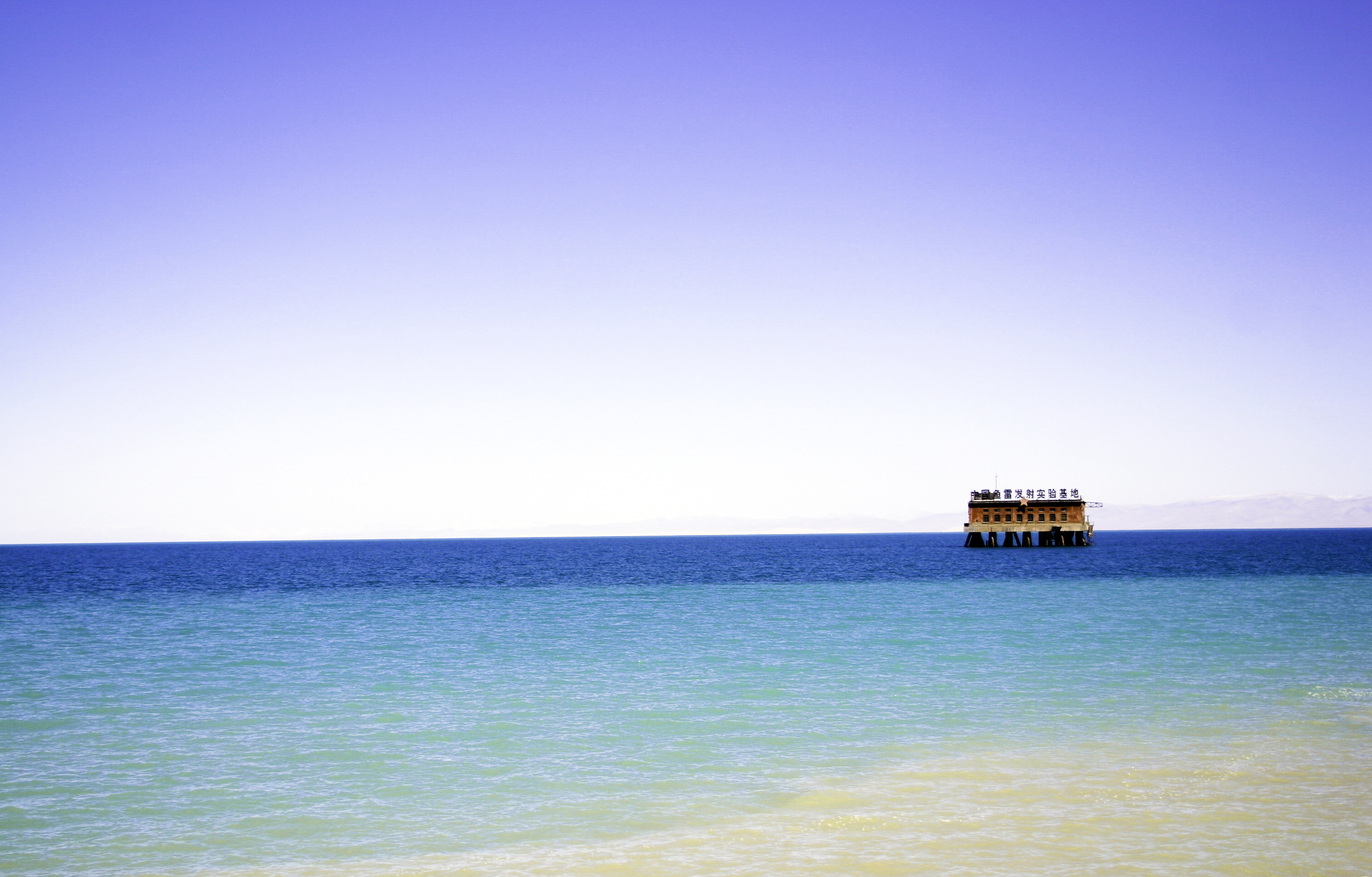
Qinghai Lake or Ch'inghai Lake, also known by #Names, other names, is the list of lakes by area, largest lakes of China, lake in China. Located in an endorheic basin in Qinghai Province, to which it gave its name, Qinghai Lake is classified as an alkaline lake, alkaline saline lake, salt lake. The lake has fluctuated in size, shrinking over much of the 20th century but increasing since 2004. It had a surface area of , an average depth of , and a maximum depth of in 2008. Names Qinghai is the romanization of Chinese, romanized Standard Chinese pinyin pronunciation of the name Although modern Chinese distinguishes between the colors blue and green, Blue–green distinction in language, this distinction did not exist in classical Chinese. The color (''qīng'') was Blue–green distinction in language#Chinese, a "single" color inclusive of both blue and green as separate shades. (English for ''qīng'' is cyan or turquoise, also linguists have coined the portmanteau "grue" to ... [...More Info...] [...Related Items...] OR: [Wikipedia] [Google] [Baidu] |
|
 |
Qinghai Province
Qinghai (; alternately romanized as Tsinghai, Ch'inghai), also known as Kokonor, is a landlocked province in the northwest of the People's Republic of China. It is the fourth largest province of China by area and has the third smallest population. Its capital and largest city is Xining. Qinghai borders Gansu on the northeast, Xinjiang on the northwest, Sichuan on the southeast and the Tibet Autonomous Region on the southwest. Qinghai province was established in 1928 during the period of the Republic of China, and until 1949 was ruled by Chinese Muslim warlords known as the Ma clique. The Chinese name "Qinghai" is after Qinghai Lake, the largest lake in China. The lake is known as Tso ngon in Tibetan, and as Kokonor Lake in English, derived from the Mongol Oirat name for Qinghai Lake. Both Tso ngon and Kokonor are names found in historic documents to describe the region.Gangchen Khishong, 2001. ''Tibet and Manchu: An Assessment of Tibet-Manchu Relations in Five Phases ... [...More Info...] [...Related Items...] OR: [Wikipedia] [Google] [Baidu] |
 |
Classical Chinese
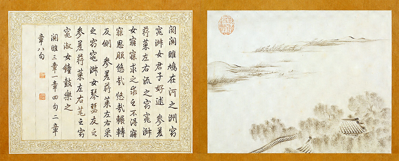
Classical Chinese, also known as Literary Chinese (古文 ''gǔwén'' "ancient text", or 文言 ''wényán'' "text speak", meaning "literary language/speech"; modern vernacular: 文言文 ''wényánwén'' "text speak text", meaning "literary language writing"), is the language of the classic literature from the end of the Spring and Autumn period through to the either the start of the Qin dynasty or the end of the Han dynasty, a written form of Old Chinese (上古漢語, ''Shànɡɡǔ Hànyǔ''). Classical Chinese is a traditional style of written Chinese that evolved from the classical language, making it different from any modern spoken form of Chinese. Literary Chinese was used for almost all formal writing in China until the early 20th century, and also, during various periods, in Japan, Ryukyu, Korea and Vietnam. Among Chinese speakers, Literary Chinese has been largely replaced by written vernacular Chinese, a style of writing that is similar to modern spoken ... [...More Info...] [...Related Items...] OR: [Wikipedia] [Google] [Baidu] |
.jpg) |
Kunlun Mountains
The Kunlun Mountains ( zh, s=昆仑山, t=崑崙山, p=Kūnlún Shān, ; ug, كۇئېنلۇن تاغ تىزمىسى / قۇرۇم تاغ تىزمىسى ) constitute one of the longest mountain chains in Asia, extending for more than . In the broadest sense, the chain forms the northern edge of the Tibetan Plateau south of the Tarim Basin. The exact definition of Kunlun Mountains varies over time. Older sources used Kunlun to mean the mountain belt that runs across the center of China, that is, Altyn Tagh along with the Qilian and Qin Mountains. Recent sources have the Kunlun range forming most of the south side of the Tarim Basin and then continuing east, south of the Altyn Tagh. Sima Qian (''Records of the Grand Historian'', scroll 123) says that Emperor Wu of Han sent men to find the source of the Yellow River and gave the name Kunlun to the mountains at its source. The name seems to have originated as a semi-mythical location in the classical Chinese text ''Classic of M ... [...More Info...] [...Related Items...] OR: [Wikipedia] [Google] [Baidu] |
|
Lake Heihai
Lake Heihai is a small meso saline lake in Golmud County, Haixi Prefecture, Qinghai Province, in western China. Names "Lake Heihai" is an English clarification of the pinyin romanization of the Chinese name meaning . (As with Qinghai Lake, the Chinese word for "sea" is sometimes used to translate the Mongolian ''naɣur'' (), which was once used ambiguously for all large bodies of water.) The lake is also known as ("Jade Pond of the Queen Mother of the West") from an old legendary location in the Kunlun Mountains and sometimes confused with Lake Hala in the Qilian Mountains. Geography Lake Heihai is located about south of the city of Golmud in Golmud County, Haixi Prefecture, Qinghai Province, at an elevation of or above sea level in western China. It lies in a valley roughly long and wide between the Kunlun Mountains (highest elevation about ) to the south and the Burhan Buda (highest elevation about ) to the north. Earthquakes are common, as the lake lies near t ... [...More Info...] [...Related Items...] OR: [Wikipedia] [Google] [Baidu] |
|
|
Qing Dynasty
The Qing dynasty ( ), officially the Great Qing,, was a Manchu-led imperial dynasty of China and the last orthodox dynasty in Chinese history. It emerged from the Later Jin dynasty founded by the Jianzhou Jurchens, a Tungusic-speaking ethnic group who unified other Jurchen tribes to form a new "Manchu" ethnic identity. The dynasty was officially proclaimed in 1636 in Manchuria (modern-day Northeast China and Outer Manchuria). It seized control of Beijing in 1644, then later expanded its rule over the whole of China proper and Taiwan, and finally expanded into Inner Asia. The dynasty lasted until 1912 when it was overthrown in the Xinhai Revolution. In orthodox Chinese historiography, the Qing dynasty was preceded by the Ming dynasty and succeeded by the Republic of China. The multiethnic Qing dynasty lasted for almost three centuries and assembled the territorial base for modern China. It was the largest imperial dynasty in the history of China and in 1790 ... [...More Info...] [...Related Items...] OR: [Wikipedia] [Google] [Baidu] |
|
 |
Upper Mongols
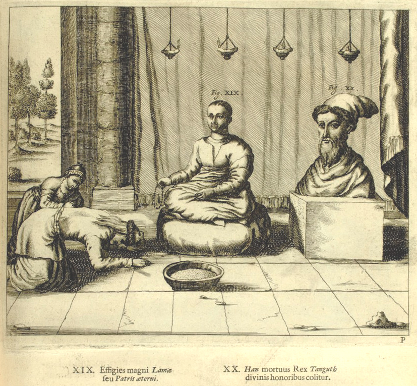
The Upper Mongols ( Mongolian: Дээд монгол, ''Deed mongol'', Mongolian script: ), also known as the Köke Nuur Mongols ( Mongolian: Хөх нуурын Монгол, Mongolian script: , "Blue lake Mongol") or Qinghai Mongols ( Chinese: 青海蒙古), are ethnic Mongol people of Oirat and Khalkha origin who settled around Qinghai Lake in so-called Upper Mongolia. As part of the Khoshut Khanate of Tsaidam and the Koke Nuur they played a major role in Sino–Mongol–Tibetan politics during the 17th and 18th centuries. The Upper Mongols adopted Tibetan dress and jewelry despite still living in the traditional Mongolian ger and writing in the script. History After the disintegration of the Proto-Mongolic Xianbei state, nomadic groups such as the ( Monguor) migrated under the rule of their Khan, Tuyuhun, from their original settlements on the Liaodong Peninsula to the western region of modern Qinghai. The Tuyuhun Empire (284–670) stretched 1,500 kilometers from e ... [...More Info...] [...Related Items...] OR: [Wikipedia] [Google] [Baidu] |
|
Calque
In linguistics, a calque () or loan translation is a word or phrase borrowed from another language by literal word-for-word or root-for-root translation. When used as a verb, "to calque" means to borrow a word or phrase from another language while translating its components, so as to create a new lexeme in the target language. For instance, the English word "skyscraper" was calqued in dozens of other languages. Another notable example is the Latin weekday names, which came to be associated by ancient Germanic speakers with their own gods following a practice known as '' interpretatio germanica'': the Latin "Day of Mercury", ''Mercurii dies'' (later "mercredi" in modern French), was borrowed into Late Proto-Germanic as the "Day of Wōđanaz" (*''Wodanesdag''), which became ''Wōdnesdæg'' in Old English, then "Wednesday" in Modern English. The term ''calque'' itself is a loanword from the French noun ("tracing, imitation, close copy"), while the word ''loanword'' is a calqu ... [...More Info...] [...Related Items...] OR: [Wikipedia] [Google] [Baidu] |
|
|
Mongolian Language
Mongolian is the official language of Mongolia and both the most widely spoken and best-known member of the Mongolic language family. The number of speakers across all its dialects may be 5.2 million, including the vast majority of the residents of Mongolia and many of the ethnic Mongol residents of the Inner Mongolia Autonomous Region of the People's Republic of China.Estimate from Svantesson ''et al.'' (2005): 141. In Mongolia, Khalkha Mongolian is predominant, and is currently written in both Cyrillic and traditional Mongolian script. In Inner Mongolia, the language is dialectally more diverse and is written in the traditional Mongolian script. However, Mongols in both countries often use the Latin script for convenience on the Internet. In the discussion of grammar to follow, the variety of Mongolian treated is the standard written Khalkha formalized in the writing conventions and in grammar as taught in schools, but much of what is to be said is also valid for ve ... [...More Info...] [...Related Items...] OR: [Wikipedia] [Google] [Baidu] |
|
 |
Chinese Postal Map
The history of the postage stamps and postal history of China is complicated by the gradual decay of Imperial China and the years of civil war and Japanese occupation in the 1930s and 1940s. In modern times, postal delivery is handled by China Post. Early history Regular government postal service is known from the Zhou dynasty in the 1st millennium BC. During the Yuan dynasty under Kublai Khan in the 12th century, China was integrated into the much larger Mongolian Örtöö system. Marco Polo reported that there were 10,000 post stages during that time. In addition, private letters were carried by the Min Hsin Chu, a system of letter guilds (''hongs''). Later the 1727 Treaty of Kyakhta with Russia provided for the first regular exchange of mail. Qing Dynasty Although postal service in China goes back some 2,500 years, modern postal services were not established until 1877 by the Qing government. A policy of isolation was forcibly ended in the 19th century by th ... [...More Info...] [...Related Items...] OR: [Wikipedia] [Google] [Baidu] |
 |
Tarim Basin
The Tarim Basin is an endorheic basin in Northwest China occupying an area of about and one of the largest basins in Northwest China.Chen, Yaning, et al. "Regional climate change and its effects on river runoff in the Tarim Basin, China." Hydrological Processes 20.10 (2006): 2207–2216.online 426 KB) Located in China's Xinjiang region, it is sometimes used synonymously to refer to the southern half of the province, or Nanjiang (), as opposed to the northern half of the province known as Dzungaria or Beijiang. Its northern boundary is the Tian Shan mountain range and its southern boundary is the Kunlun Mountains on the edge of the Tibetan Plateau. The Taklamakan Desert dominates much of the basin. The historical Uyghur name for the Tarim Basin is Altishahr ( Traditional spelling: 六城 or ), which means 'six cities' in Uyghur. Geography and relation to Xinjiang Xinjiang consists of two main geographically, historically, and ethnically distinct regions with different h ... [...More Info...] [...Related Items...] OR: [Wikipedia] [Google] [Baidu] |
|
East China Sea
The East China Sea is an arm of the Western Pacific Ocean, located directly offshore from East China. It covers an area of roughly . The sea’s northern extension between mainland China and the Korean Peninsula is the Yellow Sea, separated by an imaginary line between the eastern tip of Qidong at the Yangtze River estuary and the southwestern tip of South Korea's Jeju Island. The East China Sea is bounded in the east and southeast by the middle portion of the first island chain off the eastern Eurasian continental mainland, including the Japanese island of Kyushu and the Ryukyu Islands, and in the south by the island of Taiwan. It connects with the Sea of Japan in the northeast through the Korea Strait, the South China Sea in the southwest via the Taiwan Strait, and the Philippine Sea in the southeast via gaps between the various Ryukyu Islands (e.g. Tokara Strait and Miyako Strait). Most of the East China Sea is shallow, with almost three-fourths of it bei ... [...More Info...] [...Related Items...] OR: [Wikipedia] [Google] [Baidu] |
|
 |
Four Seas
The Four Seas () were four bodies of water that metaphorically made up the boundaries of ancient China. There is a sea for each for the four cardinal directions. The West Sea is Qinghai Lake, the East Sea is the East China Sea, the North Sea is Lake Baikal, and the South Sea is the South China Sea. Two of the seas were symbolic until they were tied to genuine locations during the Han dynasty's wars with the Xiongnu. The lands "within the Four Seas", a literary name for China, are alluded to in Chinese literature and poetry. History The original Four Seas were a metaphor for the borders of pre-Han dynasty China. Only two of the Four Seas were tied to real locations, the East Sea with the East China Sea and the South Sea with the South China Sea. During the Han dynasty, wars with the Xiongnu brought them north to Lake Baikal. They recorded that the lake was a "huge sea" (hanhai) and designated it the mythical North Sea. They also encountered Qinghai Lake, which they call ... [...More Info...] [...Related Items...] OR: [Wikipedia] [Google] [Baidu] |