|
Preesall
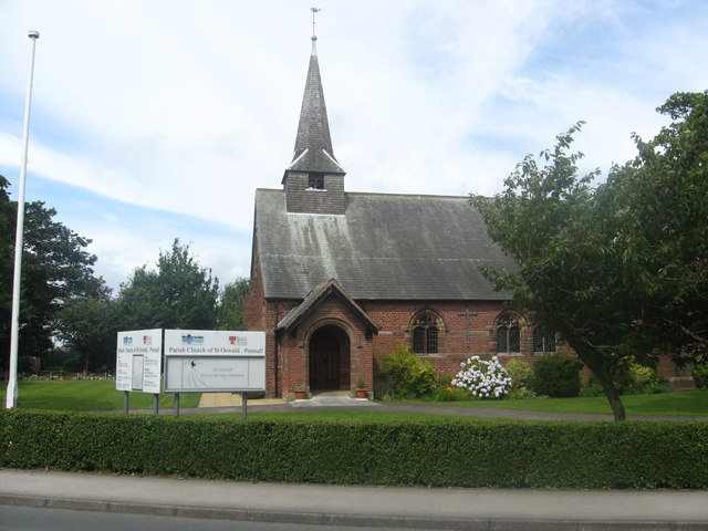
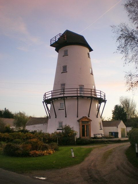
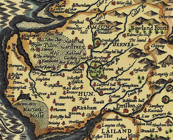
Preesall is a town, civil parish and electoral ward in Lancashire, England. The parish (until 1910 known as Preesall with Hackensall) covers the eastern bank of the estuary of the River Wyre, including Knott End-on-Sea, Pilling Lane and the village of Preesall itself. The parish of Preesall had a population of 5,314 recorded in the 2001 census, rising to 5,694 at the 2011 census. History There is evidence that the eastern side of the River Wyre was occupied during the Danish invasions of the 9th and 10th centuries. Preesall is mentioned in the Domesday Book (1086) as being a part of the Hundred of Amounderness and the Domesday place name is given as ''Pressouede''. The names Preesall and Hackensall are both probably Norse in origin, with Preesall meaning "a hill and a heath" and Hackensall probably deriving from "Haakon", a Viking seafarer who sailed up the River Wyre and set up an encampment in the 10th century. In 1190 the land was granted to a bowman in the service of Pr ... [...More Info...] [...Related Items...] OR: [Wikipedia] [Google] [Baidu] |
Black Bull, Preesall
The Black Bull, formerly known as the Black Bull Inn and Black Bull Hotel, is a public house in Preesall, Lancashire, England. Dating to 1762, it stands on Park Lane. The inn's first licencee was John Bamber, who ran it between 1776 and 1789. Between 1853 and 1892, the role was filled by John Parkinson. In 1872, during Parkinson's tenure, a "syndicate of men" from Barrow-in-Furness stayed at the inn during their search for iron ore in the area. None was to be found, but they did discover a bed of rock salt, from which they took a sample. Upon returning to the inn, Parkinson's 17-year-old daughter, Dorothy, processed the sample by dissolving, filtering and boiling it, thus creating the very first example of Preesall salt. In 1902, Preesall Salt Works was built to the north of the village's salt marshes, on the eastern banks of the River Wyre. [...More Info...] [...Related Items...] OR: [Wikipedia] [Google] [Baidu] |
Borough Of Wyre
Wyre is a local government district with borough status in Lancashire, England. The population of the non-metropolitan district at the 2011 census was 107,749. The district borders the unitary authority area of Blackpool as well as the districts of Lancaster, Ribble Valley, Fylde and Preston. The council is based in Poulton-le-Fylde. The district is named after the River Wyre, which runs through the district. The district is a rare contemporary example of a non-contiguous local government area. There are no road or rail connections between the parts of the borough divided by the River Wyre, and it is necessary to travel through the Fylde district in order to travel between the two divided parts of Wyre, or else use the passenger ferry between Fleetwood and Knott End. The borough also includes parts of Blackpool built-up area. History The district was created on 1 April 1974 under the Local Government Act 1972, as a non-metropolitan district covering the territory of fi ... [...More Info...] [...Related Items...] OR: [Wikipedia] [Google] [Baidu] |
Knott End-on-Sea
Knott End-on-Sea is a village in Lancashire, England, on the southern side of Morecambe Bay, across the Wyre estuary from Fleetwood. Knott End has a pub, the Bourne Arms, county library and golf club. Buses run regularly from Knott End and there is also a three-minute ferry crossing to Fleetwood. Knott End also has two clubs, The Squash and Knott End Working Men's Club. See also * Knott End Railway *Knott End-on-Sea railway station Knott End railway station served Knott End on Sea in Lancashire, England, with a ferry service to Fleetwood. The station opened in 1908 and closed for passengers in 1930 and for freight in 1950. History The station opened on 30 July 1908 by ... External links Preesall Town CouncilWyre Borough CouncilLancashire County CouncilLocal InformationOver-Wyre and Knott End History and TopographyVisit Poulton-le-Fylde, local photos and video Villages in Lancashire Geography of the Borough of Wyre The Fylde Populated coastal places in Lanc ... [...More Info...] [...Related Items...] OR: [Wikipedia] [Google] [Baidu] |
Lancashire
Lancashire ( , ; abbreviated Lancs) is the name of a historic county, ceremonial county, and non-metropolitan county in North West England. The boundaries of these three areas differ significantly. The non-metropolitan county of Lancashire was created by the Local Government Act 1972. It is administered by Lancashire County Council, based in Preston, and twelve district councils. Although Lancaster is still considered the county town, Preston is the administrative centre of the non-metropolitan county. The ceremonial county has the same boundaries except that it also includes Blackpool and Blackburn with Darwen, which are unitary authorities. The historic county of Lancashire is larger and includes the cities of Manchester and Liverpool as well as the Furness and Cartmel peninsulas, but excludes Bowland area of the West Riding of Yorkshire transferred to the non-metropolitan county in 1974 History Before the county During Roman times the area was part of the Bri ... [...More Info...] [...Related Items...] OR: [Wikipedia] [Google] [Baidu] |
Lancaster And Fleetwood (UK Parliament Constituency)
Lancaster and Fleetwood is a constituency created in 2010 represented in the House of Commons of the UK Parliament by Cat Smith of the Labour Party. History ;Creation Following their review of parliamentary representation in Lancashire, the Boundary Commission created a new Wyre and Preston North constituency, fought at the 2010 general election, which split the previous linking of Lancaster and Wyre. As a consequence, Lancaster and the coastal town of Fleetwood have been attached for parliamentary purposes. ;Summary of results to date In 2010 the winning candidate was Eric Ollerenshaw, a Conservative. He was defeated in the 2015 general election by Labour's Cat Smith. The 2015 result gave the seat the 16th-smallest majority of Labour's 232 seats by percentage of majority. Ollerenshaw attempted to regain the seat at the 2017 general election but was again defeated by Smith, who significantly increased her majority to over 6,500. At the 2019 General election Smith's majorit ... [...More Info...] [...Related Items...] OR: [Wikipedia] [Google] [Baidu] |
River Wyre
The River Wyre is a river in Lancashire, England, United Kingdom, which flows into the Irish Sea at Fleetwood. It is approximately 28 miles (45 km) in length. The river is a County Biological Heritage Site and has a sheltered estuary which, from its northwest corner, penetrates deep into the almost square peninsula of the Fylde. Etymology The name ''Wyre'' is of pre-Roman, likely if specific, Common Brittonic origin. It may be derived from ''*wiΣ-'', a form of the element ''*wei'', with a basic sense of "flowing", with the suffix ''–urā''. The River Wyre possibly shares its etymology with other river names, including the Wear in County Durham and the Quair Water in Scotland. Geography The river rises in the Forest of Bowland in central Lancashire, as two distinct tributaries, the Tarnbrook Wyre and the Marshaw Wyre, whose confluence is near the village of Abbeystead. In 1984 a pumping station, built just below the confluence as part of a water transfer scheme ... [...More Info...] [...Related Items...] OR: [Wikipedia] [Google] [Baidu] |
Pilling
Pilling is a village and civil parish within the Borough of Wyre, Wyre borough of Lancashire, England. It is north-northeast of Poulton-le-Fylde, south-southwest of Lancaster, Lancashire, Lancaster and northwest of Preston, Lancashire, Preston, in a part of the Fylde known as Over Wyre. The civil parish of Pilling, which includes the localities of Stake Pool, Scronkey and Eagland Hill, had a total resident population of 1,739 in 2001, increasing to 2,020 at the 2011 Census. Populations in the 19th century ranged from 1,281 in 1851 to 1,572 in 1871. Etymology Eilert Ekwall suggests the name is Common Brittonic, Celtic, linking it with the Welsh toponymy, Welsh place-name element Pil (placename), "Pîl" (rendered as Pyl in Old English). This etymology would suggest the settlement started as a tidal inlet used as a harbour. Ekwall suggested the geography of Pilling may be "accurately described as a pill". The name appears as ''Pylin'' in 1246 and, if the name is indeed Celt ... [...More Info...] [...Related Items...] OR: [Wikipedia] [Google] [Baidu] |
Amounderness
The Amounderness Hundred () is one of the six subdivisions of the historic county of Lancashire in North West England, but the name is older than the system of hundreds first recorded in the 13th century and might best be described as the name of a Norse wapentake. In the Domesday Book, it was used for some territories north of the River Ribble included together with parts of Yorkshire. The area eventually became part of Lancashire, sitting geographically between the Rivers Lune and Ribble, in the strip of coast between the Irish Sea and Bowland Forest. Etymology and history In the 19th century, the name was considered to have been first recorded in 705, as Hacmunderness. The Domesday Book in 1086 spells it Agemundrenessa. There are two suggested etymologies for Amounderness. The traditional 19th century reading was that the name derived from ''ac'' (oak) and ''mund'' (protection), "a ness or promontory sheltered by oaks". This was given currency by Porter.Porter, J, ''A His ... [...More Info...] [...Related Items...] OR: [Wikipedia] [Google] [Baidu] |
Normans
The Normans (Norman language, Norman: ''Normaunds''; french: Normands; la, Nortmanni/Normanni) were a population arising in the medieval Duchy of Normandy from the intermingling between Norsemen, Norse Viking settlers and indigenous West Francia, West Franks and Gallo-Roman culture, Gallo-Romans. The term is also used to denote emigrants from the duchy who conquered other territories such as England and Sicily. The Norse settlements in West Francia followed a series of raids on the French northern coast mainly from Denmark, although some also sailed from Norway and Sweden. These settlements were finally legitimized when Rollo, a Scandinavian Viking leader, agreed to swear fealty to Charles the Simple, King Charles III of West Francia following the Siege of Chartres (911), siege of Chartres in 911. The intermingling in Normandy produced an Ethnic group, ethnic and cultural "Norman" identity in the first half of the 10th century, an identity which continued to evolve over the ce ... [...More Info...] [...Related Items...] OR: [Wikipedia] [Google] [Baidu] |
Brine
Brine is a high-concentration solution of salt (NaCl) in water (H2O). In diverse contexts, ''brine'' may refer to the salt solutions ranging from about 3.5% (a typical concentration of seawater, on the lower end of that of solutions used for brining foods) up to about 26% (a typical saturated solution, depending on temperature). Brine forms naturally due to evaporation of ground saline water but it is also generated in the mining of sodium chloride. Brine is used for food processing and cooking (pickling and brining), for de-icing of roads and other structures, and in a number of technological processes. It is also a by-product of many industrial processes, such as desalination, so it requires wastewater treatment for proper disposal or further utilization (fresh water recovery). In nature Brines are produced in multiple ways in nature. Modification of seawater via evaporation results in the concentration of salts in the residual fluid, a characteristic geologic deposit call ... [...More Info...] [...Related Items...] OR: [Wikipedia] [Google] [Baidu] |
Imperial Chemical Industries
Imperial Chemical Industries (ICI) was a British chemical company. It was, for much of its history, the largest manufacturer in Britain. It was formed by the merger of four leading British chemical companies in 1926. Its headquarters were at Millbank in London. ICI was a constituent of the FT 30 and later the FTSE 100 indices. ICI made general chemicals, plastics, paints, pharmaceuticals and speciality products, including food ingredients, speciality polymers, electronic materials, fragrances and flavourings. In 2008, it was acquired by AkzoNobel, which immediately sold parts of ICI to Henkel and integrated ICI's remaining operations within its existing organisation. History Development of the business (1926–1944) The company was founded in December 1926 from the merger of four companies: Brunner Mond, Nobel Explosives, the United Alkali Company, and British Dyestuffs Corporation. It established its head office at Millbank in London in 1928. Competing with DuPont a ... [...More Info...] [...Related Items...] OR: [Wikipedia] [Google] [Baidu] |
Rossall School
Rossall School is a public school (English independent day and boarding school) for 0–18 year olds, between Cleveleys and Fleetwood, Lancashire. Rossall was founded in 1844 by St Vincent Beechey as a sister school to Marlborough College which had been founded the previous year. Its establishment was "to provide, at a moderate cost, for the sons of Clergymen and others, a classical, mathematical and general education of the highest class, and to do all things necessary, incidental, or conducive to the attainment of the above objects."''The Rossall Register 1844–1894'' – Anguline Research Archives – p.44 Along with Cheltenham, Lancing and Marlborough, Rossall was part of a flurry of expansion in public school education during the early Victorian period. Set in a estate next to Rossall Beach, and now with about 900 students, Rossall is a member of the Headmasters' and Headmistresses' Conference and was granted a royal charter on 21 October 1890. It accepts studen ... [...More Info...] [...Related Items...] OR: [Wikipedia] [Google] [Baidu] |


