|
Pennine Coal Measures Group
The Pennine Coal Measures Group is a lithostratigraphical term referring to the coal-bearing succession of rock strata which occur in the United Kingdom within the Westphalian Stage of the Carboniferous Period. In formal use, the term replaces the Coal Measures Group as applied to the succession of coal-bearing strata within the Pennine Basin which includes all of the coalfields of northern England and the English Midlands. It includes the largely concealed Canonbie Coalfield of southern Scotland and the coalfields of northeast Wales and the minor Anglesey coalfield. The sequence consists in the main of mudstones and siltstones together with numerous sandstones, the more significant ones of which are individually named. Some are laterally extensive, others are more restricted in their range. There are numerous coal seams, again with some being more laterally continuous than others. Those which were economically valuable were named though any individual seam may have attracted di ... [...More Info...] [...Related Items...] OR: [Wikipedia] [Google] [Baidu] |
Group (stratigraphy)
In geology, a group is a lithostratigraphic unit consisting of a series of related formations that have been classified together to form a group. Formations are the fundamental unit of stratigraphy. Groups may sometimes be combined into supergroups. Groups are useful for showing relationships between formations, and they are also useful for small-scale mapping or for studying the stratigraphy of large regions. Geologists exploring a new area have sometimes defined groups when they believe the strata within the groups can be divided into formations during subsequent investigations of the area. It is possible for only some of the strata making up a group to be divided into formations. An example of a group is the Glen Canyon Group, which includes (in ascending order) the Wingate Sandstone, the Moenave Formation, the Kayenta Formation, and the Navajo Sandstone. Each of the formations can be distinguished from its neighbor by its lithology, but all were deposited in the same vast ... [...More Info...] [...Related Items...] OR: [Wikipedia] [Google] [Baidu] |
United Kingdom
The United Kingdom of Great Britain and Northern Ireland, commonly known as the United Kingdom (UK) or Britain, is a country in Europe, off the north-western coast of the continental mainland. It comprises England, Scotland, Wales and Northern Ireland. The United Kingdom includes the island of Great Britain, the north-eastern part of the island of Ireland, and many smaller islands within the British Isles. Northern Ireland shares a land border with the Republic of Ireland; otherwise, the United Kingdom is surrounded by the Atlantic Ocean, the North Sea, the English Channel, the Celtic Sea and the Irish Sea. The total area of the United Kingdom is , with an estimated 2020 population of more than 67 million people. The United Kingdom has evolved from a series of annexations, unions and separations of constituent countries over several hundred years. The Treaty of Union between the Kingdom of England (which included Wales, annexed in 1542) and the Kingdom of Scotland in 170 ... [...More Info...] [...Related Items...] OR: [Wikipedia] [Google] [Baidu] |
Goniatite
Goniatids, informally goniatites, are ammonoid cephalopods that form the order Goniatitida, derived from the more primitive Agoniatitida during the Middle Devonian some 390 million years ago (around Eifelian stage). Goniatites (goniatitids) survived the Late Devonian extinction to flourish during the Carboniferous and Permian only to become extinct at the end of the Permian some 139 million years later. Morphology All goniatites possessed an external shell, which is divided internally into chambers filled with gas giving it buoyancy during the life of the animal. An open chamber at the front of the shell provided living space for the goniatitid animal, with access to open water through a ventral siphuncle. The general morphology and habit of goniatites was probably similar to that of their later relatives the ammonites, being free swimming and possessing a head with two well developed eyes and arms (or tentacles). Goniatite shells are small to medium in size, almost always l ... [...More Info...] [...Related Items...] OR: [Wikipedia] [Google] [Baidu] |
Marine Band (geology)
A marine band, in geology, is a bed of rock, commonly black or dark grey shale, containing an abundance of fossils of marine organisms. These strata represent episodes of flooding by seawater and are important in enabling the comparison or correlation of rock sequences in different localities. Examples * Maltby Marine Band – England * Milngavie Marine Band – Scotland * Redhall Marine Band – Scotland See also *Marine transgression A marine transgression is a geologic event during which sea level rises relative to the land and the shoreline moves toward higher ground, which results in flooding. Transgressions can be caused by the land sinking or by the ocean basins filling ... References Fossils Shale Mudstone {{geology-stub ... [...More Info...] [...Related Items...] OR: [Wikipedia] [Google] [Baidu] |
Coal Mine
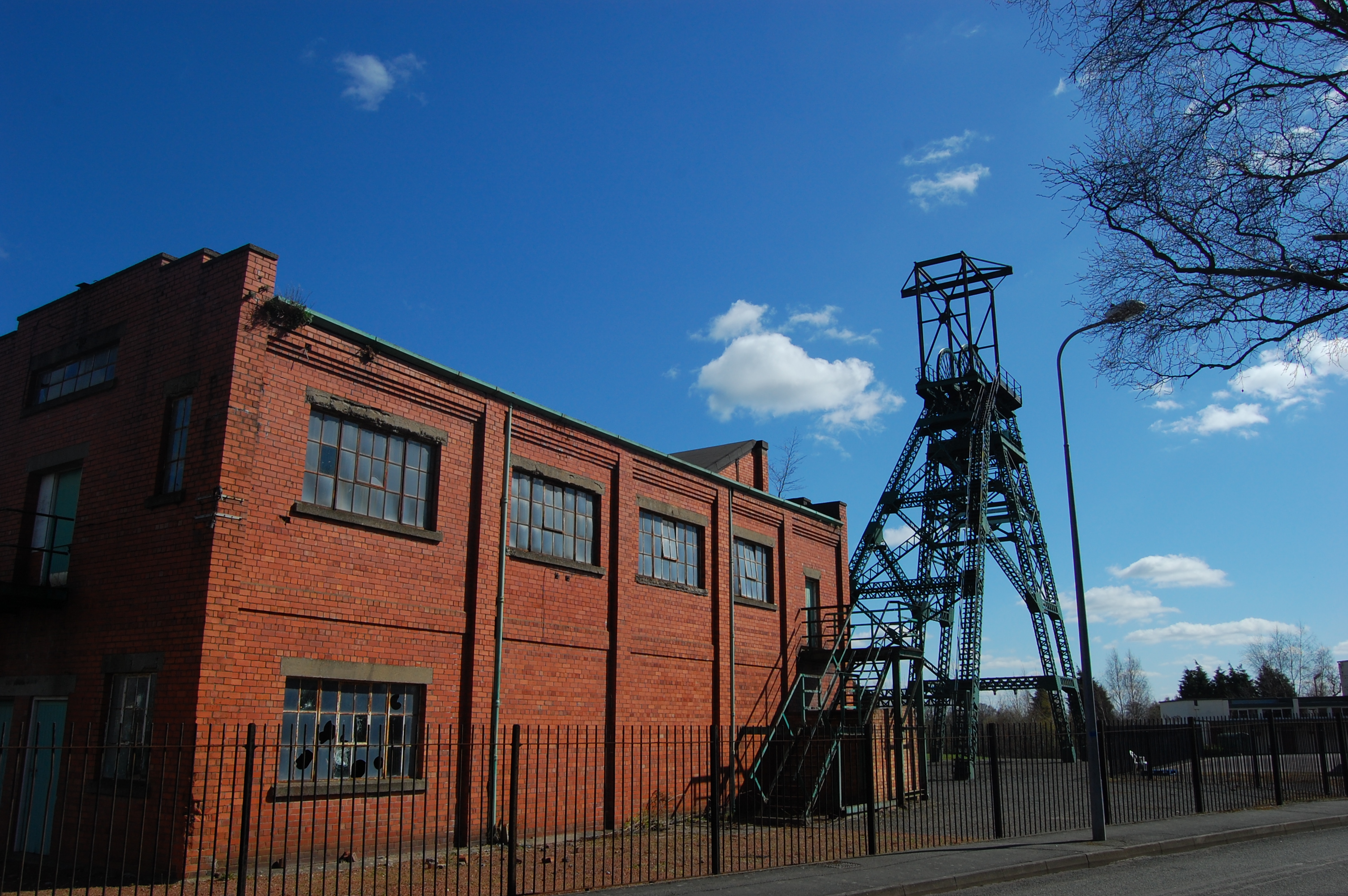
Coal mining is the process of extracting coal from the ground. Coal is valued for its energy content and since the 1880s has been widely used to generate electricity. Steel and cement industries use coal as a fuel for extraction of iron from iron ore and for cement production. In the United Kingdom and South Africa, a coal mine and its structures are a colliery, a coal mine is called a 'pit', and the above-ground structures are a 'pit head'. In Australia, "colliery" generally refers to an underground coal mine. Coal mining has had many developments in recent years, from the early days of men tunneling, digging and manually extracting the coal on carts to large open-cut and longwall mines. Mining at this scale requires the use of draglines, trucks, conveyors, hydraulic jacks and shearers. The coal mining industry has a long history of significant negative environmental impacts on local ecosystems, health impacts on local communities and workers, and contributes heavily to th ... [...More Info...] [...Related Items...] OR: [Wikipedia] [Google] [Baidu] |
Coal Seam
Coal mining is the process of extracting coal from the ground. Coal is valued for its energy content and since the 1880s has been widely used to generate electricity. Steel and cement industries use coal as a fuel for extraction of iron from iron ore and for cement production. In the United Kingdom and South Africa, a coal mine and its structures are a colliery, a coal mine is called a 'pit', and the above-ground structures are a 'pit head'. In Australia, "colliery" generally refers to an underground coal mine. Coal mining has had many developments in recent years, from the early days of men tunneling, digging and manually extracting the coal on carts to large open-cut and longwall mines. Mining at this scale requires the use of draglines, trucks, conveyors, hydraulic jacks and shearers. The coal mining industry has a long history of significant negative environmental impacts on local ecosystems, health impacts on local communities and workers, and contributes heavily to th ... [...More Info...] [...Related Items...] OR: [Wikipedia] [Google] [Baidu] |
Anglesey Coalfield
The Anglesey Coalfield is a minor British coalfield. Although it is situated in north-west Wales, this isolated coalfield on Anglesey Anglesey (; cy, (Ynys) Môn ) is an island off the north-west coast of Wales. It forms a principal area known as the Isle of Anglesey, that includes Holy Island across the narrow Cymyran Strait and some islets and skerries. Anglesey island ... is not usually considered to form a part of the North Wales Coalfield which lies in Flintshire and Denbighshire in north-east Wales although both measures were formed during the Carboniferous period. Stretching from Nant and Hirdrefaig in the Pentre Berw area along Cors Ddyga ("Tygai's marsh") and under the sea at Malltraeth village which was called 'yr Iard' or 'Iard Malltraeth'. On the western side of the Afon Cefni lies Cors Malltraeth. It was named after Cwmwd Malltraeth (Commote) which was the old Welsh way of dividing the Isle of Mona by the Welsh Princes and the Church. Both coalfields measure ... [...More Info...] [...Related Items...] OR: [Wikipedia] [Google] [Baidu] |
North Wales Coalfield
The North Wales Coalfield comprises the Flintshire Coalfield in the north and the Denbighshire Coalfield in the south. It extends from Point of Ayr in the north, through the Wrexham area to Oswestry in Shropshire in the south. A much smaller area on Anglesey where coal was formerly mined is not usually considered to form a part of the coalfield, although it is geographically in the North Wales region. History In north Wales, the Flintshire manors of Ewloe, Hopedale, and Mostyn and the Denbighshire manor of Brymbo were recorded as making profits from trading coal during the 14th and 15th centuries. By 1593, coal was exported from ports on the Dee estuary. Trade developed swiftly and by 1616, the principal collieries were at Bagillt, Englefield, Leaderbrook, Mostyn, Uphfytton and Wepre. Most were horizontal adits or shallow bell pits, although a few were sufficiently large to have accumulations of water and ventilation problems. In the Denbighshire Coalfield, the areas of ... [...More Info...] [...Related Items...] OR: [Wikipedia] [Google] [Baidu] |
Canonbie Coalfield
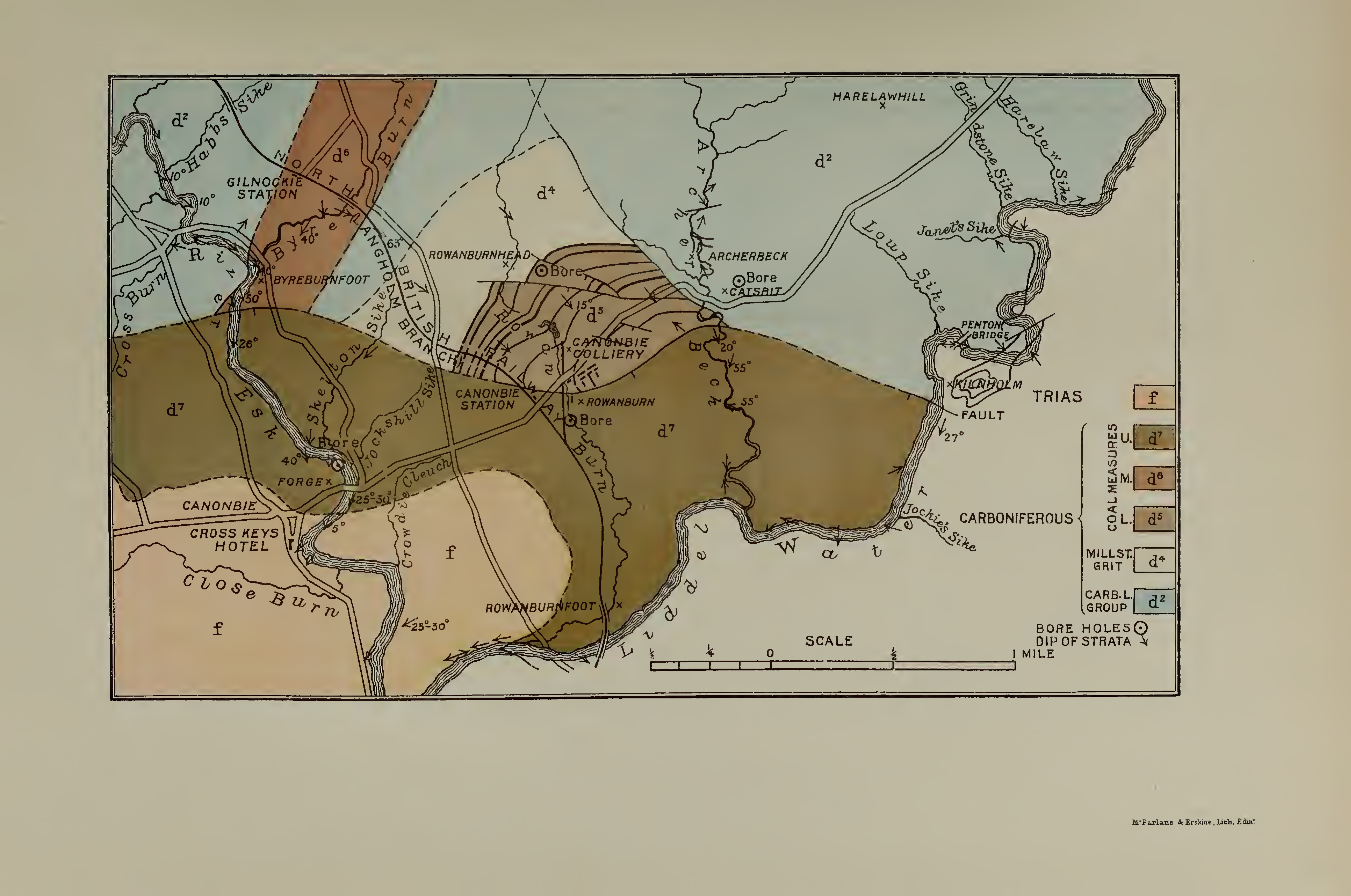
The Canonbie Coalfield is a small and largely concealed coalfield at Canonbie in the south of Scotland. A comprehensive survey by Peach and Horne was published in 1903. Canonbie colliery was worked until 1920, and another mine at Archerbeck continued until 1942. Recent work has indicated potentially economically workable reserves beneath a cover of New Red Sandstone rocks. The following coal seams occur within the Pennine Middle Coal Measures Formation in this coalfield: * Knottyholm * Archerbeck * Six Foot * Nine Foot * Five Foot * Eight Foot * Seven Foot Further less important seams lie within the underlying Pennine Lower Coal Measures Formation and within the overlying strata of the Pennine Upper Coal Measures Formation and the Warwickshire Group including the 'High Coal' at the base of the latter. New Proposal In 2014, New Age Exploration Limited proposed a new coal mine in the Canonbie area. They estimated that the new mine could operate for 26 years and yield 1.4 mil ... [...More Info...] [...Related Items...] OR: [Wikipedia] [Google] [Baidu] |
Coalfield
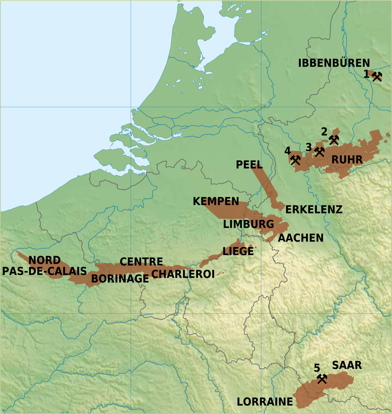
A coalfield is an area of certain uniform characteristics where coal is mined. The criteria for determining the approximate boundary of a coalfield are geographical and cultural, in addition to geological. A coalfield often groups the seams of coal, railroad companies, cultural groups, and watersheds and other geographical considerations. At one time the coalfield designation was an important category in business and industrial discussions. The terminology declined into unimportance as the 20th century progressed, and was probably only referred to by a few small railroads and history buffs by the 1980s. Renewed interest in industrial heritage and coal mining history has brought the old names of the coalfields before a larger audience. Australia New South Wales *Gunnedah Basin coalfields *Hunter Valley coalfields *South Maitland coalfields *Sydney Basin coalfields Queensland *Bowen Basin coalfields *Galilee Basin coalfields *Surat Basin coalfields *Walloon coalfields Victoria ... [...More Info...] [...Related Items...] OR: [Wikipedia] [Google] [Baidu] |
Pennine Basin
The Pennine Basin is a sedimentary basin which was active during the Carboniferous Period and which reached from the Southern Uplands of Scotland in the north to the former Wales-London-Brabant Massif in the English Midlands to the south. Sediments deposited within the basin are now exposed at the surface throughout the Pennines but are also present beneath the surface over a much wider area of northern England and indeed into northeast Wales Wales ( cy, Cymru ) is a country that is part of the United Kingdom. It is bordered by England to the east, the Irish Sea to the north and west, the Celtic Sea to the south west and the Bristol Channel to the south. It had a population in ... and just across the border into Scotland.Aitkenhead, N. et al 2002 ''British regional geology: the Pennines and adjacent areas'' (4th edn) (British Geological Survey, Nottingham) The basin was complex and consisted, at different times, of a variety of sub-basins separated by blocks across wh ... [...More Info...] [...Related Items...] OR: [Wikipedia] [Google] [Baidu] |
Coal Measures Group
The Coal Measures Group is a lithostratigraphical term coined to refer to the coal-bearing succession of rock strata which occur in the United Kingdom within the Westphalian Stage of the Carboniferous Period. Other than in Northern Ireland the term is now obsolete in formal use and is replaced by the Pennine Coal Measures Group, Scottish Coal Measures Group and the South Wales Coal Measures Group for the three distinct depositional provinces of the British mainland. Pennine Coal Measures Group Within the Pennine Basin the Pennine Coal Measures Group is preceded (underlain) by the Millstone Grit Group which is of Namurian age. It is succeeded (overlain) by the Warwickshire Group which comprises a largely non-productive sequence of red beds. It comprises the: :* Pennine Upper Coal Measures Formation :* Pennine Middle Coal Measures Formation :* Pennine Lower Coal Measures Formation The 'Pennine Basin' includes all of the coalfields of northern England and the English Midlan ... [...More Info...] [...Related Items...] OR: [Wikipedia] [Google] [Baidu] |


