|
North Wales Coalfield
The North Wales Coalfield comprises the Flintshire Coalfield in the north and the Denbighshire Coalfield in the south. It extends from Point of Ayr in the north, through the Wrexham area to Oswestry in Shropshire in the south. A much smaller area on Anglesey where coal was formerly mined is not usually considered to form a part of the coalfield, although it is geographically in the North Wales region. History In north Wales, the Flintshire manors of Ewloe, Hopedale, and Mostyn and the Denbighshire manor of Brymbo were recorded as making profits from trading coal during the 14th and 15th centuries. By 1593, coal was exported from ports on the Dee estuary. Trade developed swiftly and by 1616, the principal collieries were at Bagillt, Englefield, Leaderbrook, Mostyn, Uphfytton and Wepre. Most were horizontal adits or shallow bell pits, although a few were sufficiently large to have accumulations of water and ventilation problems. In the Denbighshire Coalfield, the areas of ... [...More Info...] [...Related Items...] OR: [Wikipedia] [Google] [Baidu] |
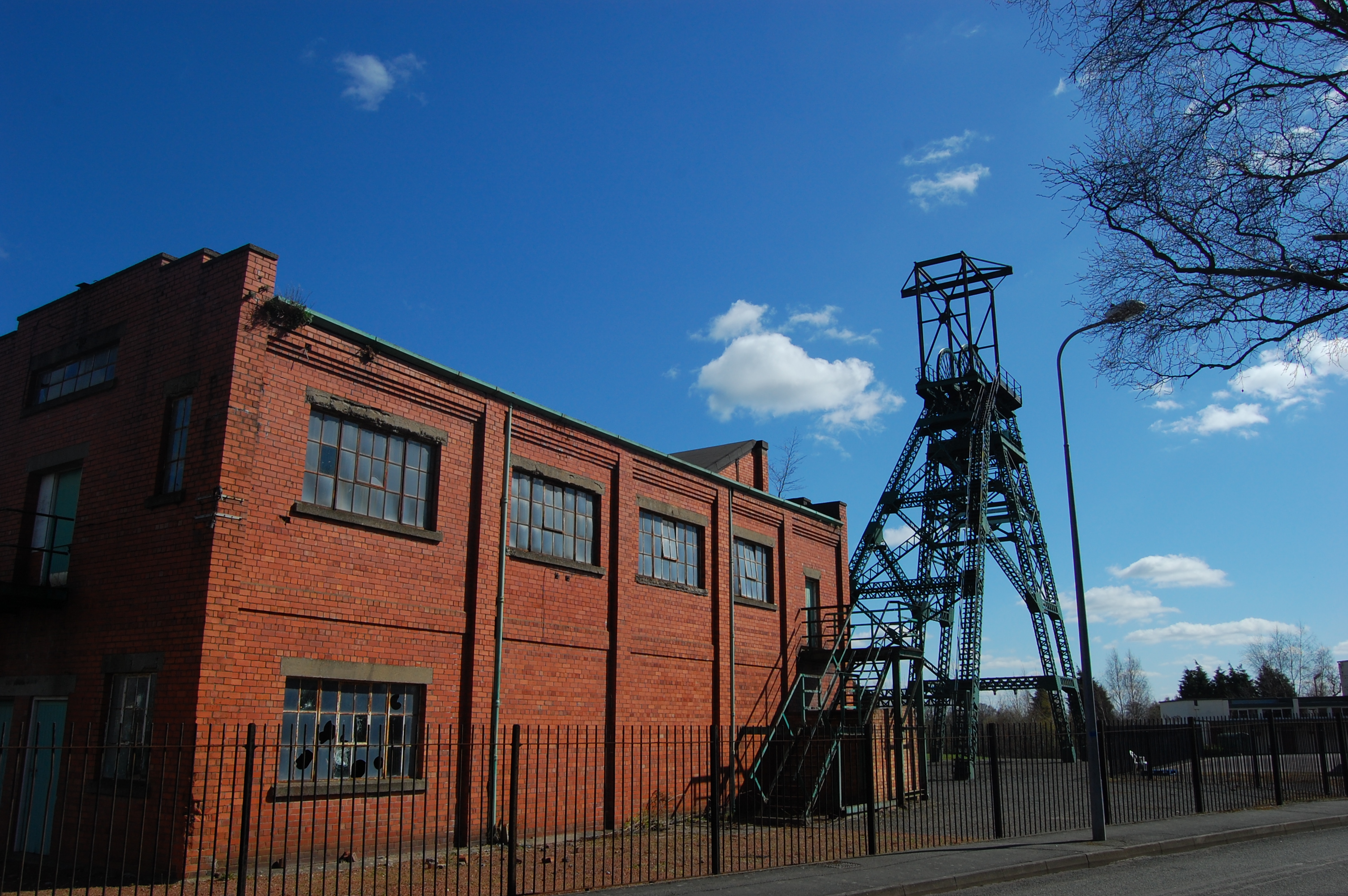
Bersham Colliery Engine House And Winding Gear
Bersham ( cy, Y Bers) is a village in Wrexham County Borough, Wales, that lies next to the River Clywedog, and is in the community of Esclusham. Bersham was historically a major industrial centre of the area, but despite this the village still retains a rural feeling. Historical significance The village holds special importance for economic historians, for not only did it house the workshops of the skilled Davies brothers, it was one of the cradles of the Industrial Revolution. This is the place where British iron making began in 1670, where smelting iron ore with coke began in 1721, and where John Wilkinson, the 'Iron Mad' pioneer of the Industrial Revolution, set up shop in 1761. For many years the area was one of the most important iron manufacturing centres in the world. The Bersham Ironworks Museum tells the story of the man who bored cannon for the American War of Independence and cylinders for James Watt's revolutionary steam engine that changed the face of th ... [...More Info...] [...Related Items...] OR: [Wikipedia] [Google] [Baidu] |
Geography Of Flintshire
Geography (from Greek: , ''geographia''. Combination of Greek words ‘Geo’ (The Earth) and ‘Graphien’ (to describe), literally "earth description") is a field of science devoted to the study of the lands, features, inhabitants, and phenomena of Earth. The first recorded use of the word γεωγραφία was as a title of a book by Greek scholar Eratosthenes (276–194 BC). Geography is an all-encompassing discipline that seeks an understanding of Earth and its human and natural complexities—not merely where objects are, but also how they have changed and come to be. While geography is specific to Earth, many concepts can be applied more broadly to other celestial bodies in the field of planetary science. One such concept, the first law of geography, proposed by Waldo Tobler, is "everything is related to everything else, but near things are more related than distant things." Geography has been called "the world discipline" and "the bridge between the human and ... [...More Info...] [...Related Items...] OR: [Wikipedia] [Google] [Baidu] |
Coal Mining In Wales
The coal industry in Wales played an important role in the Industrial Revolution. Coal mining in Wales expanded in the 18th century to provide fuel for the blast furnaces of the iron and copper industries that were expanding in southern Wales. The industry had reached large proportions by the end of that century, and then further expanded to supply steam-coal for the steam vessels that were beginning to trade around the world. The Cardiff Coal Exchange set the world price for steam-coal and Cardiff became a major coal-exporting port. The South Wales Coalfield was at its peak in 1913 and was one of the largest coalfields in the world. It remained the largest coalfield in Britain until 1925. The supply of coal dwindled, and pits closed in spite of a UK-wide strike against closures. Aberpergwm Colliery is the last deep mine in Wales. The South Wales Coalfield was not the only coal mining area of the country. There was a sizeable industry in Flintshire and Denbighshire in no ... [...More Info...] [...Related Items...] OR: [Wikipedia] [Google] [Baidu] |
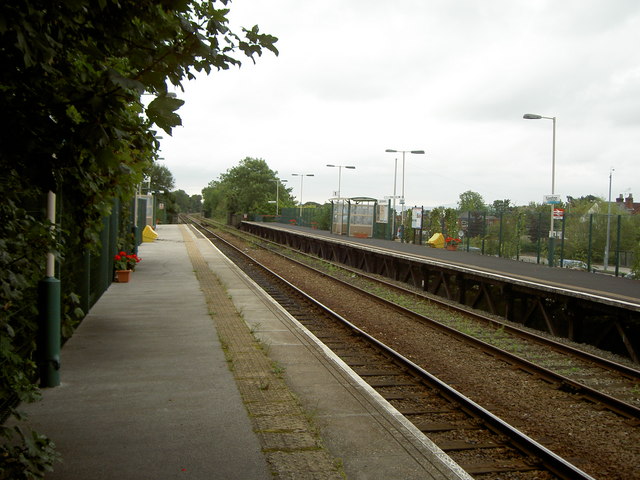
Chirk
Chirk ( cy, Y Waun) is a town and community in Wrexham County Borough, Wales, south of Wrexham, between it and Oswestry. At the 2011 census, it had a population of 4,468. Historically in the traditional county of Denbighshire, and later Clwyd, it has been part of Wrexham County Borough since a local government reorganisation in 1996. The border with the English county of Shropshire is immediately south of the town, on the other side of the River Ceiriog. The town is served by Chirk railway station and the A5/A483 roads. Etymology The name of the town in English, Chirk, derives from the name of the River Ceiriog, which itself may mean "the favoured one". The Welsh place name, ', is literarally "The Moor". History and heritage Chirk Castle, a National Trust property, is a medieval castle. Two families are associated with the town and its castle: the Trevor family of Brynkinallt and the Myddelton family. The Hughes of Gwerclas, a family descended from the ancient kings of ... [...More Info...] [...Related Items...] OR: [Wikipedia] [Google] [Baidu] |
Rhosllannerchrugog
RhosllanerchrugogDavies, Jenkins and Baines (eds) ''The Welsh Academy Encyclopedia of Wales'', 2008, p.752 (also spelled Rhosllannerchrugog, or simply Rhos) is a village and community in Wrexham County Borough, Wales. It lies within the historic county of Denbighshire. The entire built-up area including Penycae, Ruabon and Cefn Mawr had a population of 25,362. Etymology The name of the village is derived from that of the old Llanerchrugog estate, once one of the landholdings of Cynwrig ap Rhiwallon, Lord of Maelor Gymraeg.''Archaeologia Cambrensis: The Journal of the Cambrian Archaeological Association'', 1895, p.225-6 The name ''Llanerchrugog'' is usually stated to be based on Welsh llannerch, "''clearing''" or "''glade''"; and (with soft mutation), "''heathery''", although an etymology based on crugog, "hilly", "rough", has also been suggested.Morgan, ''A handbook of the origin of place-names in Wales and Monmouthshire'', 1887, p.50 The name of the mining village which l ... [...More Info...] [...Related Items...] OR: [Wikipedia] [Google] [Baidu] |
Ruabon
Ruabon ( cy, Rhiwabon ) is a village and community in Wrexham County Borough, Wales. The name comes from ''Rhiw Fabon'', ''rhiw'' being the Welsh word for "slope" or "hillside" and ''Fabon'' being a mutation from St Mabon, the original church name, of earlier, Celtic origin. An older English spelling, ''Rhuabon'', can sometimes be seen. In 2001, more than 80% of the population of 2,400 were born in Wales, with 13.6% having some ability in Welsh. Early history There is evidence that a settlement existed in Ruabon in the Bronze Age. In 1898, building works in the centre of Ruabon exposed a cist or stone urn containing cremated human remains dating from 2000 years BC. In 1917, the remains of a Bronze Age round barrow were discovered on the playing fields of Ruabon Grammar School; they contained human remains, a flint arrowhead and a bronze axe. Overlooking Ruabon, the Gardden ( cy, Caer Ddin) is an ancient hillfort surrounded by circular ditches, dating back to the Iron Age. ... [...More Info...] [...Related Items...] OR: [Wikipedia] [Google] [Baidu] |
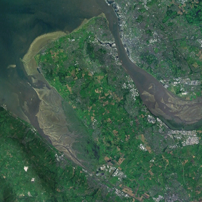
Wirral Peninsula
Wirral (; ), known locally as The Wirral, is a peninsula in North West England. The roughly rectangular peninsula is about long and wide and is bounded by the River Dee to the west (forming the boundary with Wales), the River Mersey to the east, and the Irish Sea to the north. Historically, the Wirral was wholly in Cheshire; in the Domesday Book, its border with the rest of the county was placed at "two arrow falls from Chester city walls". However, since the Local Government Act 1972, only the southern third has been in Cheshire, with almost all the rest lying in the Metropolitan Borough of Wirral, Merseyside. An area of saltmarsh to the south-west of the peninsula lies in the Welsh county of Flintshire. The most extensive urban development is on the eastern side of the peninsula. The Wirral contains both affluent and deprived areas, with affluent areas largely in the west, south and north of the peninsula, and deprived areas concentrated in the east, especially Bir ... [...More Info...] [...Related Items...] OR: [Wikipedia] [Google] [Baidu] |
Neston
Neston is a town and civil parish on the Wirral Peninsula, in Cheshire, England. It is part of the unitary authority of Cheshire West and Chester. The village of Parkgate is located to the north west and the villages of Little Neston and Ness are to the south of Neston. At the 2001 census the population of Neston ward was recorded as 3,521, increasing to 4,329 at the 2011 census. The civil parish also includes Little Neston, Parkgate, Willaston and part of Burton and Ness, and had a population of 15,162 in 2001, increasing to 15,221 in 2011. History The name is of Viking origin, deriving from the Old Norse ''Nes-tún'', meaning 'farmstead or settlement at/near a promontory or headland'. Another Nesttun town can be found near Bergen, Norway. It is also mentioned in the Domesday Book as ''Nestone'' under the ownership of a William Fitznigel, with a population of eight households. Civic history A royal charter was granted to Neston in 1728 in support of its status as a ... [...More Info...] [...Related Items...] OR: [Wikipedia] [Google] [Baidu] |
Dee Estuary
The Dee Estuary ( cy, Aber Dyfrdwy) is a large estuary by means of which the River Dee flows into Liverpool Bay. The estuary starts near Shotton after a five-mile (8 km) 'canalised' section and the river soon swells to be several miles wide forming the boundary between the Wirral Peninsula in north-west England and Flintshire in north-east Wales. The Dee Estuary's largest towns along it include Hollywell, Flint, Connah's Quay, Shotton, Queensferry, Saltney Ferry, Chester (City), Heswall, West Kirby and Neston as well as other villages and towns alongside it. The A548 also passes along the estuary in Wales and parts of Cheshire West and Chester and Merseyside in England. The North Wales Coast Line follows the course of the Dee Estuary between Prestatyn and Chester. Geology The estuary is unusual in that comparatively little water occupies so large a basin. One theory is that larger rivers such as the Severn and/or Mersey once flowed into the Dee. The current view is ... [...More Info...] [...Related Items...] OR: [Wikipedia] [Google] [Baidu] |
Caergwrle
Caergwrle () is a village in the county of Flintshire, in north east Wales. Approximately from Wrexham and situated on the A541 road, it is contiguous with the villages of Abermorddu and Hope, though in parts Caergwrle and Hope are separated by a river border. The village lies on the River Alyn and sits at the base of Hope Mountain. At the 2001 Census, the population was 1,650. The population was subsequently absorbed in the community of Hope and only the electoral ward remained. The population of this ward as taken at the 2011 census was 1,619. The ward includes the area of Abermorddu. Further south is the village of Cefn-y-Bedd. Origins of name The name ''Caergwrle'' derives from the Welsh ''caer'' 'fort' and a lost English placename *''Corley'' 'river meadow of the crane'. Folk etymology explained the name by means of a ''cawr'' ('giant') named ''Gwrle'', who was supposed to have lived in nearby Caergwrle Castle and to have been buried in the nearby Neolithic burial mo ... [...More Info...] [...Related Items...] OR: [Wikipedia] [Google] [Baidu] |
Bersham Colliery
Bersham Colliery was a large coal mine located near Rhostyllen in Wrexham County Borough, Wales. The mine accessed seams found in the Denbighshire Coalfield. History The Wrexham area in the 19th Century was highly industrialised. At the peak there were 38 different collieries operating in the area, each producing coal totalling over 2.5 million tonnes annually to the numerous brickworks and steelworks in the area, including Brymbo Steel Works and Shotton Steel Works. 19th century When the colliery first opened it was named Glan-yr-Afon ( en, Riverside) Colliery. Operated by Bersham Coal Company, the first shaft was sunk in 1864 on the site of a brickworks immediately adjacent to the Shrewsbury to Chester railway line, however due to difficulties the pit did not reach the main coal seams and the site was left abandoned until 1871 when the pit was deepened by new owners, the Barnes family of Liverpool; coal production started in 1874 with two shafts; No.1 at a diameter of ... [...More Info...] [...Related Items...] OR: [Wikipedia] [Google] [Baidu] |


