 |
Puyallup Tribe
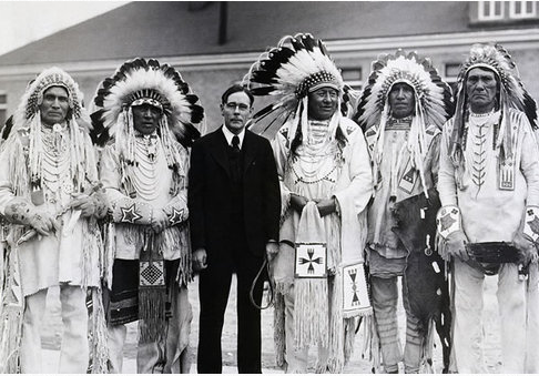
The Puyallup, Spuyalpabš or S’Puyalupubsh (pronounced: Spoy-all-up-obsh) ('generous and welcoming behavior to all people, who enter our lands') are a federally recognized Coast Salish Native American tribe from western Washington state, United States. They were relocated onto reservation lands in what is today Tacoma, Washington, in late 1854, after signing the Treaty of Medicine Creek with the United States. Today they have an enrolled population of 6,700, of whom 3,000 live on the reservation. The Puyallup Indian Reservation is one of the most urban Indian reservations in the United States. It is located primarily in northern Pierce County, with a very small part extending north into the city of Federal Way, in King County. Parts of seven communities in the Tacoma metropolitan area extend onto reservation land; in addition the tribe controls off-reservation trust land. In decreasing order of included population, the communities are Tacoma, Waller, Fife, Milton, ... [...More Info...] [...Related Items...] OR: [Wikipedia] [Google] [Baidu] |
|
Puyallup Seal
Puyallup may refer to: * Puyallup (tribe), a Native American tribe * Puyallup, Washington, a city ** Puyallup High School ** Puyallup School District ** Puyallup station, a Sounder commuter rail station ** Washington State Fair, formerly the Puyallup Fair * Puyallup River, a river in the U.S. state of Washington * Lake Puyallup, developed along the south edge of the Puget Sound Glacier * Puyallup Glacier, a glacier on the west flank of Mount Rainier in Washington * , a Washington State ferry * Puyallup (YT-806), ''Puyallup'' (YT-806), a United States Navy ''Valiant''-class harbor tug {{Disambiguation, geo, ship ... [...More Info...] [...Related Items...] OR: [Wikipedia] [Google] [Baidu] |
|
|
Waller, Washington
Waller is a census-designated place (CDP) in Pierce County, Washington, United States. The population was 9,200 at the 2000 census. Geography Waller is located at (47.204286, -122.367698). According to the United States Census Bureau, the CDP has a total area of 9.2 square miles (24.0 km2), of which, 9.2 square miles (23.9 km2) of it is land and 0.04 square miles (0.1 km2) of it (0.43%) is water. Demographics As of the census of 2000, there were 9,200 people, 3,585 households, and 2,505 families living in the CDP. The population density was 999.0 people per square mile (385.7/km2). There were 3,772 housing units at an average density of 409.6/sq mi (158.1/km2). The racial makeup of the CDP was 89.00% White, 1.53% African American, 2.07% Native American, 2.09% Asian, 0.16% Pacific Islander, 1.82% from other races, and 3.34% from two or more races. Hispanic or Latino of any race were 4.33% of the population. There were 3,585 households, out ... [...More Info...] [...Related Items...] OR: [Wikipedia] [Google] [Baidu] |
|
 |
Wheeler Howard Act
The Indian Reorganization Act (IRA) of June 18, 1934, or the Wheeler–Howard Act, was U.S. federal legislation that dealt with the status of American Indians in the United States. It was the centerpiece of what has been often called the "Indian New Deal". The major goal was to reverse the traditional goal of cultural assimilation of Native Americans into American society and to strengthen, encourage and perpetuate the tribes and their historic Native American cultures in the United States. The Act also restored to Indians the management of their assets—land and mineral rights—and included provisions intended to create a sound economic foundation for the residents of Indian reservations. The law did not apply to the territories—including what would become the state of Hawaii, and the state of Alaska—nor did they apply to the state of Oklahoma, which until the McGirt case was regarded as having dissolved its reservations. In 1936 however, the rights of the Indigenous ... [...More Info...] [...Related Items...] OR: [Wikipedia] [Google] [Baidu] |
|
Puyallup Nation Flag
Puyallup may refer to: * Puyallup (tribe) The Puyallup, Spuyalpabš or S’Puyalupubsh (pronounced: Spoy-all-up-obsh) ('generous and welcoming behavior to all people, who enter our lands') are a List of federally recognized tribes in the United States, federally recognized Coast Salish ..., a Native American tribe * Puyallup, Washington, a city ** Puyallup High School ** Puyallup School District ** Puyallup station, a Sounder commuter rail station ** Washington State Fair, formerly the Puyallup Fair * Puyallup River, a river in the U.S. state of Washington * Lake Puyallup, developed along the south edge of the Puget Sound Glacier * Puyallup Glacier, a glacier on the west flank of Mount Rainier in Washington * , a Washington State ferry * ''Puyallup'' (YT-806), a United States Navy ''Valiant''-class harbor tug {{Disambiguation, geo, ship ... [...More Info...] [...Related Items...] OR: [Wikipedia] [Google] [Baidu] |
|
 |
Indian Land Claims Settlements
Indian Land Claims Settlements are settlements of Native American land claims by the United States Congress, codified in 25 U.S.C. ch. 19. In several instances, these settlements ended live claims of aboriginal title in the United States. The first two—the Rhode Island Claims Settlement Act and the Maine Indian Claims Settlement Act—extinguished all aboriginal title in Rhode Island and Maine, respectively, following initial court rulings in the tribes' favor. The Mohegan Nation (Connecticut) Land Claims Settlement of 1994 also followed a judicial ruling in favor of a tribe, but did not extinguish all aboriginal title in the state. Other tribes had pending land claims. The '' Passamaquoddy'' (1975), '' Narragansett I and II'' (1976), and ''Mohegan'' (1980, 1982) cases occurred in the U.S. Supreme Court's '' Oneida I'' (1974) decision, which held that there was federal subject-matter jurisdiction for such claims. The Florida Indian (Miccosukee) Land Claims Settl ... [...More Info...] [...Related Items...] OR: [Wikipedia] [Google] [Baidu] |
|
Puyallup Tribe Of Indians Settlement Act Of 1989
The Port of Tacoma is an independent seaport located in Tacoma, Washington. The port was created by a vote of Pierce County citizens on November 5, 1918. The ''Edmore'' was the first ship to call at the port in 1921. The port's marine cargo operations, among the largest in the United States, was merged with the Port of Seattle's in 2015 to form the Northwest Seaport Alliance. History The port started out on of land, and now owns more than 2,400 acres (972 hectares) of land that are used for shipping terminal activity, warehousing, distributing, and manufacturing. Nineteenth Century Prior to the establishment of the Port of Tacoma, much of Tacoma's shipping activity took place along Ruston Way and along the mouth of the Thea Foss Waterway, which opens into Commencement Bay and the larger Puget Sound. Tacoma's role as a shipping center dates to 1853, when the first cargo of lumber was shipped to San Francisco. Tacoma's status as a major trading hub was greatly strengthened by the ... [...More Info...] [...Related Items...] OR: [Wikipedia] [Google] [Baidu] |
|
 |
Port Of Tacoma
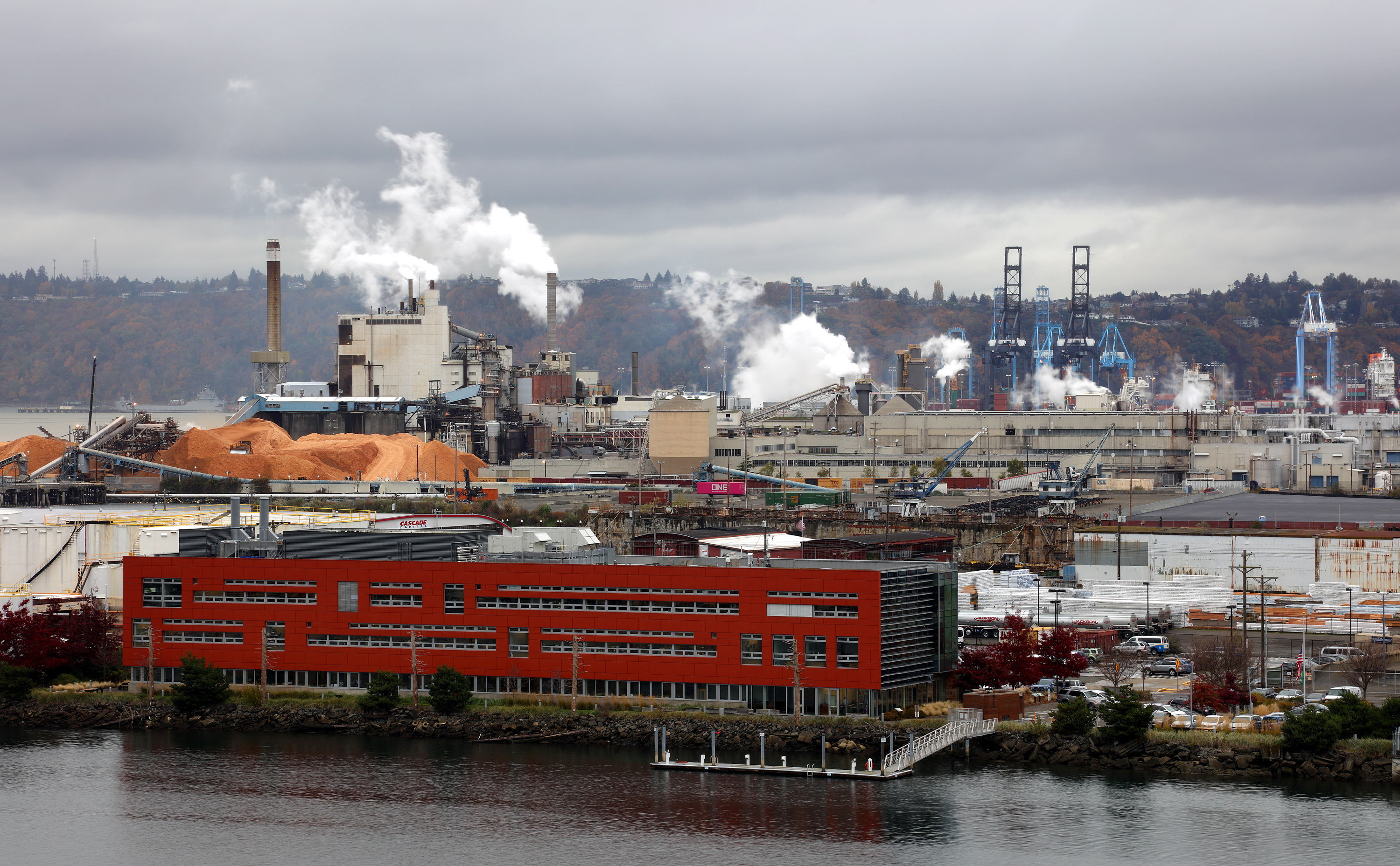
The Port of Tacoma is an independent seaport located in Tacoma, Washington. The port was created by a vote of Pierce County citizens on November 5, 1918. The ''Edmore'' was the first ship to call at the port in 1921. The port's marine cargo operations, among the largest in the United States, was merged with the Port of Seattle's in 2015 to form the Northwest Seaport Alliance. History The port started out on of land, and now owns more than 2,400 acres (972 hectares) of land that are used for shipping terminal activity, warehousing, distributing, and manufacturing. Nineteenth Century Prior to the establishment of the Port of Tacoma, much of Tacoma's shipping activity took place along Ruston Way and along the mouth of the Thea Foss Waterway, which opens into Commencement Bay and the larger Puget Sound. Tacoma's role as a shipping center dates to 1853, when the first cargo of lumber was shipped to San Francisco. Tacoma's status as a major trading hub was greatly strengthened by ... [...More Info...] [...Related Items...] OR: [Wikipedia] [Google] [Baidu] |
|
Fife Heights, Washington
Fife Heights is a census-designated place (CDP) in Pierce County, Washington, United States. The population was 2,137 at the 2010 census. The community is bordered by Federal Way on the north, Milton on the east, Fife on the south, and Tacoma on the west. It is contained within the Puyallup Indian Reservation. Education Fife Heights is served by Fife Public Schools Fife Public Schools is a school district comprising parts of the Washington state cities of Fife, Milton, Edgewood, Tacoma, Pacific as well as unincorporated census-designated places Lakeland South and Fife Heights. The district was establis ..., a public school district. References Census-designated places in Pierce County, Washington Census-designated places in Washington (state) {{PierceCountyWA-geo-stub ... [...More Info...] [...Related Items...] OR: [Wikipedia] [Google] [Baidu] |
|
|
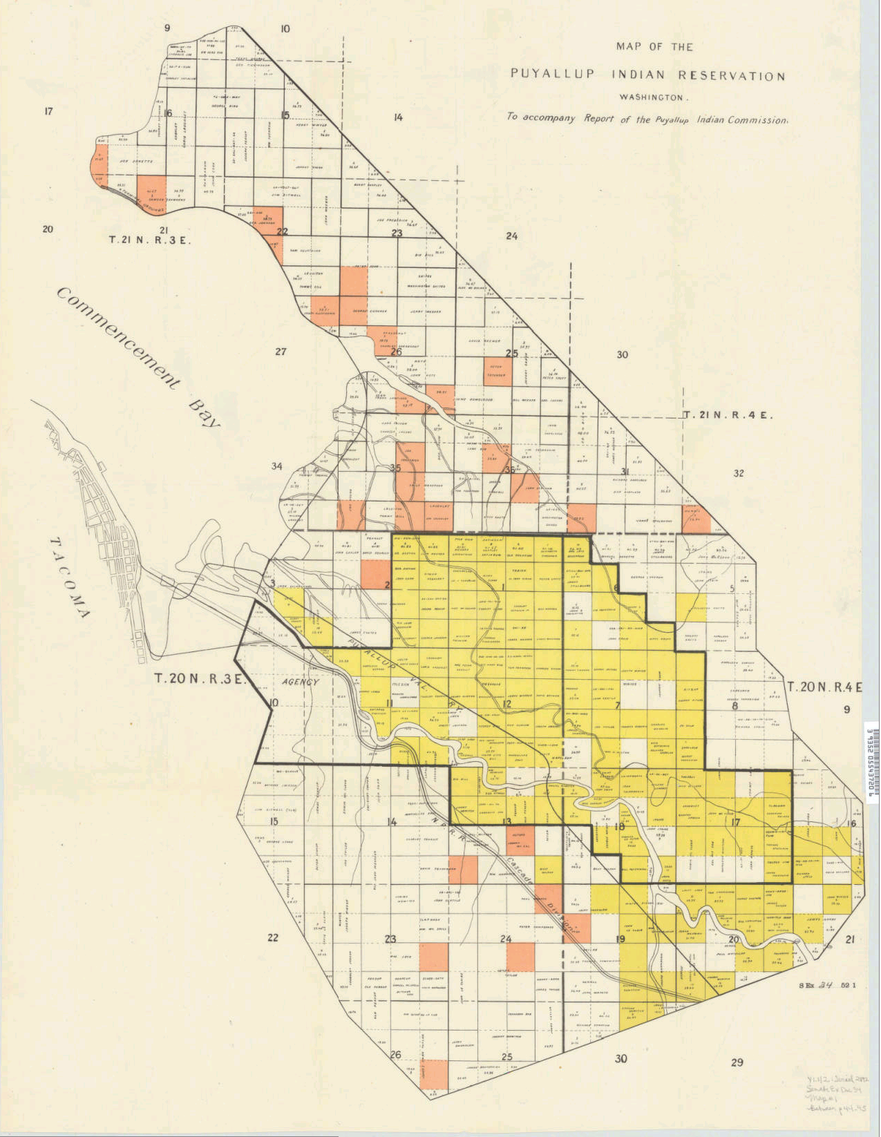
Puyallup Reservation Map 1892
Puyallup may refer to: * Puyallup (tribe), a Native American tribe * Puyallup, Washington, a city ** Puyallup High School ** Puyallup School District ** Puyallup station, a Sounder commuter rail station ** Washington State Fair, formerly the Puyallup Fair * Puyallup River The Puyallup River ( ) is a river in the U.S. state of Washington. About long, it is formed by glaciers on the west side of Mount Rainier. It flows generally northwest, emptying into Commencement Bay, part of Puget Sound. The river and its tribu ..., a river in the U.S. state of Washington * Lake Puyallup, developed along the south edge of the Puget Sound Glacier * Puyallup Glacier, a glacier on the west flank of Mount Rainier in Washington * , a Washington State ferry * ''Puyallup'' (YT-806), a United States Navy ''Valiant''-class harbor tug {{Disambiguation, geo, ship ... [...More Info...] [...Related Items...] OR: [Wikipedia] [Google] [Baidu] |
|
|
Salishan Languages
The Salishan (also Salish) languages are a family of languages of the Pacific Northwest in North America (the Canadian province of British Columbia and the American states of Washington, Oregon, Idaho and Montana). They are characterised by agglutinativity and syllabic consonants. For instance the Nuxalk word ''clhp’xwlhtlhplhhskwts’'' (), meaning "he had had n his possessiona bunchberry plant", has thirteen obstruent consonants in a row with no phonetic or phonemic vowels. The Salishan languages are a geographically contiguous block, with the exception of the Nuxalk (Bella Coola), in the Central Coast of British Columbia, and the extinct Tillamook language, to the south on the central coast of Oregon. The terms ''Salish'' and ''Salishan'' are used interchangeably by linguists and anthropologists studying Salishan, but this is confusing in regular English usage. The name ''Salish'' or ''Selisch'' is the endonym of the Flathead Nation. Linguists later applied the ... [...More Info...] [...Related Items...] OR: [Wikipedia] [Google] [Baidu] |
|
 |
United States Census, 2000
The United States census of 2000, conducted by the Census Bureau, determined the resident population of the United States on April 1, 2000, to be 281,421,906, an increase of 13.2 percent over the 248,709,873 people enumerated during the 1990 census. This was the twenty-second federal census and was at the time the largest civilly administered peacetime effort in the United States. Approximately 16 percent of households received a "long form" of the 2000 census, which contained over 100 questions. Full documentation on the 2000 census, including census forms and a procedural history, is available from the Integrated Public Use Microdata Series. This was the first census in which a state – California – recorded a population of over 30 million, as well as the first in which two states – California and Texas – recorded populations of more than 20 million. Data availability Microdata from the 2000 census is freely available through the Integrated Public Use Microdata Se ... [...More Info...] [...Related Items...] OR: [Wikipedia] [Google] [Baidu] |
 |
Puyallup, Washington
Puyallup ( or ) is a city in Pierce County, Washington, United States, located about 10 miles (16 km) southeast of Tacoma and 35 miles (56 km) south of Seattle. It had a population of 42,973 at the 2020 census. The city's name comes from the Puyallup Tribe of Native Americans and means "the generous people". Puyallup is also home to the Washington State Fair, the state's largest fair. History The Puyallup Valley was originally inhabited by the Puyallup people, known in their language as the spuyaləpabš, meaning "generous and welcoming behavior to all people (friends and strangers) who enter our lands." The first white settlers in the region were part of the first wagon train to cross the Cascade Range at Naches Pass in 1853. Native Americans numbered about 2,000 in what is now the Puyallup Valley in the 1830s and 1840s. The first European settlers arrived in the 1850s. In 1877, Ezra Meeker platted a townsite and named it Puyallup after the local Puyallup Indian tr ... [...More Info...] [...Related Items...] OR: [Wikipedia] [Google] [Baidu] |