|
Punta Nati Lighthouse
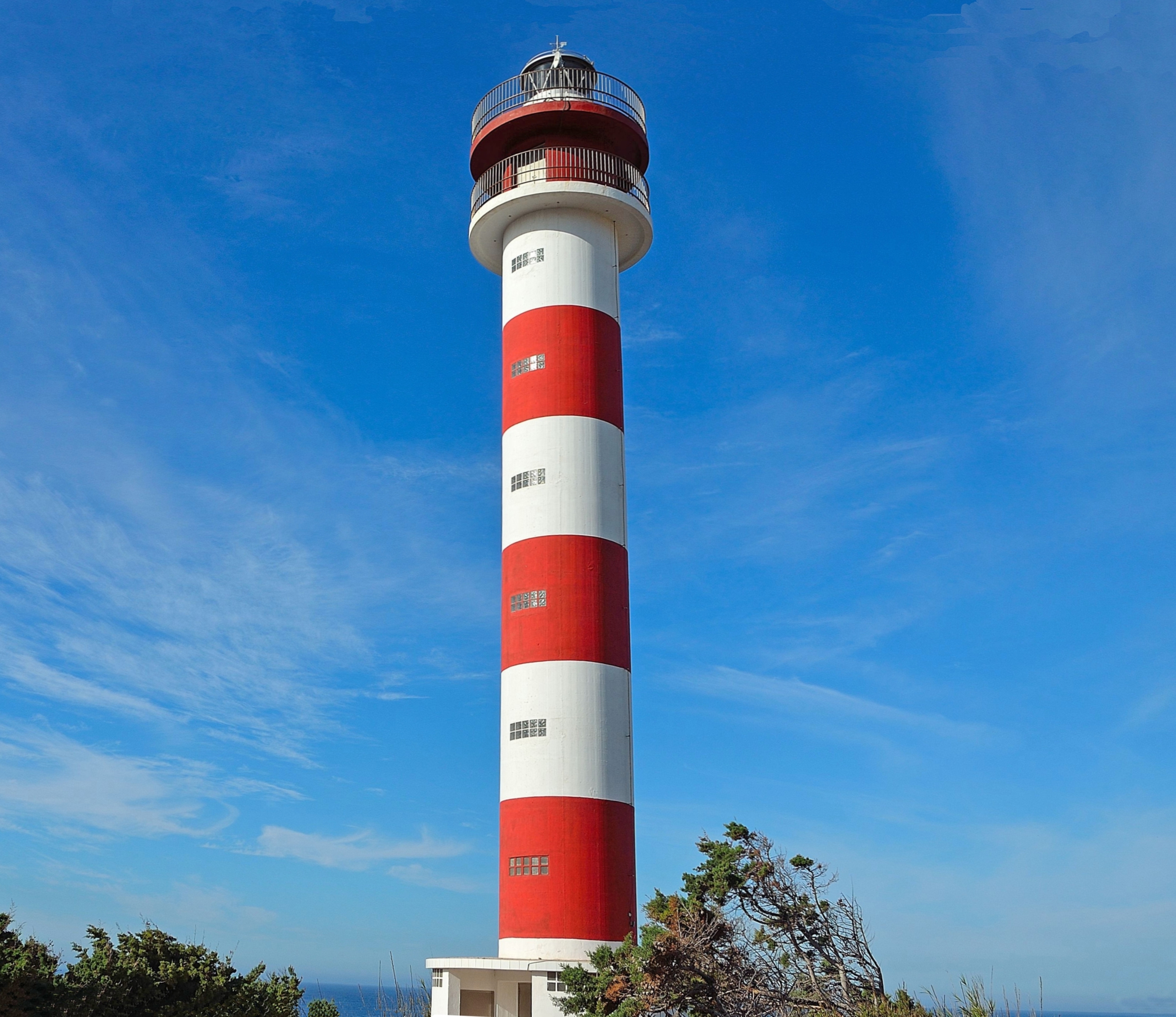
The Punta Nati Lighthouse is an active aid to navigation located on the rocky north western coast of the Spanish island of Menorca. The lighthouse was built following demands from the French authorities to light the northern coast of the island. This was primarily in response to the sinking of the French steamship ''Général Chanzy'' nearby in 1910, during which 156 passengers and crew lost their lives. Designed by the engineer Mauro Serret, Punta Nati was constructed rapidly in just over a year, it became operational in 1913, and was fully completed in 1914. The loss of the ''Général Chanzy'' was the catalyst for building the light, but a number of other shipwrecks had also occurred in the area despite the presence of the lighthouse at Cavalleria, which was completed in 1857. Construction of a third lighthouse on the northern coast at Favàritx began in 1917, which was also designed by Serret. Loss of the Général Chanzy Named after the famous French general Antoine Chanz ... [...More Info...] [...Related Items...] OR: [Wikipedia] [Google] [Baidu] |
Menorca
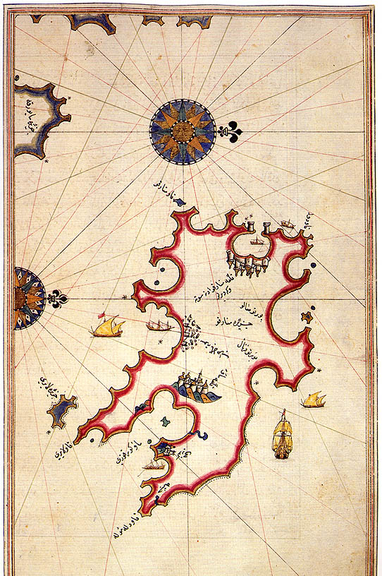
Menorca or Minorca (from la, Insula Minor, , smaller island, later ''Minorica'') is one of the Balearic Islands located in the Mediterranean Sea belonging to Spain. Its name derives from its size, contrasting it with nearby Majorca. Its capital is Mahón ( ca, Maó), situated on the island's eastern end, although Menorca is not a province and forms a political union with the other islands in the archipelago. Ciutadella and Mahon are the main ports and largest towns. The port of Mahon is the second biggest natural port in the world. Menorca has a population of approximately 93,397 (at 1 January 2019). It is located 39°47' to 40°00'N, 3°52' to 4°24'E. Its highest point, called El Toro (from Catalan "''turó''" meaning ''hill''), is above sea level. History The island is known for its collection of megalithic stone monuments: ''navetes'', ''taules'' and '' talaiots'', which indicate very early prehistoric human activity. Some of the earliest culture on Menorca was ... [...More Info...] [...Related Items...] OR: [Wikipedia] [Google] [Baidu] |
Port Authority
In Canada and the United States, a port authority (less commonly a port district) is a governmental or quasi-governmental public authority for a special-purpose district usually formed by a legislative body (or bodies) to operate ports and other transportation infrastructure. In Canada, the federal Minister of Transport selects the local chief executive board member and the rest of the board is appointed at the recommendation of port users to the federal Minister; while all Canadian port authorities have a federal or Crown charter called ''Letters Patent''. Numerous Caribbean nations have port authorities, including those of Aruba, British Virgin Islands, Bahamas, Jamaica, Cayman Islands, Trinidad and Tobago, St. Lucia, St. Maarten, St. Vincent and the Grenadines. Central and South America also have port agencies such as ''autoridad'' and ''consorcio'' (authority and consortium). In Mexico, the federal government created sixteen port administrations in 1994–1995 called ''Adm ... [...More Info...] [...Related Items...] OR: [Wikipedia] [Google] [Baidu] |
Buildings And Structures In Menorca
A building, or edifice, is an enclosed structure with a roof and walls standing more or less permanently in one place, such as a house or factory (although there's also portable buildings). Buildings come in a variety of sizes, shapes, and functions, and have been adapted throughout history for a wide number of factors, from building materials available, to weather conditions, land prices, ground conditions, specific uses, prestige, and aesthetic reasons. To better understand the term ''building'' compare the list of nonbuilding structures. Buildings serve several societal needs – primarily as shelter from weather, security, living space, privacy, to store belongings, and to comfortably live and work. A building as a shelter represents a physical division of the human habitat (a place of comfort and safety) and the ''outside'' (a place that at times may be harsh and harmful). Ever since the first cave paintings, buildings have also become objects or canvasses of much artisti ... [...More Info...] [...Related Items...] OR: [Wikipedia] [Google] [Baidu] |
Lighthouses In The Balearic Islands
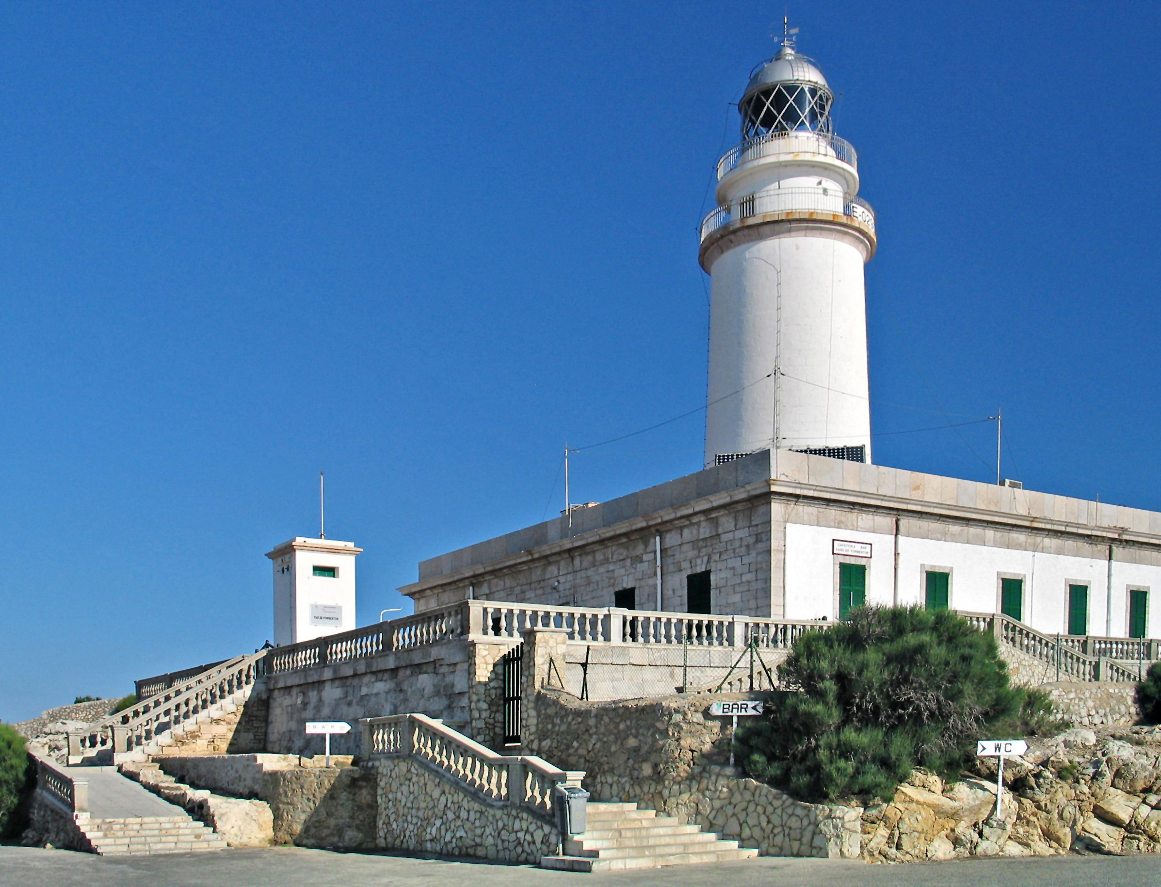
A lighthouse is a tower, building, or other type of physical structure designed to emit light from a system of lamps and lenses and to serve as a beacon for navigational aid, for maritime pilots at sea or on inland waterways. Lighthouses mark dangerous coastlines, hazardous shoals, reefs, rocks, and safe entries to harbors; they also assist in aerial navigation. Once widely used, the number of operational lighthouses has declined due to the expense of maintenance and has become uneconomical since the advent of much cheaper, more sophisticated and effective electronic navigational systems. History Ancient lighthouses Before the development of clearly defined ports, mariners were guided by fires built on hilltops. Since elevating the fire would improve the visibility, placing the fire on a platform became a practice that led to the development of the lighthouse. In antiquity, the lighthouse functioned more as an entrance marker to ports than as a warning signal for reefs and ... [...More Info...] [...Related Items...] OR: [Wikipedia] [Google] [Baidu] |
List Of Lighthouses In The Balearic Islands ...
This is a list of lighthouses in the Balearic Islands. The Spanish archipelago lies at the western end of the Mediterranean Sea. Lighthouses See also * List of lighthouses in Spain * List of lighthouses in the Canary Islands References External links * {{DEFAULTSORT:Balearic Islands * Lists of lighthouses in Spain Lighthouses A lighthouse is a tower, building, or other type of physical structure designed to emit light from a system of lamps and lenses and to serve as a beacon for navigational aid, for maritime pilots at sea or on inland waterways. Lighthouses mark ... [...More Info...] [...Related Items...] OR: [Wikipedia] [Google] [Baidu] |
List Of Lighthouses In Spain
This is a list of lighthouses in Spain. Lighthouses By autonomous communities * List of lighthouses in the Balearic Islands This is a list of lighthouses in the Balearic Islands. The Spain, Spanish archipelago lies at the western end of the Mediterranean Sea. Lighthouses See also * List of lighthouses in Spain * List of lighthouses in the Canary Islands Refe ... * List of lighthouses in the Canary Islands See also * Lists of lighthouses and lightvessels * List of tallest lighthouses References External links {{Architecture of Spain ... [...More Info...] [...Related Items...] OR: [Wikipedia] [Google] [Baidu] |
Spanish Civil War
The Spanish Civil War ( es, Guerra Civil Española)) or The Revolution ( es, La Revolución, link=no) among Nationalists, the Fourth Carlist War ( es, Cuarta Guerra Carlista, link=no) among Carlism, Carlists, and The Rebellion ( es, La Rebelión, link=no) or The Uprising ( es, La Sublevación, link=no) among Republicans. was a civil war in Spain fought from 1936 to 1939 between the Republican faction (Spanish Civil War), Republicans and the Nationalist faction (Spanish Civil War), Nationalists. Republicans were loyal to the left-leaning Popular Front (Spain), Popular Front government of the Second Spanish Republic, and consisted of various socialist, communist, separatist, anarchist, and Republicanism in Spain, republican parties, some of which had opposed the government in the pre-war period. The opposing Nationalists were an alliance of Falangism, Falangists, monarchists, conservatives, and Traditionalism (Spain), traditionalists led by a National Defense Junta, military junt ... [...More Info...] [...Related Items...] OR: [Wikipedia] [Google] [Baidu] |
Bunker
A bunker is a defensive military fortification designed to protect people and valued materials from falling bombs, artillery, or other attacks. Bunkers are almost always underground, in contrast to blockhouses which are mostly above ground. They were used extensively in World War I, World War II, and the Cold War for weapons facilities, command and control centers, and storage facilities. Bunkers can also be used as protection from tornadoes. Trench bunkers are small concrete structures, partly dug into the ground. Many artillery installations, especially for coastal artillery, have historically been protected by extensive bunker systems. Typical industrial bunkers include mining sites, food storage areas, dumps for materials, data storage, and sometimes living quarters. When a house is purpose-built with a bunker, the normal location is a reinforced below-ground bathroom with fiber-reinforced plastic shells. Bunkers deflect the blast wave from nearby explosions to prevent ... [...More Info...] [...Related Items...] OR: [Wikipedia] [Google] [Baidu] |
Camí De Cavalls
The Camí de Cavalls is an ancient path, in length, that encircles the island of Menorca, Spain. This long-distance walking route is the GR 223 of the Senderos de Gran Recorrido network in Spain that connects some of the most inaccessible beaches of Menorca. History It is widely accepted that the Camí de Cavalls was built in order to connect the watchtowers, fortresses and cannons distributed along the coast of the island and to make the transport of troops and artillery easier. However, the date of its origin is not so clear. The most accepted theory attributes it to the French invaders during the different periods they lived in the island, but according to some studies, it could have been created in the 14th century. Since its original function was the defence and the control of the island, it was patrolled by soldiers mounted on Menorquin horses, hence the word ''cavalls'' (meaning "horses" in Catalan) in the name of the path. Restoration During decades part of the ... [...More Info...] [...Related Items...] OR: [Wikipedia] [Google] [Baidu] |
National Geospatial-Intelligence Agency
The National Geospatial-Intelligence Agency (NGA) is a combat support agency within the United States Department of Defense whose primary mission is collecting, analyzing, and distributing geospatial intelligence (GEOINT) in support of national security. Initially known as the National Imagery and Mapping Agency (NIMA) from 1996 to 2003, it is a member of the United States Intelligence Community. NGA headquarters, also known as NGA Campus East or NCE, is located at Fort Belvoir North Area in Springfield, Virginia. The agency also operates major facilities in the St. Louis, Missouri area (referred to as NGA Campus West or NCW), as well as support and liaison offices worldwide. The NGA headquarters, at , is the third-largest government building in the Washington metropolitan area after The Pentagon and the Ronald Reagan Building. In addition to using GEOINT for U.S. military and intelligence efforts, NGA provides assistance during natural and man-made disasters, aids in se ... [...More Info...] [...Related Items...] OR: [Wikipedia] [Google] [Baidu] |
Majorca
Mallorca, or Majorca, is the largest island in the Balearic Islands, which are part of Spain and located in the Mediterranean. The capital of the island, Palma, is also the capital of the autonomous community of the Balearic Islands. The Balearic Islands have been an autonomous region of Spain since 1983. There are two small islands off the coast of Mallorca: Cabrera (southeast of Palma) and Dragonera (west of Palma). The anthem of Mallorca is "La Balanguera". Like the other Balearic Islands of Menorca, Ibiza, and Formentera, the island is an extremely popular holiday destination, particularly for tourists from the Netherlands, Germany and the United Kingdom. The international airport, Palma de Mallorca Airport, is one of the busiest in Spain; it was used by 28 million passengers in 2017, with use increasing every year since 2012. Etymology The name derives from Classical Latin ''insula maior'', "larger island". Later, in Medieval Latin, this became ''Maiorca'', "the large ... [...More Info...] [...Related Items...] OR: [Wikipedia] [Google] [Baidu] |
Spain
, image_flag = Bandera de España.svg , image_coat = Escudo de España (mazonado).svg , national_motto = '' Plus ultra'' ( Latin)(English: "Further Beyond") , national_anthem = (English: "Royal March") , image_map = , map_caption = , image_map2 = , capital = Madrid , coordinates = , largest_city = Madrid , languages_type = Official language , languages = Spanish , ethnic_groups = , ethnic_groups_year = , ethnic_groups_ref = , religion = , religion_ref = , religion_year = 2020 , demonym = , government_type = Unitary parliamentary constitutional monarchy , leader_title1 = Monarch , leader_name1 = Felipe VI , leader_title2 = Prime Minister , leader_name2 = Pedro Sánchez , legislature = ... [...More Info...] [...Related Items...] OR: [Wikipedia] [Google] [Baidu] |


