|
Pujada Bay
Pujada Bay, sometimes (usually historically) called Pujaga Bay, is a bay on the Pacific coast of the southern Philippine island of Mindanao. It is an arm of the Philippine Sea in Davao Oriental province formed by the Guanguan Peninsula which separates it from the Mayo Bay on the east and the Pujada Peninsula which separates it from the Davao Gulf on the west. Pujada Bay borders Mati, the province's capital and largest city, with its port and city proper situated at its head. It is entered between Lamigan Point on the east and Tumago Point on the west, with the Pujada Island dividing its entrance into two channels. There are three other islands on the bay, namely Uanivan, Oak and Ivy islands. The bay has been declared a marine protected area known as the Pujada Bay Protected Landscape and Seascape. It covers protecting the bay and its coastal area including its four islands. It was declared through Proclamation No. 431 on 31 July 1994 by President Fidel Ramos. Description Puja ... [...More Info...] [...Related Items...] OR: [Wikipedia] [Google] [Baidu] |
Mati, Davao Oriental
Mati, officially the City of Mati ( ceb, Dakbayan sa Mati; fil, Lungsod ng Mati), is a 5th class component city and capital of the province of Davao Oriental, Philippines. According to the 2020 census, it has a population of 147,547 people. It is located on the south-eastern side of Mindanao. History Mati comes from the Mandayan word ''Maa-ti'', which refers to the town's creek that easily dries up even after heavy rain. Pioneer settlers were tribes Kalagan, Mandayan and both Maguindanao & Maranao whom carried strong Arabic and Indo-Malayan influences. Spanish period Captain Prudencio Garcia, the pioneer political-military head in 1861, and his comrade Juan Nazareno founded the settlement of Mati and two other communities in Davao Oriental. American period By October 29, 1903, Mati was declared a municipality by virtue of Act No. 21. By 1907, Act No. 189 further reaffirmed the establishment of its local government. Francisco Rojas was the first appointed mayor while t ... [...More Info...] [...Related Items...] OR: [Wikipedia] [Google] [Baidu] |
Davao Oriental
Davao Oriental ( Cebuano: ''Sidlakang Dabaw''; tl, Silangang Davao), officially the Province of Davao Oriental, is a province in the Philippines located in the Davao Region in Mindanao. Its capital is city of Mati, and it borders the province of Davao de Oro to the west, and Agusan del Sur and Surigao del Sur to the north. The province is the traditional homeland of the Mandaya and Kalagan/Kaagan. Davao Oriental is the easternmost province in the country with Pusan Point in the municipality of Caraga as the easternmost location. The Philippine Sea, part of the Pacific Ocean, faces Davao Oriental to the east. Part of the province lies on an unnamed peninsula that encloses the Davao Gulf to the west. The province is the top producer of coconut and copra in the country, earning the province the title ''Coconut Capital of the Philippines''. It is also home to Mount Hamiguitan Wildlife Sanctuary, a UNESCO World Heritage Site. Etymology The name of the province was derived from the ... [...More Info...] [...Related Items...] OR: [Wikipedia] [Google] [Baidu] |
Mindanao
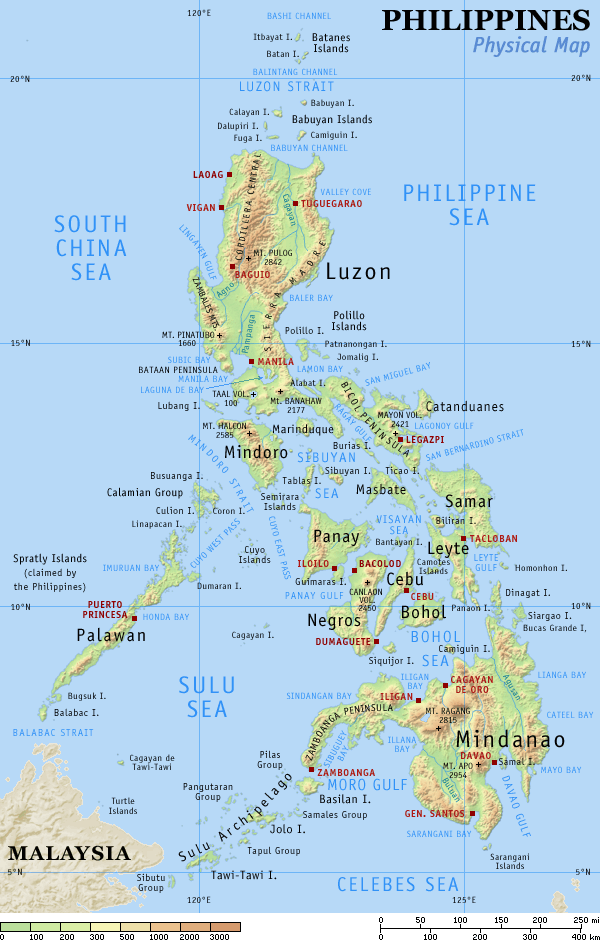
Mindanao ( ) ( Jawi: مينداناو) is the second-largest island in the Philippines, after Luzon, and seventh-most populous island in the world. Located in the southern region of the archipelago, the island is part of an island group of the same name that also includes its adjacent islands, notably the Sulu Archipelago. According to the 2020 census, Mindanao has a population of 26,252,442 people, while the entire island group has an estimated population of 27,021,036 according to the 2021 census. Mindanao is divided into six administrative regions: the Zamboanga Peninsula, Northern Mindanao, the Caraga region, the Davao region, Soccsksargen, and the autonomous region of Bangsamoro. According to the 2020 census, Davao City is the most populous city on the island, with 1,776,949 people, followed by Zamboanga City (pop. 977,234), Cagayan de Oro (pop. 728,402), General Santos (pop. 697,315), Butuan (pop. 372,910), Iligan (pop. 363,115) and Cotabato City (pop. 325,079). ... [...More Info...] [...Related Items...] OR: [Wikipedia] [Google] [Baidu] |
Philippines
The Philippines (; fil, Pilipinas, links=no), officially the Republic of the Philippines ( fil, Republika ng Pilipinas, links=no), * bik, Republika kan Filipinas * ceb, Republika sa Pilipinas * cbk, República de Filipinas * hil, Republika sang Filipinas * ibg, Republika nat Filipinas * ilo, Republika ti Filipinas * ivv, Republika nu Filipinas * pam, Republika ning Filipinas * krj, Republika kang Pilipinas * mdh, Republika nu Pilipinas * mrw, Republika a Pilipinas * pag, Republika na Filipinas * xsb, Republika nin Pilipinas * sgd, Republika nan Pilipinas * tgl, Republika ng Pilipinas * tsg, Republika sin Pilipinas * war, Republika han Pilipinas * yka, Republika si Pilipinas In the recognized optional languages of the Philippines: * es, República de las Filipinas * ar, جمهورية الفلبين, Jumhūriyyat al-Filibbīn is an archipelagic country in Southeast Asia. It is situated in the western Pacific Ocean and consists of around 7,641 islands t ... [...More Info...] [...Related Items...] OR: [Wikipedia] [Google] [Baidu] |
Philippine Sea
The Philippine Sea is a marginal sea of the Western Pacific Ocean east of the Philippine archipelago (hence the name), the largest in the world, occupying an estimated surface area of . The Philippine Sea Plate forms the floor of the sea. Its western border is the first island chain to the west, comprising the Ryukyu Islands in the northwest and Taiwan in the west. Its southwestern border comprises the Philippine islands of Luzon, Catanduanes, Samar, Leyte, and Mindanao. Its northern border comprises the Japanese islands of Honshu, Shikoku and Kyūshū. Its eastern border is the second island chain to the east, comprising the Bonin Islands and Iwo Jima in the northeast, the Mariana Islands (including Guam, Saipan, and Tinian) in the due east, and Halmahera, Palau, Yap and Ulithi (of the Caroline Islands) in the southeast. Its southern border is Indonesia's Morotai Island. The sea has a complex and diverse undersea relief. The floor is formed into a structural basin by a s ... [...More Info...] [...Related Items...] OR: [Wikipedia] [Google] [Baidu] |
Pacific Ocean
The Pacific Ocean is the largest and deepest of Earth's five oceanic divisions. It extends from the Arctic Ocean in the north to the Southern Ocean (or, depending on definition, to Antarctica) in the south, and is bounded by the continents of Asia and Oceania in the west and the Americas in the east. At in area (as defined with a southern Antarctic border), this largest division of the World Ocean—and, in turn, the hydrosphere—covers about 46% of Earth's water surface and about 32% of its total surface area, larger than Earth's entire land area combined .Pacific Ocean . '' Britannica Concise.'' 2008: Encyclopædia Britannica, Inc. The centers of both the |
Davao Gulf
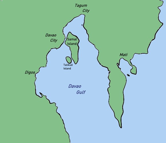
Davao Gulf is a gulf situated in the southeastern portion of Mindanao in the Philippines. It has an area of or about 520,000 hectares. Davao Gulf cuts into the island of Mindanao from the Philippine Sea. It is surrounded by all five provinces in the Davao Region. The largest island in the gulf is Samal Island. Davao City, on the gulf's west coast, is the largest and busiest port on the gulf. The Bagobo and the Kaagan / Kalagan, who are the indigenous lumad tribes endemic in Davao, are known inhabitants of the said gulf. Wildlife The gulf water is regarded as one of the most diverse cetacean habitats in the nation, being home for at least 10 species of toothed whales and dolphins such as sperm whales and beaked whales. Also whale sharks and sea cows are seen frequently. Furthermore, several ecological phenomena have been observed in the Davao Gulf such as a previously unknown predator of the crown-of-thorns starfish The crown-of-thorns starfish (frequently abbreviated to COTS ... [...More Info...] [...Related Items...] OR: [Wikipedia] [Google] [Baidu] |
List Of Protected Areas Of The Philippines
This is a list of protected areas of the Philippines administered by the Department of Environment and Natural Resources (DENR)'s Biodiversity Management Bureau under the National Integrated Protected Areas System (NIPAS) Act of 1992. As of 2020, there are 244 protected areas in the Philippines covering a total area of about – 15.4% of the Philippines' total area. History The first important legislation that formed the basis of the current system of national parks and protected areas in the Philippines is Act No. 648, enacted in 1903 by the Philippine Commission. This act authorized the civil governor to "reserve for civil public purposes, and from sale or settlement, any part of the public domain not appropriated by law for special public purposes." A total of eight national reserves had been established on July 26, 1904, pursuant to this law. These are the Lamao Forest Reserve in Bataan, Mariquina Reserve in Rizal, Angat River Reserve in Bulacan, Caliraya Falls Reserv ... [...More Info...] [...Related Items...] OR: [Wikipedia] [Google] [Baidu] |
Department Of Environment And Natural Resources
The Department of Environment and Natural Resources ( fil, Kagawaran ng Kapaligiran at Likas na Yaman, DENR or KKLY) is the executive department of the Philippine government responsible for governing and supervising the exploration, development, utilization, and conservation of the country's natural resources. History of the DENR The Department of Environment and Natural Resources was first established on January 1, 1917, as the Department of Agriculture and Natural Resources (DANR) through the enactment of Act No. 2666 by the Philippine Commission, otherwise known as "An Act to Re-organize the Executive Department of the Government of the Philippine Islands," on November 18, 1916. In 1932, the DANR was reorganized into the Department of Agriculture and Commerce (DAC). In 1947, a reorganization act changed the DAC back to the Department of Agriculture and Natural Resources. The Natural Resources arm of the DANR was finally spun off on May 17, 1974, as the Ministry of Natural ... [...More Info...] [...Related Items...] OR: [Wikipedia] [Google] [Baidu] |
Fidel Ramos
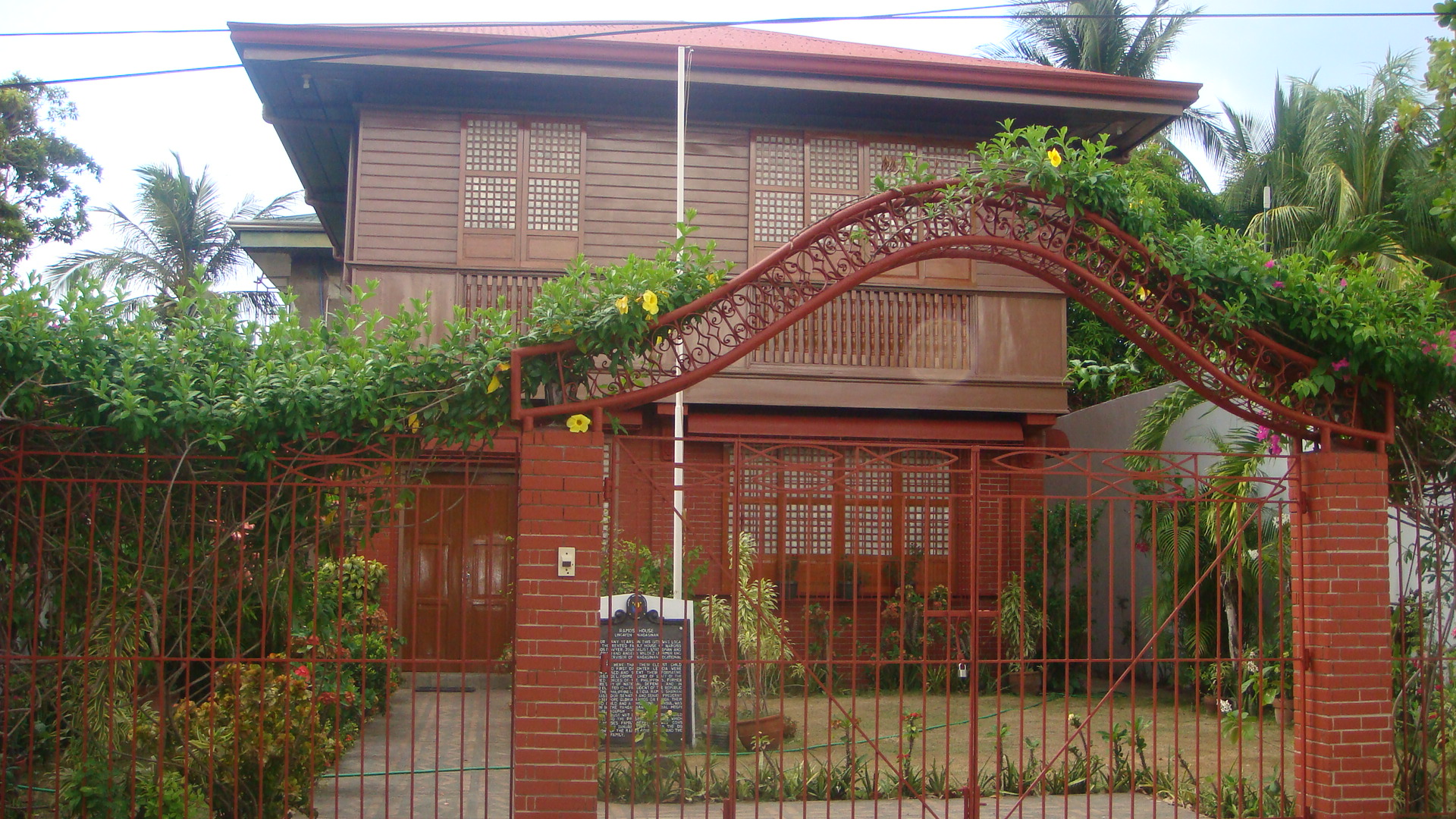
Fidel Valdez Ramos (, ; March 18, 1928 – July 31, 2022), popularly known as FVR and Eddie Ramos, was a Filipino general and politician who served as the 12th president of the Philippines from 1992 to 1998. He was the only career military officer who reached the rank of five-star general/admiral ''de jure''. Rising from second lieutenant to commander-in-chief of the armed forces, Ramos was widely credited and admired by many for revitalizing and renewing international confidence in the Philippine economy during his six years in office. He is the third oldest to assume the presidency, together with the current 17th president, Bongbong Marcos, next to Sergio Osmeña and Rodrigo Duterte. Ramos rose through the ranks in the Philippine military early in his career and became Chief of the Philippine Constabulary and Vice Chief-of-Staff of the Armed Forces of the Philippines during the term of President Ferdinand Marcos. During the 1986 EDSA People Power Revolution, Ramos was h ... [...More Info...] [...Related Items...] OR: [Wikipedia] [Google] [Baidu] |
Montipora
''Montipora'' is a genus of Scleractinian corals in the phylum Cnidaria. Members of the genus ''Montipora'' may exhibit many different growth morphologies. With eighty five known species, ''Montipora'' is the second most species rich coral genus after '' Acropora''. Description Growth morphologies for the genus ''Montipora'' include submassive, laminar, foliaceous, encrusting, and branching. It is not uncommon for a single ''Montipora'' colony to display more than one growth morphology. Healthy ''Montipora'' corals can be a variety of colors, including orange, brown, pink, green, blue, purple, yellow, grey, or tan. Although they are typically uniform in color, some species, such as ''Montipora spumosa'' or ''Montipora verrucosa'', may display a mottled appearance. ''Montipora'' corals have the smallest corallites of any coral family. Columellae are not present. Coenosteum and corallite walls are porous, which can result in elaborate structures. The coenosteum of each ''Montipo ... [...More Info...] [...Related Items...] OR: [Wikipedia] [Google] [Baidu] |
Acropora
''Acropora'' is a genus of small polyp stony coral in the phylum Cnidaria. Some of its species are known as table coral, elkhorn coral, and staghorn coral. Over 149 species are described. ''Acropora'' species are some of the major reef corals responsible for building the immense calcium carbonate substructure that supports the thin living skin of a reef. Anatomy and distribution Depending on the species and location, ''Acropora'' species may grow as plates or slender or broad branches. Like other corals, ''Acropora'' corals are colonies of individual polyps, which are about 2 mm across and share tissue and a nerve net. The polyps can withdraw back into the coral in response to movement or disturbance by potential predators, but when undisturbed, they protrude slightly. The polyps typically extend further at night to help capture plankton and organic matter from the water. The species are distributed in the Indo-Pacific (over 100 species) and Caribbean (3 species). ... [...More Info...] [...Related Items...] OR: [Wikipedia] [Google] [Baidu] |


.jpg)


