|
Puerto Escondido, Baja California Sur
Puerto Escondido is a large natural harbor in the Mexican state of Baja California Sur. It is located in the Loreto Municipality, Baja California Sur, Loreto Municipality 28 km south of Loreto, Baja California Sur, Loreto, on Mexican Federal Highway 1, Federal Highway 1 on the western shore of the Gulf of California. French architect and urban planner François Spoerry designed the neighborhood of Puerto Escondido, but it was abandoned after only 3 buildings were constructed. The nearest community to Puerto Escondido is Tripui, a privately owned leasehold community, largely of ex-pat Americans and Canadians with a store, hotel and restaurant. It is about 1 kilometer from Puerto Escondido. A new residential community is being constructed on one of original artificial islands called Waicuri. The completed first phase will include 19 waterfront luxury homes, all with private docks. The first home was completed in July, 2018, and is called, "Casa Palo Blanco." Description The ... [...More Info...] [...Related Items...] OR: [Wikipedia] [Google] [Baidu] |
Administrative Divisions Of Mexico
The United Mexican States ( es, Estados Unidos Mexicanos) is a federal republic composed of 32 federal entities: 31 states and Mexico City, an autonomous entity. According to the Constitution of 1917, the states of the federation are free and sovereign in all matters concerning their internal affairs. Each state has its own congress and constitution. Federal entities of Mexico States Roles and powers of the states The states of the Mexican Federation are free, sovereign, autonomous and independent of each other. They are free to govern themselves according to their own laws; each state has a constitution that cannot contradict the federal constitution, which covers issues of national competence. The states cannot make alliances with other states or any independent nation without the consent of the whole federation, except those related to defense and security arrangements necessary to keep the border states secure in the event of an invasion. The political organizat ... [...More Info...] [...Related Items...] OR: [Wikipedia] [Google] [Baidu] |
Baja California Sur
Baja California Sur (; 'South Lower California'), officially the Free and Sovereign State of Baja California Sur ( es, Estado Libre y Soberano de Baja California Sur), is the least populated state and the 31st admitted state of the 32 federal entities which comprise the 31 States of Mexico. It is also the ninth-largest Mexican state in terms of area. Before becoming a state on 8 October 1974, the area was known as the ''El Territorio Sur de Baja California'' ("South Territory of Lower California"). It has an area of , or 3.57% of the land mass of Mexico, and occupies the southern half of the Baja California Peninsula, south of the 28th parallel, plus the uninhabited Rocas Alijos in the Pacific Ocean. It is bordered to the north by the state of Baja California, to the west by the Pacific Ocean, and to the east by the Gulf of California. The state has maritime borders with Sonora and Sinaloa to the east, across the Gulf of California. The state is home to the tourist resorts ... [...More Info...] [...Related Items...] OR: [Wikipedia] [Google] [Baidu] |
Loreto Municipality, Baja California Sur
Loreto () is a municipality of the Mexican state of Baja California Sur. It was created in 1992 from the partition of the neighboring Comondú Municipality. The municipal seat is in the town of Loreto, which was the former capital of Las Californias during Spanish colonial times. The 2010 census reported a population of 16,738, about 88 percent of whom lived in the town of Loreto. The municipality has an area of 4,311 km² (1,664.49 sq mi). Demographics Major communities The largest localities (cities, towns, and villages) are: Sister cities * Ventura, California (United States)Staff (March 30, 2015"Ventura, Loreto discuss new sister city program during binational visit"''Ventura County Star'' (subscription may be required for this article.) See also Alfredo Garcia Green Alfredo (, ) is a cognate of the Anglo-Saxon name Alfred and a common Italian, Galician, Portuguese and Spanish language personal name. People with the given name include: *Alfredo (born 1946 ... [...More Info...] [...Related Items...] OR: [Wikipedia] [Google] [Baidu] |
Mexican State
The states of Mexico are first-level administrative territorial entities of the country of Mexico, which is officially named Mexico, United Mexican States. There are 32 federal entities in Mexico (31 states and the capital, Mexico City, as a separate entity that is not formally a state). States are further divided into municipalities of Mexico, municipalities. Mexico City is divided in boroughs of Mexico City, boroughs, officially designated as or , similar to other state's municipalities but with different administrative powers. List ''Mexico's post agency, Correos de México, does not offer an official list of state name abbreviations, and as such, they are not included below. A list of Mexican states and several versions of their abbreviations can be found Template:Mexico State-Abbreviation Codes, here.'' } , style="text-align: center;" , ''Coahuila de Zaragoza'' , , style="text-align: center;" colspan=2 , Saltillo , style="text-align: right;" , , style="text-align ... [...More Info...] [...Related Items...] OR: [Wikipedia] [Google] [Baidu] |
Loreto, Baja California Sur
Loreto is a city and municipal seat of Loreto Municipality, Baja California Sur, on the West Coast of Mexico. Located on the Gulf of California, the city had a population of 20,385 inhabitants in 2019. Loreto is a regional economic and cultural center, as well as a major tourist destination on the Baja California Peninsula. Loreto was founded in 1697, when Juan María de Salvatierra founded Misión de Nuestra Señora de Loreto Conchó. The city served as the capital of Province of the Californias until 1777, when the capital moved to Monterey, California. Loreto continued to serve as the capital of Baja California until 1829. The city grew rapidly in the 20th century and is today a major tourist destination and regional hub. History Loreto was the first Spanish colonial settlement of the Viceroyalty of New Spain on the Baja California Peninsula. The town was founded in 1697 by Jesuit missionaries, who found a steady spring of fresh water on this site, as the Misión N ... [...More Info...] [...Related Items...] OR: [Wikipedia] [Google] [Baidu] |
Mexican Federal Highway 1
Federal Highway 1 ( es, Carretera Federal 1, Fed. 1) is a free (libre) part of the federal highway corridors () of Mexico, and the highway follows the length of the Baja California Peninsula from Tijuana, Baja California, in the north to Cabo San Lucas, Baja California Sur, in the south. The road connects with ''Via Rapida'', which merges into the American Interstate 5 (I-5) at the San Ysidro Port of Entry, which crosses the international border south of San Ysidro, California. Fed. 1 is often called the ''Carretera Transpeninsular'' (Transpeninsular Highway) and runs a length of from Tijuana to Cabo San Lucas. Most of its course, particularly south of Ensenada, is as a two-lane rural highway. Completed in 1973, Fed. 1's official name is the Benito Juárez Transpeninsular Highway (), named in honor of Mexico's president during the country's 1860s invasion by France. Route description The road begins in the border city of Tijuana, where it continues northward ... [...More Info...] [...Related Items...] OR: [Wikipedia] [Google] [Baidu] |
Gulf Of California
The Gulf of California ( es, Golfo de California), also known as the Sea of Cortés (''Mar de Cortés'') or Sea of Cortez, or less commonly as the Vermilion Sea (''Mar Bermejo''), is a marginal sea of the Pacific Ocean that separates the Baja California Peninsula from the Mexico, Mexican mainland. It is bordered by the states of Baja California, Baja California Sur, Sonora, and Sinaloa with a coastline of approximately . Rivers that flow into the Gulf of California include the Colorado River, Colorado, Fuerte River, Fuerte, Mayo River (Mexico), Mayo, Sinaloa River, Sinaloa, Sonora River, Sonora, and the Yaqui River, Yaqui. The surface of the gulf is about . Maximum depths exceed because of the complex geology, linked to plate tectonics. The gulf is thought to be one of the most diverse seas on Earth and is home to more than 5,000 species of micro-invertebrates. Parts of the Gulf of California are a UNESCO World Heritage Site. Geography History The marine expeditions of Fortún ... [...More Info...] [...Related Items...] OR: [Wikipedia] [Google] [Baidu] |
François Spoerry
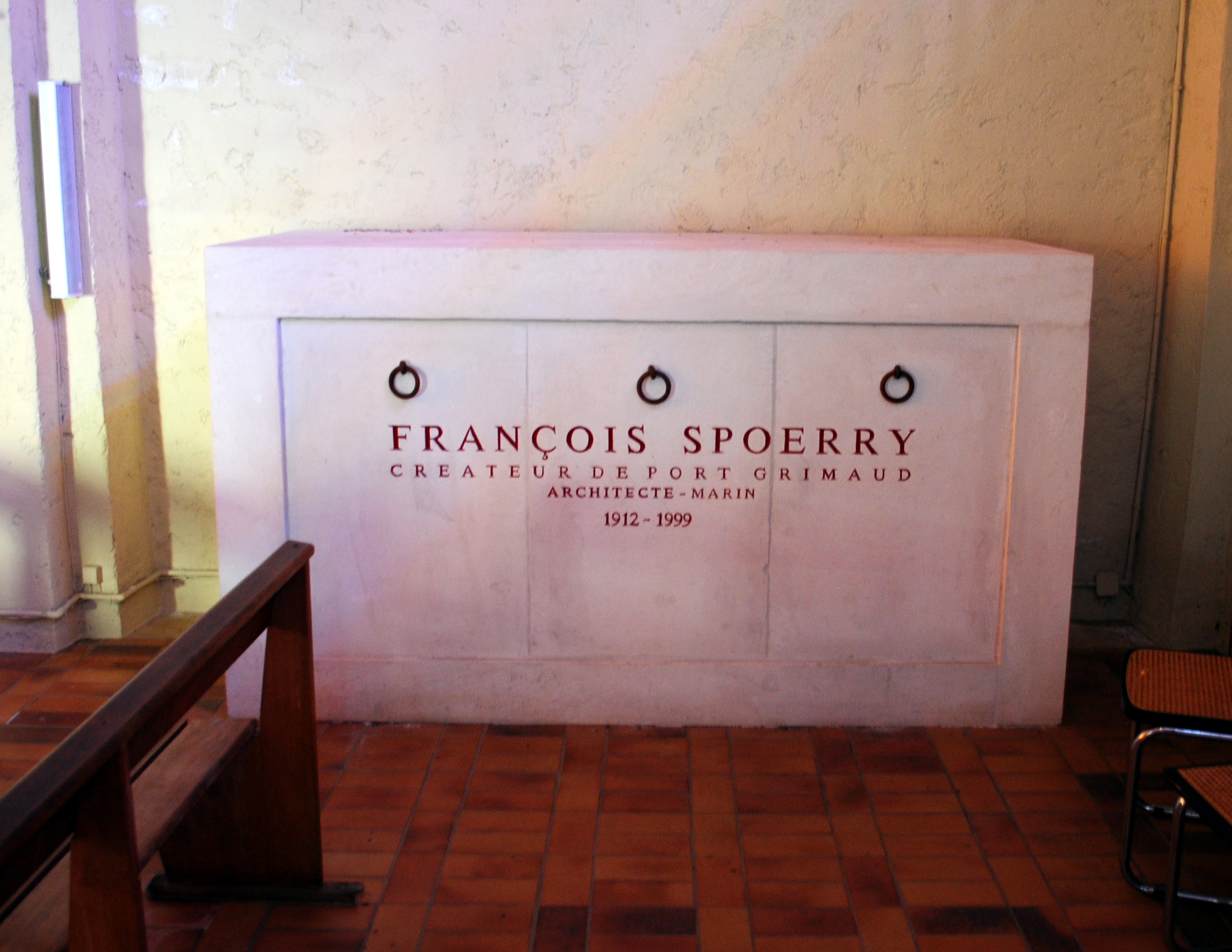
François Henry Spoerry (28 December 1912 – 11 January 1999) was a French people, French architecture, architect, developer, and urban planner that created the seaside town of Port Grimaud. He was an Officier of the Légion d'honneur and an Officier of the Ordre des Arts et des Lettres. Early years He was born in Mulhouse to a large, industrious family that had moved from Switzerland to Mulhouse in 1848 to start up a textile business. The family had a holiday home at Partigon. His parents were Henry Spoerry (1879–1966) and Jeanne Schlumberger. Spoerry had three younger sisters: Anne Spoerry, Anne-Marie, a physician, aviator and adventurer, Therese, and Martine. After finishing school, Spoerry studied architecture at the École des Beaux-Arts, Strasbourg in 1930. He became an assistant to Jacques Couëlle during the period of 1932 through 1934. He graduated from Marseille's École des Beaux-Arts in 1943 . During World War II, he used an architectural research project in ... [...More Info...] [...Related Items...] OR: [Wikipedia] [Google] [Baidu] |
Populated Places In Baja California Sur
Population typically refers to the number of people in a single area, whether it be a city or town, region, country, continent, or the world. Governments typically quantify the size of the resident population within their jurisdiction using a census, a process of collecting, analysing, compiling, and publishing data regarding a population. Perspectives of various disciplines Social sciences In sociology and population geography, population refers to a group of human beings with some predefined criterion in common, such as location, race, ethnicity, nationality, or religion. Demography is a social science which entails the statistical study of populations. Ecology In ecology, a population is a group of organisms of the same species who inhabit the same particular geographical area and are capable of interbreeding. The area of a sexual population is the area where inter-breeding is possible between any pair within the area and more probable than cross-breeding with ind ... [...More Info...] [...Related Items...] OR: [Wikipedia] [Google] [Baidu] |


