|
Przemyśl Land
Przemyśl Land ( pl, Ziemia przemyska) was an administrative unit of Kyivan Rus, Kingdom of Poland and Polish–Lithuanian Commonwealth. It existed since the integration of Principality of Peremyshl into Kingdom of Ruthenia and until 1772, and was one of five lands (see ziemia) of Poland's Ruthenian Voivodeship. Its capital was at Przemyśl, where local sejmiks also took place. Together with Red Ruthenia, Przemyśl Land was annexed by King Kazimierz Wielki in 1340. It remained part of Poland in unchanged form until 1772, when, following the first partition of Poland, it became of Habsburg's province of Galicia. In the 15th century, Przemyśl Land was divided into the following counties: Przemyśl, Jarosław, Leżajsk, Łańcut, Mosciska, Rzeszów, Przeworsk, Sambor, Drohobycz, Stryj, Tyczyn and Zydaczow (the last one was later transferred to Lwów Land). By the 17th century, the number of counties was reduced to four (Przemyśl, Sambor, Drohobycz, Stryj). According to the ... [...More Info...] [...Related Items...] OR: [Wikipedia] [Google] [Baidu] |
Mostyska
Mostyska ( uk, Мости́ська, pl, Mościska, both in the ''plural''), is a small city in Yavoriv Raion, Lviv Oblast (oblast, region) of Ukraine. It hosts the administration of Mostyska urban hromada, one of the hromadas of Ukraine. Population: . The city is located in western portion of Sian Lowland near the border with Poland (). History The names ''Mościska'' and ''Mostyska'' share a common etymological Slav root "most", which means "bridge", or the place associated with "river crossings". In 1340, Mostyska, together with the territory of Red Ruthenia, was annexed by Polish King Kazimierz Wielki, and the town remained in Poland for over 400 years, until 1772 (see Partitions of Poland). Mościska, as it was called, was in the Przemyśl region, and the Ruthenian Voivodeship. In 1404, King Wladyslaw Jagiello granted it a Magdeburg rights, Magdeburg town charter. Mościska was the seat of a starosta, and the town was severely damaged several times destroyed during Tatar ... [...More Info...] [...Related Items...] OR: [Wikipedia] [Google] [Baidu] |
Zygmunt Gloger
Zygmunt Gloger (3 November 1845 in Tybory-Kamianka – 16 August 1910 in Warsaw) was a Polish historian, archaeologist, geographer and ethnographer, bearer of the Wilczekosy coat of arms. Gloger founded the precursor of modern and widely popular Polish Tourist and Sightseeing Society (PTTK).Zygmunt Gloger - Starożytnik z Jeżewa. Internet Archive. Life Under the professional influence of historians and geographers as well as Józef Ignacy Krasicki, and later |
Sanok Land
Sanok Land ( pl, ziemia sanocka, ) was a historical administrative division unit (''ziemia'') of the Polish–Lithuanian Commonwealth from the 14th-18th centuries. It consisted of land that now belongs to the powiats (counties) of: Sanok, Brzozów, Lesko and partially Krosno and Rzeszów. Ziemia Sanocka was a part of the Ruthenian Voivodeship (Red Ruthenia of Lesser Poland) with the capital at Lwów (now Lviv, Ukraine). Little is known about the area of Sanok in the early years of Polish history. According to archaeological findings, a number of gords already existed here when the region was under possible control of Great Moravia. Following several Polish - Ruthenian conflicts, Sanok became part of Red Ruthenia, and in 1150, the town was ransacked in a Hungarian raid. Until 1340, Sanok was part of various Ruthenian duchies, and later the Kingdom of Galicia-Volhynia. In 1340, the Land of Sanok, together with whole Red Ruthenia, was annexed by King Kazimierz Wielki. The King int ... [...More Info...] [...Related Items...] OR: [Wikipedia] [Google] [Baidu] |
Lwów Land
Lwów Land ( pl, ziemia lwowska, la, Terra Leopoliensis) was an administrative unit (ziemia) of the Kingdom of Poland (1385–1569), Kingdom of Poland the Polish–Lithuanian Commonwealth between 1340 and 1772. Its capital was Lwów. Regional Sejmiks for Lwow Land, Sanok Land and Przemysl Land took place in Sadowa Wisznia. The legal system of the Land was based on the Magdeburg Law. Lwów Land, which was part of the Ruthenian Voivodeship, was divided into two Powiat, counties - Lwów County and Żydaczów county. It sent six deputies to the Tribunal of the Crown of Poland and the land bordered Przemyśl Land and Sanok Land to the west, Belz Voivodeship to the north, and Halicz Land to the south. According to the 1676 royal report, in the Lwów Land there were 42 towns and 618 villages. Sources * Lustracja województwa ruskiego, podolskiego i bełskiego, 1564-1565 Warszawa, (I) 2001, ss. 289. * Lustracje województw ruskiego, podolskiego i bełskiego 1564 - 1565, wyd. K. Ch� ... [...More Info...] [...Related Items...] OR: [Wikipedia] [Google] [Baidu] |
Sandomierz Voivodeship
Sandomierz Voivodeship ( pl, Województwo Sandomierskie, la, Palatinatus Sandomirensis) was a unit of administration and local government in Poland from the 14th century to the partitions of Poland in 1772–1795. It was part of the Lesser Poland region. Originally Sandomierz Voivodeship also covered the area around Lublin, but in 1474 its three eastern counties were organized into Lublin Voivodeship. In the 16th century, it had 374 parishes, 100 towns and 2586 villages. The voivodeship was based on the Sandomerz ''ziemia'', which earlier was the Duchy of Sandomierz. The Duchy of Sandomierz was created in 1138 by King Bolesław III Wrymouth, who in his testament divided Poland into five principalities. One of them, with the capital at Sandomierz, was assigned to Krzywousty's son, Henry of Sandomierz. Later on, with southern part of the Seniorate Province (which emerged into the Duchy of Krakow), the Duchy of Sandomierz created Lesser Poland, divided into Kraków and Sandomierz ... [...More Info...] [...Related Items...] OR: [Wikipedia] [Google] [Baidu] |
Lublin Voivodeship (1474–1795)
Lublin Voivodeship ( la, Palatinatus Lublinensis; pl, Województwo Lubelskie) was an administrative region of the Kingdom of Poland created in 1474 out of three eastern counties of Sandomierz Voivodeship and lasting until the Partitions of Poland in 1795. Together with Sandomierz Voivodeship and Kraków Voivodeship, it was part of historic Lesser Poland (see Lesser Poland Province of the Polish Crown). Lublin Voivodeship had two senators in the Senate of the Kingdom of Poland: the Voivode and the Castellan of Lublin. Local sejmiks took place in Lublin. The entire area of the voivodeship was located east of the Vistula river, and its boundaries did not change from the time of its creation (1474), until its dissolution by Austrian authorities in 1795, after the third and final partition of Poland. After 1795, the entire Lublin Voivodeship became part of Austrian province of West Galicia. In 1809, former Lublin Voivodeship was annexed by the Duchy of Warsaw (since 1815 – Russian- ... [...More Info...] [...Related Items...] OR: [Wikipedia] [Google] [Baidu] |
Lesser Poland
Lesser Poland, often known by its Polish name Małopolska ( la, Polonia Minor), is a historical region situated in southern and south-eastern Poland. Its capital and largest city is Kraków. Throughout centuries, Lesser Poland developed a separate culture featuring diverse architecture, folk costumes, dances, cuisine, traditions and a rare Lesser Polish dialect. The region is rich in historical landmarks, monuments, castles, natural scenery and UNESCO World Heritage Sites. The region should not be confused with the modern Lesser Poland Voivodeship, which covers only the southwestern part of Lesser Poland. Historical Lesser Poland was much larger than the current voivodeship that bears its name. It reached from Bielsko-Biała in the southwest as far as to Siedlce in the northeast. It consisted of the three voivodeships of Kraków, Sandomierz and Lublin. It comprised almost 60,000 km2 in area; today's population in this area is about 9,000,000 inhabitants. Its landscap ... [...More Info...] [...Related Items...] OR: [Wikipedia] [Google] [Baidu] |
Zydaczow
Zhydachiv ( uk, Жидачів) is a city in Stryi Raion, Lviv Oblast (region) in western Ukraine. It hosts the administration of Zhydachiv urban hromada, one of the hromadas of Ukraine. Local government is administered by the Zhydachivska city council. Its population is approximately . Zhydachiv lies on the Stryi River. It has two schools and one Ukrainian gymnasium. Name The city has historically had numerous name variants, reflecting its complex past, including pl, Żydaczów and yi, זידיטשוב (''Zidichov''). It was mentioned for the first time in 1164 under the name ''Udech''. In documents from the 14th to 17th centuries, the city was referred to as Zudech, Zudachiv, Sudachiv, Zidachiv, Sidachiv, Zudechev and more. History The first written mention of the city dates from the year 1164. At that time the city was part of Galician Rus' and was an important trade center at the confluence of the river Stryi in Dniester with a stone church of St. Nicholas. Then call ... [...More Info...] [...Related Items...] OR: [Wikipedia] [Google] [Baidu] |
Tyczyn
Tyczyn is a town in southern Poland with a population of 3,353 inhabitants (02.06.2009). It is located in the Rzeszów County of the Subcarpathian Voivodeship. History Bartold Tyczner, a merchant from Moravia, founded Tyczyn in 1368 during the reign of King Casimir III of Poland. The Jews migrated into the area during the 15th and 16th centuries. Tyczyn is located in the lower Carpathian foothills, about halfway between the two large towns of Kraków to the west and Lviv (Lwów) to the east. The center of town is on top of a hill surrounded by numerous farming villages. To the north of town is the Strug River. The town grew and dominated the area until the mid-17th century when it was destroyed first by a Tatar and later by a Cossack invasion. During the years 1792 to 1918 Tyczyn and the southern part of Poland, known as Polish Galicia, became part of the Austrian-Hungarian Empire. During those years the area of Tyczyn came under administrative control of Rzeszów, a ... [...More Info...] [...Related Items...] OR: [Wikipedia] [Google] [Baidu] |
Stryi
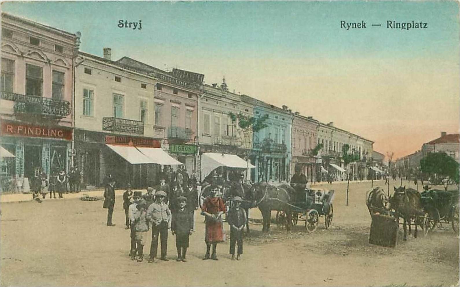
Stryi ( uk, Стрий, ; pl, Stryj) is a city located on the left bank of the river Stryi in Lviv Oblast (region) of western Ukraine 65 km to the south of Lviv (in the foothills of the Carpathian Mountains). It serves as the administrative center of Stryi Raion (district). Stryi hosts the administration of Stryi urban hromada, one of the hromadas of Ukraine. Its population is approximately . Stryi is considered to be the first city in Ukraine to bear the blue-over-yellow Ukrainian national flag when it was hoisted on the flagpole of the Town Hall on March 14, 1990, even before the fall of the Soviet Union in December 1991. Population Name The city takes its name from the name of the river Stryi, one of the tributaries of the Dniester. Stryi, as a name of river is a very old name and means "stream". Its etymology stems from an Indo-European root *sreu. Words that have the same root can be found in modern Ukrainian - струм, струя, Polish - ''struga'', ''strumie� ... [...More Info...] [...Related Items...] OR: [Wikipedia] [Google] [Baidu] |
Drohobycz
Drohobych ( uk, Дрого́бич, ; pl, Drohobycz; yi, דראָהאָביטש;) is a city of regional significance in Lviv Oblast, Ukraine. It is the administrative center of Drohobych Raion and hosts the administration of Drohobych urban hromada, one of the hromadas of Ukraine. In 1939–1941 and 1944–1959 it was the center of Drohobych Oblast. The city was founded at the end of eleventh century as an important trading post and transport node between Kyiv Rus' and the lands to the West of Rus'. After extinction of the local Ruthenian dynasty and subsequent incorporation of the Kingdom of Galicia–Volhynia into the Polish Kingdom by 1349, from the fifteenth century the city was developing as a mercantile and saltworks centre. Drohobych became part of the Habsburg Empire in 1772 after the first partition of Polish–Lithuanian Commonwealth. In the mid-nineteenth century it became Europe's largest oil extraction center, which significantly contributed to its rapid develo ... [...More Info...] [...Related Items...] OR: [Wikipedia] [Google] [Baidu] |


