|
Princes Islands
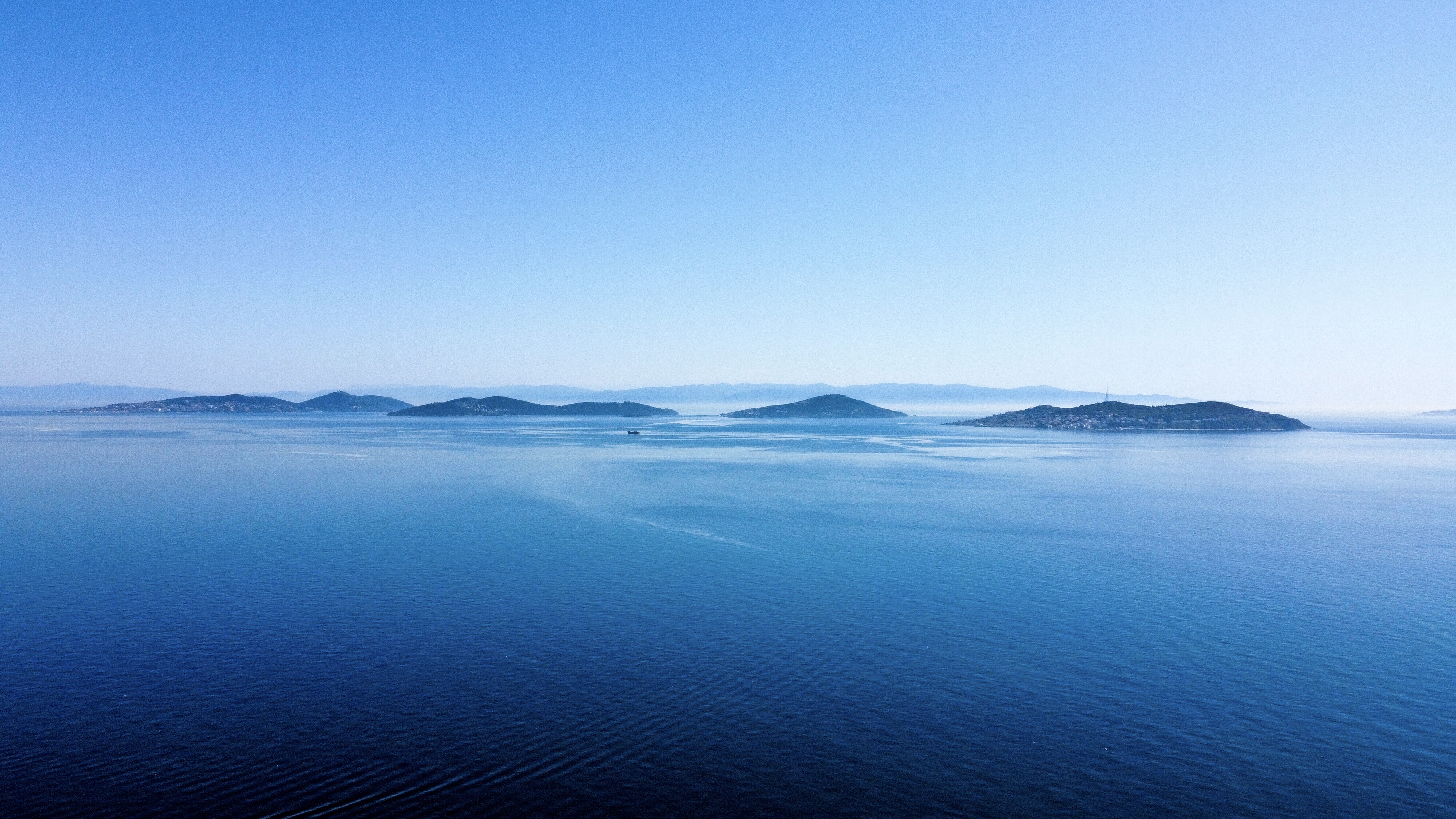
The Princes' Islands ( tr, Prens Adaları; the word "princes" is plural, because the name means "Islands of the Princes", el, Πριγκηπονήσια, ''Pringiponisia''), officially just Adalar ( en, Islands); alternatively the Princes' Archipelago; is an archipelago off the coast of Istanbul, Turkey, in the Sea of Marmara. The islands constitute the Adalar district of Istanbul Province. With a total land area of , it is the eighth smallest district in Istanbul, and with a permanent population of 16,372 (2021), it is by far the least populous district in Istanbul. They consist of four larger islands, Büyükada ("Big Island") with an area of , Heybeliada ("Saddlebag Island") with an area of , Burgazada ("Fortress Island") with an area of , Kınalıada ("Henna Island") with an area of , and five much smaller ones, Sedef Adası ("Mother-of-Pearl Island") with an area of , Yassıada ("Flat Island") with an area of , Sivriada ("Sharp Island") with an area of , Kaşık Adası (" ... [...More Info...] [...Related Items...] OR: [Wikipedia] [Google] [Baidu] |
List Of Districts Of Istanbul
This is a list of districts of Istanbul in Turkey ( tr, İstanbul'un ilçeleri) as of 31 December 2021. The number of the districts increased from 32 to 39 shortly before the 2009 local elections. Population Historical information Pera (now Beyoğlu) and Galata in the late 19th and early 20th centuries were a part of the Municipality of the Sixth Circle (french: Municipalité du VIme Cercle), established under the laws of 11 Jumada al-Thani (Djem. II) and 24 Shawwal (Chev.) 1274, in 1858; the organisation of the central city in the city walls, "Stamboul" ( tr, İstanbul), was not affected by these laws. All of Constantinople (all of which today is now Istanbul) was in the Prefecture of the City of Constantinople (french: Préfecture de la Ville de Constantinople). See also * List of neighbourhoods of Istanbul Notes References {{reflist Districts of Istanbul Istanbul Districts A district is a type of administrative division that, in some countries, is ... [...More Info...] [...Related Items...] OR: [Wikipedia] [Google] [Baidu] |
Heybeliada
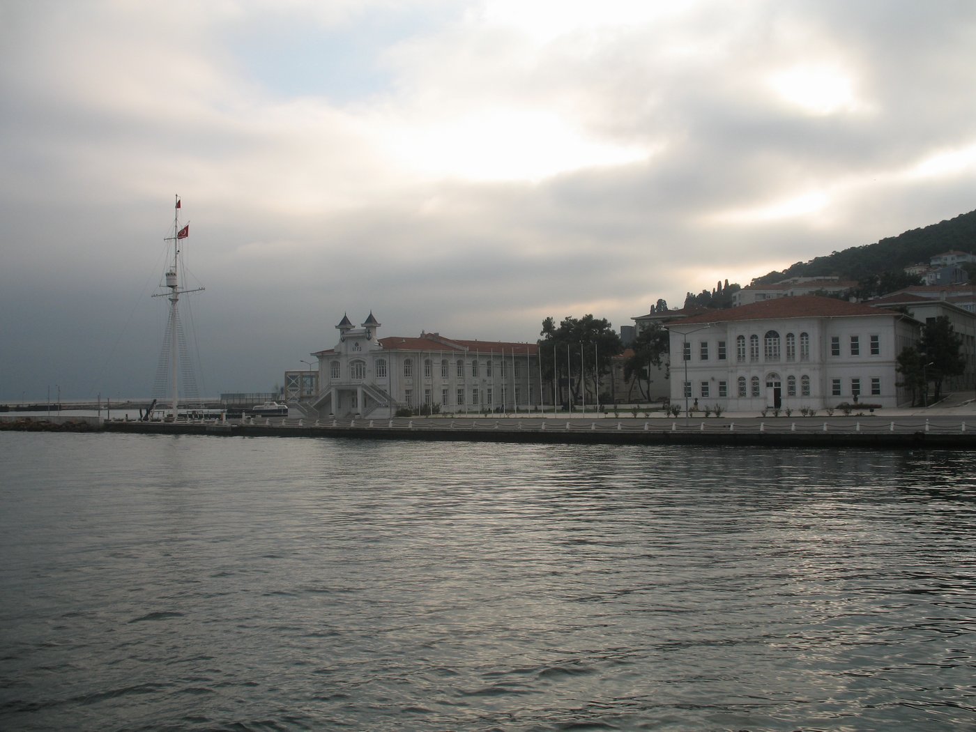
Heybeliada, or Heybeli Ada, is the second largest of the Prince' Islands in the Sea of Marmara, near Istanbull, Turkey. It is officially a neighbourhood of the Adalar district of Istanbul. Its name, meaning 'with a saddlebag' in Turkish, in supposed reference to the valley between two hills. The island was known as ''Halki'', ''Halkitis'' ( el, Χαλκίτις) and ''Demonesos'' ( Greek: Δημόνησος) in antiquity, the first two toponyms deriving from the Greek word ''halkos'' ( el, χαλκός), meaning copper. The island was famous for its copper and copper ores in antiquity. In winter the island's population is only about 5,500, but in summer, the owners of summer houses return and the population swells to approximately 30,000. Launched in 2008, TCG ''Heybeliada'', used by the Turkish Navy is named after the island. Until 2020, the only vehicles permitted on the island were ambulances, fire tenders, police cars etc; the only official form of transport was by ... [...More Info...] [...Related Items...] OR: [Wikipedia] [Google] [Baidu] |
Beşiktaş
Beşiktaş () is a district and municipality of Istanbul, Turkey, located on the European shore of the Bosphorus strait. It is bordered on the north by Sarıyer and Şişli, on the west by Kağıthane and Şişli, on the south by Beyoğlu, and on the east by the Bosphorus. Directly across the Bosphorus is the district of Üsküdar. The district includes a number of important sites along the European shore of the Bosphorus, from Dolmabahçe Palace in the south to the Bebek, Istanbul, Bebek area in the north. It is also home to many inland (and relatively expensive, upper-middle class) neighborhoods such as Levent and Etiler. Some of its other well-known neighborhoods include Yıldız, Beşiktaş, Yıldız, Kuruçeşme, Ortaköy, and Arnavutköy. Beşiktaş' historic commercial centre is the quarter and Çarşı, Beşiktaş, Çarşı (literally, "marketplace"), which adjoins the small Abbasağa Park. Running in the north–south direction, Barbaros Boulevard is a major feeder r ... [...More Info...] [...Related Items...] OR: [Wikipedia] [Google] [Baidu] |
Maltepe, Istanbul
Maltepe is a district in Istanbul, Turkey, on the northern shore of the Sea of Marmara. It touches Kadıköy district to the west, Kartal to the east and Ataşehir to the northwest. The mayor of Maltepe is Ali Kılıç ( CHP). History In Byzantine times, the area was known as Bryas ( el, Βρύας). In ca. 837, the emperor Theophilos (r. 829–842) erected here a palace in Arab style, inspired by the palaces of the Abbasids in Baghdad, described to him by his ambassador to the Abbasid court, John Grammatikos. A ruin in nearby Küçükyalı has been identified as it. This coast has been a retreat from the city since Byzantine and Ottoman times, and right up until the 1970s was a rural area peppered with summer homes for wealthy Istanbul residents. Being on the suburban railway line Maltepe was a favorite spot for day-trippers or weekenders to visit the beach and many summer houses were built there. Many of these houses remain but now Maltepe is no longer a beach retreat. Malte ... [...More Info...] [...Related Items...] OR: [Wikipedia] [Google] [Baidu] |
Kartal
Kartal is a district of Istanbul, Turkey, located on the Asian side of the city, on the coast of the Marmara Sea between Maltepe and Pendik. Despite being far from the city centre, Kartal is heavily populated (total population of 541,209) (2008 census). The total land area is 147,000 m2, which includes some countryside areas inland. The district's neighbours are Maltepe to the west, Sultanbeyli and Sancaktepe to the north and Pendik to the east. Inland from the coast, the land rises sharply up to the hills Yakacık and Aydos, the latter of which is the highest point in Istanbul. History Kartal ('eagle' in Turkish, by folk etymology) was a fishing village on the shore of the Marmara Sea during the Byzantine Empire, called Kartalimen or Kartalimin in Greek, and was founded at the beginning of the 6th century. In the 11th century, the town was conquered by the ruler of the Seljuks, Suleyman Shah. In 1329, Kartal became part of the Ottoman Empire, the Byzantines re-took the c ... [...More Info...] [...Related Items...] OR: [Wikipedia] [Google] [Baidu] |
Kadıköy
Kadıköy (), known in classical antiquity and during the Roman and Byzantine eras as Chalcedon ( gr, Χαλκηδών), is a large, populous, and cosmopolitan district in the Asian side of Istanbul, Turkey, on the northern shore of the Sea of Marmara. It partially faces the historic city centre of Fatih on the European side of the Bosporus. One of the expensive neighborhood in Istanbul. Kadıköy is also the name of the most prominent neighbourhood of the district, a residential and commercial area that, with its numerous bars, cinemas and bookshops, is the liberal cultural centre of the Anatolian side of Istanbul. Kadıköy became a district in 1928 when it was separated from Üsküdar district. The neighbourhoods of İçerenköy, Bostancı and Suadiye were also separated from the district of Kartal in the same year, and eventually joined the newly formed district of Kadıköy. Its neighbouring districts are Üsküdar to the northwest, Ataşehir to the northeast, Maltepe t ... [...More Info...] [...Related Items...] OR: [Wikipedia] [Google] [Baidu] |
Bostancı
Bostancı is a neighbourhood of Kadıköy, located on the Anatolian side of Istanbul, Turkey, on the shore of the Sea of Marmara. As the easternmost neighbourhood of the Kadıköy district; it borders Suadiye and Kozyatağı (also neighbourhoods of Kadıköy) to the west, İçerenköy (a neighbourhood of Ataşehir) to the north, and Altıntepe (a neighbourhood of Maltepe) to the east. A predominantly residential area, Bostancı is an important transport interchange with stops on the Marmaray and M4 Metro lines and ferries leaving for the Princes' Islands in the Sea of Marmara. It is generally considered the starting point of Bağdat Avenue, the major shopping street that runs as far as Kadıköy. Because of its position on the water, Bostanci has several fish restaurants. It is also popular as a place to stop off for late night fast food. Several places stay open all night serving people returning from the bars and clubs on Bağdat Avenue. History In the Byzantine period ... [...More Info...] [...Related Items...] OR: [Wikipedia] [Google] [Baidu] |
Büyükada Splendid Palace
Büyükada ( el, Πρίγκηπος or Πρίγκιπος, rendered ''Prinkipos'' or ''Prinkipo''), meaning "Big Island" in Turkish, is the largest of the Princes' Islands in the Sea of Marmara, near Istanbul, with an area of about . It is officially a neighbourhood in the Adalar (''Islands'') district of Istanbul Province, Turkey. During the first half of the 20th century, the island was popular with prosperous Greeks, Jews and Armenians as a refuge from the summer heat of Istanbul. Nowadays the island is almost as solidly Turkish as any suburb of mainland Istanbul. Historically, many residents of Büyükada were fishermen. However, by the late 2010s tourism to Büyükada swelled enormously as it became a favourite day-trip destination for visitors from greenery-starved Arab countries in particular. The surge in tourism was a major factor in bringing to an end the tradition of using phaetons as the only transport on the island in 2020. Visitors have been writing about Büy� ... [...More Info...] [...Related Items...] OR: [Wikipedia] [Google] [Baidu] |
Tavşan Adası
Tavşan Adası ("Rabbit Island" in Turkish) (Greek: Neandros (Νέανδρος), the name of a mythological figure.) or Balıkçı Adası is the smallest of the Princes' Islands in the Sea of Marmara, to the southeast of Istanbul, Turkey. It is under the administration of the Adalar (literally ''Islands'' or ''Isles'') district of Istanbul Province. The island has an area of . See also * List of islands of Turkey This is a list of islands of Turkey. There are around 500 islands and islets in the Turkey. These islands are located in the Aegean Sea, Black Sea, Mediterranean Sea, Sea of Marmara, and Turkish lakes. The Turkish words for island/islands/rocks ... Islands of the Sea of Marmara Islands of Turkey Neighbourhoods of Adalar, Istanbul Islands of Istanbul Province {{Istanbul-geo-stub ... [...More Info...] [...Related Items...] OR: [Wikipedia] [Google] [Baidu] |
Kaşık Adası
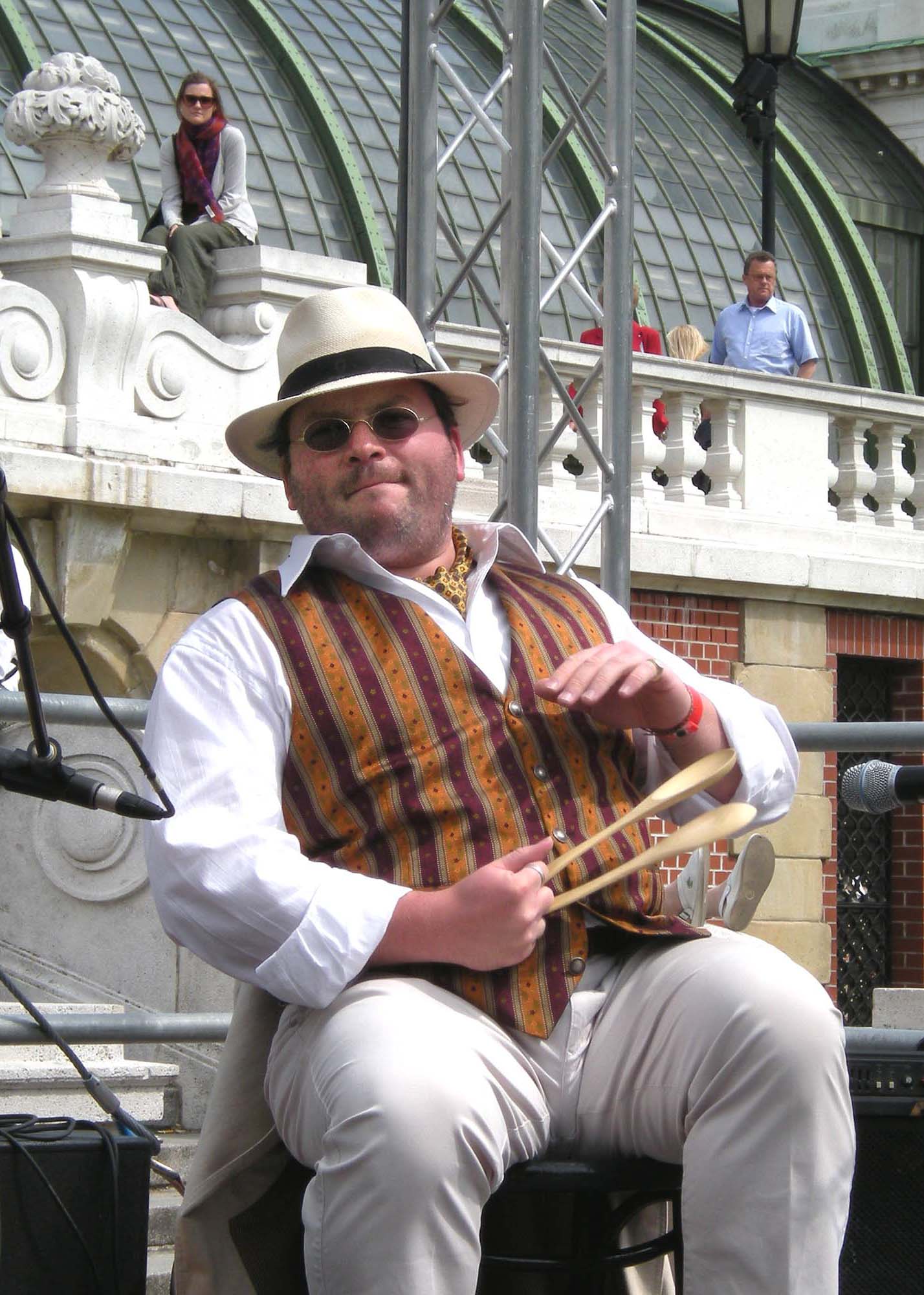
Spoons can be played as a makeshift percussion instrument, or more specifically, an idiophone related to the castanets. They are played by hitting one spoon against the other. Techniques # Fire tongs style: A pair of spoons is held tight with concave sides facing out and with index finger between their handles to space them apart. When the pair is struck, the spoons sharply hit each other and then spring back to their original position. The spoons are typically struck against the knee and the palm of the hand. The fingers and other body parts may also be used as striking surfaces to produce different sounds, rhythms, rattles and visual effects. # Salad serving style: One spoon between little, ring, and long finger; the other spoon between ring, thumb, and index finger in such a way that they can be rotated with ring finger as the common axis. They can be hit to each other at the convex sides by gathering the fingers (mostly middle and thumb). # Castanets style: Two in each h ... [...More Info...] [...Related Items...] OR: [Wikipedia] [Google] [Baidu] |
Sivriada
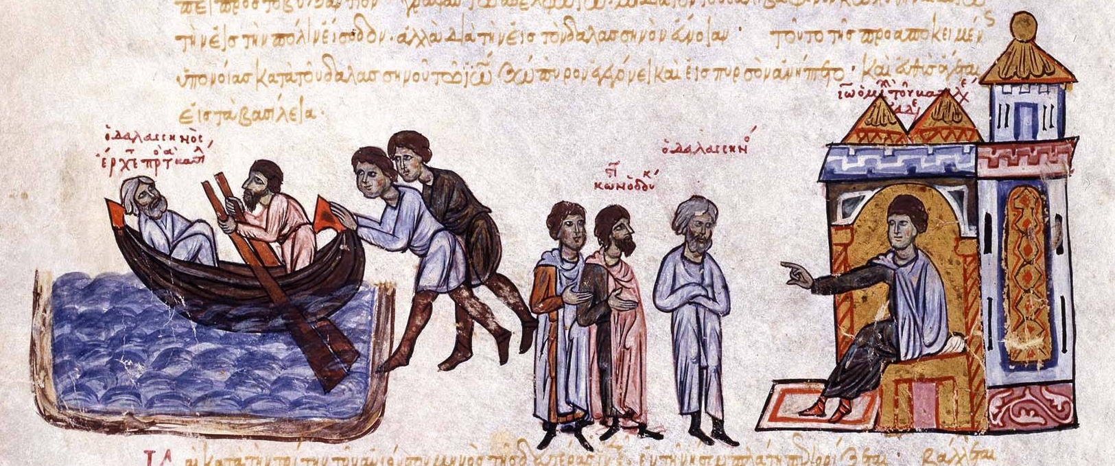
Sivriada ( el, , ''Oxeia'') also known as Hayırsızada, is one of the Princes' Islands in the Sea of Marmara, near Istanbul. The island, which has an area of 0.05 km², is officially a neighbourhood in the Adalar district of Istanbul, Turkey. Sivriada was often used by the Byzantine clerics as a distant place for peaceful worship, and by the Byzantine emperors as a convenient prison to detain prominent people whom they deemed troublesome. The first famous person to be imprisoned in the island by the order of emperor Nikephoros I was Plato of Sakkoudion, the uncle of renowned cleric Theodoros Stoudites, for supporting his nephew in his conflict with the emperor. Other famous people who stayed in the island for religious and political reasons were Gebon, Basil Skleros, Nikephoritzes (the chief minister of Michael VII Doukas), Patriarch John of Antioch and Patriarch Michael II of Constantinople. The graves of those who died on the island during the Byzantine period can stil ... [...More Info...] [...Related Items...] OR: [Wikipedia] [Google] [Baidu] |
Yassıada
Yassıada ( Turkish: Flat Island), officially renamed Democracy and Freedom Island ( Turkish: Demokrasi ve Özğürlükler Adası) in 2013, is one of the Princes' Islands in the Sea of Marmara, to the southeast of Istanbul. In Byzantine times, it was known as Plati ( el, Πλάτη). The island, which has an area of 183000 m2, is officially a neighbourhood of Adalar ( Turkish: Islands) district of Istanbul Province, Turkey. History The Byzantines first used Yassıada as a place to send prominent figures into exile. One such person was the Armenian Patriarch (Catholicos) Narses who was sent here before being imprisoned at Prinkipos in the 4th century AD. they were still using the island for political prisoners Into the 11th century and the remains of four underground prison cells from this period can still be seen. The Byzantine Emperor Theofilos built the Platea Monastery on the island and Patriarch Ignatios, who was exiled to the island in 860, built a church on it; tun ... [...More Info...] [...Related Items...] OR: [Wikipedia] [Google] [Baidu] |


.jpg)


