|
Prashar Lake
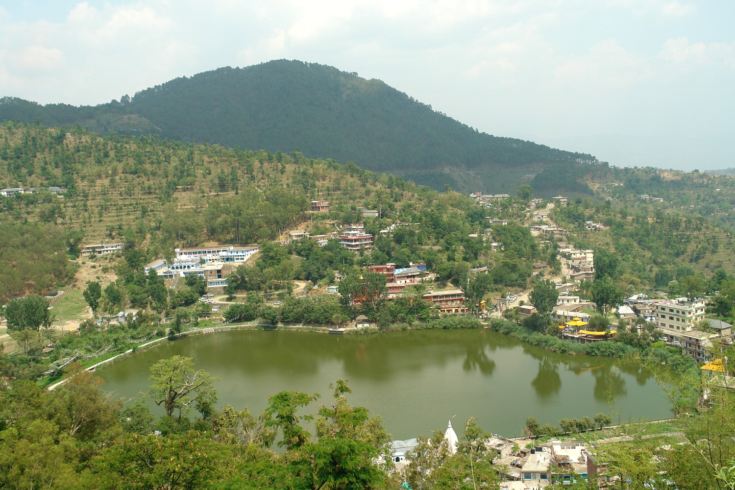
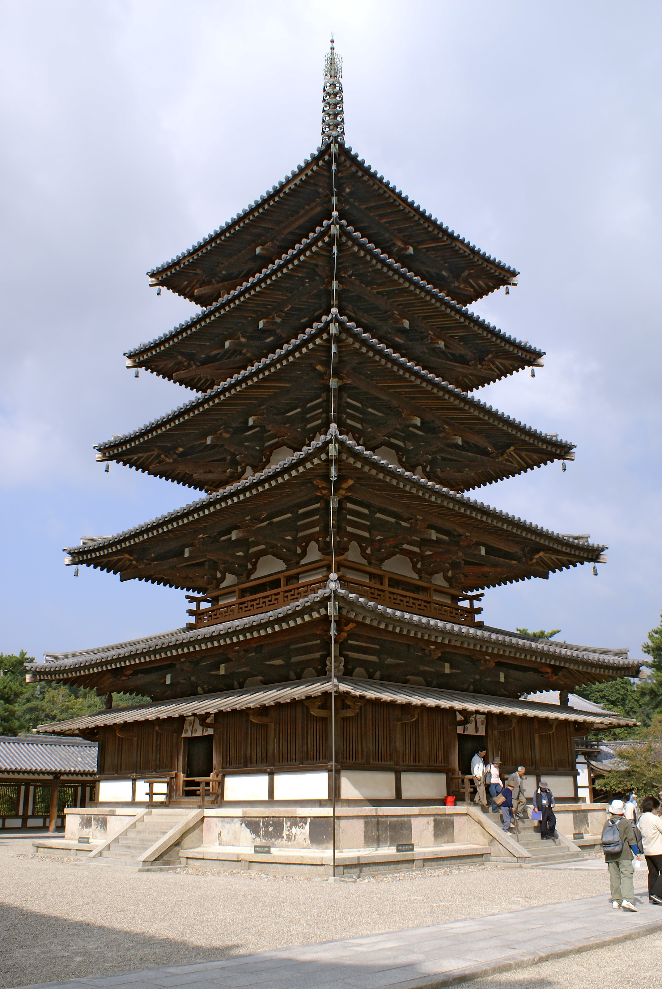
Prashar Lake (also spelled Parashar Lake) is a freshwater lake located at an altitude of in the Mandi district of Himachal Pradesh, India. It lies east of the town of Mandi, and has a three storied pagoda-like temple dedicated to the sage Prashar situated on its bank. It contains a floating island inside it. History The lake is considered sacred to the sage Parashara, who meditated here back then. The temple was built in the 13th century by Raja Ban Sen of Mandi in honor of the sage and thus, considering the Himachali architecture, the lake was named after him. Details The lake is located at a height of above sea level. With deep blue waters, the lake is held sacred to the sage Parashar and he is regarded to have meditated there. Surrounded by snow-capped peaks and looking down on the fast flowing river Beas, the lake can be approached from Mandi or from Bajaura in Kullu Valley. Both routes are . There is a round, floating island in the lake, which is a common natural p ... [...More Info...] [...Related Items...] OR: [Wikipedia] [Google] [Baidu] |
Mandi District
Mandi district is one of the central districts of Himachal Pradesh state in northern India. The town of Mandi is the headquarters of the district. The main native language is Mandeali. As of 2011 it is the second most populous district of Himachal Pradesh (out of 12), after Kangra. Demographics According to the 2011 census Mandi district has a population of 999,777, roughly equal to the nation of Fiji or the US state of Montana. This gives it a ranking of 446th in India (out of a total of 640). The district has a population density of . Its population growth rate over the decade 2001-2011 was 10.89%. Mandi has a sex ratio of 1012 females for every 1000 males and a literacy rate of 82.81%. At the 2011 census, 59% of the population in the district identified their first language as Mandeali, 33% opted for Pahari (a term broadly applicable to most Indo-Aryan languages of Himachal and Uttarakhand), while 4.1% chose Hindi, 0.66% – Punjabi and 0.47% – Kangri. Subd ... [...More Info...] [...Related Items...] OR: [Wikipedia] [Google] [Baidu] |
Holomictic
Holomictic lakes are lakes that have a uniform temperature and density from surface to bottom at a specific time during the year, which allows the lake waters to mix in the absence of Stratification (water), stratification. Details Holomictic lakes mix at least occasionally, in contrast to Meromictic lake, meromictic lakes. Most lakes on Earth are holomictic; meromictic lakes are rare, although they may be less rare than commonly thought. Amictic lake, Amictic lakes are sealed off by ice and never mix. There are four types of holomictic lakes: * polymictic lake, Polymictic (mixing many times annually) * Cold monomictic lake, Monomictic (mixing once annually; exhibiting negative stratification) * Warm Monomictic (mixing once annually; exhibiting positive stratification) * dimictic lake, Dimictic (mixing twice annually) * Oligomictic (mixing less than once annually) See also * Thermocline * References External links"Circulation: annual patterns of dimictic lakes" at Encycl ... [...More Info...] [...Related Items...] OR: [Wikipedia] [Google] [Baidu] |
Himachal Pradesh
Himachal Pradesh (; ; "Snow-laden Mountain Province") is a state in the northern part of India. Situated in the Western Himalayas, it is one of the thirteen mountain states and is characterized by an extreme landscape featuring several peaks and extensive river systems. Himachal Pradesh is the northernmost state of India and shares borders with the union territories of Jammu and Kashmir and Ladakh to the north, and the states of Punjab to the west, Haryana to the southwest, Uttarakhand to the southeast and a very narrow border with Uttar Pradesh to the south. The state also shares an international border to the east with the Tibet Autonomous Region in China. Himachal Pradesh is also known as , meaning 'Land of Gods' and which means 'Land of the Brave'. The predominantly mountainous region comprising the present-day Himachal Pradesh has been inhabited since pre-historic times, having witnessed multiple waves of human migrations from other areas. Through its history, the ... [...More Info...] [...Related Items...] OR: [Wikipedia] [Google] [Baidu] |
Mandi, Himachal Pradesh
Mandi ( formerly known as Mandav Nagar, also known as Sahor) is a major city and a municipal corporation in Mandi District in the Indian state of Himachal Pradesh. It is situated north of state capital, Shimla in the north-west Himalayas at an average altitude of 880 metres and experiences pleasant summers and cold winters. Mandi is connected to the Pathankot through National Highway 20 which is almost 220 km(140 mi) long and to Manali and Chandigarh through National Highway 21 which is 323 km(201 mi) long. Mandi is approximately 184.6 km (114.7 mi) from Chandigarh, the nearest major city, and 440.9 km (273.9 mi) from New Delhi, the national capital. In the 2011 Indian census, Mandi city had a population of 26,422. Mandi district is currently the 2nd largest economy in the state next to Kangra. Mandi, in the state is having second highest sex ratio of 1013 females per thousand males. It serves as the headquarters of Mandi Distri ... [...More Info...] [...Related Items...] OR: [Wikipedia] [Google] [Baidu] |
Pagoda
A pagoda is an Asian tiered tower with multiple eaves common to Nepal, India, China, Japan, Korea, Myanmar, Vietnam, and other parts of Asia. Most pagodas were built to have a religious function, most often Buddhist but sometimes Taoist, and were often located in or near viharas. The pagoda traces its origins to the stupa of ancient India. Chinese pagodas () are a traditional part of Chinese architecture. In addition to religious use, since ancient times Chinese pagodas have been praised for the spectacular views they offer, and many classical poems attest to the joy of scaling pagodas. Chinese sources credit the Nepalese architect Araniko with introducing the pagoda to China. The oldest and tallest pagodas were built of wood, but most that survived were built of brick or stone. Some pagodas are solid with no interior. Hollow pagodas have no higher floors or rooms, but the interior often contains an altar or a smaller pagoda, as well as a series of staircases for the vis ... [...More Info...] [...Related Items...] OR: [Wikipedia] [Google] [Baidu] |
Floating Island
A floating island is a mass of floating aquatic plants, mud, and peat ranging in thickness from several centimeters to a few meters. Floating islands are a common natural phenomenon that are found in many parts of the world. They exist less commonly as an artificial phenomenon. Floating islands are generally found on marshlands, lakes, and similar wetland locations, and can be many hectares in size. Natural occurrences Sometimes referred to as ''tussocks'', ''floatons'', or ''suds'', natural floating islands are composed of vegetation growing on a buoyant mat of plant roots or other organic detritus. In aquatic regions of Northwestern Europe several hundred hectares or thousand acres of floating meadows (German ''Schwingrasen'', Dutch ''trilveen'') have been preserved, which are partly used as agricultural land, partly as nature reserves. They typically occur when growths of cattails, bulrush, sedge, and reeds extend outward from the shoreline of a wetland area. As the wate ... [...More Info...] [...Related Items...] OR: [Wikipedia] [Google] [Baidu] |
Kullu Valley
Kullu Valley is a broad open valley in Himachal Pradesh, India, formed by the Beas River between Manali and Larji. This valley is famous for its temples, beauty and its majestic hills covered with pine and deodar forest and sprawling apple orchards. The course of the Beas river presents a succession of magnificent, clad with forests of deodar, towering above trees of pine on the lower rocky ridges. Kullu valley is sandwiched between the Pir Panjal, Lower Himalayan and Great Himalayan Ranges. Ski touring is a sport growing in popularity in the Himilayan peaks surrounding the valley. Economy ''See Economy section in Kullu district.'' Tourism ''For places of interest, festivals, and outdoor sports in the Kullu valley, see Attractions section in Kullu district.'' Further reading ''See Further Readings section in Kullu district Kullu is a district in Himachal Pradesh, India. It borders Rampur district to the south, Mandi and Kangra districts to the west, and the La ... [...More Info...] [...Related Items...] OR: [Wikipedia] [Google] [Baidu] |
Bhima
In Hindu epic Mahabharata, Bhima ( sa, भीम, ) is the second among the five Pandavas. The ''Mahabharata'' relates many events that portray the might of Bhima. Bhima was born when Vayu, the wind god, granted a son to Kunti and Pandu. After the death of Pandu and Madri, Kunti with her sons stayed in Hastinapura. From his childhood, Bhima had a rivalry with his cousins Kauravas, especially Duryodhana. Duryodhana and his uncle, Shakuni, tried to kill Bhima multiple times. One was by poisoning and throwing Bhima into a river. Bhima was rescued by Nāgas and was given a drink which made him very strong and immune to all venom. After the event of Lakshagriha, the Pandavas and their mother decided to hide from Hastinapura. During this period Bhima slew many Rakshasa including Bakasura and Hidimba. Bhima had three wives Hidimbi, the Rakshasi sister of Hidimba, Draupadi, who was married to five Pandavas because of Kunti's misunderstanding, and Valandhara, a princess of Kash ... [...More Info...] [...Related Items...] OR: [Wikipedia] [Google] [Baidu] |
Lakes Of Himachal Pradesh
Reservoirs *Maharana Pratap Sagar *Pandoh Lake *Gobind Sagar *Chamera Dam Low Altitude Lakes *Renuka Lake *Macchial Lake Mid Altitude Lakes *Dal Lake (HP), Dal Lake District kangra *Khajjiar, Khajjiar Lake District Chamba *Kumarwah Lake District Mandi *Rewalsar Lake, Rewalsar Lake District mandi High Altitude Lakes *Prashar Lake (2730m)- Mandi district *Dehnasar Lake (4280m) -Kangra district *Nako Lake (3662m) - Kinnaur district *Chandra Tal (4300m) -Lahaul & Spiti district *Suraj Tal (4883m) -Lahaul & Spiti district *Dhankar Lake *Dashair (4270m) *Bhrighu Lake (4235m) - Kullu district *Manimahesh Lake (4080m) -Chamba district *Gadasru Lake (3470m) - Chamba district *Mahakali Lake (4080m) -Chamba district *Lama Dal (3960m) -Chamba district *Chander Naun (4260m) *Kareri Lake (2934m) -Kangra district *Nag Dal Lake (4150m) *Kamrunag lake (3334m) Mandi in district.mandi In the Shimla area lie the small rain water fed lakes of Tani Jubbar, Kunihar and Karwali that lie ... [...More Info...] [...Related Items...] OR: [Wikipedia] [Google] [Baidu] |
Geography Of Mandi District
Geography (from Greek: , ''geographia''. Combination of Greek words ‘Geo’ (The Earth) and ‘Graphien’ (to describe), literally "earth description") is a field of science devoted to the study of the lands, features, inhabitants, and phenomena of Earth. The first recorded use of the word γεωγραφία was as a title of a book by Greek scholar Eratosthenes (276–194 BC). Geography is an all-encompassing discipline that seeks an understanding of Earth and its human and natural complexities—not merely where objects are, but also how they have changed and come to be. While geography is specific to Earth, many concepts can be applied more broadly to other celestial bodies in the field of planetary science. One such concept, the first law of geography, proposed by Waldo Tobler, is "everything is related to everything else, but near things are more related than distant things." Geography has been called "the world discipline" and "the bridge between the human and ... [...More Info...] [...Related Items...] OR: [Wikipedia] [Google] [Baidu] |


