|
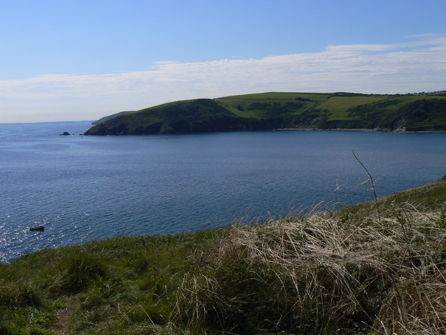
Portnadler Bay
Portnadler Bay lies 1.5 miles to the south-west of the town of Looe, Cornwall. It contains a secluded beach that is reachable on foot via a steep path that descends from the main coastal path A coastal path (or a littoral path) is a trail along a sea shore or a lake shore for pedestrians, and sometimes for cyclists or equestrians. Some coastal paths were originally created for use by customs or coastguard officials looking out for s .... References Bays of Cornwall {{Cornwall-geo-stub ... [...More Info...] [...Related Items...] OR: [Wikipedia] [Google] [Baidu] |
Looe
Looe (; kw, Logh, ) is a coastal town and civil parish in south-east Cornwall, England, with a population of 5,280 at the 2011 census. Looe is west of Plymouth and south of Liskeard, divided in two by the River Looe, East Looe ( kw, links=no, Logh) and West Looe ( kw, links=no, Porthbyhan, "little cove") being connected by a bridge. Looe developed as two separate towns each with MPs and its own mayor. The town centres around a small harbour and along the steep-sided valley of the River Looe which flows between East and West Looe to the sea beside a sandy beach. Offshore to the west, opposite the stonier Hannafore Beach, lies Looe Island. History Prehistory and foundation Archeological evidence indicates that the area around Looe has been inhabited since the Neolithic period (although a possible series of ancient field systems, south of nearby Penarthtown, could suggest earlier Palaeolithic activity). A Neolithic stone axe, made of greenstone, was found in 1978 on a tid ... [...More Info...] [...Related Items...] OR: [Wikipedia] [Google] [Baidu] |
Cornwall
Cornwall (; kw, Kernow ) is a historic county and ceremonial county in South West England. It is recognised as one of the Celtic nations, and is the homeland of the Cornish people. Cornwall is bordered to the north and west by the Atlantic Ocean, to the south by the English Channel, and to the east by the county of Devon, with the River Tamar forming the border between them. Cornwall forms the westernmost part of the South West Peninsula of the island of Great Britain. The southwesternmost point is Land's End and the southernmost Lizard Point. Cornwall has a population of and an area of . The county has been administered since 2009 by the unitary authority, Cornwall Council. The ceremonial county of Cornwall also includes the Isles of Scilly, which are administered separately. The administrative centre of Cornwall is Truro, its only city. Cornwall was formerly a Brythonic kingdom and subsequently a royal duchy. It is the cultural and ethnic origin of the Cornish dias ... [...More Info...] [...Related Items...] OR: [Wikipedia] [Google] [Baidu] |
South West Coast Path
The South West Coast Path is England's longest waymarked long-distance footpath and a National Trail. It stretches for , running from Minehead in Somerset, along the coasts of Devon and Cornwall, to Poole Harbour in Dorset. Because it rises and falls with every river mouth, it is also one of the more challenging trails. The total height climbed has been calculated to be 114,931 ft (35,031 m), almost four times the height of Mount Everest. It has been voted 'Britain's Best Walking route' twice in a row by readers of The Ramblers' ''Walk'' magazine, and regularly features in lists of the world's best walks. The final section of the path was designated as a National Trail in 1978. Many of the landscapes which the South West Coast Path crosses have special status, either as a national park or one of the heritage coasts. The path passes through two World Heritage Sites: the Dorset and East Devon Coast, known as the Jurassic Coast, was designated in 2001, and the Cornwall ... [...More Info...] [...Related Items...] OR: [Wikipedia] [Google] [Baidu] |


