|
Portmahomack
Portmahomack ( gd, Port Mo Chalmaig; 'Haven of My .e. 'Saint'Colmóc') is a small fishing village in Easter Ross, Scotland. It is situated in the Tarbat Peninsula in the parish of Tarbat. Tarbat Ness Lighthouse is about from the village at the end of the Tarbat Peninsula. Ballone Castle lies about from the village. There is evidence of early settlement, and the area seems to have been the site of significant activity during the time of the Picts, early Christianity and the Vikings. The village is situated on a sandy bay and has a small harbour designed by Thomas Telford: it shares with Hunstanton the unusual distinction of being on the east coast but facing west. Portmahomack lies inside the Moray Firth Special Area of Conservation with the associated dolphin and whale watching activity. The village has a primary school, golf course, hotel, a number of places to eat and a shop with a sub-post office. The nearest rail access is at Fearn railway station and the nearest ... [...More Info...] [...Related Items...] OR: [Wikipedia] [Google] [Baidu] |
Picts
The Picts were a group of peoples who lived in what is now northern and eastern Scotland (north of the Firth of Forth) during Late Antiquity and the Early Middle Ages. Where they lived and what their culture was like can be inferred from early medieval texts and Pictish stones. Their Latin name, , appears in written records from the 3rd to the 10th century. Early medieval sources report the existence of a distinct Pictish language, which today is believed to have been an Insular Celtic language, closely related to the Common Brittonic, Brittonic spoken by the Celtic Britons, Britons who lived to the south. Picts are assumed to have been the descendants of the Caledonians, Caledonii and other British Iron Age, Iron Age tribes that were mentioned by Roman historians or on the Ptolemy's world map, world map of Ptolemy. The Pictish kingdom, often called Pictland in modern sources, achieved a large degree of political unity in the late 7th and early 8th centuries through the expa ... [...More Info...] [...Related Items...] OR: [Wikipedia] [Google] [Baidu] |
Martin Carver
Martin Oswald Hugh Carver, FSA, Hon FSA Scot, (born 8 July 1941) is Emeritus Professor of Archaeology at the University of York, England, director of the Sutton Hoo Research Project and a leading exponent of new methods in excavation and survey. He specialises in the archaeology of early Medieval Europe. He has an international reputation for his excavations at Sutton Hoo, on behalf of the British Museum and the Society of Antiquaries and at the Pictish monastery at Portmahomack Tarbat, Easter Ross, Scotland. He has undertaken archaeological research in England, Scotland, France, Italy and Algeria. Early life Carver was born on 8 July 1941 to John Hobart Carver and Jocelyn Louisa Grace Carver (née Tweedie). He was the grandson of Oswald Carver. He was educated at Ladycross School, a Catholic preparatory school in Seaford, East Sussex, and then Wellington College, an independent school in Crowthorne, Berkshire. Military service Having graduated from the Royal Military Acad ... [...More Info...] [...Related Items...] OR: [Wikipedia] [Google] [Baidu] |
Rockfield, Highland
Rockfield ( gd, Creag Tarail Bhig) is a hamlet in the parish of Tarbat, on the Tarbat Peninsula, near the village of Portmahomack, Easter Ross, Highland, Scotland. There is a small stone jetty and the traditional way of life included fishing and agriculture. Rockfield is generally east-facing, below the level of a raised beach. Coastal Walks Rockfield is a good place to start or finish a coastal walk. In a south-south-west direction you can walk from Rockfield to the Seaboard Village of Balintore. In a north-north-east direction you can walk from Rockfield to Tarbat Ness, round the headland and return to Portmahomack on the other side of the peninsula. Rockfield to Balintore This walk places the Moray Firth on your left with the opportunity to observe dolphins and occasional whales. The distance is reported as 8.5 km with modest changes in elevation. Rockfield to Tarbat Ness and on to Portmahomack This walk may be broken into two halves. The first half, from Roc ... [...More Info...] [...Related Items...] OR: [Wikipedia] [Google] [Baidu] |
Tarbat Ness Lighthouse OS Map 25inch Rosshire XXX
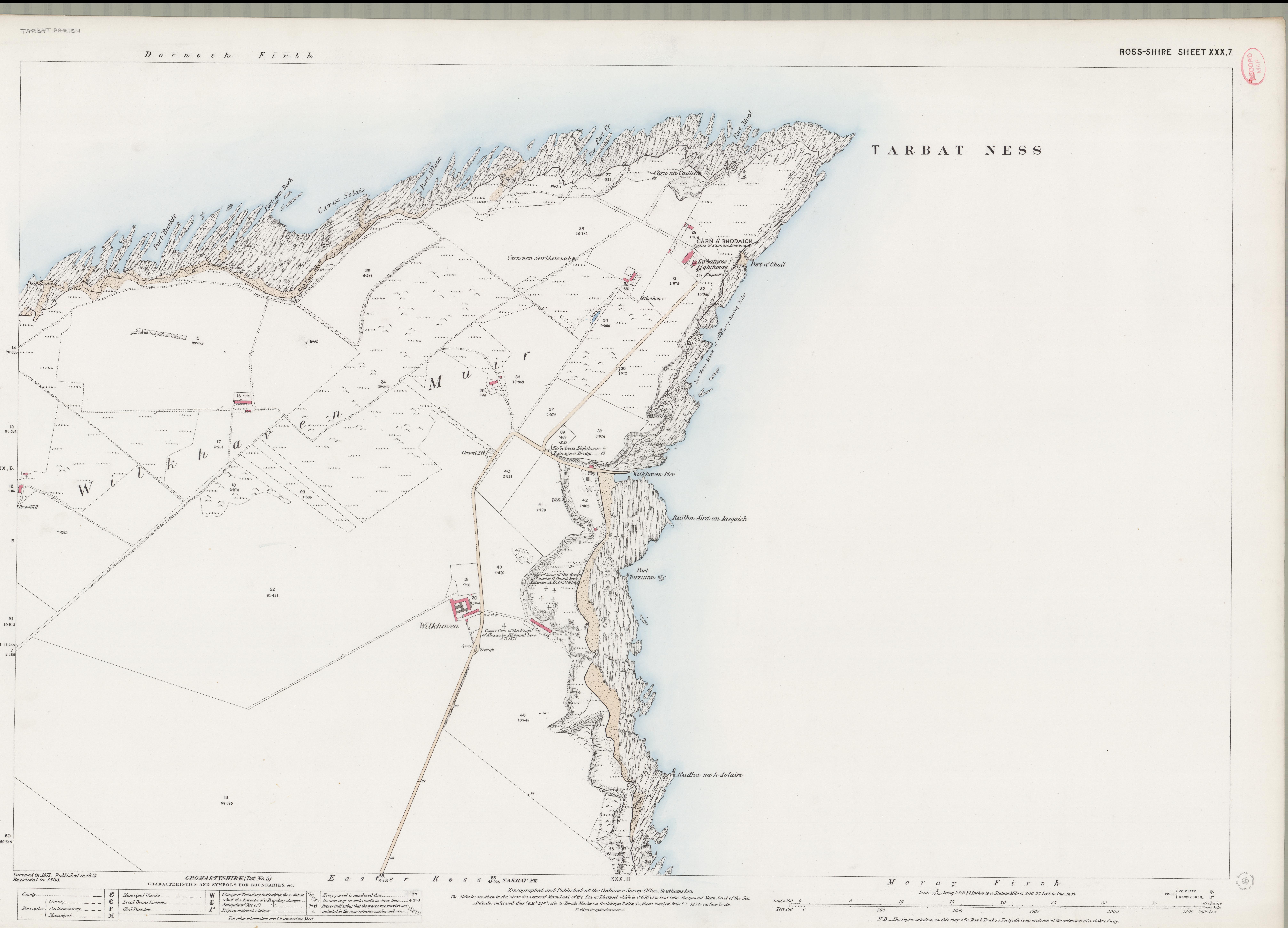
Tarbat (Gaelic , meaning 'a crossing or isthmus'Place-names of Ross and Cromarty, by W J Watson, publ. The Northern Counties Printing and Publishing Co. Ltd., Inverness 1904; p.45) is a civil parish in Highland, Scotland, in the north-east corner of Ross and Cromarty. The parish is a promontory between Dornoch Firth to the north-west and Moray Firth to the east, while to the south it borders the parish of Fearn.Ordnance Gazetteer of Scotland: A survey of Scottish Topography statistical biographical and historical, by Francis H. Groome; publ. Thomas C. Jack, Edinburgh, 1882 - 1885. (Article on Tarbat) The peninsula is relatively flat, the highest point being the hill adjacent to Geanies House which reaches , on the southern border of the parish.Historic Environment Scotland Portal website (Article on Geanies House) portal.historicenvironment.scot/designation/GDL00217 Retrieved April 2021Ordnance Survey series 1 in. to 1 mile Sheet 22 - Dornoch, Publ. 1965 The coast along the D ... [...More Info...] [...Related Items...] OR: [Wikipedia] [Google] [Baidu] |
Tarbat
Tarbat (Gaelic , meaning 'a crossing or isthmus'Place-names of Ross and Cromarty, by W J Watson, publ. The Northern Counties Printing and Publishing Co. Ltd., Inverness 1904; p.45) is a civil parish in Highland, Scotland, in the north-east corner of Ross and Cromarty. The parish is a promontory between Dornoch Firth to the north-west and Moray Firth to the east, while to the south it borders the parish of Fearn.Ordnance Gazetteer of Scotland: A survey of Scottish Topography statistical biographical and historical, by Francis H. Groome; publ. Thomas C. Jack, Edinburgh, 1882 - 1885. (Article on Tarbat) The peninsula is relatively flat, the highest point being the hill adjacent to Geanies House which reaches , on the southern border of the parish.Historic Environment Scotland Portal website (Article on Geanies House) portal.historicenvironment.scot/designation/GDL00217 Retrieved April 2021Ordnance Survey series 1 in. to 1 mile Sheet 22 - Dornoch, Publ. 1965 The coast along the D ... [...More Info...] [...Related Items...] OR: [Wikipedia] [Google] [Baidu] |
Tarbat Ness Lighthouse
The Tarbat Ness Lighthouse is located at the North West tip of the Tarbat Ness peninsula near the fishing village of Portmahomack on the east coast of Scotland. It was built in 1830 by Robert Stevenson and has an elevation of and 203 steps to the top of the tower. History At the Battle of Tarbat Ness in the 11th century, Thorfinn the Mighty defeated "Karl Hundason", possibly a Viking name for Macbeth. Further down the peninsula at Portmahomack, in the 1480s the Clan Ross slaughtered a raiding party from the Clan Mackay by locking them in the Tarbat Old Church and setting fire to it. This event is known as the Battle of Tarbat. Lighthouse A storm in the Moray Firth in November 1826 saw the loss of 16 vessels and brought many applications for lighthouses to be constructed at Tarbat Ness and at Covesea Skerries. Tarbat Ness Lighthouse was engineered by Robert Stevenson for the Northern Lighthouse Board and the light was first exhibited on 26 January 1830. James Smith of Inv ... [...More Info...] [...Related Items...] OR: [Wikipedia] [Google] [Baidu] |
Tarbat Old Church
Tarbat (Gaelic , meaning 'a crossing or isthmus'Place-names of Ross and Cromarty, by W J Watson, publ. The Northern Counties Printing and Publishing Co. Ltd., Inverness 1904; p.45) is a civil parish in Highland, Scotland, in the north-east corner of Ross and Cromarty. The parish is a promontory between Dornoch Firth to the north-west and Moray Firth to the east, while to the south it borders the parish of Fearn.Ordnance Gazetteer of Scotland: A survey of Scottish Topography statistical biographical and historical, by Francis H. Groome; publ. Thomas C. Jack, Edinburgh, 1882 - 1885. (Article on Tarbat) The peninsula is relatively flat, the highest point being the hill adjacent to Geanies House which reaches , on the southern border of the parish.Historic Environment Scotland Portal website (Article on Geanies House) portal.historicenvironment.scot/designation/GDL00217 Retrieved April 2021Ordnance Survey series 1 in. to 1 mile Sheet 22 - Dornoch, Publ. 1965 The coast along the D ... [...More Info...] [...Related Items...] OR: [Wikipedia] [Google] [Baidu] |
Battle Of Tarbat Ness
Tarbat Ness (Scottish Gaelic: ''Rubha Thairbeirt'') is headland that lies at the end of the Tarbat peninsula in Easter Ross, Scotland. The name is from the Gaelic ''tairbeart'' meaning "isthmus" and the Old Norse ''ness'', meaning " headland". It lies at the south of the entrance to the Dornoch Firth. Geology and geomorphology The Upper Old Red Sandstone Devonian period bedrock contains fish fossils. There are examples of a range of pitting, saltspray and honeycomb erosion and "some of the best examples of differential erosion processes on tilted sandstone strata in Scotland".Hansom, J."Tarbat Ness" JNCC/''Geological Conservation Review''. Volume 28: Coastal Geomorphology of Great Britain. Chapter 3: Hard-rock cliffs. Retrieved 27 January 2014. The height of the headland reaches 17m above sea level in the south and east and 10m in the north and west. The raised beaches provide evidence of the post-glacial changes in sea level. Water depths offshore reach 10m at 300m offshore and ... [...More Info...] [...Related Items...] OR: [Wikipedia] [Google] [Baidu] |
Tain
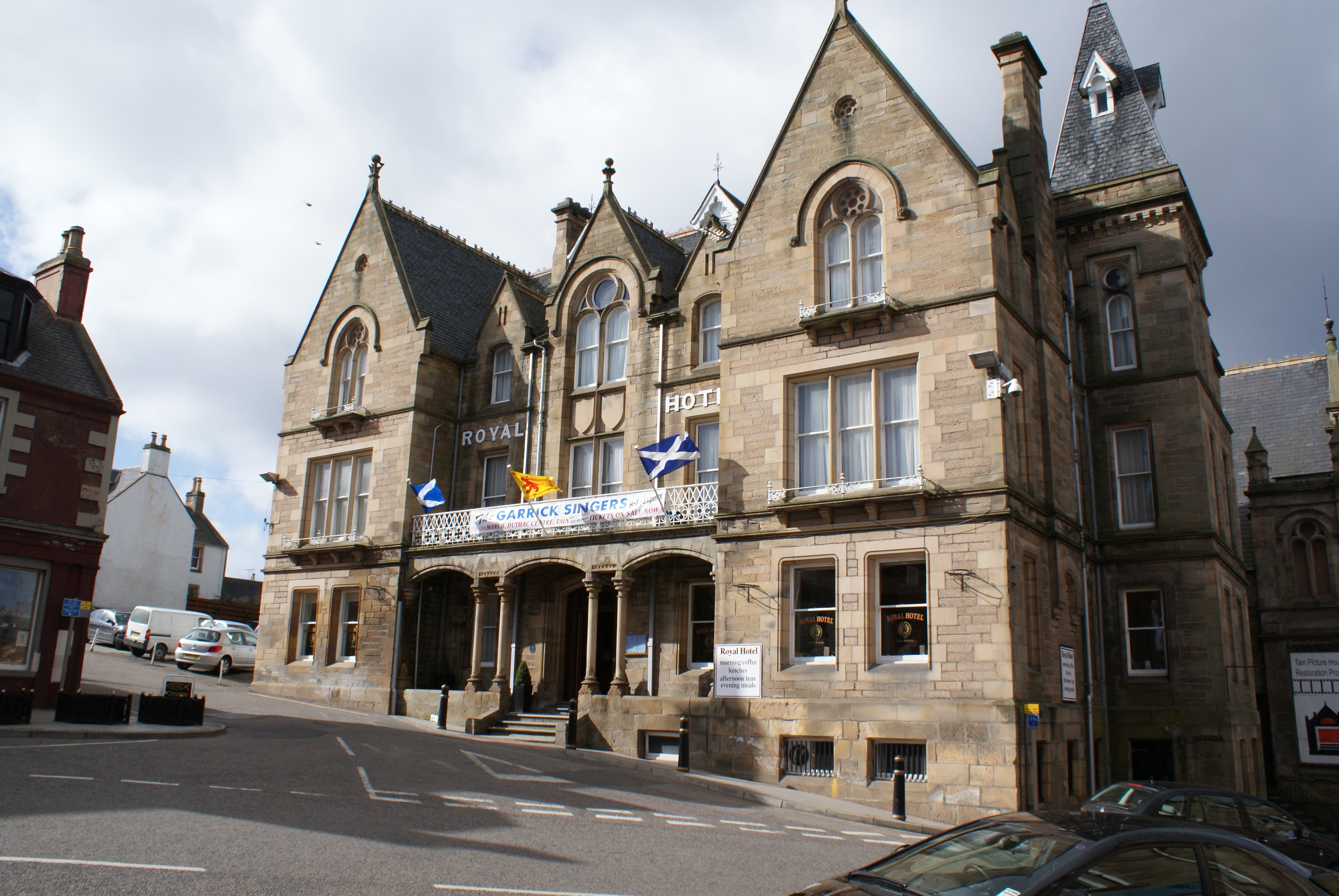
Tain ( Gaelic: ''Baile Dhubhthaich'') is a royal burgh and parish in the County of Ross, in the Highlands of Scotland. Etymology The name derives from the nearby River Tain, the name of which comes from an Indo-European root meaning 'flow'. The Gaelic name, ''Baile Dubhthaich'', means 'Duthac's town', after a local saint also known as Duthus. History Tain was granted its first royal charter in 1066, making it Scotland's oldest royal burgh, commemorated in 1966 with the opening of the Rose Garden by Queen Elizabeth, the Queen Mother. The 1066 charter, granted by King Malcolm III, confirmed Tain as a sanctuary, where people could claim the protection of the church, and an immunity, in which resident merchants and traders were exempt from certain taxes. Little is known of earlier history although the town owed much of its importance to Duthac. He was an early Christian figure, perhaps 8th or 9th century, whose shrine had become so important by 1066 that it resulted in the royal ch ... [...More Info...] [...Related Items...] OR: [Wikipedia] [Google] [Baidu] |
Highland (council Area)
Highland ( gd, A' Ghàidhealtachd, ; sco, Hieland) is a council area in the Scottish Highlands and is the largest local government area in the United Kingdom. It was the 7th most populous council area in Scotland at the 2011 census. It shares borders with the council areas of Aberdeenshire, Argyll and Bute, Moray and Perth and Kinross. Their councils, and those of Angus and Stirling, also have areas of the Scottish Highlands within their administrative boundaries. The Highland area covers most of the mainland and inner-Hebridean parts of the historic counties of Inverness-shire and Ross and Cromarty, all of Caithness, Nairnshire and Sutherland and small parts of Argyll and Moray. Despite its name, the area does not cover the entire Scottish Highlands. Name Unlike the other council areas of Scotland, the name ''Highland'' is often not used as a proper noun. The council's website only sometimes refers to the area as being ''Highland'', and other times as being ''the Hig ... [...More Info...] [...Related Items...] OR: [Wikipedia] [Google] [Baidu] |
Fearn Railway Station
, symbol_location = gb , symbol = rail , image = Fearn Railway Station.JPG , borough = Hill of Fearn, Highland , country = Scotland , coordinates = , grid_name = Grid reference , grid_position = , manager = ScotRail , platforms = 1 , code = FRN , original = Inverness and Ross-shire Railway , pregroup = Highland Railway , postgroup = LMSR , years = 1 June 1864 , events = Opened , mpassengers = , footnotes = Passenger statistics from the Office of Rail and Road , embedded = Fearn railway station is a railway station serving the village of Hill of Fearn in the Highland council area of Scotland, located around from the village. It is situated on the Far North Line, form , between Tain and Invergordon, and is also the nearest station to Balintore, Hilton and Shandwick (the ... [...More Info...] [...Related Items...] OR: [Wikipedia] [Google] [Baidu] |
Easter Ross
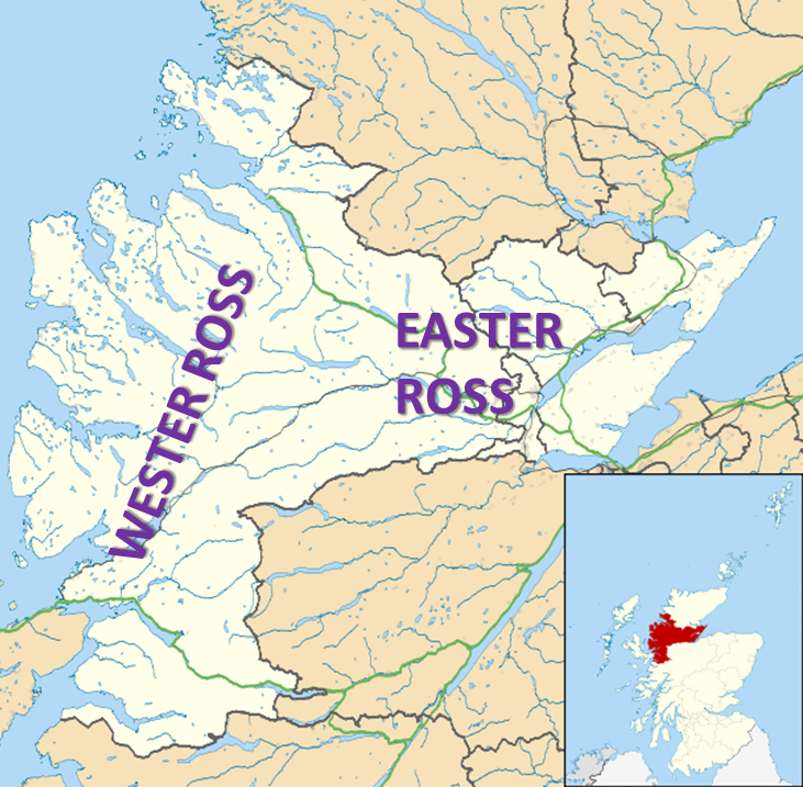
Easter Ross ( gd, Ros an Ear) is a loosely defined area in the east of Ross, Highland, Scotland. The name is used in the constituency name Caithness, Sutherland and Easter Ross, which is the name of both a British House of Commons constituency and a Scottish Parliament constituency. The two constituencies have however different boundaries. Settlements Places in Easter Ross include: * Alness * Dingwall (included in some contexts in the term ''Easter Ross'', though in some contexts it refers to the area to the north-east of Dingwall) * Evanton * Invergordon * Kildary * Milntown of Tarbat (Milton) * Portmahomack * The Seaboard villages: ** Balintore ** Hilton of Cadboll ** Shandwick * Tain Easter Ross is well known for Black Isle and its towns: Avoch, Rosemarkie, Fortrose, and Cromarty. See also * Black Isle * Ross and Cromarty * Ross-shire * Wester Ross Wester Ross () is an area of the Northwest Highlands of Scotland in the council area of Highland. The area is loosel ... [...More Info...] [...Related Items...] OR: [Wikipedia] [Google] [Baidu] |


