|
Polomet
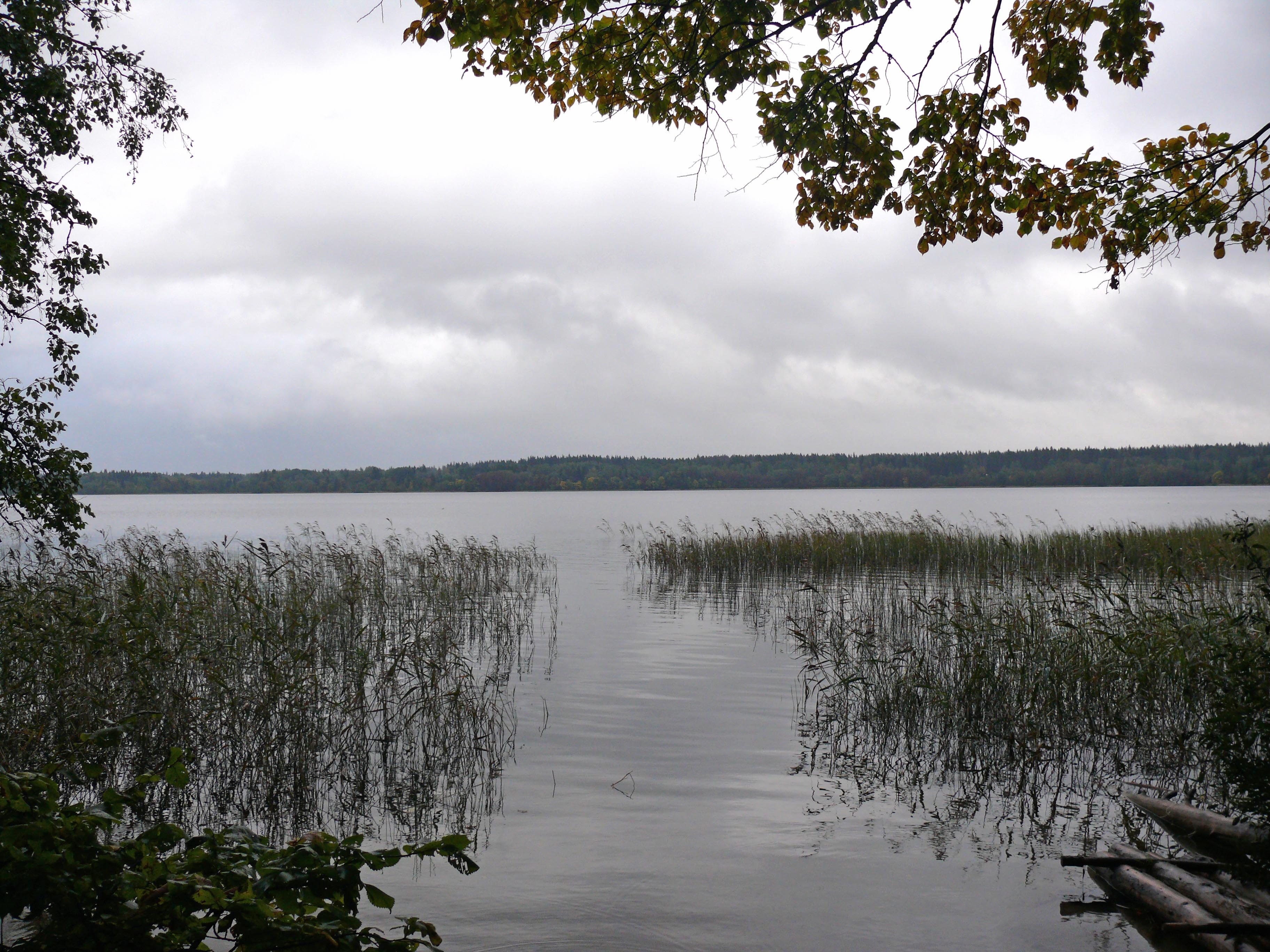
The Polomet (russian: Полометь) is a river in Valdaysky, Krestetsky, and Demyansky Districts of Novgorod Oblast in Russia. It is a right tributary of the Pola. It is long, and the area of its basin . The principal tributary of the Polomet is the Luzhonka (left). The source of the Polomet is in Lake Russkoye in the Valdai Hills. The upper course of the Polomet is located within Valdaysky National Park. The river flows west, then turns north. At the '' selo'' of Yazhelbitsy the Polomet makes a turn, crosses into Krestetsky District, returns to Valdaysky District, and crosses into Demyansky District. In Demyansky District, it flows southwest. In the selo of Lychkovo, it crosses the railroad which connects Bologoye and Pskov via Staraya Russa. The mouth of the Polomet is close to the village of Kostkovo (which is located on the left bank of the Pola). The river basin of the Polomet comprises the western part of Valdaysky District, including some of the lakes in Valdaysky ... [...More Info...] [...Related Items...] OR: [Wikipedia] [Google] [Baidu] |
Pola (river)
The Pola () is a river in Andreapolsky and Penovsky Districts of Tver Oblast and in Maryovsky, Demyansky, and Parfinsky Districts of Novgorod Oblast of Russia. It is a tributary of Lake Ilmen. It is long, and the area of its basin . The principal tributaries of the Pola are the Maryovka, the Kamenka, the Yavon, and the Polomet, all from the right. The source of the Pola is located in the Valdai Hills, at the border between Andreapolsky and Penovsky Districts of Tver Oblast, southwest of the village of Pyatygino. It flows north, making the border between these districts, and enters Novgorod Oblast. The Pola accepts the Maryovka River from the right and turns east, then it accepts the Kamenka River from the right and turns north. In the village of Veliky Zavod the river makes a loop, and at the tip of the loop, in the village of Novoye Sokhnovo, it accepts the Yavon River from the right. In Novoye Sokhnovo the Pola turns west and in the village of Kostkovo it accepts the P ... [...More Info...] [...Related Items...] OR: [Wikipedia] [Google] [Baidu] |
Valdaysky District
Valdaysky District (russian: Валда́йский райо́н) is an administrativeLaw #559-OZ and municipalLaw #371-OZ district (raion), one of the twenty-one in Novgorod Oblast, Russia. It is located in the southeast of the oblast and borders with Okulovsky District in the north, Bologovsky District of Tver Oblast in the east, the territory of the closed administrative-territorial formation of Ozyorny of Tver Oblast in the southeast, Firovsky District of Tver Oblast in the south, Demyansky District in the southwest, and with Krestetsky District in the northwest. The area of the district is . Its administrative center is the town of Valday. Population: 29,943 ( 2002 Census); The population of Valday accounts for 60.8% of the district's total population. Geography Valdaysky District is located in the Valdai Hills and is notable for having many lakes. The biggest lakes in the district are Lakes Valdayskoye, Shlino (shared with Firovsky District), and Velyo (shared with Dem ... [...More Info...] [...Related Items...] OR: [Wikipedia] [Google] [Baidu] |
Krestetsky District
Krestetsky District (russian: Кресте́цкий райо́н) is an administrativeLaw #559-OZ and municipalLaw #351-OZ district (raion), one of the twenty-one in Novgorod Oblast, Russia. It is located in the center of the oblast and borders with Malovishersky District in the north, Okulovsky District in the northeast, Valdaysky District in the southeast, Demyansky District in the south, Parfinsky District in the southwest, and with Novgorodsky District in the northwest. The area of the district is . Its administrative center is the urban locality (a work settlement) of Kresttsy. Population: 15,667 ( 2002 Census); The population of Kresttsy accounts for 67.4% of the district's total population. Geography The district is located between the Valdai Hills and the Ilmen Depression. The eastern part of the district lies in the Valdai Hills and is higher than the western part. There are lakes located there, and many of the rivers in the district have their source in the eastern ... [...More Info...] [...Related Items...] OR: [Wikipedia] [Google] [Baidu] |
Demyansky District
Demyansky District (russian: Демянский район) is an administrativeLaw #559-OZ and municipalLaw #397-OZ district (raion), one of the twenty-one in Novgorod Oblast, Russia. It is located in the south of the oblast and borders with Krestetsky District in the north, Valdaysky District in the northeast, Firovsky District of Tver Oblast in the southeast, Ostashkovsky District of Tver Oblast in the south, Maryovsky District in the southwest, Starorussky District in the west, and with Parfinsky District in the northwest. The area of the district is . Its administrative center is the urban locality (a work settlement) of Demyansk. Population: 16,020 ( 2002 Census); The population of Demyansk accounts for 41.3% of the district's total population. Geography Demyansky District is located in the Valdai Hills. As typical for the region, the east of the district contains many lakes. The biggest ones are Lake Seliger, which the district shares with Tver Oblast, and Lake Vely ... [...More Info...] [...Related Items...] OR: [Wikipedia] [Google] [Baidu] |
Valdaysky National Park
Valdaysky National Park (russian: Валдайский национальный парк, Valdayskiy natsional'nyy park) is a national park in the north of Russia, located in Valdaysky, Okulovsky, and Demyansky Districts of Novgorod Oblast. It was established May 17, 1990. Since 2004, the National Park has the status of a UNESCO Biosphere Reserve. Valdaysky National Park, which includes the town of Valday, Lake Valdayskoye, and the northern part of Lake Seliger, is one of the most popular tourist destinations in Central Russia and has well-developed tourist infrastructure. History The area of the park in the Middle Ages belonged to the Novgorod Republic. In particular, one of the versions puts the location of the Ignach Cross, a place mentioned in the chronicles where Mongols advancing to Novgorod in 1238 turned back, inside the park limits. (The precise location is unknown). Valday was first mentioned in a chronicle in 1495. The growth of Valday was facilitated by constru ... [...More Info...] [...Related Items...] OR: [Wikipedia] [Google] [Baidu] |
Lake Russkoye
A lake is an area filled with water, localized in a basin, surrounded by land, and distinct from any river or other outlet that serves to feed or drain the lake. Lakes lie on land and are not part of the ocean, although, like the much larger oceans, they do form part of the Earth's water cycle. Lakes are distinct from lagoons, which are generally coastal parts of the ocean. Lakes are typically larger and deeper than ponds, which also lie on land, though there are no official or scientific definitions. Lakes can be contrasted with rivers or streams, which usually flow in a channel on land. Most lakes are fed and drained by rivers and streams. Natural lakes are generally found in mountainous areas, rift zones, and areas with ongoing glaciation. Other lakes are found in endorheic basins or along the courses of mature rivers, where a river channel has widened into a basin. Some parts of the world have many lakes formed by the chaotic drainage patterns left over from the last ... [...More Info...] [...Related Items...] OR: [Wikipedia] [Google] [Baidu] |
Yazhelbitsy
Yazhelbitsy (russian: Яжелбицы) is a village ('' selo'') in Valdaysky District of Novgorod Oblast, Russia, located on the M 10 highway south-east of Veliky Novgorod. It was the site of the 1456 Treaty of Yazhelbitsy between Grand Prince Vasily II (r. 1425-1462) and Novgorod the Great Veliky Novgorod ( rus, links=no, Великий Новгород, t=Great Newtown, p=vʲɪˈlʲikʲɪj ˈnovɡərət), also known as just Novgorod (), is the largest city and administrative centre of Novgorod Oblast, Russia. It is one of the ol ..., in which Novgorod's political independence was strictly curtailed. Failure to abide by the treaty led to Novgorod's defeat at Shelon River in 1471 and its final subjugation by Moscow in 1478. References Notes Sources * * Rural localities in Novgorod Oblast Valdaysky Uyezd {{NovgorodOblast-geo-stub ... [...More Info...] [...Related Items...] OR: [Wikipedia] [Google] [Baidu] |
Staraya Russa
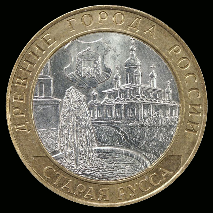
Staraya Russa ( rus, Старая Русса, p=ˈstarəjə ˈrusːə) is a town in Novgorod Oblast, Russia, located on the Polist River, south of Veliky Novgorod, the administrative center of the oblast. Its population has steadily decreased over the past years, going from 41,538 recorded in the 1989 Census to 35,511 in the 2002 Census to 31,809 in the 2010 Census. Etymology The origin of the name of Staraya Russa is unclear. The most involved and widespread hypothesis was presented by philologists and linguists R. A. Akheyeva, V. L. Vasilyev, and M.V. Gorbanevsky. According to this hypothesis, ''Russa'' comes from Rus'—a Slavic people, who settled in the vicinity to control trade routes leading from Novgorod to Polotsk and Kiev—which, in turn, is usually thought to originate from an Old Norse term for "the men who row" (''rods-'') as rowing was the main method of navigating the rivers of Eastern Europe, and that it could be linked to the Swedish coastal ... [...More Info...] [...Related Items...] OR: [Wikipedia] [Google] [Baidu] |
Pskov
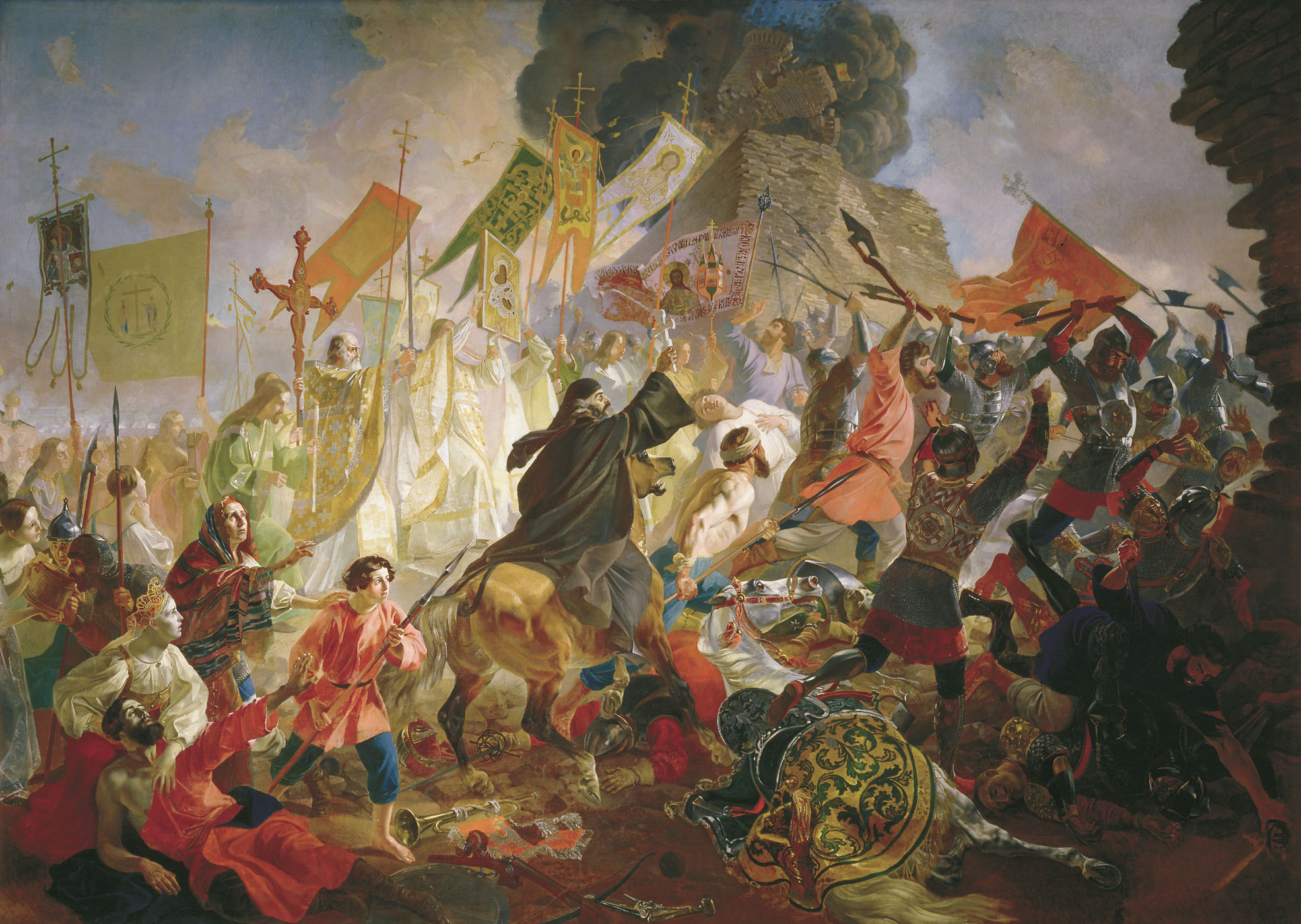
Pskov ( rus, Псков, a=pskov-ru.ogg, p=pskof; see also names in other languages) is a city in northwestern Russia and the administrative center of Pskov Oblast, located about east of the Estonian border, on the Velikaya River. Population: Pskov is one of the oldest cities in Russia. It served as the capital of the Pskov Republic and was a trading post of the Hanseatic League before it came under the control of the Grand Duchy of Moscow. History Early history Pskov is one of the oldest cities in Russia. The name of the city, originally Pleskov (historic Russian spelling , ''Plěskov''), may be loosely translated as "he townof purling waters". It was historically known in English as Plescow. Its earliest mention comes in 903, which records that Igor of Kiev married a local lady, Olga (later Saint Olga of Kiev). Pskovians sometimes take this year as the city's foundation date, and in 2003 a great jubilee took place to celebrate Pskov's 1,100th anniversary. The f ... [...More Info...] [...Related Items...] OR: [Wikipedia] [Google] [Baidu] |
Bologoye, Tver Oblast
Bologoye (russian: Болого́е) is a town and the administrative center of Bologovsky District in Tver Oblast, Russia, as well as a major railway hub. It is located approximately halfway between Moscow and St. Petersburg on the railway route connecting the two cities. Population: Etymology The name of the town derives from the name of nearby Lake Bologoye. History The first mention of Bologoye in historic records dates back to 1495, which is considered its year of foundation. In the course of the administrative reform carried out in 1708 by Peter the Great, Bologoye was included into the Ingermanland Governorate (known since 1710 as the St. Petersburg Governorate). In 1727, a separate Novgorod Governorate was split off.Snytko et al., p. 16 In 1770, it became a part of Valdaysky Uyezd of Novgorod Viceroyalty. In 1796, the viceroyalty was transformed into Novgorod Governorate.Snytko et al., p. 22 In 1851, Bologoye became a station of the Moscow – ... [...More Info...] [...Related Items...] OR: [Wikipedia] [Google] [Baidu] |
Valdai Hills
The Valdai Hills (russian: Валда́йская возвы́шенность, Valdáyskaya vozvýshennost'), sometimes referred to as just Valdai (russian: Валда́й, Valdáy), are an upland region in the north-west of central European Russia running north–south, about midway between Saint Petersburg and Moscow, spanning the Leningrad, Novgorod, Tver, Pskov, and Smolensk Oblasts. The Valdai Hills are a popular tourist destination, particularly for fishing. The towns of Ostashkov and Valday are also known for their historical associations. Valdaysky National Park was established in 1990 in the southern part of Novgorod Oblast to protect the landscapes of the highest part of the hills. The park includes Lake Valdayskoye and the northern section of Lake Seliger, as well as the town of Valday. Since 2004, the National Park has the status of a UNESCO Biosphere Reserve. Geography and geology The hills are a northward extension of the Central Russian Upland. To the northwest ... [...More Info...] [...Related Items...] OR: [Wikipedia] [Google] [Baidu] |

_02.jpg)


