|
Poles In Bosnia And Herzegovina
Poles are one of 17 constitutionally recognized ethnic minorities in Bosnia and Herzegovina. They arrived during the Austro-Hungarian rule in Bosnia and Herzegovina and settled mostly in the north of Bosnia proper, bringing new technology and skilled manpower. Their destiny was tied closely to that of the Ukrainian minority, with whom they joined the Yugoslav Resistance after the Axis invasion of Yugoslavia. After the Second World War, Bosnian Poles faced difficulties with establishing their rights as a minority as well as persecution by local population and remaining fascist collaborators. This forced a vast majority to answer the Polish government's call for repatriation. There were around 30,000 Poles in Bosnia and Herzegovina in 1930, while their number today is estimated to be less than a thousand, with communities in the major cities of Sarajevo, Banja Luka, Zenica and Mostar. Arrival and integration History of Poles in Bosnia begins during the Ottoman rule, but a signi ... [...More Info...] [...Related Items...] OR: [Wikipedia] [Google] [Baidu] |
Austro-Hungarian Occupation Of Bosnia And Herzegovina
The campaign to establish Austro-Hungarian rule in Bosnia and Herzegovina lasted from 29 July to 20 October 1878 against the local resistance fighters supported by the Ottoman Empire. The Austro-Hungarian Army entered the country in two large movements: one from the north into Bosnia, and another from the south into Herzegovina. A series of battles in August culminated in the fall of Sarajevo on the 19th after a day of street-to-street fighting. In the hilly countryside a guerrilla campaign continued until the last rebel stronghold fell after their leader was captured. Background Following the Russo-Turkish War of 1877–78, the Congress of Berlin was organized by the Great Powers. By article 25 of the resulting Treaty of Berlin (13 July 1878), Bosnia and Herzegovina remained under the sovereignty of the Ottoman Empire, but the Austro-Hungarian Empire was granted the authority to occupy the ''vilayet'' (province) of Bosnia and Herzegovina indefinitely, taking on its mili ... [...More Info...] [...Related Items...] OR: [Wikipedia] [Google] [Baidu] |
Prijedor
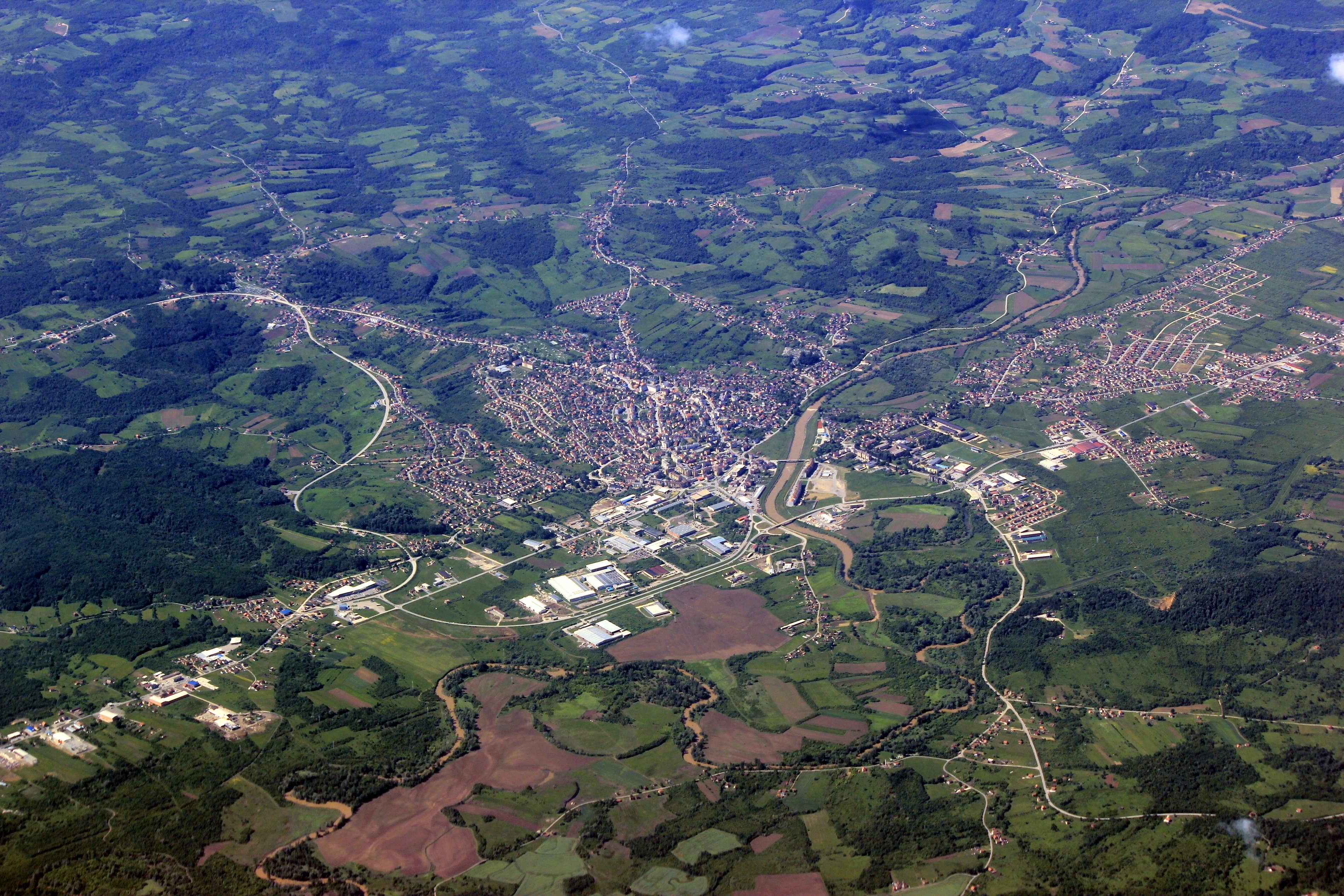
Prijedor ( sr-cyrl, Приједор, ) is a city and municipality located in the Republika Srpska entity of Bosnia and Herzegovina. As of 2013, it has a population of 89,397 inhabitants within its administrative limits. Prijedor is situated in the north-western part of the Bosanska Krajina geographical region. Prijedor is known for its mixed religious heritage comprising Eastern Orthodox Christianity, Roman Catholicism and Islam. Historic buildings from the Ottoman and Austrian-Hungarian periods are a feature of the urban landscape. The city underwent extensive renovation between 2006–2009. Geography The town of Prijedor, within the municipality of Prijedor, is located in the north-western part of Bosnia and Herzegovina, on the banks of the Sana and Gomjenica rivers, and at the south-western hills of the Kozara mountain. The area of the municipality is . The town is situated at 44°58'39" N and 16°42'29" E, at an altitude of above sea level. It is traditionally a part o ... [...More Info...] [...Related Items...] OR: [Wikipedia] [Google] [Baidu] |
Bosanski Novi
Novi Grad (Serbian Cyrillic: ), formerly Bosanski Novi ( sr-cyrl, Босански Нови), is a town and municipality in Bosnia and Herzegovina. Administratively, it is located in the Republika Srpska entity. Situated in the far northwest of the country, it lies across the Una from the Croatian town of Dvor. , the town has a population of 11,063 while its municipality comprises a total of 27,115 inhabitants. Known for its scenic quay, Novi Grad lies at the confluence of the Una and Sana rivers. Geography Novi Grad is located on the right bank of the Una and both banks of the Sana, between two geographic zones: the slopes of the mountains of Grmeč and Kozara, and the alluvial land surrounding the town's two rivers. The town itself is located above sea level, at nearly 45°N; the climate is temperate-continental. Its governed municipality covers an area of . History The town was first mentioned in 1280 under the Latin name ''Castrum Novum'' which, literally translated, mea ... [...More Info...] [...Related Items...] OR: [Wikipedia] [Google] [Baidu] |
Derventa
Derventa ( sr-cyrl, Дервента) is a city located in Republika Srpska, an entity of Bosnia and Herzegovina. It is situated in the Posavina region, northwest of the city of Doboj. As of 2013, the town has a total of 11,631 inhabitants, while the municipality has 27,404 inhabitants. Geography The Derventa municipality borders with Brod, Modriča, Doboj, Stanari, Prnjavor and Srbac, as well as Croatia across the Sava river. It has an area of . The town of Derventa lies on the river Ukrina, and roads lead from it to Brod, Kotorsko (Doboj), Prnjavor (Banja Luka) and Srbac. The town has a suburb called ''Derventski Lug'' which has grown substantially in recent years due to growth of Municipality. History From 1929 to 1939, Derventa was part of the Vrbas Banovina and from 1939 to 1941 of the Banovina of Croatia within the Kingdom of Yugoslavia. Prior to the Bosnian War, there was a significant population of ethnic Croats within Derventa, while the majority were Bosniaks. W ... [...More Info...] [...Related Items...] OR: [Wikipedia] [Google] [Baidu] |
Prnjavor, Bosnia And Herzegovina
Prnjavor ( sr-cyr, Прњавор, ) is a town and municipality located in Republika Srpska, an entity of Bosnia and Herzegovina, between cities of Banja Luka and Doboj. According to the 2013 census, the town has a population of 8,120 inhabitants, with 35,956 inhabitants in the municipality. Geography Physical geography The municipality is located in the basin of the Ukrina river and is characterized by a mostly lowland hilly terrain configuration with the highest peak of 594m (mountain Ljubić). The Municipality of Prnjavor is shielded on all sides by low mountains such as Ljubić (south) and Motajica (north). The town of Prnjavor is located at an altitude of 185m. Other thant the river Ukrina which forms in the Municipality of Prnjavor by merging of the Big and Small Ukrina near the village of Kulaši, there are also the rivers of Vijaka and Lišnja and various other streams. On the river Vijaka in the foothills of Ljubić there is a man made lake Drenova and further downst ... [...More Info...] [...Related Items...] OR: [Wikipedia] [Google] [Baidu] |
Posavina
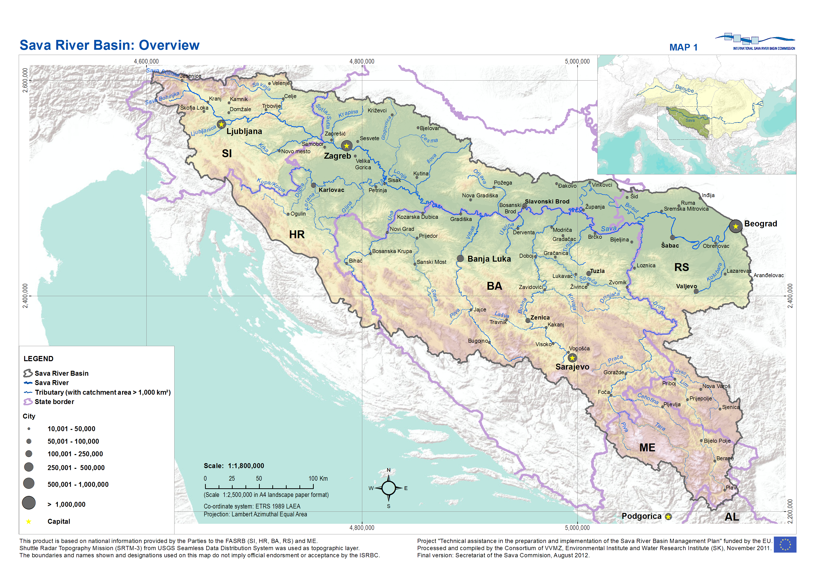
Posavina ( sr-cyr, Посавина) is a geographical region that stretches along the Sava river, encompassing only the inner areas of the Sava river basin, that are adjacent or near to the Sava river itself, namely catch region spanning from the Julian Alps in the northwest to the confluence with the Danube in the southeast. It passes through several countries of former Yugoslavia, namely Slovenia, Croatia, Bosnia and Herzegovina and Serbia. In Slovene, the term Posavina is not used to describe the parts of Slovenia that lie by the Sava river. Instead, the terms Posavje and Zasavje are used. Geography Geography of the Posavina region is defined by geological features of the central (inner) zones of the Sava river basin, that are near or adjacent to the Sava river itself. The region is stretched along the Sava river, that flows from west to east, connecting valleys and plains in transitional regions between the Dinaric Mountains and the Pannonian Plain. Geographical borders o ... [...More Info...] [...Related Items...] OR: [Wikipedia] [Google] [Baidu] |
Bosanska Krajina
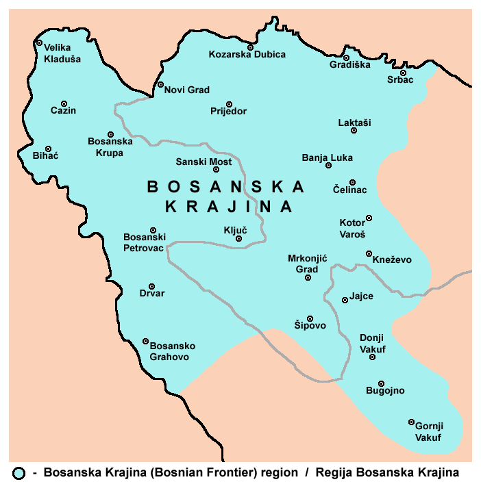
Bosanska Krajina ( sr-cyrl, Босанска Крајина, ) is a geographical region, a subregion of Bosnia, in western Bosnia and Herzegovina. It is enclosed by a number of rivers, namely the Sava (north), Glina (northwest), Vrbanja and Vrbas (east and southeast, respectively). The region is also a historic, economic and cultural entity of Bosnia and Herzegovina, famous for its natural beauties and wildlife diversity. The largest city, and its historical center is Banja Luka. Other cities and towns include Bihać, Bosanska Krupa, Bosanski Petrovac, Bosansko Grahovo, Bužim, Cazin, Drvar, Gradiška, Ključ, Kostajnica, Kozarska Dubica, Laktaši, Mrkonjić Grad, Novi Grad, Prijedor, Sanski Most, Šipovo, Velika Kladuša. Bosanska Krajina is not a formal entity within the structure of Bosnia and Herzegovina; however it has a significant cultural and historical identity that was formed through several historic and economic events. The territory of Bosanska Krajina is curre ... [...More Info...] [...Related Items...] OR: [Wikipedia] [Google] [Baidu] |
Rusyns
Rusyns (), also known as Carpatho-Rusyns (), or Rusnaks (), are an East Slavs, East Slavic ethnic group from the Carpathian Rus', Eastern Carpathians in Central Europe. They speak Rusyn language, Rusyn, an East Slavic languages, East Slavic Variety (linguistics), language variety, treated variously as either a distinct language or a dialect of the Ukrainian language. As traditional adherents of Eastern Christianity, the majority of Rusyns are Eastern Catholics, though a minority of Rusyns still practice Eastern Orthodoxy. Rusyns primarily self-identify as a distinct Slavs, Slavic people and they are recognized as such in Croatia, Hungary, Poland, Romania, Serbia, and Slovakia, where they have official national minority, minority status. Alternatively, some identify more closely with their country of residence (i.e. Poles, Polish, Slovaks, Slovak), while others are a branch of the Ukrainians, Ukrainian people. Rusyns are descended from an East Slavic population which inhabit ... [...More Info...] [...Related Items...] OR: [Wikipedia] [Google] [Baidu] |
Eastern Orthodox
Eastern Orthodoxy, also known as Eastern Orthodox Christianity, is one of the three main branches of Chalcedonian Christianity, alongside Catholicism and Protestantism. Like the Pentarchy of the first millennium, the mainstream (or "canonical") Eastern Orthodox Church is organised into autocephalous churches independent from each other. In the 21st century, the number of mainstream autocephalous churches is seventeen; there also exist autocephalous churches unrecognized by those mainstream ones. Autocephalous churches choose their own primate. Autocephalous churches can have jurisdiction (authority) over other churches, some of which have the status of "autonomous" which means they have more autonomy than simple eparchies. Many of these jurisdictions correspond to the territories of one or more modern states; the Patriarchate of Moscow, for example, corresponds to Russia and some of the other post-Soviet states. They can also include metropolises, bishoprics, parishes, monas ... [...More Info...] [...Related Items...] OR: [Wikipedia] [Google] [Baidu] |
Cisleithania
Cisleithania, also ''Zisleithanien'' sl, Cislajtanija hu, Ciszlajtánia cs, Předlitavsko sk, Predlitavsko pl, Przedlitawia sh-Cyrl-Latn, Цислајтанија, Cislajtanija ro, Cisleithania uk, Цислейтанія, Tsysleitaniia it, Cisleitania , officially The Kingdoms and Lands Represented in the Imperial Council, () was the northern and western part of Austria-Hungary, the Dual Monarchy created in the Compromise of 1867—as distinguished from ''Transleithania'' (i.e., the Hungarian Lands of the Crown of Saint Stephen east of beyond"the Leitha River). This name for the region was a common, but unofficial one. The Cisleithanian capital was Vienna, the residence of the Austrian emperor. The territory had a population of 28,571,900 in 1910. It reached from Vorarlberg in the west to the Kingdom of Galicia and Lodomeria and the Duchy of Bukovina (today part of Ukraine and Romania) in the east, as well as from the Kingdom of Bohemia in the north to the Kingdom of Dalmatia (t ... [...More Info...] [...Related Items...] OR: [Wikipedia] [Google] [Baidu] |


