|
Pogorzans
Polish Uplanders ( pl, Pogórzanie; also known as Western Pogorzans and Eastern Pogorzans), are a distinctive subethnic group of Poles that mostly live in the Central Beskidian Range of the Subcarpathian highlands. The Polish Uplanders inhabited the central and the southern half of the Beskids in Poland, including the Ciężkowickie, Strzyżowskie and Dynowskie Plateau as well as Doły Jasielsko-Sanockie, from the White River (''Biała'') in the west to the San River in the east. They represent the major population groups inhabiting the Subcarpathian Voivodeship. These are mainly Polish people with a part numbers of German and Rusyn people . Polish Uplanders are neighbours with: ''Lachy sądeckie'' to the west; '' Krakowiacy'' and '' Rzeszowiacy'' to the north, and; ''Dolinians'' and Lemkos (both Rusyn subgroups) to the south. With regard to cultural differences Uplanders are divided into two parts: western (the area of Gorlice, Jasło and Strzyżów), southern Sanok, and eas ... [...More Info...] [...Related Items...] OR: [Wikipedia] [Google] [Baidu] |
Polish Subcarpathia
Subcarpathian Voivodeship or Subcarpathia Province (in pl, Województwo podkarpackie ) is a voivodeship, or province, in the southeastern corner of Poland. Its administrative capital and largest city is Rzeszów. Along with the Marshall, it is governed by the Subcarpathian Regional Assembly. Historically, most of the province's territory was part of the Kingdom of Galicia–Volhynia, the Kingdom of Galicia and Lodomeria and the Ruthenian Voivodeship. In the interwar period, it was part of the Lwów Voivodeship. The voivodeship was created on 1 January 1999 out of the former Rzeszów, Przemyśl, Krosno and (partially) Tarnów and Tarnobrzeg Voivodeships, pursuant to the Polish local-government reforms adopted in 1998. The name derives from the region's location near the Carpathian Mountains, and the voivodeship comprises areas of two historic regions of Eastern Europe — Lesser Poland (western and northwestern counties) and Red Ruthenia. During the interwar period (1918-193 ... [...More Info...] [...Related Items...] OR: [Wikipedia] [Google] [Baidu] |
Doły Jasielsko-Sanockie
The Doły Jasielsko-Sanockie, la, Regio Pedemontana german: Sanoker Flachland ( Jasielsko– Sanockie Valleys, Jasło and Sanok Valleys, the Jasło-Sanok Basin or Jasielsko-Sanockie Pits) is a mountain range stretching between the Wisłoka and San Rivers in the West Carpathian Plateau and Central Beskidian Piedmont in Poland. Geography The mountains reach up to 250–500 meters above sea level. The range is situated in the southern part of the Subcarpathian Voivodeship. It is the lowest mountain range of the Polish Carpathians. They can be divided into: Gorlickie Depression, Jasielskie Plateau, Jasielsko – Krośnieńska Valley and Bukowskie Plateau. They stretch along a 100 km long and 18 km wide strip of land between Low Beskids in the south and heights of plateau in the north. From the tourist point of view the region of Doły (''Pits'') is limited from the west by the valley of Ropa River, from the east by the Wisłok and San rivers, from the south ... [...More Info...] [...Related Items...] OR: [Wikipedia] [Google] [Baidu] |
Haczów
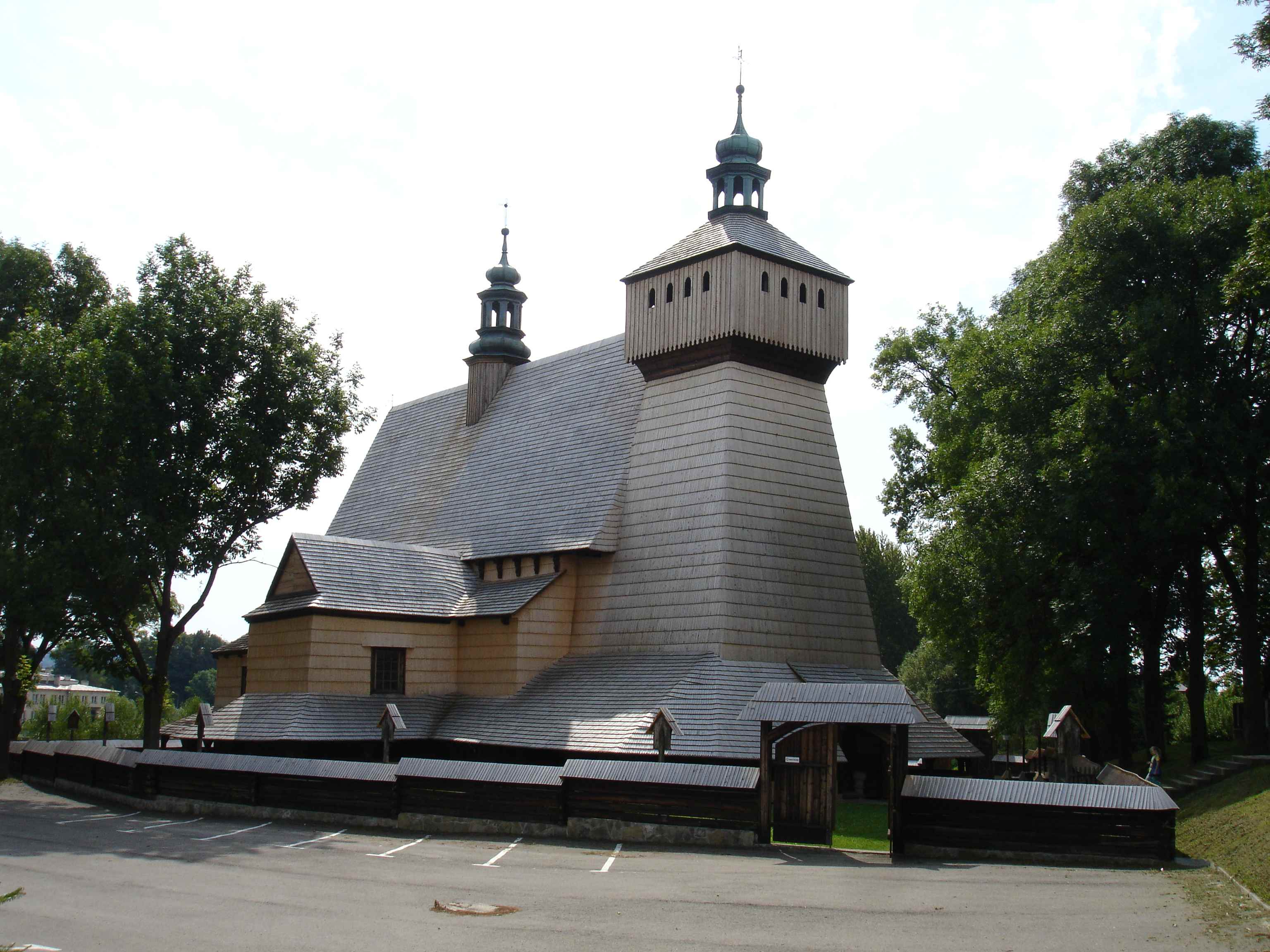
Haczów ( uk, Гачів, ''Hachiv'') is a village in Brzozów County, Subcarpathian Voivodeship, in south-eastern Poland. It is the seat of the gmina (administrative district) called Gmina Haczów. It lies approximately west of Brzozów and south of the regional capital Rzeszów. The village has a population of 3,370. According to the administrative division during the years of 1975–1998, Haczów was located in the Krosno Voivodeship. The village is the site of Assumption of Mary and St. Michael's Archangel church, built in the end of the 14th century. In 1624, it was severely damaged by Tatar attacks. The site is one of the six with Wooden Churches of Southern Little Poland, on the UNESCO list of World Heritage Sites since 2003. Inside a valuable figural wall paintings dating from 1494 can be seen. The church has recently been renovated. It is believed that the Haczów church is the biggest Gothic wooden church in Europe. Etymology The origin of the name of the villag ... [...More Info...] [...Related Items...] OR: [Wikipedia] [Google] [Baidu] |
Harta, Hungary
Harta (german: Hartau; hr, Hartava or ) is a village in Bács-Kiskun county, Hungary. Demography * Magyars * Germans , native_name_lang = de , region1 = , pop1 = 72,650,269 , region2 = , pop2 = 534,000 , region3 = , pop3 = 157,000 3,322,405 , region4 = , pop4 = ... Racke Pinkuše, 2. lipnja 2005. References External links * in Hungarian *Harta a Vendégvárón*HartaPortal - hírek Hartáról Populated places in Bács-Kiskun County Hungarian German communities {{Bacs-geo-stub ... [...More Info...] [...Related Items...] OR: [Wikipedia] [Google] [Baidu] |
Dylągówka
Dylągówka is a village in the administrative district of Gmina Hyżne, within Rzeszów County, Subcarpathian Voivodeship, in south-eastern Poland. It lies approximately south-east of Hyżne Hyżne is a village in Rzeszów County, Subcarpathian Voivodeship, in south-eastern Poland. It is the seat of the gmina (administrative district) called Gmina Hyżne. It lies on the Tatyna river, approximately south-east of the regional capital ... and south-east of the regional capital Rzeszów. The village has a population of 1,000. References Villages in Rzeszów County {{Rzeszów-geo-stub ... [...More Info...] [...Related Items...] OR: [Wikipedia] [Google] [Baidu] |
Iskrzynia
Iskrzynia is a village in the administrative district of Gmina Korczyna, within Krosno County, Subcarpathian Voivodeship, in south-eastern Poland. It lies approximately south-east of Korczyna, east of Krosno, and south of the regional capital Rzeszów Rzeszów ( , ; la, Resovia; yi, ריישא ''Raisha'')) is the largest city in southeastern Poland. It is located on both sides of the Wisłok River in the heartland of the Sandomierz Basin. Rzeszów has been the capital of the Subcarpathian Vo .... The village has a population of 1,200. References Iskrzynia {{Krosno-geo-stub ... [...More Info...] [...Related Items...] OR: [Wikipedia] [Google] [Baidu] |
Iwonicz
Iwonicz is a village in the administrative district of Gmina Iwonicz-Zdrój, within Krosno County, Subcarpathian Voivodeship, in south-eastern Poland. It lies approximately north of Iwonicz-Zdrój, south-east of Krosno, and south of the regional capital Rzeszów. The village has a population of 4,509. See also * Walddeutsche Walddeutsche (lit. "Forest Germans" or ''Taubdeutsche'' – "Deaf Germans"; pl, Głuchoniemcy – "deaf Germans") was the name for a group of German-speaking people, originally used in the 16th century for two language islands around Łańcut an ... References Villages in Krosno County {{Krosno-geo-stub ... [...More Info...] [...Related Items...] OR: [Wikipedia] [Google] [Baidu] |
Bukowsko
Bukowsko (; yi, בוקאווסק, Bikofsk; uk, Буківсько, Bukivsʹko) is a village in Sanok County, Subcarpathian Voivodeship, Poland. It's in the Bukowsko Upland mountains, parish ''in loco'', located near the towns of Medzilaborce and Palota (in northeastern Slovakia). During the Polish–Lithuanian Commonwealth it was in Lesser Poland prowincja. Characteristics Bukowsko is the administrative and cultural centre of the Gmina Bukowsko. It is crossed by the rail road connecting it with Slovakia. It is especially the private sector and service industries that are developing rapidly at this time. It is home to the Uniwersytet Ludowy, opened in 2005, which contains many artworks and effects of the folk handworks inspiration. Bukowsko is situated in the poorest region of Poland. History Settled in prehistoric times, the southern-eastern Poland region that is now Podkarpacie was overrun in pre-Roman times by various tribes, including the Celts, Goths and Vandals ... [...More Info...] [...Related Items...] OR: [Wikipedia] [Google] [Baidu] |
Jaćmierz
Jaćmierz ( uk, Ячмир, ''Yachmyr'') is a village in the administrative district of Gmina Zarszyn, within Sanok County, Subcarpathian Voivodeship, in south-eastern Poland. It lies approximately north of Zarszyn, north-west of Sanok, and south of the regional capital Rzeszów. The village has an approximate population of 830. See also * Walddeutsche Walddeutsche (lit. "Forest Germans" or ''Taubdeutsche'' – "Deaf Germans"; pl, Głuchoniemcy – "deaf Germans") was the name for a group of German-speaking people, originally used in the 16th century for two language islands around Łańcut an ... References Villages in Sanok County Ruthenian Voivodeship Kingdom of Galicia and Lodomeria Lwów Voivodeship {{Sanok-geo-stub ... [...More Info...] [...Related Items...] OR: [Wikipedia] [Google] [Baidu] |
Frysztak
Frysztak ( yi, פֿריסטיק Fristik; german: Freistadt) is a village in the Gmina Frysztak, Strzyżów County, Subcarpathian Voivodeship, Poland, from Krosno. Frysztak lies in historic Lesser Poland. It is located on a hillock near the river Wisłok, on the road from Rzeszów to Krosno. History Frysztak was mentioned in a 1259 AD document as a town with Magdeburg Rights given by King Bolesław V the Chaste and named after the German ''Freistadt'', literally "Freestead". For centuries, it was a private town, administratively located in the Sandomierz Voivodeship in the Lesser Poland Province. In 1474, the town was completely destroyed by Hungarian army of King Matthias Corvinus, after which Frysztak declined. Its German-speaking population of the Walddeutsche became Polonized in the course of the time. The Hasidic leader Rabbi Menachem Mendel of Rimanov (1745–1815) lived and worked there for many years. In 1772, it was annexed by Austria in the First Partition of Pola ... [...More Info...] [...Related Items...] OR: [Wikipedia] [Google] [Baidu] |
Jasło
Jasło is a county town in south-eastern Poland with 36,641 inhabitants, as of 31 December 2012. It is situated in the Subcarpathian Voivodeship (since 1999), and it was previously part of Krosno Voivodeship (1975–1998). It is located in Lesser Poland, in the heartland of the Doły (Pits), and its average altitude is 320 metres above sea level, although there are some hills located within the confines of the city. The Patron Saint of the city is Saint Anthony of Padua. History In the early days of Polish statehood, Jasło was part of the Castellany of Biecz, out of which ''Biecz County'' emerged in the 14th century. A list of rectories, created for collecting tithes, a church in "Jassel" in Zręcin deanery, Kraków diocese, is shown in 1328.Sulimierski, Filip, Bronisław Chlebowski, and Władysław Walewski. ''Słownik Geograficzny Królestwa Polskiego I Innych Krajów Słowiańskich: Warszawa 1880-1902''. Translated by William F. "Fred" Hoffman. Warszawa: BUW. Sekcja Dokumen ... [...More Info...] [...Related Items...] OR: [Wikipedia] [Google] [Baidu] |


