|
Podtatranská Kotlina
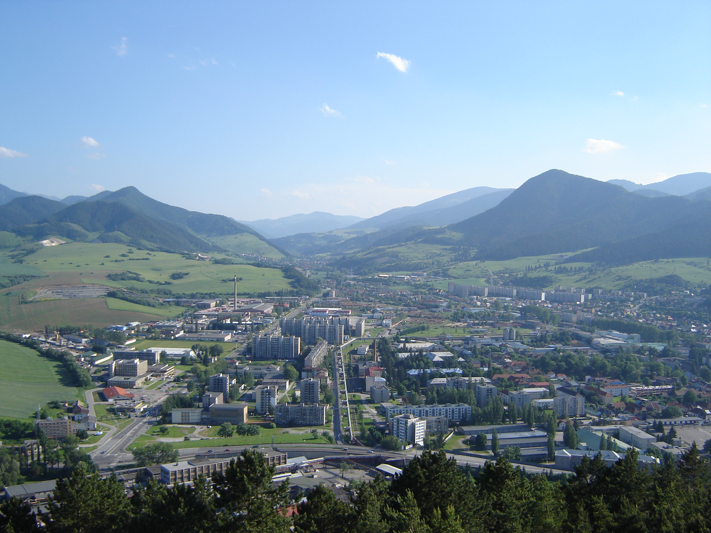
The Podtatranská kotlina (literally Sub-Tatra Basin or Basin under Tatra(s)) is a basin in northern Slovakia, part of the Fatra-Tatra Area, which belongs to the Inner Western Carpathians. Towns and cities include Ružomberok, Liptovský Mikuláš, Liptovský Hrádok, Svit, Poprad, Kežmarok, Spišská Belá and Podolínec. Location and characteristics The Podtatranská kotlina is oriented on an east-west axis and is around long and around wide in the north-south direction. It borders: *Tatras in the north * Spišská Magura in the north-east *Levoča Hills in the east *Kozie chrbty in the south-east *Low Tatras in the south *Greater Fatra in the south-west * Choč Mountains in the north-west The basin is divided into three sub-divisions: ''Liptovská kotlina'' (Liptov Basin), ''Popradská kotlina'' (Poprad Basin) and ''Tatranské predhorie'', also called ''podhorie'' (Tatra Piedmont). The border between the former named basins is also the drainage divide; the Váh Rive ... [...More Info...] [...Related Items...] OR: [Wikipedia] [Google] [Baidu] |
Low Tatras
The Low Tatras or Low Tatra ( sk, Nízke Tatry; hu, Alacsony-Tátra) is a mountain range of the Inner Western Carpathians in central Slovakia. It is located south of the Tatras proper, from which it is separated by the valleys of the Váh and Poprad rivers (the Liptov-Spiš abasement). The valley formed by the Hron River is situated south of the Low Tatras range. The ridge runs west-eastwards and is about 80 km long. The Čertovica pass divides the range into two parts. The highest peaks of the Low Tatras are located in its western part. Ďumbier is the highest mountain at 2,042 m AMSL. Its neighbour Chopok (2,024 m) is accessible by a chairlift, and it is the most visited place in the Low Tatras. Other peaks in the western part include Dereše (2,004 m) and Chabenec (1,955 m). The highest peak in the eastern part is Kráľova hoľa (1,946 m). The best viewpoints in western part are Veľká Chochuľa, Salatín, Chabenec, Skalka, Chopok, Ďumbier, Siná, Polu ... [...More Info...] [...Related Items...] OR: [Wikipedia] [Google] [Baidu] |
Štrba
Štrba is a village in the Poprad District, Prešov Region, northern Slovakia. It is situated in the Sub-Tatra Basin, which separates the High Tatras and Low Tatras at the European continental divide between the Baltic and the Black Sea. It is approximately 16 km (10 mi.) west of the city of Poprad. Etymology Slovak ''Štrba'', ''Štrbina''—a narrow place (a gap, a cleft, etc.). The name is probably related to an old trade route between Liptov and Spiš. The Hungarian (1321 ''Csorba/Chorba'') and the German name (1431 ''Tschirban'') come from the Slovak. History Historical records first mention Štrba in 1280 as a medieval village of The Kingdom of Hungary. The village owns the lands around the mountain glacial lake, and now resort, of Štrbské pleso, to which it gave its name. Locals had started to profit from the construction of High Tatras facilities at the end of 19th century. Geography The municipality lies at an altitude of 829 metres and covers an area of 4 ... [...More Info...] [...Related Items...] OR: [Wikipedia] [Google] [Baidu] |
Ružomberok
Ružomberok (; german: Rosenberg; hu, Rózsahegy; pl, Rużomberk) is a town in northern Slovakia, in the historical Liptov region. It has a population of around 27,000 inhabitants (45,000 with nearby villages). Etymology The name of the initial settlement located on today's Makovický street was ''Revúca'' ( Slovak "roaring", derived from the Revúca river). In its neighborhood, German colonists build a new settlement ''Rosenberg'' named after wild roses growing in the area. This name was later adopted by Slovaks as ''Ružomberok''. Geography It is situated at the westernmost reaches of the Sub-Tatra Basin, more exactly its subdivision Liptov Basin, surrounded by the mountain ranges of Chočské vrchy, Greater Fatra and Low Tatras. Rivers flowing through the town are Váh, from east to west, Revúca, a left tributary from the south, on the way to Banská Bystrica and ''Likavka'' brook from the north, on the way to Dolný Kubín. The town is located around 65 km fr ... [...More Info...] [...Related Items...] OR: [Wikipedia] [Google] [Baidu] |
Above Mean Sea Level
Height above mean sea level is a measure of the Vertical position, vertical distance (height, elevation or altitude) of a location in reference to a historic mean sea level taken as a vertical datum. In geodesy, it is formalized as ''orthometric heights''. The combination of unit of measurement and the physical quantity (height) is called "metres above mean sea level" in the metric system, while in United States customary units, United States customary and imperial units it would be called "Foot (length), feet above mean sea level". Mean sea levels are affected by climate change and other factors and change over time. For this and other reasons, recorded measurements of elevation above sea level at a reference time in history might differ from the actual elevation of a given location over sea level at a given moment. Uses Metres above sea level is the standard measurement of the elevation or altitude of: * Geographic locations such as towns, mountains and other landmarks. * The ... [...More Info...] [...Related Items...] OR: [Wikipedia] [Google] [Baidu] |
Baltic Sea
The Baltic Sea is an arm of the Atlantic Ocean that is enclosed by Denmark, Estonia, Finland, Germany, Latvia, Lithuania, Poland, Russia, Sweden and the North and Central European Plain. The sea stretches from 53°N to 66°N latitude and from 10°E to 30°E longitude. A marginal sea of the Atlantic, with limited water exchange between the two water bodies, the Baltic Sea drains through the Danish Straits into the Kattegat by way of the Øresund, Great Belt and Little Belt. It includes the Gulf of Bothnia, the Bay of Bothnia, the Gulf of Finland, the Gulf of Riga and the Bay of Gdańsk. The "Baltic Proper" is bordered on its northern edge, at latitude 60°N, by Åland and the Gulf of Bothnia, on its northeastern edge by the Gulf of Finland, on its eastern edge by the Gulf of Riga, and in the west by the Swedish part of the southern Scandinavian Peninsula. The Baltic Sea is connected by artificial waterways to the White Sea via the White Sea–Baltic Canal and to ... [...More Info...] [...Related Items...] OR: [Wikipedia] [Google] [Baidu] |
Vistula
The Vistula (; pl, Wisła, ) is the longest river in Poland and the ninth-longest river in Europe, at in length. The drainage basin, reaching into three other nations, covers , of which is in Poland. The Vistula rises at Barania Góra in the south of Poland, above sea level in the Silesian Beskids (western part of Carpathian Mountains), where it begins with the Little White Vistula (''Biała Wisełka'') and the Black Little Vistula (''Czarna Wisełka''). It flows through Poland's largest cities, including Kraków, Sandomierz, Warsaw, Płock, Włocławek, Toruń, Bydgoszcz, Świecie, Grudziądz, Tczew and Gdańsk. It empties into the Vistula Lagoon (''Zalew Wiślany'') or directly into the Gdańsk Bay of the Baltic Sea with a delta of six main branches ( Leniwka, Przekop, Śmiała Wisła, Martwa Wisła, Nogat and Szkarpawa). The river is often associated with Polish culture, history and national identity. It is the country's most important waterway and natu ... [...More Info...] [...Related Items...] OR: [Wikipedia] [Google] [Baidu] |
Dunajec
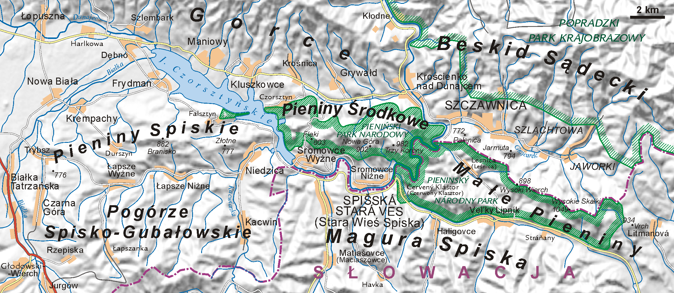
The Dunajec (); Goral dialects: ''Dónajec'') is a river running through northeastern Slovakia and southern Poland. It is also regarded as the main river of the Goral Lands. It is a right tributary of the Vistula River. It begins in Nowy Targ at the junction of two short mountain rivers, Czarny Dunajec and Biały Dunajec (Black and White Dunajec). Dunajec forms the border between Poland and Slovakia for in the Pieniny Środkowe (Slovak: Centrálne Pieniny) range, east of the Czorsztyn reservoir. Geography The Dunajec is long, including its source river Czarny Dunajec,Statistical Yearbook of the Republic of Poland 2017 [...More Info...] [...Related Items...] OR: [Wikipedia] [Google] [Baidu] |
Black Sea
The Black Sea is a marginal mediterranean sea of the Atlantic Ocean lying between Europe and Asia, east of the Balkans, south of the East European Plain, west of the Caucasus, and north of Anatolia. It is bounded by Bulgaria, Georgia, Romania, Russia, Turkey, and Ukraine. The Black Sea is supplied by major rivers, principally the Danube, Dnieper, and Don. Consequently, while six countries have a coastline on the sea, its drainage basin includes parts of 24 countries in Europe. The Black Sea covers (not including the Sea of Azov), has a maximum depth of , and a volume of . Most of its coasts ascend rapidly. These rises are the Pontic Mountains to the south, bar the southwest-facing peninsulas, the Caucasus Mountains to the east, and the Crimean Mountains to the mid-north. In the west, the coast is generally small floodplains below foothills such as the Strandzha; Cape Emine, a dwindling of the east end of the Balkan Mountains; and the Dobruja Plateau considerably ... [...More Info...] [...Related Items...] OR: [Wikipedia] [Google] [Baidu] |
Danube
The Danube ( ; ) is a river that was once a long-standing frontier of the Roman Empire and today connects 10 European countries, running through their territories or being a border. Originating in Germany, the Danube flows southeast for , passing through or bordering Austria, Slovakia, Hungary, Croatia, Serbia, Romania, Bulgaria, Moldova, and Ukraine before draining into the Black Sea. Its drainage basin extends into nine more countries. The largest cities on the river are Vienna, Budapest, Belgrade and Bratislava, all of which are the capitals of their respective countries; the Danube passes through four capital cities, more than any other river in the world. Five more capital cities lie in the Danube's basin: Bucharest, Sofia, Zagreb, Ljubljana and Sarajevo. The fourth-largest city in its basin is Munich, the capital of Bavaria, standing on the Isar River. The Danube is the second-longest river in Europe, after the Volga in Russia. It flows through much of C ... [...More Info...] [...Related Items...] OR: [Wikipedia] [Google] [Baidu] |
Váh
The Váh (; german: Waag, ; hu, Vág; pl, Wag w Słowniku geograficznym Królestwa Polskiego i innych krajów słowiańskich (''in Geographical Dictionary of Polish Kingdom and other Slavic countries'').) is the longest within . Towns on the river include Liptovský Hrádok, Liptovský Mikuláš, Ružomberok, [...More Info...] [...Related Items...] OR: [Wikipedia] [Google] [Baidu] |
Poprad River
The Poprad ( hu, Poprád, links=no, german: Popper, links=no) is a river in northern Slovakia and southern Poland, and a tributary of the Dunajec River near Stary Sącz, Poland. It has a length of 170 kilometres (63 km of which are within the Polish borders) and a basin area of 2,077 km2, (1,594 km2 of which is in Slovakia, and 483 km2 in Poland). Much of the Polish part of its basin is included in the protected area called Poprad Landscape Park featuring the Poprad River Gorge, a popular tourist destination between the towns of Piwniczna and Rytro. Poprad is the only large Slovak river flowing north into southern Poland. The river flows through the Slovak towns of Poprad, Kežmarok, Stará Ľubovňa, then forms for 31.1 km the Polish-Slovak border and flows through the Polish towns of Krynica-Zdrój, Muszyna, Piwniczna-Zdrój, Rytro, Stary Sącz, and Żegiestów, among others. Etymology The name is derived from a Proto-Slavic verb ''pręd-' ... [...More Info...] [...Related Items...] OR: [Wikipedia] [Google] [Baidu] |


