|
Plaitford
Plaitford is a small village in the Test Valley district of Hampshire, England. Its nearest town is Romsey, which lies approximately 4.9 miles (7.8 km) east from the village; the large village of West Wellow is immediately west of Plaitford. Plaitford manor was anciently within the county of Wiltshire. By 1885 it had become a civil parish, which was transferred to Hampshire in 1895. In 1932, the parishes of Plaitford and Melchet Park (north of Plaitford and also formerly in Wiltshire) were amalgamated to form the parish of Melchet Park and Plaitford. The original village of Plaitford lies to the north of the River Blackwater, a tributary of the River Test, but the chief part of the population is now found further south near the A36 road, which crosses the parish from east to west. Plaitford Green is a small district in the north of the parish. Plaitford Common, which occupies the southern portion of the parish, consists chiefly of rough grassland and is owned by the Nati ... [...More Info...] [...Related Items...] OR: [Wikipedia] [Google] [Baidu] |
Test Valley
Test Valley is a local government district and borough in Hampshire, England, named after the valley of the River Test. Its council is based in Andover. The borough was formed on 1 April 1974 by a merger of the boroughs of Andover and Romsey, along with Andover Rural District and Romsey and Stockbridge Rural District. Location Test Valley covers some of western Hampshire, stretching from boundaries with Southampton in the south to Newbury in the north. Test Valley is a predominantly rural area. It encompasses the North Wessex Downs Area of Outstanding Natural Beauty. The River Test is the centrepiece of the Test Valley; the river is a chalk stream of particular beauty known for its fishing, salmon and trout, which Lord Crickhowell (onetime chairman of the National Rivers Authority) said "should be treated as a great work of art or music". Home of the Houghton Fishing Club, an exclusive fishing club founded in 1822, which meets in the Grosvenor Hotel in Stockbridge. Demograp ... [...More Info...] [...Related Items...] OR: [Wikipedia] [Google] [Baidu] |
Hampshire
Hampshire (, ; abbreviated to Hants) is a ceremonial county, ceremonial and non-metropolitan county, non-metropolitan counties of England, county in western South East England on the coast of the English Channel. Home to two major English cities on its south coast, Southampton and Portsmouth, Hampshire is the 9th-most populous county in England. The county town of Hampshire is Winchester, located in the north of the county. The county is bordered by Dorset to the south-west, Wiltshire to the north-west, Berkshire to the north, Surrey to the north-east, and West Sussex to the south east. The county is geographically diverse, with upland rising to and mostly south-flowing rivers. There are areas of downland and marsh, and two national parks: the New Forest National Park, New Forest and part of the South Downs National Park, South Downs, which together cover 45 per cent of Hampshire. Settled about 14,000 years ago, Hampshire's recorded history dates to Roman Britain, when its chi ... [...More Info...] [...Related Items...] OR: [Wikipedia] [Google] [Baidu] |
Romsey
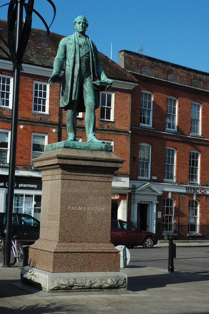
Romsey ( ) is a historic market town in the county of Hampshire, England. Romsey was home to the 17th-century philosopher and economist William Petty and the 19th-century British prime minister, Lord Palmerston, whose statue has stood in the town centre since 1857. The town was also home to the 20th-century naval officer and statesman Louis Mountbatten, 1st Earl Mountbatten of Burma, who lived at Broadlands. Romsey Abbey, the largest parish church in Hampshire, dominates the centre of the town. Other notable buildings include a 13th-century hunting lodge, an 18th-century coaching inn and the 19th-century Corn Exchange. The town is situated northwest of Southampton, southwest of Winchester and southeast of Salisbury. It sits on the outskirts of the New Forest, just over northeast of its eastern edge. The population of Romsey was 14,768 at the 2011 Census. Romsey is one of the principal towns in the Test Valley Borough and lies on the River Test, which is known for fly fishi ... [...More Info...] [...Related Items...] OR: [Wikipedia] [Google] [Baidu] |
West Wellow
Wellow is a village and civil parish in Hampshire, England that falls within the Test Valley district. The village lies just outside the New Forest, across the main A36 road which runs from the M27 motorway to Salisbury. The nearest town is Romsey, to the east, and the closest city is Southampton, to the southeast. The parish had a population of just over 3,300 in the 2011 census. Some people refer to the two villages of East Wellow and West Wellow individually, while others refer to them collectively as Wellow. There is no official administrative or political division which separates the two parts, and they share the same parish council, which also covers the small settlement of Canada. Canada is just inside the New Forest boundary and can only be reached by public road from the roundabout on the A36 at West Wellow. History King Alfred (d. 899) left "the toune of Welewe" in his will to his eldest daughter Ethelgifu. Thirteen households at "Welue" are mentioned in Do ... [...More Info...] [...Related Items...] OR: [Wikipedia] [Google] [Baidu] |
Wiltshire
Wiltshire (; abbreviated Wilts) is a historic and ceremonial county in South West England with an area of . It is landlocked and borders the counties of Dorset to the southwest, Somerset to the west, Hampshire to the southeast, Gloucestershire to the north, Oxfordshire to the northeast and Berkshire to the east. The county town was originally Wilton, after which the county is named, but Wiltshire Council is now based in the county town of Trowbridge. Within the county's boundary are two unitary authority areas, Wiltshire and Swindon, governed respectively by Wiltshire Council and Swindon Borough Council. Wiltshire is characterised by its high downland and wide valleys. Salisbury Plain is noted for being the location of the Stonehenge and Avebury stone circles (which together are a UNESCO Cultural and World Heritage site) and other ancient landmarks, and as a training area for the British Army. The city of Salisbury is notable for its medieval cathedral. Swindon is the ... [...More Info...] [...Related Items...] OR: [Wikipedia] [Google] [Baidu] |
Civil Parish
In England, a civil parish is a type of administrative parish used for local government. It is a territorial designation which is the lowest tier of local government below districts and counties, or their combined form, the unitary authority. Civil parishes can trace their origin to the ancient system of ecclesiastical parishes, which historically played a role in both secular and religious administration. Civil and religious parishes were formally differentiated in the 19th century and are now entirely separate. Civil parishes in their modern form came into being through the Local Government Act 1894, which established elected parish councils to take on the secular functions of the parish vestry. A civil parish can range in size from a sparsely populated rural area with fewer than a hundred inhabitants, to a large town with a population in the tens of thousands. This scope is similar to that of municipalities in Continental Europe, such as the communes of France. However, ... [...More Info...] [...Related Items...] OR: [Wikipedia] [Google] [Baidu] |
River Blackwater (River Test)
This River Blackwater drains small parts of the English counties of Hampshire and Wiltshire. It is a tributary of the River Test. Course It rises just to the east of the Wiltshire village of Redlynch, east of Salisbury. It then flows east into Hampshire, where it flows north of the village of Wellow and the hamlet of Wigley. The river turns south, passing under the M27 and past Broadlands Lake and the Testwood Lakes reservoirs, before joining the Test between Totton and Redbridge. The Environment Agency records the length of the main river as , with an additional for the watercourse from Redlynch to the confluence north of Hamptworth. Water quality The Environment Agency measures water quality of the river systems in England. Each is given an overall ecological status, which may be one of five levels: high, good, moderate, poor and bad. There are several components that are used to determine this, including biological status, which looks at the quantity and varieties o ... [...More Info...] [...Related Items...] OR: [Wikipedia] [Google] [Baidu] |
River Test
The River Test is a chalk stream in Hampshire in the south of England. It rises at Ashe near Basingstoke and flows southwards for to Southampton Water. Settlements on the Test include the towns of Stockbridge and Romsey. Below the village of Longparish, the river is broadly followed by the Test Way, a long-distance footpath. Much of the Test is a biological Site of Special Scientific Interest. It is part of the Solent and Southampton Water Ramsar site and Special Protection Area. The river is used for fly fishing for trout from its source to its tidal limit. Etymology Recorded forms are Terstan from 877 and 901, Tarstan stream in 1045, Terstein 1234, and Test in 1425. If Common Brittonic, not Old English, all related dictionaries show three suitable words beginning with Tre- and none with extremely rare Ter-. There is precedent to such metathesis: as for the river Tern in the far west, from tren 'strong'. If so it most likely relates to the Welsh ''tres'' (tumult, commoti ... [...More Info...] [...Related Items...] OR: [Wikipedia] [Google] [Baidu] |
A36 Road
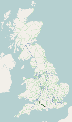
The A36 is a trunk road and primary route in southwest England that links the port city of Southampton to the city of Bath. At Bath, the A36 connects with the A4 to Bristol, thus providing a road link between the major ports of Southampton and Bristol. It also provides a link between Bristol and London via the A303. Route Originally, the A36 continued to Avonmouth, beyond Bristol, but this section was renumbered to the A4. Within Bath the A36 acts as a ring road on the southern side of the river, from the junction with the A4 at Newbridge to the west of the city. From here traffic can continue to Bristol on the A4 or to Wells and Weston-super-Mare via the A39 and A368 roads. Another link to the A4 on the eastern side at Cleveland Bridge, which provides a route to the M4 motorway via the A46, is highly congested. The A36 leaves Bath in an easterly direction towards Bathampton, then turns south to follow the Avon through its steep-sided valley, climbing out of the val ... [...More Info...] [...Related Items...] OR: [Wikipedia] [Google] [Baidu] |
National Trust For Places Of Historic Interest Or Natural Beauty
The National Trust, formally the National Trust for Places of Historic Interest or Natural Beauty, is a charity and membership organisation for heritage conservation in England, Wales and Northern Ireland. In Scotland, there is a separate and independent National Trust for Scotland. The Trust was founded in 1895 by Octavia Hill, Sir Robert Hunter and Hardwicke Rawnsley to "promote the permanent preservation for the benefit of the Nation of lands and tenements (including buildings) of beauty or historic interest". It was given statutory powers, starting with the National Trust Act 1907. Historically, the Trust acquired land by gift and sometimes by public subscription and appeal, but after World War II the loss of country houses resulted in many such properties being acquired either by gift from the former owners or through the National Land Fund. Country houses and estates still make up a significant part of its holdings, but it is also known for its protection of wild lands ... [...More Info...] [...Related Items...] OR: [Wikipedia] [Google] [Baidu] |
Villages In Hampshire
A village is a clustered human settlement or community, larger than a hamlet but smaller than a town (although the word is often used to describe both hamlets and smaller towns), with a population typically ranging from a few hundred to a few thousand. Though villages are often located in rural areas, the term urban village is also applied to certain urban neighborhoods. Villages are normally permanent, with fixed dwellings; however, transient villages can occur. Further, the dwellings of a village are fairly close to one another, not scattered broadly over the landscape, as a dispersed settlement. In the past, villages were a usual form of community for societies that practice subsistence agriculture, and also for some non-agricultural societies. In Great Britain, a hamlet earned the right to be called a village when it built a church. [...More Info...] [...Related Items...] OR: [Wikipedia] [Google] [Baidu] |


