|
Piz Corvatsch
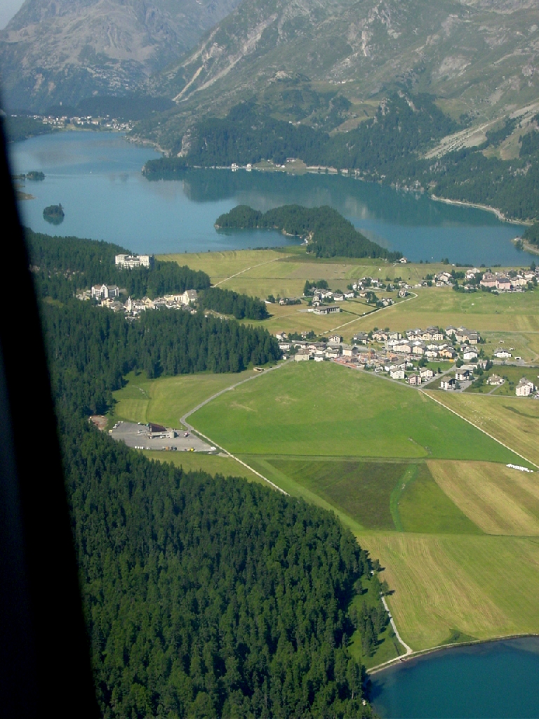
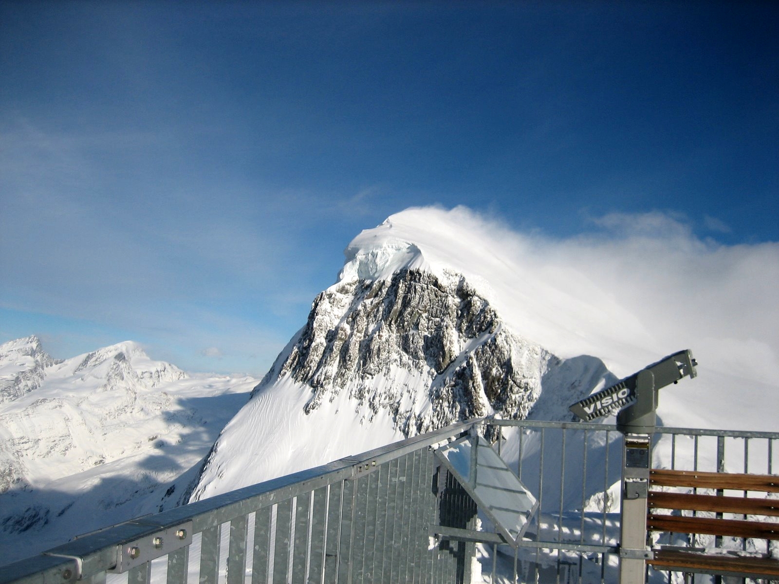
Piz Corvatsch () is a mountain in the Bernina Range of the Alps, overlooking Lake Sils and Lake Silvaplana in the Engadin region of the canton of Graubünden. With an elevation of , it is the highest point on the range separating the main Inn valley from the Val Roseg. Aside from Piz Corvatsch, two other slightly lower summits make up the Corvatsch massif: Piz Murtèl (; north of Piz Corvatsch) and the unnamed summit where lies the Corvatsch upper cable car station (; north of Piz Murtèl). Politically, the summit of Piz Corvatsch is shared between the municipalities of Sils im Engadin/Segl and Samedan, although the 3,303 m high summit lies between the municipalities of Silvaplana and Samedan. The tripoint between the aforementioned municipalities is the summit of Piz Murtèl. Several glaciers lie on the east side on the massif. The largest, below Piz Corvatsch, is named ''Vadret dal Murtèl''. The second largest, below Piz Murtèl and the station, is named ''Vadret dal Corvat ... [...More Info...] [...Related Items...] OR: [Wikipedia] [Google] [Baidu] |
Sils Im Engadin/Segl
Sils im Engadin/Segl (german: Sils im Engadin; Romansh ), often also as ''Sils i.E./Segl'', is a municipality and village in the Maloja Region, Upper Engadine in the Swiss canton of the Grisons. It consists of two villages, Segl Maria (Romansh, german: Sils Maria; ''Seglias'' is part of Segl Maria) and Segl Baselgia (German: ''Sils Baselgia''; ''Baselgia'' is Romansh for church); the Val Fex (German: ''Fextal''); and three ''Maiensäss''e (Alpine pastures traditionally used for spring grazing): Grevasalvas, Blaunca and Buaira, above ''Plaun da Lej'' on the left side of the valley. Name and coat of arms The municipality's official label uses both the German and the Romansh versions of its name: ''Segl'' is the Romansh version while ''Sils im Engadin'' is the German. Engadin is Romansh for "Valley of the Inn ( rm, En)", the river, which flows northeast from Maloja through Sils Baselgia and eventually into the Danube at Passau, Germany at the German-Austrian border. Sils i. ... [...More Info...] [...Related Items...] OR: [Wikipedia] [Google] [Baidu] |
Tourist Attractions In Switzerland
Tourism is travel for pleasure or business; also the theory and practice of touring, the business of attracting, accommodating, and entertaining tourists, and the business of operating tours. The World Tourism Organization defines tourism more generally, in terms which go "beyond the common perception of tourism as being limited to holiday activity only", as people "travelling to and staying in places outside their usual environment for not more than one consecutive year for leisure and not less than 24 hours, business and other purposes". Tourism can be domestic (within the traveller's own country) or international, and international tourism has both incoming and outgoing implications on a country's balance of payments. Tourism numbers declined as a result of a strong economic slowdown (the late-2000s recession) between the second half of 2008 and the end of 2009, and in consequence of the outbreak of the 2009 H1N1 influenza virus, but slowly recovered until the COVID-19 pa ... [...More Info...] [...Related Items...] OR: [Wikipedia] [Google] [Baidu] |
Alpine Three-thousanders
Three-thousanders are mountains with a height of between , but less than above sea level. Similar terms are commonly used for mountains of other height brackets e. g. four-thousanders or eight-thousanders. In Britain, the term may refer to mountains above . Climatological significance In temperate latitudes three-thousanders play an important role, because even in summer they lie below the zero degree line for weeks. Thus the chains of three-thousanders always form important climatic divides and support glaciation - in the Alps the contour is roughly the general limit of the "nival step"; only a few glaciated mountains are under (the Dachstein, the easternmost glaciated mountain in the Alps, is, at , not a three-thousander). In the Mediterranean, however, the three-thousanders remain free of ice and, in the tropics, they are almost insignificant from a climatic perspective; here the snow line lies at around to , and in the dry continental areas (Trans-Himalayas, Ande ... [...More Info...] [...Related Items...] OR: [Wikipedia] [Google] [Baidu] |
Mountains Of The Alps
This page tabulates only the most prominent mountains of the Alps, selected for having a topographic prominence of ''at least'' , and all of them exceeding in height. Although the list contains 537 summits, some significant alpine mountains are necessarily excluded for failing to meet the stringent prominence criterion. The list of these most prominent mountains is continued down to 2500 m elevation at List of prominent mountains of the Alps (2500–2999 m) and down to 2000 m elevation on List of prominent mountains of the Alps (2000–2499 m). All such mountains are located in either France, Italy, Switzerland, Liechtenstein, Austria, Germany or Slovenia, even in some lower regions. Together, these three lists include all 44 ultra-prominent peaks of the Alps, with 19 ultras over 3000m on this page. For a definitive list of all 82 the highest peaks of the Alps, as identified by the International Climbing and Mountaineering Federation (UIAA), and often referred to as the 'Alpi ... [...More Info...] [...Related Items...] OR: [Wikipedia] [Google] [Baidu] |
Mountains Of Graubünden
A mountain is an elevated portion of the Earth's crust, generally with steep sides that show significant exposed bedrock. Although definitions vary, a mountain may differ from a plateau in having a limited summit area, and is usually higher than a hill, typically rising at least 300 metres (1,000 feet) above the surrounding land. A few mountains are isolated summits, but most occur in mountain ranges. Mountains are formed through tectonic forces, erosion, or volcanism, which act on time scales of up to tens of millions of years. Once mountain building ceases, mountains are slowly leveled through the action of weathering, through slumping and other forms of mass wasting, as well as through erosion by rivers and glaciers. High elevations on mountains produce colder climates than at sea level at similar latitude. These colder climates strongly affect the ecosystems of mountains: different elevations have different plants and animals. Because of the less hospitable terrain an ... [...More Info...] [...Related Items...] OR: [Wikipedia] [Google] [Baidu] |
Mountains Of Switzerland
This article contains a sortable table of many of the major mountains and hills of Switzerland. The table only includes those summits that have a topographic prominence of at least above other points, and ranks them by height and prominence. Therefore it only includes mountains that might generally be regarded as 'independent' and covers most of the country, even lower areas. For a fuller list of mountains, including subsidiary points, see List of mountains of Switzerland above 3000 m and List of mountains of Switzerland above 3600 m. For a list of just the most isolated mountains, see List of most isolated mountains of Switzerland. Along with the lakes, mountains constitute a major natural feature of Switzerland with most of the cantons having summits exceeding and three of them having summits exceeding . The two main mountain ranges are the Alps (south and east) and the Jura (north and west), separated by the Swiss Plateau which also includes a large number of hills. Topo ... [...More Info...] [...Related Items...] OR: [Wikipedia] [Google] [Baidu] |
List Of Buildings And Structures In Switzerland Above 3000 M
This is a list of buildings and infrastructures above in Switzerland. As this height approximately corresponds to the level of the climatic snow line in the Alps, infrastructures located above it are generally subject to harsh weather conditions and are more difficult to build. This list also includes structures located precisely on the Italian border (*) that could be partially in Switzerland. List See also *List of highest railway stations in Switzerland *List of mountains of Switzerland above 3000 m *List of mountain huts in the Alps References *Swisstopo Swisstopo is the official name for the Swiss Federal Office of Topography (in German language, German: ''Bundesamt für Landestopografie''; French language, French: ''Office fédéral de topographie''; Italian language, Italian: ''Ufficio fed ... topographic maps {{reflist * Mountaineering in Switzerland ... [...More Info...] [...Related Items...] OR: [Wikipedia] [Google] [Baidu] |
List Of Mountains Of Switzerland Accessible By Public Transport
This is a list of mountains of Switzerland above 800 metres whose summits are accessible by public transport. This list includes mountains with a topographic prominence of at least 30 metres that have a station above the height of their key col and within 120 metres (height difference) from the summit. The station can be reached by cable car, funicular, railway or bus. This list notably includes the Klein Matterhorn and the Säntis, respectively the highest and the most prominentInformation retrieved on 5 March 2014 froCore Europe 50 Most Prominent Peaks (peakbagger.com)an/ref> peaks of Europe with public transport access. It also includes the Chasseral, the most isolated summit of the country accessible to pedestrians. This list does not include ski lifts. For a list of ski areas, see List of ski areas and resorts in Switzerland. For a general list of mountains, see List of mountains of Switzerland. List See also *List of aerial tramways in Switzerland *List of funiculars ... [...More Info...] [...Related Items...] OR: [Wikipedia] [Google] [Baidu] |
MeteoSwiss
MeteoSwiss (german: MeteoSchweiz, french: MétéoSuisse, it, MeteoSvizzera), officially the Federal Office of Meteorology and Climatology, is an office of the federal administration of Switzerland. It employs 290 people at locations in Zurich, Zurich Airport, Geneva, Locarno and Payerne. History Originally established as the Central Meteorological Institute (MZA), by 1863 it operated 88 weather stations. Its name was changed in 1979 to ''Swiss Meteorological Institute'' (SMA). Since 1996, it has been operating as MeteoSwiss. Since 2006, its official name is "Federal Office of Meteorology and Climatology MeteoSwiss". Function The office observes the weather around the clock, creating weather forecasts and alerting authorities and population, when strong winds, heavy rainfall, storms or heat waves are forecast. In addition, it provides weather services for the civil, military and private aviation. The office also carries out a program of research and development to understand ... [...More Info...] [...Related Items...] OR: [Wikipedia] [Google] [Baidu] |
Köppen Climate Classification
The Köppen climate classification is one of the most widely used climate classification systems. It was first published by German-Russian climatologist Wladimir Köppen (1846–1940) in 1884, with several later modifications by Köppen, notably in 1918 and 1936. Later, the climatologist Rudolf Geiger (1894–1981) introduced some changes to the classification system, which is thus sometimes called the Köppen–Geiger climate classification system. The Köppen climate classification divides climates into five main climate groups, with each group being divided based on seasonal precipitation and temperature patterns. The five main groups are ''A'' (tropical), ''B'' (arid), ''C'' (temperate), ''D'' (continental), and ''E'' (polar). Each group and subgroup is represented by a letter. All climates are assigned a main group (the first letter). All climates except for those in the ''E'' group are assigned a seasonal precipitation subgroup (the second letter). For example, ''Af'' indi ... [...More Info...] [...Related Items...] OR: [Wikipedia] [Google] [Baidu] |
Tundra
In physical geography, tundra () is a type of biome where tree growth is hindered by frigid temperatures and short growing seasons. The term ''tundra'' comes through Russian (') from the Kildin Sámi word (') meaning "uplands", "treeless mountain tract". There are three regions and associated types of tundra: Arctic tundra, alpine tundra, and Antarctic tundra. Tundra vegetation is composed of dwarf shrubs, sedges, grasses, mosses, and lichens. Scattered trees grow in some tundra regions. The ecotone (or ecological boundary region) between the tundra and the forest is known as the tree line or timberline. The tundra soil is rich in nitrogen and phosphorus. The soil also contains large amounts of biomass and decomposed biomass that has been stored as methane and carbon dioxide in the permafrost, making the tundra soil a carbon sink. As global warming heats the ecosystem and causes soil thawing, the permafrost carbon cycle accelerates and releases much of these soil-contained g ... [...More Info...] [...Related Items...] OR: [Wikipedia] [Google] [Baidu] |


