|
Piraeus Prefecture
Piraeus Prefecture ( el, Νομός Πειραιά or Νομός Πειραιώς) was one of the prefectures of Greece. Created in 1964 as a separate Prefecture (Νομός) and after the dissolution of the prefecture in 1972 was one of the 4 prefectures (Νομαρχίες) of Attica prefecture, and from 1994, part of the Athens-Piraeus super-prefecture (1994–2011). The capital of the prefecture was Piraeus. As a part of the 2011 Kallikratis government reform, the prefecture was abolished, and its territory was divided into two regional units: Islands and Piraeus. History The prefecture covered the south-western part of the agglomeration of Athens, several islands in the Saronic Gulf ( Salamis, Aegina, Agkistri, Poros, Hydra, Dokos, Spetses, Spetsopoula), Methana and Troizina on the Peloponnese peninsula, and the islands of Kythira and Antikythera south of the Peloponnese. An indication of the geographical diversity of the prefecture was the stark difference in population d ... [...More Info...] [...Related Items...] OR: [Wikipedia] [Google] [Baidu] |
Prefectures Of Greece
During the first administrative division of independent Greece in 1833–1836 and again from 1845 until their abolition with the Kallikratis reform in 2010, the prefectures ( el, νομοί, sing. νομός, translit=nomoi, sing. nomós) were the country's main administrative unit. They are now defunct, and have been approximately replaced by regional units. They are called departments in ISO 3166-2:GR and by the United Nations Group of Experts on Geographical Names. The prefectures were the second-degree organization of local government, grouped into 13 regions or (before 1987) 10 geographical departments, and in turn divided into provinces and comprising a number of communities and municipalities. The prefectures became self-governing entities in 1994, when the first prefectural-level elections took place. The prefects were previously appointed by the government. By 2010, their number had risen to 51, of which one, the Attica Prefecture, where more than a third of the ... [...More Info...] [...Related Items...] OR: [Wikipedia] [Google] [Baidu] |
Athens
Athens ( ; el, Αθήνα, Athína ; grc, Ἀθῆναι, Athênai (pl.) ) is both the capital and largest city of Greece. With a population close to four million, it is also the seventh largest city in the European Union. Athens dominates and is the capital of the Attica region and is one of the world's oldest cities, with its recorded history spanning over 3,400 years and its earliest human presence beginning somewhere between the 11th and 7th millennia BC. Classical Athens was a powerful city-state. It was a centre for the arts, learning and philosophy, and the home of Plato's Academy and Aristotle's Lyceum. It is widely referred to as the cradle of Western civilization and the birthplace of democracy, largely because of its cultural and political influence on the European continent—particularly Ancient Rome. In modern times, Athens is a large cosmopolitan metropolis and central to economic, financial, industrial, maritime, political and cultural life in Gre ... [...More Info...] [...Related Items...] OR: [Wikipedia] [Google] [Baidu] |
Kythira
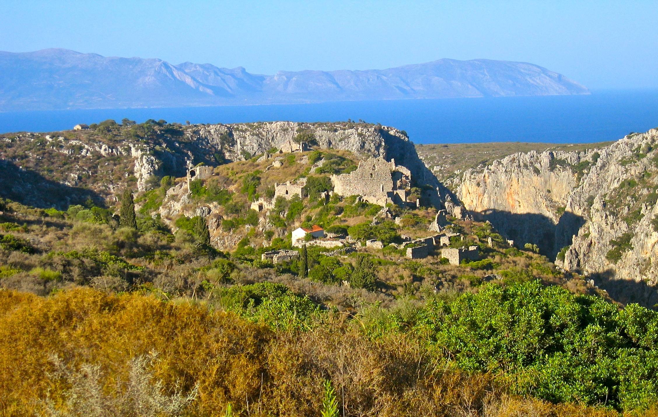
Kythira (, ; el, Κύθηρα, , also transliterated as Cythera, Kythera and Kithira) is an Greek islands, island in Greece lying opposite the south-eastern tip of the Peloponnese peninsula. It is traditionally listed as one of the seven main Ionian Islands, although it is distant from the main group. Administratively, it belongs to the Islands (regional unit), Islands regional unit, which is part of the Attica (region), Attica region, despite its distance from the Saronic Islands, around which the rest of Attica is centered. As a municipality, it includes the island of Antikythera to the south. The island is strategically located between the Greek mainland and Crete, and from ancient times until the mid 19th century was a crossroads of merchants, sailors, and conquerors. As such, it has had a long and varied history and has been influenced by many civilizations and cultures. This is reflected in its architecture (a blend of traditional, Aegean Sea, Aegean and Venice, Venetian el ... [...More Info...] [...Related Items...] OR: [Wikipedia] [Google] [Baidu] |
Peloponnese
The Peloponnese (), Peloponnesus (; el, Πελοπόννησος, Pelopónnēsos,(), or Morea is a peninsula and geographic regions of Greece, geographic region in southern Greece. It is connected to the central part of the country by the Isthmus of Corinth land bridge which separates the Gulf of Corinth from the Saronic Gulf. From the late Middle Ages until the 19th century the peninsula was known as the Morea ( grc-x-byzant, Μωρέας), (Morèas) a name still in colloquial use in its demotic Greek, demotic form ( el, Μωριάς, links=no), (Moriàs). The peninsula is divided among three administrative regions of Greece, administrative regions: most belongs to the Peloponnese (region), Peloponnese region, with smaller parts belonging to the West Greece and Attica (region), Attica regions. Geography The Peloponnese is a peninsula located at the southern tip of the mainland, in area, and constitutes the southernmost part of mainland Greece. It is connected to the mainlan ... [...More Info...] [...Related Items...] OR: [Wikipedia] [Google] [Baidu] |
Troizina
Troezen (; ancient Greek: Τροιζήν, modern Greek: Τροιζήνα ) is a small town and a former municipality in the northeastern Peloponnese, Greece, on the Argolid Peninsula. Since the 2011 local government reform it is part of the municipality Troizinia-Methana, of which it is a municipal unit. It is part of the Islands regional unit. Troezen is located southwest of Athens, across the Saronic Gulf, and a few miles south of Methana. The seat of the former municipality (pop. 6,507) was in Galatas. Before 2011, Troizina was part of the Argolis and Korinthos prefecture from 1833 to 1925, Attica prefecture from 1925 to 1964, Piraeus Prefecture from 1964 to 1972 and then back in Attica prefecture (in antiquity it was part of Argolis). The municipality had a land area of 190.697 km². Its largest towns and villages are Galatás (pop. 2,195 in 2011), Kalloní (pop. 669), Troizína (pop. 673), Taktikoúpoli (250), Karatzás (287), Dryópi (239), Ágios Geórgios (228), and ... [...More Info...] [...Related Items...] OR: [Wikipedia] [Google] [Baidu] |
Methana
Methana ( el, Μέθανα) is a town and a former municipality on the Peloponnese peninsula, Greece. Since the 2011 local government reform it is part of the municipality Troizinia-Methana, of which it is a municipal unit. The municipal unit has an area of 50.161 km2. Methana is situated on a volcanic (the Methana Volcano) peninsula, attached to the Peloponnese. Administratively, it belongs to the Attica region. The town (pop. 892 in 2011) is located north of the road connecting to the rest of the Peloponnese and Galatas. The highest point is (Helona Mountain). The municipal unit has a land area of and a population of 1,657 inhabitants at the 2011 census. The largest settlements besides the town of Methana are Vathý (pop. 129), Megalochóri (115), Kounoupítsa (75), Kypséli (47), Ágioi Theódoroi (45), and Dritsaíika (205) Subdivisions The municipal unit Methana is subdivided into the following communities (constituent villages in brackets): * Kounoupitsa (Kounoupi ... [...More Info...] [...Related Items...] OR: [Wikipedia] [Google] [Baidu] |
Spetsopoula
Spetsopoula ( el, Σπετσοπούλα) is an island situated to the southeast of Spetses, which is one of the Saronic Islands, in the region of Attica and the Aegean Sea. It is located at about from Athens. Its area is about 2 Km2. According to 2011 census the island is uninhabited but the previous census (2001) reported a population of 8 inhabitants. Historical information The ancient name of the island was Aristera and is referred by Greek traveler and geographer Pausanias. The modern name means small Spetses and owes it in the nearby Spetses. In 1962 the island was purchased by Greek shipping magnate Stavros Niarchos. Spetsopoula is linked with the death of Eugenia Livanos Eugenia Livanos-Niarchos ( el, Ευγενία Λιβανού, ; 1927 – 4 May 1970) was the third wife of Stavros Niarchos. She was the daughter of shipping magnate Stavros G. Livanos and his wife Arietta Zafirakis. Her sister was Athina Livano ..., former wife of Stavros Niarchos. She was found dead ... [...More Info...] [...Related Items...] OR: [Wikipedia] [Google] [Baidu] |
Spetses
Spetses ( el, Σπέτσες, grc, Πιτυούσσα "Pityussa", Arvanitika: Πετσε̱) is an upscale affluent island in Attica, Greece. It is included as one of the Saronic Islands. Until 1948, it was part of the old prefecture of Argolis and Corinthia Prefecture, which is now split into Argolis and Corinthia. In ancient times, it was known as Pityussa; Spetses is a borrowing from Italian ''spezie'' "spices". The island is now an independent municipality (pop. 4,027), with no internal boundaries within the municipality. The town of Spetses (pop. 4,001 in 2011) is the only large settlement on the island. The other settlements on the island are Moní Ayíon Pánton (pop. 0), Ligonéri (4), Ágioi Anárgyroi (18), Kouzoúnos (4). Also part of the Municipality of Spetses are the islands of Spetsopoula, Falkonera, and Velopoula (all uninhabited). The municipality has an area of 27.121 km2. An unusual aspect of Spetses is that no private automobiles are allowed within the t ... [...More Info...] [...Related Items...] OR: [Wikipedia] [Google] [Baidu] |
Dokos
Dokos ( el, Δοκός) is a small Greek island of the Argo-Saronic Gulf, adjacent to Hydra, and separated from the Peloponnese by a narrow strait called, on some maps, "the Hydra Gulf." It is part of the municipality of Ýdra (Hydra) in Islands regional unit and reported a population of 18 persons at the 2011 census. The island is populated only by some Orthodox monks and perennial sheep herders. The island is rocky, reaching a height of 308 metres. During the ancient times it was called Aperopia (Ἀπεροπία). Archaeology It has, since the ancient years, considered to be a strategic location. On the east side lie the ruins of a great Byzantine - Venetian Castle. During the Middle Ages, the island served as a refuge for Albanian settlers' animals. Dokos, according to archaeological studies, has been inhabited since Chalcolithic, 6000 BC. In 1975, Peter Throckmorton Edgerton Alvord Throckmorton (July 30, 1928 – June 5, 1990), known as Peter Throckmorton, was an Ameri ... [...More Info...] [...Related Items...] OR: [Wikipedia] [Google] [Baidu] |
Hydra, Saronic Islands
Hydra, or Ydra or Idra ( el, Ύδρα, Ýdra, , Arvanitika: Nύδρα/Nidhra), is one of the Saronic Islands of Greece, located in the Aegean Sea between the Myrtoan Sea and the Argolic Gulf. It is separated from the Peloponnese by a narrow strip of water. In ancient times, the island was known as Hydrea (Ὑδρέα, derived from the Greek word for "water"), a reference to the natural springs on the island. The municipality of Hydra consists of the islands Hydra (pop. 1,948, area ), Dokos (pop. 18, area ), and a few uninhabited islets, total area . The province of Hydra ( el, Επαρχία Ύδρας) was one of the provinces of the Argolis and Corinthia prefecture from 1833 to 1942, Attica prefecture from 1942 to 1964, Piraeus prefecture from 1964 to 1972 and then back to Attica as part of the newly establishment Piraeus prefecture of Attica prefecture. Its territory corresponded with that of the current municipality. It was abolished in 2006. Today the municipality of ... [...More Info...] [...Related Items...] OR: [Wikipedia] [Google] [Baidu] |
Poros
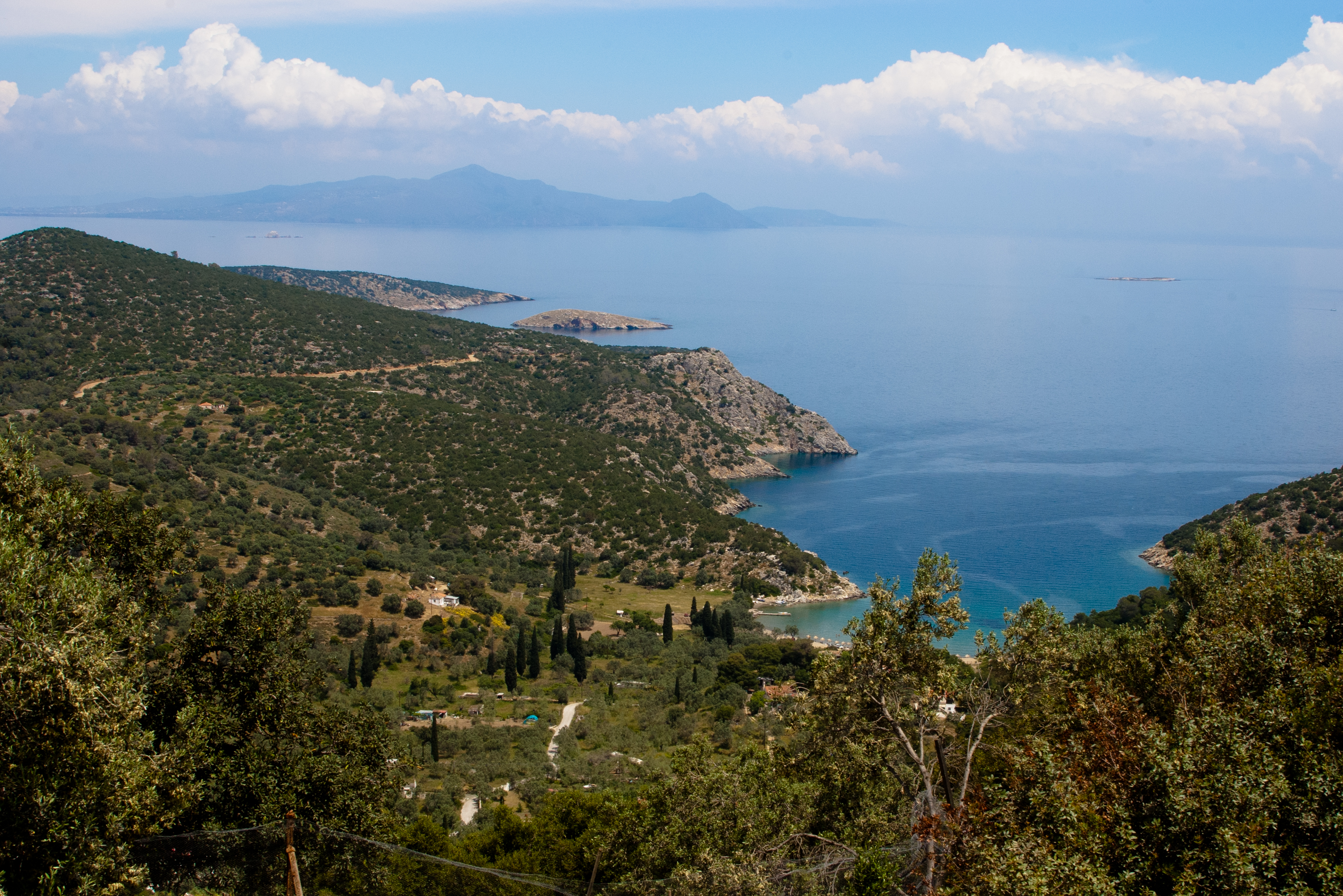
Poros ( el, Πόρος) is a small Greece, Greek island-pair in the southern part of the Saronic Gulf, about south from the port of Piraeus and separated from the Peloponnese by a wide sea channel, with the town of Galatas, Troizina, Galatas on the mainland across the strait. Its surface area is about and it has 3,780 inhabitants. The ancient name of Poros was Pogon. Like other ports in the Saronic, it is a popular weekend destination for Athenian travellers. Poros consists of two islands: Sphaeria ( el, Σφαιρία, ), the southern part, which is of volcanic origin, where today's city is located, and Kalaureia ( el, Καλαυρία, ), also Kalavria or Calauria (meaning 'gentle breeze'), the northern and largest part. A bridge connects the two islands over a narrow strait. Poros is an island with rich vegetation. Much of the northern and far eastern/western sides of the island are bushy, whereas large areas of old pine forest are found in the south and center of the isla ... [...More Info...] [...Related Items...] OR: [Wikipedia] [Google] [Baidu] |
Agkistri
Agistri, also Angistri or Agkistri (Greek: Αγκίστρι , English: "fishing hook"), is a small populated island and municipality in the Saronic Gulf in the Islands regional unit, Greece. Settlements There are only three settlements on Agistri - Milos (Megalochori), Skala and Limenaria. Milos (pop. 566) is the main village where the majority of the Greek population of the island lives. Skala (pop. 448) is a twenty-minute walk from Milos along the coastal road. Skala is where most of the tourist facilities and hotels are. Limenaria (pop. 128) is a very small village on the other side of the island with very little tourism. The island's population is 1,142 inhabitants according to the 2011 Greek census. Its land area is . History The island was settled by Arvanites likely starting in the late 17th century.Jochalas, Titos P. (1971): Über die Einwanderung der Albaner in Griechenland: Eine zusammenfassene Betrachtung On the immigration of Albanians to Greece: A summary" München ... [...More Info...] [...Related Items...] OR: [Wikipedia] [Google] [Baidu] |


