|
Pillar Point Air Force Station
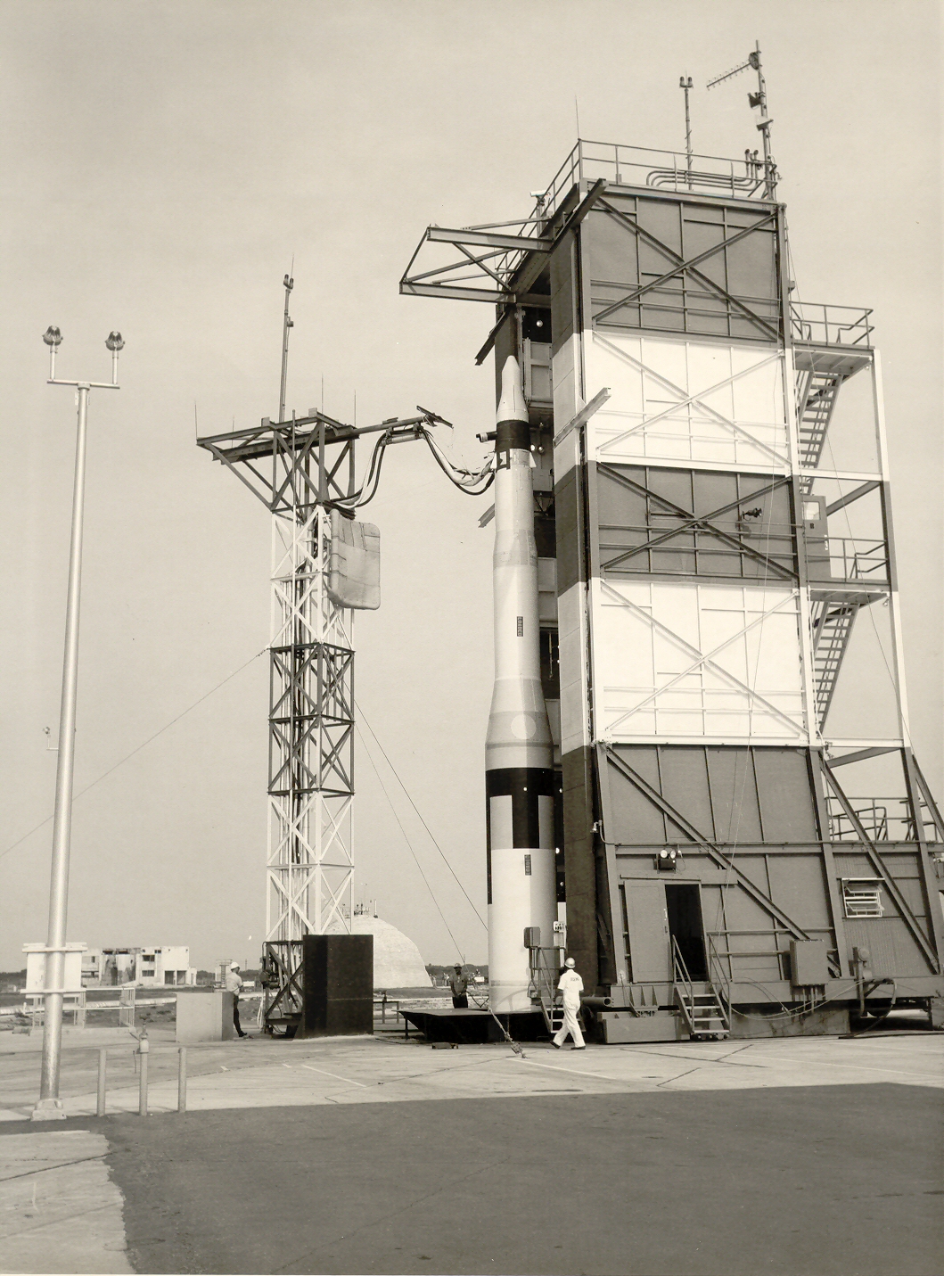
Pillar Point Air Force Station, formerly Pillar Point Military Reservation, is a United States Armed Forces facility on 48 acres overlooking Pillar Point Harbor, California. Pillar Point is 15 miles south of the City of San Francisco in San Mateo County. The facility was built and founded on October 10, 1940, as part of the World War II harbor defenses of San Francisco, as there was concern that Japan might attack San Francisco. Large artillery, .50-caliber machine guns for anti-aircraft defense, searchlights, barracks, concrete bunkers, cyclone fences, and an electric system were installed for defensive measures. In June 1944, a short-range UHF Surface Craft Detection Radar System, model SCR-296, built by Western Electric Company was installed. The SCR-296 could detect and track seagoing surface craft. After the war, on January 17, 1946, the radar system was removed. In 1949 the Military Reservation was closed. The US Navy opened the base on September 4, 1959, as a missile ... [...More Info...] [...Related Items...] OR: [Wikipedia] [Google] [Baidu] |
LGM-30 Minuteman
The LGM-30 Minuteman is an American land-based intercontinental ballistic missile (ICBM) in service with the Air Force Global Strike Command. , the LGM-30G Minuteman III version is the only land-based ICBM in service in the United States and represents the land leg of the U.S. nuclear triad, along with the Trident submarine-launched ballistic missile (SLBM) and nuclear weapons carried by long-range strategic bombers. Development of the Minuteman began in the mid-1950s when basic research indicated that a solid-fuel rocket motor could stand ready to launch for long periods of time, in contrast to liquid-fueled rockets that required fueling before launch and so might be destroyed in a surprise attack. The missile was named for the colonial minutemen of the American Revolutionary War, who could be ready to fight on short notice. The Minuteman entered service in 1962 as a deterrence weapon that could hit Soviet cities with a second strike and countervalue counterattack if the U.S ... [...More Info...] [...Related Items...] OR: [Wikipedia] [Google] [Baidu] |
Half Moon Bay Flight Strip
Eddie Andreini Sr. Airfield, officially Half Moon Bay Airport is a public airport in San Mateo County, northwest of Half Moon Bay, California, United States. The airport is on the Pacific Coast, south of San Francisco. History The Half Moon Bay Airport is about 20 miles south of San Francisco. It was built by the California State Highway Department for the U.S. Army in 1942 as an auxiliary airfield for Salinas Army Air Base. Known as Half Moon Bay Flight Strip, the airport supported Salinas AAF's ground support mission to train light observation and reconnaissance squadrons. These were light aircraft and fighters modified with camera equipment. Salinas Army Airbase also had the mission of conducting coastal patrols. As such, the airfield would have been garrisoned by a detachment of the 301st Base Headquarters and Air Base Squadron. With the reorganization of the Army Air Forces that took place in the first quarter of 1944, the site was transferred to Air Technical Service ... [...More Info...] [...Related Items...] OR: [Wikipedia] [Google] [Baidu] |
Francisco Guerrero Y Palomares
Francisco Guerrero y Palomares (1811 – 13 July 1851) was a Californio politician and ranchero, who served as the third and sixth Alcalde of San Francisco (then known as Yerba Buena). He was notoriously murdered in 1851, in a scandal involving American prospectors seeking to discredit the land claims of Californios. Life Guerrero was born in Tepic, New Spain (colonial México). He came to Alta California with the Hijar-Padres Colony in 1834, and settled in Yerba Buena (San Francisco). He was married to Josefa de Haro (daughter of Alcalde Francisco de Haro), and had five sons. He was the third Alcalde of Yerba Buena in 1836. Guerrero served again as the sixth Alcalde in 1839. In 1844 he was granted Rancho Corral de Tierra, located in present-day San Mateo County, California. A section of the land grant is now a part of the Golden Gate National Recreation Area. Francisco Guerrero was murdered in 1851 by Francis LeBras, in American San Francisco. He is buried at the Mission ... [...More Info...] [...Related Items...] OR: [Wikipedia] [Google] [Baidu] |
Rancho Corral De Tierra
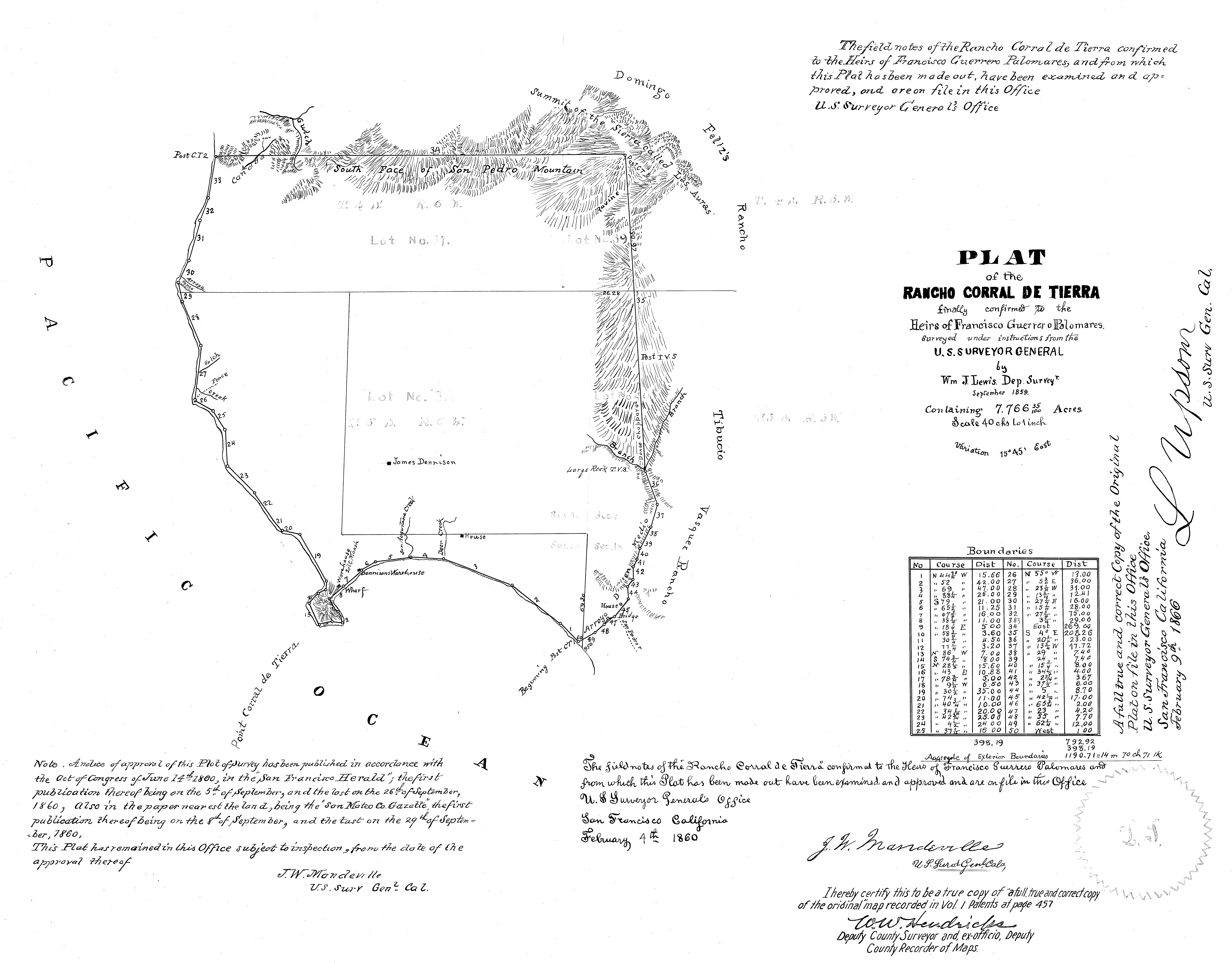
Rancho Corral de Tierra (Guerrero y Palomares) was a Mexican land grant in present-day coastal western San Mateo County, northern California. The larger northern part of Rancho Corral de Tierra was given in 1839 by Governor Pro-Tem Manuel Jimeno to Francisco Guerrero y Palomares. The name means ''earthen corral'' in Spanish. Jimeno granted Tiburcio Vasquez the smaller southern Rancho Corral de Tierra (Vasquez) part. Guerrero y Palomares's northern portion extended from Martini Creek south along the Pacific coast past Montara to Arroyo de en Medio just south of El Granada, and included the present-day communities of Moss Beach, and Princeton-by-the-Sea. Most of its former land grant is now a part of the Golden Gate National Recreation Area. [...More Info...] [...Related Items...] OR: [Wikipedia] [Google] [Baidu] |
Air Force Special Operations Command
Air Force Special Operations Command (AFSOC), headquartered at Hurlburt Field, Florida, is the special operations component of the United States Air Force. An Air Force major command (MAJCOM), AFSOC is also the U.S. Air Force component command to United States Special Operations Command (USSOCOM), a unified combatant command located at MacDill Air Force Base, Florida. AFSOC provides all Air Force Special Operations Forces (SOF) for worldwide deployment and assignment to regional unified combatant commands. Before 1983, Air Force special operations forces were primarily assigned to the Tactical Air Command (TAC) and were generally deployed under the control of U.S. Air Forces in Europe (USAFE) or, as had been the case during the Vietnam War, Pacific Air Forces (PACAF). Just as it had relinquished control of the C-130 theater airlift fleet to Military Airlift Command (MAC) in 1975, TAC relinquished control of Air Force SOF to MAC in December 1982. AFSOC was initially establishe ... [...More Info...] [...Related Items...] OR: [Wikipedia] [Google] [Baidu] |
United States Navy
The United States Navy (USN) is the maritime service branch of the United States Armed Forces and one of the eight uniformed services of the United States. It is the largest and most powerful navy in the world, with the estimated tonnage of its active battle fleet alone exceeding the next 13 navies combined, including 11 allies or partner nations of the United States as of 2015. It has the highest combined battle fleet tonnage (4,635,628 tonnes as of 2019) and the world's largest aircraft carrier fleet, with eleven in service, two new carriers under construction, and five other carriers planned. With 336,978 personnel on active duty and 101,583 in the Ready Reserve, the United States Navy is the third largest of the United States military service branches in terms of personnel. It has 290 deployable combat vessels and more than 2,623 operational aircraft . The United States Navy traces its origins to the Continental Navy, which was established during the American Revo ... [...More Info...] [...Related Items...] OR: [Wikipedia] [Google] [Baidu] |
United States Space Force
The United States Space Force (USSF) is the space service branch of the U.S. Armed Forces, one of the eight U.S. uniformed services, and the world's only independent space force. Along with its sister branch, the U.S. Air Force, the Space Force is part of the Department of the Air Force, one of the three civilian-led military departments within the Department of Defense. The Space Force, through the Department of the Air Force, is overseen by the secretary of the Air Force, a civilian political appointee who reports to the secretary of defense, and is appointed by the president with Senate confirmation. The military head of the Space Force is the chief of space operations who is typically the most senior Space Force officer. The chief of space operations exercises supervision over the Space Force's units and serves as one of the Joint Chiefs of Staff. The Space Force is the smallest U.S. armed service, consisting of 8,400 military personnel. The Space Force operates 77 sp ... [...More Info...] [...Related Items...] OR: [Wikipedia] [Google] [Baidu] |
Vandenberg Air Force Base
Vandenberg may refer to: * Vandenberg (surname), including a list of people with the name * USS General Harry Taylor (AP-145), USNS ''General Hoyt S. Vandenberg'' (T-AGM-10), transport ship in the United States Navy, sank as an artificial reef in Key West, Florida * Vandenberg Space Force Base, a United States military installation with a spaceport * Vandenberg (band), a Dutch hard rock band ** Vandenberg (album), ''Vandenberg'' (album), their 1982 debut album * Vandenberg resolution, a United States Congress resolution passed in 1948 {{disambig ... [...More Info...] [...Related Items...] OR: [Wikipedia] [Google] [Baidu] |
Western Range (USSF)
The Western Range (WR) is the space launch range that supports the major launch head at Vandenberg Space Force Base. Managed by the Space Launch Delta 30, the WR extends from the West Coast of the United States to 90° East longitude in the Indian Ocean where it meets the Eastern Range Operations involve military, government, and commercial interests. The WR has been operated by civilian contractors since its establishment, following the precedent of the Eastern Range. On 1 October 2003, InDyne Inc. took over the range contract from ITT Industries which had operated the range for the previous 44 years. History Navy's Pacific Missile Range (PMR) The Navy established the Naval Missile Facility at Point Arguello (NMFPA) after the transfer from the Army of 19,800 acres from the southern portion of Camp Cooke in May 1958. Camp Cooke was a World War II training and POW facility and a maximum security Disciplinary Barracks site. Cooke Air Force Base, later Vandenberg Space Fo ... [...More Info...] [...Related Items...] OR: [Wikipedia] [Google] [Baidu] |
C Band (IEEE)
The C band is a designation by the Institute of Electrical and Electronics Engineers (IEEE) for a portion of the electromagnetic spectrum in the microwave range of frequencies ranging from 4.0 to 8.0 gigahertz (GHz). However, the U.S. Federal Communications Commission C band proceeding and auction, designated 3.7–4.2 GHz as C band. The C band is used for many satellite communications transmissions, some Wi-Fi devices, some cordless telephones, as well as some Radar and weather radar systems. Use in satellite communication The communications C band was the first frequency band that was allocated for commercial telecommunications via satellites. The same frequencies were already in use for terrestrial microwave radio relay chains. Nearly all C-band communication satellites use the band of frequencies from 3.7 to 4.2 GHz for their downlinks, and the band of frequencies from 5.925 to 6.425 GHz for their uplinks. Note that by using the band from ... [...More Info...] [...Related Items...] OR: [Wikipedia] [Google] [Baidu] |
AN/TPQ-36 Firefinder Radar
Hughes AN/TPQ-36 Firefinder weapon locating system is a mobile radar system developed in the mid-late 1970s by Hughes Aircraft Company and manufactured by Northrop Grumman and ThalesRaytheonSystems, achieving initial operational capability in May 1982. The system is a "weapon-locating radar", designed to detect and track incoming mortar, artillery and rocket fire to determine the point of origin for counter-battery fire. It is currently in service at battalion and higher levels in the United States Army, United States Marine Corps, Australian Army, Portuguese Army, Turkish Army, and the Armed Forces of Ukraine. The radar is typically trailer-mounted and towed by a Humvee. Upgrades Firefinder (V)7 adds a modular azimuth position system (MAPS). MAPS has a north seeking laser gyrocompass and a microprocessor controlled Honeywell H-726 inertial navigation system. Prior Firefinders used a survey team to find site latitude, longitude, and direction to North. With MAPS, reaction ... [...More Info...] [...Related Items...] OR: [Wikipedia] [Google] [Baidu] |


