|
Pfäfers
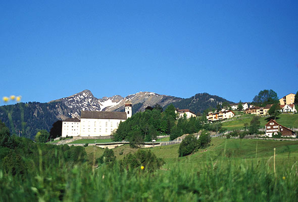
Pfäfers is a municipality in the ''Wahlkreis'' (constituency) of Sarganserland in the canton of St. Gallen in Switzerland. The villages Pfäfers, St. Margrethenberg, Vadura, Valens, Vasön and Vättis belong to the municipality. History The ''Taminatal'' can look back on a long history of settlement. In the ''Drachenloch'' above Vättis stonetools of cavemen and bones of bears, perhaps 50,000 years old, were found. Examples from the find are on display in the local museum in Vättis. Pfäfers reached importance through the foundation of the Benedictine monastery, Pfäfers Abbey, in the first half of the 8th century. It existed for over a thousand years and was closed in 1838. Since 1847 the abbey premises have been used as a mental institution. Pfäfers is first mentioned in 762 as ''abbas de Fabarias''. In 1247 it was mentioned as ''Pheuers'' and in 1288 as ''Pfaevaers''. In Romansh it is known as ''Faveras''. In the 14th century Walser settled in the ''Calfeisental''. U ... [...More Info...] [...Related Items...] OR: [Wikipedia] [Google] [Baidu] |
Pfäfers Abbey
Pfäfers Abbey (german: Kloster Pfäfers), also known as St. Pirminsberg from its position on a mountain, was a Benedictine monastery in Pfäfers near Bad Ragaz, in the canton of St. Gallen, Switzerland. Situated at the junction of the Tamina and Rhine valleys, it flourished as a religious house and owner of lands and serfs, as well as assuming extraordinary importance as a political and cultural centre of the Chur–Raetian region. History Middle Ages According to the chronicles of Hermann of Reichenau, Pfäfers Abbey was founded from Reichenau Abbey in 731, as (Latin for ''bean field''Isaac Taylor, ''Names and Their Histories: A Handbook of Historical Geography and Topographical Nomenclature'', 2nd ed. London: Rivingtons, 1898p. 222 "from a ''fabaria'', or plantation of beans"); the first monks came from Reichenau. The founding legend refers to the itinerant bishop Saint Pirmin, with the first documentary mention of the abbey in 762. The monastery controlled the important ... [...More Info...] [...Related Items...] OR: [Wikipedia] [Google] [Baidu] |
Sarganserland (Wahlkreis)
The Sarganserland is a constituency (''Wahlkreis'') of the canton of St. Gallen, Switzerland, with a population of 36,892 (). The constituency corresponds to the historical county of Sargans (13th to 15th century) and the later '' Landvogtei'' Sargans in the Old Swiss Confederacy (15th to 18th century). Part of the Canton of Linth in the Helvetic Republic, the Sarganserland together with Pfäfers was joined to the canton of St. Gallen at its formation in 1803. Geographically, it includes the land between the Rhine at Sargans (the tripoint of St. Gallen, Grisons and Liechtenstein) and upper Lake Walen, including the Seeztal. The territory of Pfäfers lies along the Tamina, in the Rhine basin, and was not historically part of Sargans county but was independently owned by Pfäfers Abbey, and had been joined to the canton of Linth in 1798. Demographics Sarganserland ''Wahlkreis'' has a population of (as of ). Of the foreign population, (), 373 are from Germany, 854 are from Ital ... [...More Info...] [...Related Items...] OR: [Wikipedia] [Google] [Baidu] |
Bad Ragaz
Bad Ragaz is a municipality in the ''Wahlkreis'' (constituency) of Sarganserland in the canton of St. Gallen in Switzerland. It is the home of a famous natural spring and is a popular spa and health resort destination. History Bad Ragaz is first mentioned ''circa'' 843 as ''Ragaces''. As plain Ragaz, the locality was originally a farming village. It had over the centuries a certain importance owing to its position on the north–south route between Germany and Italy. Its history was closely linked to that of the Benedictine Pfäfers Abbey, an important monastery dating back perhaps to the eighth century, which was the dominant landholder around the village and the principal rights holder. The residence of the Prince Abbot of Pfäfers, a building known as the ''Hof Ragaz'' served as the premises of the local governor or ''Statthalter'', a position exercised by the Abbey. One of the most notable events in the local chronicles is the ''Battle of Ragaz'', an episode in the Old ... [...More Info...] [...Related Items...] OR: [Wikipedia] [Google] [Baidu] |
Landquart, Graubünden
Landquart is a municipality in the Landquart Region in the Swiss canton of Graubünden. It was formed when the municipalities of Igis and Mastrils merged on 1 January 2012 into the new municipality of Landquart.Amtliches Gemeindeverzeichnis der Schweiz published by the Swiss Federal Statistical Office accessed 21 December 2011 The municipality "Landquart" draws its name from a locality in the former municipality of Igis. History Igis is first mentioned about 840 as ''Ovinae/Aviuns''. In 1149 it was mentioned as ''Auuine'', in 1225 as ''Huiuns'' and in 1253 as ''Yges''. Mastrils is first mentioned in 1318 as ''Ponstrils''. In 1345 it was mentioned as ''Bastrils''. Geog ...
|
Stausee Mapragg
Stausee Mapragg (''Mapragg reservoir'') is located at Pfäfers in the Canton of St. Gallen The canton of St. Gallen, also canton of St Gall (german: link=no, Kanton St. Gallen ; rm, Chantun Son Gagl; french: Canton de Saint-Gall; it, Canton San Gallo), is a canton of Switzerland. The capital is St. Gallen. Located in northeaste ..., Switzerland. Its surface area is . The reservoir and Gigerwaldsee are operated by Kraftwerke Sarganserwald ( NOK group) for pumped-storage hydroelectricity. See also * List of mountain lakes of Switzerland External linksSwissdams: Mapgragg* company informationKraftwerke Sarganserland visitor informationscheme Lakes of the canton of St. Gallen Mapragg {{StGallen-geo-stub ... [...More Info...] [...Related Items...] OR: [Wikipedia] [Google] [Baidu] |
Chur
, neighboring_municipalities= Arosa, Churwalden, Tschiertschen-Praden, Domat/Ems, Felsberg, Malix, Trimmis, Untervaz, Pfäfers , twintowns = Bad Homburg (Germany), Cabourg (France), Mayrhofen (Austria), Mondorf-les-Bains (Luxembourg), Terracina (Italy) '' Chur (, locally ; it, Coira ; rm, label=Sursilvan, Cuera ; rm, label= Vallader, Cuoira ; rm, label= Puter and Rumantsch Grischun, Cuira ; rm, label= Surmiran, Coira; rm, label=Sutsilvan, Cuera or ; french: Coire ) la, CVRIA, and . is the capital and largest town of the Swiss canton of the Grisons and lies in the Grisonian Rhine Valley, where the Rhine turns towards the north, in the northern part of the canton. The city, which is located on the right bank of the Rhine, is reputedly the oldest town of Switzerland. The official language of Chur is German,In this context, the term "German" is used as an umbrella term for any variety of German. A person is allowed to communicate with the authorities by us ... [...More Info...] [...Related Items...] OR: [Wikipedia] [Google] [Baidu] |
Gigerwaldsee
Gigerwaldsee is a reservoir in the municipality of Pfäfers, in the Canton of St. Gallen, Switzerland. The reservoir has a volume of 35.6 million m³ and a surface area of . The arch dam Gigerwald was completed in 1976. It has a height of 147 m. See also *List of lakes of Switzerland *List of mountain lakes of Switzerland This is a list of high-altitude lakes in Switzerland. It includes all significant lakes, natural or artificial, with an area over 4 hectares and a height over 800 metres above sea level. This height approximately corresponds to the transiti ... External links * Lakes of the canton of St. Gallen Reservoirs in Switzerland Arch dams {{StGallen-lake-stub ... [...More Info...] [...Related Items...] OR: [Wikipedia] [Google] [Baidu] |
Mels
Mels is a municipality in the ''Wahlkreis'' (constituency) of Sarganserland in the Seeztal, canton of St. Gallen, Switzerland. History Mels is first mentioned in 765 as ''Maile'' though this comes from a later copy of the original document. In 1018 it was mentioned as ''Meilis''. Geography Mels has an area, , of . Of this area, 42.6% is used for agricultural purposes, while 29.3% is forested. Of the rest of the land, 2.6% is settled (buildings or roads) and the remainder (25.5%) is non-productive (rivers or lakes). The municipality is located in the Sarganserland ''Wahlkreis''. In terms of area, it is the largest municipality in the canton and covers the Weisstannen valley and a part of the Seez valley. Northwest of town is ''Castels'' hill and west of the Nidberg is Castels fortress. It consists of the village of Mels, the settlements of Heiligkreuz bei Mels, Plons, Ragnatsch, the hamlets of Butz, St. Martin, Mädris and Tils, the alpine settlement of Vermol as well as ... [...More Info...] [...Related Items...] OR: [Wikipedia] [Google] [Baidu] |
Tamins
Tamins ( rm, Tumein) is a village and a municipality in the Imboden Region in the Swiss canton of Graubünden. History Tamins is first mentioned in 1224 as ''Tuminne''. In 1225 it was mentioned as ''Tvminnis'' and in 1399 as ''Tumins''. Geography Tamins has an area, , of . Of this area, 16.5% is used for agricultural purposes, while 50.1% is forested. Of the rest of the land, 1.4% is settled (buildings or roads) and the remainder (32%) is non-productive (rivers, glaciers or mountains). Before 2017, the municipality was located in the Trins sub-district, of the Imboden district, after 2017 it was part of the Imboden Region. It is a small settlement north of the confluence of the Hinterrhein and Vorderrhein. It consists of the village of Tamins and since 1803 the village of Reichenau at the confluence of Hinterrhein and Vorderrhein and the Castle (Schloss) of Reichenau. is located in the municipality. Demographics Tamins has a population (as of ) of . , 13.0% of the p ... [...More Info...] [...Related Items...] OR: [Wikipedia] [Google] [Baidu] |
Trin
Trin is a municipality in the Imboden Region in the Swiss canton of Graubünden. Crestasee is located in Trin. History Trin is first mentioned in the 12th Century as ''Turunnio''. Geography Trin is perched on the mountain-side above the Rhine valley on the road between Domat/Ems and Flims. The village of Mulin (also in the municipality) is at the foot of the slope on the edge of the valley. Trin has an area, , of . Of this area, 33.2% is used for agricultural purposes, while 24.3% is forested. Of the rest of the land, 1.7% is settled (buildings or roads) and the remainder (40.8%) is non-productive (rivers, glaciers or mountains). Before 2017, the municipality was located in the Trins sub-district of the Imboden district, after 2017 it was part of the Imboden Region. It consists of the villages of Trin, Digg and Mulin. Until 1943 Trin was known as Trins. [...More Info...] [...Related Items...] OR: [Wikipedia] [Google] [Baidu] |
Untervaz
Untervaz is a municipality in the Landquart Region in the Swiss canton of Graubünden. History Untervaz is first mentioned between 768-800 as ''Uaze''. Between 801-850 it was mentioned as ''Vazes'' and between 1210-1300 it was called ''Vatz inferiore''. Geography Untervaz has an area, , of . Of this area, 40% is used for agricultural purposes, while 46.9% is forested. Of the rest of the land, 4.8% is settled (buildings or roads) and the remainder (8.2%) is non-productive (rivers, glaciers or mountains). Before 2017, the municipality was located in the Fünf Dörfer sub-district of the Landquart district, after 2017 it was part of the Landquart Region. It is on the eastern foot of the Calanda mountains and is in the ''Churer Rheintal'' (Chur branch of the Rhine valley). Demographics Untervaz has a population (as of ) of . , 9.0% of the population was made up of foreign nationals. Over the last 10 years the population has grown at a rate of 14.1%. Most of the population ( ... [...More Info...] [...Related Items...] OR: [Wikipedia] [Google] [Baidu] |
Glarus Süd
Glarus Süd is a municipality in the Swiss canton of Glarus. It comprises the upper Linth valley, and the entire Sernf valley, and includes the villages of Betschwanden, Braunwald, Diesbach, Elm, Engi, Haslen, Hätzingen, Leuggelbach, Linthal, Luchsingen, Matt, Mitlödi, Nidfurn, Rüti, Schwanden, Schwändi and Sool. Glarus Süd is one of three municipalities of the canton of Glarus, the others being Glarus and Glarus Nord. History The municipality of Glarus Süd was created on 1 January 2011, incorporating the former municipalities of Betschwanden, Braunwald, Elm, Engi, Haslen, Linthal, Luchsingen, Matt, Mitlödi, Rüti, Schwanden, Schwändi and Sool. At the time of its creation, Glarus Süd was the largest Swiss municipality by area. As of 1 January 2015, it was overtaken in size by the expanded municipality of Scuol in the canton of Graubünden. Geography Glarus Süd incorporates all of the valley of the Linth river from Mitlödi, just upstre ... [...More Info...] [...Related Items...] OR: [Wikipedia] [Google] [Baidu] |


