|
Pfaffenberg (Hohenstein-Ernstthal)
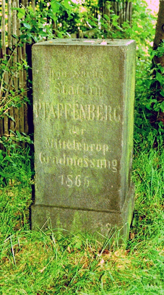
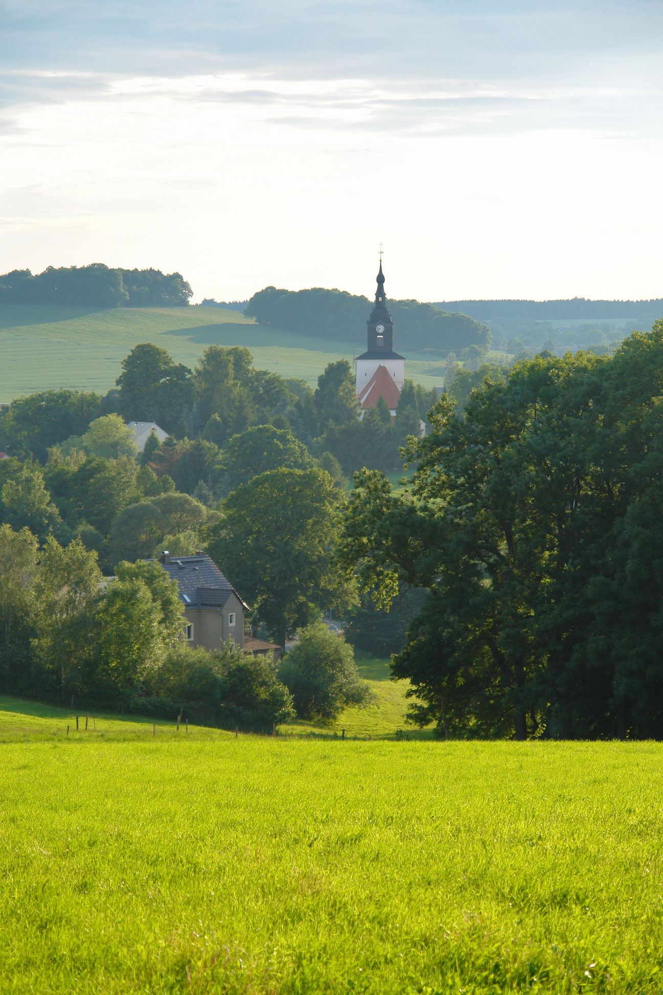
Pfaffenberg is a mountain in Hohenstein-Ernstthal in the state of Saxony, southeastern Germany. It is part of the Saxon Uplands. In the 1860s, the Royal Saxon Triangulation In trigonometry and geometry, triangulation is the process of determining the location of a point by forming triangles to the point from known points. Applications In surveying Specifically in surveying, triangulation involves only angle me ... operated station number 16 on the Pfaffenberg. The triangulation point is still visible. Mountains of Saxony {{Saxony-geo-stub ... [...More Info...] [...Related Items...] OR: [Wikipedia] [Google] [Baidu] |
Saxony
Saxony (german: Sachsen ; Upper Saxon: ''Saggsn''; hsb, Sakska), officially the Free State of Saxony (german: Freistaat Sachsen, links=no ; Upper Saxon: ''Freischdaad Saggsn''; hsb, Swobodny stat Sakska, links=no), is a landlocked state of Germany, bordering the states of Brandenburg, Saxony-Anhalt, Thuringia, Bavaria, as well as the countries of Poland and the Czech Republic. Its capital is Dresden, and its largest city is Leipzig. Saxony is the tenth largest of Germany's sixteen states, with an area of , and the sixth most populous, with more than 4 million inhabitants. The term Saxony has been in use for more than a millennium. It was used for the medieval Duchy of Saxony, the Electorate of Saxony of the Holy Roman Empire, the Kingdom of Saxony, and twice for a republic. The first Free State of Saxony was established in 1918 as a constituent state of the Weimar Republic. After World War II, it was under Soviet occupation before it became part of the communist East Ger ... [...More Info...] [...Related Items...] OR: [Wikipedia] [Google] [Baidu] |
Germany
Germany,, officially the Federal Republic of Germany, is a country in Central Europe. It is the second most populous country in Europe after Russia, and the most populous member state of the European Union. Germany is situated between the Baltic and North seas to the north, and the Alps to the south; it covers an area of , with a population of almost 84 million within its 16 constituent states. Germany borders Denmark to the north, Poland and the Czech Republic to the east, Austria and Switzerland to the south, and France, Luxembourg, Belgium, and the Netherlands to the west. The nation's capital and most populous city is Berlin and its financial centre is Frankfurt; the largest urban area is the Ruhr. Various Germanic tribes have inhabited the northern parts of modern Germany since classical antiquity. A region named Germania was documented before AD 100. In 962, the Kingdom of Germany formed the bulk of the Holy Roman Empire. During the 16th ce ... [...More Info...] [...Related Items...] OR: [Wikipedia] [Google] [Baidu] |
Hohenstein-Ernstthal
Hohenstein-Ernstthal () is a town in the Zwickau rural district, Saxony, Germany. The towns of Hohenstein and Ernstthal were united in 1898, and the town is either known by its hyphenated form, or simply called Hohenstein. The town grew in the 15th century after silver mines were established nearby. Ernstthal was named in honor of August Ernst von Schoenburg. Physicist Gotthilf Heinrich von Schubert and inventor Christoph Gottlieb Schröter were born in Hohenstein. The writer Karl May was born in Ernstthal. The house of his birth is a museum. Furthermore, Hohenstein-Ernstthal is especially famous for the Sachsenring racing circuit. History In the 15th century, the town of Hohenstein was established after silver was found and mined there. The name is said to be derived from the phrase ″uff dem hohen Stein″ (on the high rock), that the first settlers used when they saw the Pfaffenberg mountain. In 1680 some people from Hohenstein moved to the forest near the town to escape t ... [...More Info...] [...Related Items...] OR: [Wikipedia] [Google] [Baidu] |
Saxon Uplands
The Saxon Uplands, Saxon HillsElkins, T H (1972). ''Germany'' (3rd ed.). London: Chatto & Windus, 1972. . or Ore Mountain Foreland (german: Erzgebirgsvorland}) is a strip of countryside of about 200 m to high, in the German state of Saxony, that lies immediately north of the German Ore Mountains and runs mainly through the areas of Zwickauer Land, Zwickau, Chemnitzer Land, Chemnitz, Mittelsachsen and the country south of Dresden. It borders on the Upper Pleißeland to the extreme west, the Ore Mountain Basin in the south and the Mulde Loess Hills to the north and east. Immediately north of the Western and Central Ore Mountains lie the cities of Zwickau and Chemnitz in the Ore Mountain Basin, whose western extension, the ''Upper Pleißeland'' is usually considered part of the basin today. Northeast of Chemnitz a narrow strip of land, the ''Mulde Loess Hills'' (''Mulde-Lösshügelland'') is squeezed in between the Dresden Basin (''Elbtalkessel'') and the eastern section of the Ore M ... [...More Info...] [...Related Items...] OR: [Wikipedia] [Google] [Baidu] |
Triangulation
In trigonometry and geometry, triangulation is the process of determining the location of a point by forming triangles to the point from known points. Applications In surveying Specifically in surveying, triangulation involves only angle measurements at known points, rather than measuring distances to the point directly as in trilateration; the use of both angles and distance measurements is referred to as triangulateration. In computer vision Computer stereo vision and optical 3D measuring systems use this principle to determine the spatial dimensions and the geometry of an item. Basically, the configuration consists of two sensors observing the item. One of the sensors is typically a digital camera device, and the other one can also be a camera or a light projector. The projection centers of the sensors and the considered point on the object's surface define a (spatial) triangle. Within this triangle, the distance between the sensors is the base ''b'' and must be known. ... [...More Info...] [...Related Items...] OR: [Wikipedia] [Google] [Baidu] |
Station Pfaffenberg
Station may refer to: Agriculture * Station (Australian agriculture), a large Australian landholding used for livestock production * Station (New Zealand agriculture), a large New Zealand farm used for grazing by sheep and cattle ** Cattle station, a cattle-rearing station in Australia or New Zealand **Sheep station, a sheep-rearing station in Australia or New Zealand Communications * Radio communication station, a radio frequency communication station of any kind, including audio, TV, and non-broadcast uses ** Radio broadcasting station, an audio station intended for reception by the general public ** Amateur radio station, a station operating on frequencies allocated for ham or other non-commercial use ** Broadcast relay station ** Ground station (or Earth station), a terrestrial radio station for extraplanetary telecommunication with satellites or spacecraft ** Television station * Courier station, a relay station in a courier system ** Station of the ''cursus publicus'', a sta ... [...More Info...] [...Related Items...] OR: [Wikipedia] [Google] [Baidu] |


