|
Permin
The Permin is a bay in the Saaler Bodden lagoon south of Wustrow in northeast Germany. Originally, the Permin was a channel between the Saaler Bodden and the Baltic Sea and the southern estuarine channel of the River Recknitz. It borders on the Fischland in the south.''Seehäfen'' at fischland-darss-zingst.net. Retrieved 7 January 2022. Because the Permin was navigable in the 13th and 14th centuries with average water depths of around 2 to 3 metres, it formed an important waterway for trade to and from the towns of Ribnitz and Barth, although its navigability was frequently degraded by storms and silting u ... [...More Info...] [...Related Items...] OR: [Wikipedia] [Google] [Baidu] |
Bodden
Bodden are briny bodies of water often forming lagoons, along the southwestern shores of the Baltic Sea, primarily in Germany's state of Mecklenburg-Vorpommern. These lagoons can be found especially around the island of Rügen, Usedom and the Fischland-Darss-Zingst peninsula. Some of them are protected reserves, forming the Western Pomerania Lagoon Area National Park. They have a distinctive geological origin and are enclosed by peninsulae, spits and islands, leaving only narrow connections to adjacent bodden or the open sea. Freshwater inflow from the mainland and saltwater inflow from the open sea, which depends on wind direction and force as well as the proximity of the bodden to the sea, result in fluctuating salt gradients and distinctive ecosystems. During the Littorina Sea transgression, an island archipelago was formed by the carving of narrow glacial basins and channels resulting from meltwater. Bodden were formed in a comparatively short period between spits and ... [...More Info...] [...Related Items...] OR: [Wikipedia] [Google] [Baidu] |
Saaler Bodden
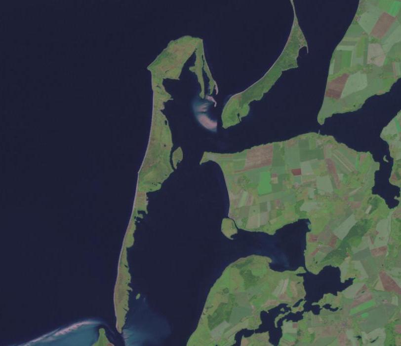
The Saaler Bodden forms the southwestern part of the Darss-Zingst Bodden Chain and lies east of the Fischland peninsula about 30 kilometres northeast of Rostock.''Die General Karte No. 1 - Schwerin-Rostock-Rügen'', 1:200,000 scale, Mairs Geographische Verlag/Falk Verlag, Ostfildern, 2008. Its average depth is around two metres, which restricts angling and the use of pleasure craft. It is a lagoon-like stretch of water known as a ''bodden'', which is typical of this part of the Baltic coastline. South of the Saaler Bodden is the town of Ribnitz-Damgarten, which is divided into two by the mouth of the 72 kilometre long Recknitz river. This southern part of the ''bodden'' is called the Lake Ribnitz (''Ribnitzer See''). Apart from the Recknitz near Damgarten, the other streams that empty into the Ribnitzer See are the ''Klosterbach'' near Ribnitz and ''Körkwitzer Bach'' and ''Fischergraben'' near Körkwitz. A stream called the ''Saaler Bach'' (in its lower reaches known as the '' ... [...More Info...] [...Related Items...] OR: [Wikipedia] [Google] [Baidu] |
Fischland Luftbild
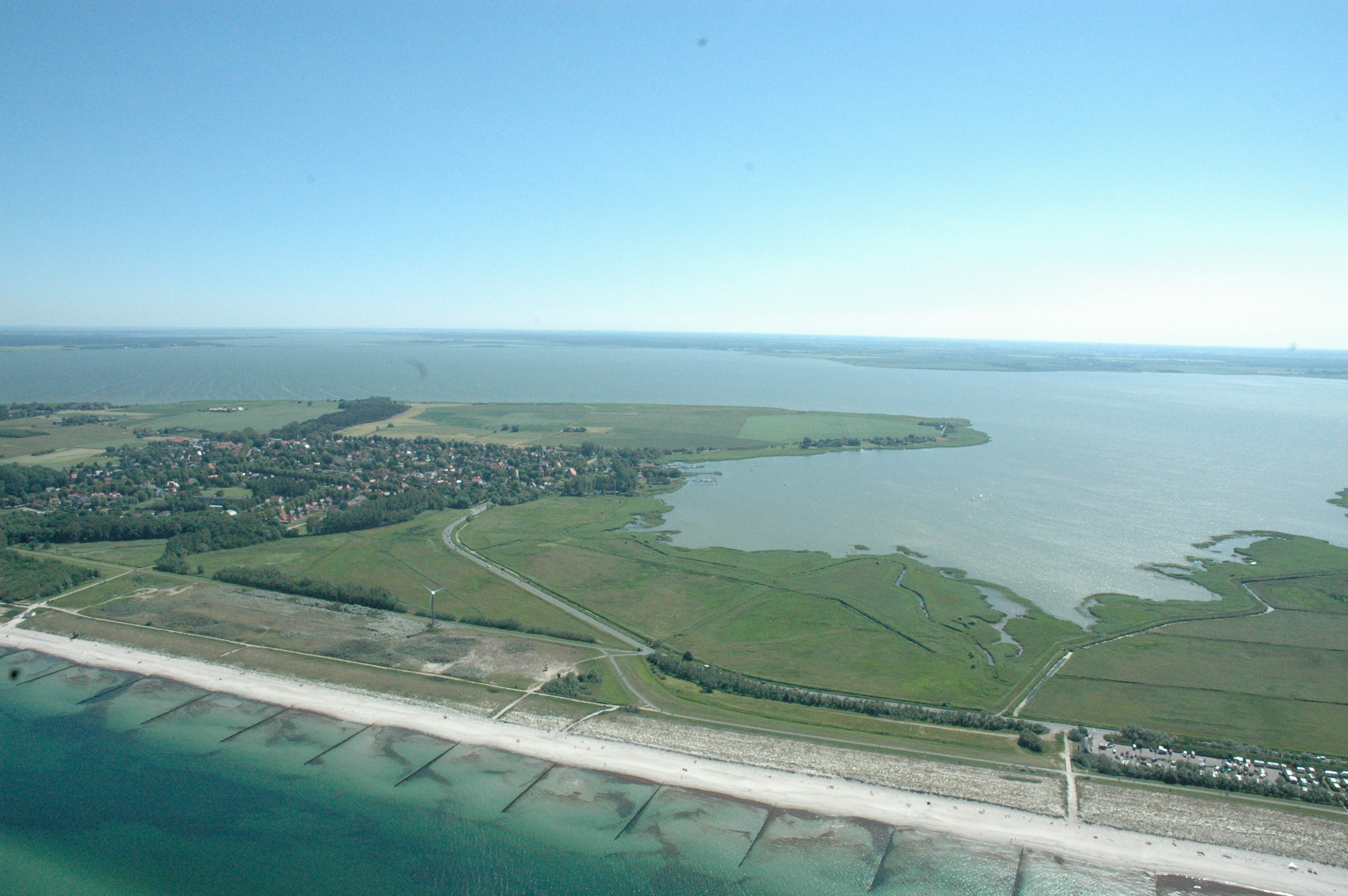
Fischland (literally "fish land") is an isthmus on the southern Baltic Sea coast on the Bay of Mecklenburg in northeastern Germany. It is part of the peninsula of Fischland-Darß-Zingst. Fischland was an island until the 14th century and was bounded by the navigable estuarine branches of the River Recknitz: the Permin in the south and the Loop in the north. In more recent times its southern boundary has usually been considered to be the Recknitz Meadowland (''Recknitzer Stadtwiesen'') and the Rostock Heath (''Rostocker Heide''). To the west and east its boundaries are more obvious: on the one side is its active cliffed coast on the Baltic, and on the other the coastline alongside the Saaler Bodden, only a few centimetres above sea level. Fischland is about 5 km long, between 500 metres and 2 km wide and runs from southwest to northeast. The Pleistocene island core, which is subjected to marked changes as a result of water and wind action, consists of glacial san ... [...More Info...] [...Related Items...] OR: [Wikipedia] [Google] [Baidu] |
Loop (channel)
The Loop or Darss Canal (''Darßer Kanal'') was an inlet of the sea between the lagoon known as the ''Saaler Bodden'' and the Baltic Sea near Ahrenshoop on the German coast. It formed the northern boundary of the region of Fischland. Originally the Loop was the northern estuarine branch of the River Recknitz. The old inlet ran between the present villages of Ahrenshoop and Althagen. The Loop was roughly two metres deep and had posts for mooring boats and barges. Its navigability was frequently curtailed by storms and silting up. Today only a small ditch remains on the former Mecklenburg-Pomeranian border, which runs alongside a main road, the so-called ''Grenzweg'' ("border way"). The cartographer and court astronomer at the Mecklenburg court, Tilemann Stella, described the Loop thus: ''"Between the village of Oldenhagen lthagenand the Arnshope hrenshoop the waters of the Ribnitz river and lake break through into the salty sea. Beyond the beach is a large pile of rock and br ... [...More Info...] [...Related Items...] OR: [Wikipedia] [Google] [Baidu] |
Fischland
Fischland (literally "fish land") is an isthmus on the southern Baltic Sea coast on the Bay of Mecklenburg in northeastern Germany. It is part of the peninsula of Fischland-Darß-Zingst. Fischland was an island until the 14th century and was bounded by the navigable estuarine branches of the River Recknitz: the Permin in the south and the Loop in the north. In more recent times its southern boundary has usually been considered to be the Recknitz Meadowland (''Recknitzer Stadtwiesen'') and the Rostock Heath (''Rostocker Heide''). To the west and east its boundaries are more obvious: on the one side is its active cliffed coast on the Baltic, and on the other the coastline alongside the Saaler Bodden, only a few centimetres above sea level. Fischland is about 5 km long, between 500 metres and 2 km wide and runs from southwest to northeast. The Pleistocene island core, which is subjected to marked changes as a result of water and wind action, consists of glacial san ... [...More Info...] [...Related Items...] OR: [Wikipedia] [Google] [Baidu] |
Bays Of The Baltic Sea
A bay is a recessed, coastal body of water that directly connects to a larger main body of water, such as an ocean, a lake, or another bay. A large bay is usually called a gulf, sea, sound, or bight. A cove is a small, circular bay with a narrow entrance. A fjord is an elongated bay formed by glacial action. A bay can be the estuary of a river, such as the Chesapeake Bay, an estuary of the Susquehanna River. Bays may also be nested within each other; for example, James Bay is an arm of Hudson Bay in northeastern Canada. Some large bays, such as the Bay of Bengal and Hudson Bay, have varied marine geology. The land surrounding a bay often reduces the strength of winds and blocks waves. Bays may have as wide a variety of shoreline characteristics as other shorelines. In some cases, bays have beaches, which "are usually characterized by a steep upper foreshore with a broad, flat fronting terrace".Maurice Schwartz, ''Encyclopedia of Coastal Science'' (2006), p. 129. Bays were ... [...More Info...] [...Related Items...] OR: [Wikipedia] [Google] [Baidu] |
Bays Of Mecklenburg-Western Pomerania
A bay is a recessed, coastal body of water that directly connects to a larger main body of water, such as an ocean, a lake, or another bay. A large bay is usually called a gulf, sea, sound, or bight. A cove is a small, circular bay with a narrow entrance. A fjord is an elongated bay formed by glacial action. A bay can be the estuary of a river, such as the Chesapeake Bay, an estuary of the Susquehanna River. Bays may also be nested within each other; for example, James Bay is an arm of Hudson Bay in northeastern Canada. Some large bays, such as the Bay of Bengal and Hudson Bay, have varied marine geology. The land surrounding a bay often reduces the strength of winds and blocks waves. Bays may have as wide a variety of shoreline characteristics as other shorelines. In some cases, bays have beaches, which "are usually characterized by a steep upper foreshore with a broad, flat fronting terrace".Maurice Schwartz, ''Encyclopedia of Coastal Science'' (2006), p. 129. Bays were ... [...More Info...] [...Related Items...] OR: [Wikipedia] [Google] [Baidu] |
Fischland-Darß-Zingst
Fischland-Darß-Zingst or Fischland-Darss-Zingst at www.fischland-darss-zingst.net. Accessed on 18 Dec 2011. is a long in the coastal district of , in the German state of . The three parts of the peninsula, from ... [...More Info...] [...Related Items...] OR: [Wikipedia] [Google] [Baidu] |
Stream
A stream is a continuous body of surface water flowing within the bed and banks of a channel. Depending on its location or certain characteristics, a stream may be referred to by a variety of local or regional names. Long large streams are usually called rivers, while smaller, less voluminous and more intermittent streams are known as streamlets, brooks or creeks. The flow of a stream is controlled by three inputs – surface runoff (from precipitation or meltwater), daylighting (streams), daylighted subterranean river, subterranean water, and surfaced groundwater (Spring (hydrology), spring water). The surface and subterranean water are highly variable between periods of rainfall. Groundwater, on the other hand, has a relatively constant input and is controlled more by long-term patterns of precipitation. The stream encompasses surface, subsurface and groundwater fluxes that respond to geological, geomorphological, hydrological and biotic controls. Streams are importan ... [...More Info...] [...Related Items...] OR: [Wikipedia] [Google] [Baidu] |
1872 Baltic Sea Flood
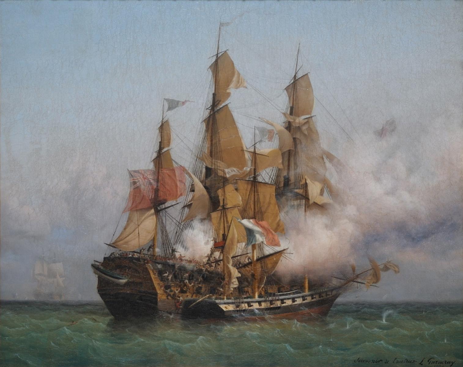
The 1872 Baltic Sea flood (german: Ostseesturmhochwasser 1872), often referred to as a storm flood, ravaged the Baltic Sea coast from Denmark to Pomerania, also affecting Sweden, during the night between 12 and 13 November 1872 and was, until then, the worst storm surge in the Baltic. The highest recorded peak water level was about 3.3 m above sea level (NN). Course In the days before the storm tide, a storm blew from the southwest across the Baltic that drove the sea towards Finland and ''Balticum''. The result was flooding there and extreme low water levels on the Danish-German coastlines. As a result, large quantities of water were able to flow into the western Baltic from the North Sea. The storm increased in strength, and changed direction. The winds now blew from the northeast, and drove the water masses back in a south-westerly direction. Because the water could only flow slowly back into the North Sea, huge waves caught coastal dwellers by surprise on the morning ... [...More Info...] [...Related Items...] OR: [Wikipedia] [Google] [Baidu] |
Privateering
A privateer is a private person or ship that engages in maritime warfare under a commission of war. Since robbery under arms was a common aspect of seaborne trade, until the early 19th century all merchant ships carried arms. A sovereign or delegated authority issued commissions, also referred to as a letter of marque, during wartime. The commission empowered the holder to carry on all forms of hostility permissible at sea by the usages of war. This included attacking foreign vessels and taking them as prizes, and taking prize crews as prisoners for exchange. Captured ships were subject to condemnation and sale under prize law, with the proceeds divided by percentage between the privateer's sponsors, shipowners, captains and crew. A percentage share usually went to the issuer of the commission (i.e. the sovereign). Privateering allowed sovereigns to raise revenue for war by mobilizing privately owned armed ships and sailors to supplement state power. For participants, privateeri ... [...More Info...] [...Related Items...] OR: [Wikipedia] [Google] [Baidu] |
Ahrenshoop
Ahrenshoop is a municipality in the Vorpommern-Rügen district, in Mecklenburg-Vorpommern, Germany on the Fischland-Darß-Zingst peninsula of the Baltic Sea. It used to be a small fishing village, but is today known for its tourism and as a holiday resort. Early history Ahrenshoop was first mentioned in 1311 as the defining point of the border of the town of Ribnitz´s property. In 1328 Duke Heinrich II of Mecklenburg donated the area east of this border to the monastery of Ribnitz. In 1395 forces of the City of Rostock destroyed a stronghold, built by Bogislaw VI. of Pomerania, and the harbour of Ahrenshoop. In 1591 the border between Mecklenburg and Pomerania was defined, which runs through the village, still existing today as the "Grenzweg" (border road). After the Treaty of Westphalia in 1648 the Eastern part of the village became part of Swedish Pomerania until 1815, when Sweden ceded Pomerania to Prussia. Until the Grand Duchy of Mecklenburg-Schwerin joined the German Zo ... [...More Info...] [...Related Items...] OR: [Wikipedia] [Google] [Baidu] |



.png)
_nahe_dem_Weiherdamm_in_Wildbergerhütte.jpg)
