|
Loop (channel)
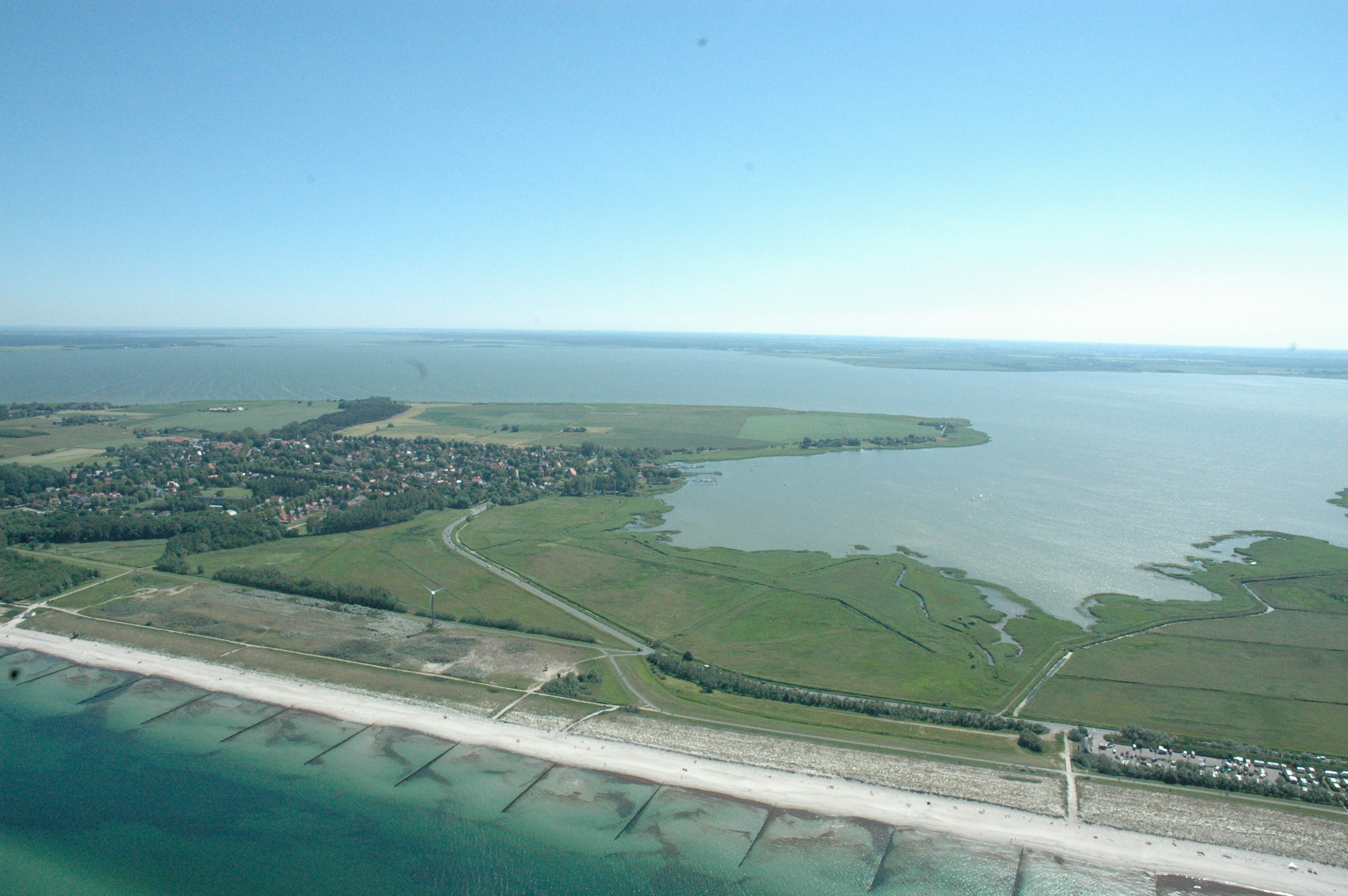
The Loop or Darss Canal (''Darßer Kanal'') was an inlet of the sea between the lagoon known as the ''Saaler Bodden'' and the Baltic Sea near Ahrenshoop on the German coast. It formed the northern boundary of the region of Fischland. Originally the Loop was the northern estuarine branch of the River Recknitz. The old inlet ran between the present villages of Ahrenshoop and Althagen. The Loop was roughly two metres deep and had posts for mooring boats and barges. Its navigability was frequently curtailed by storms and silting up. Today only a small ditch remains on the former Mecklenburg-Pomeranian border, which runs alongside a main road, the so-called ''Grenzweg'' ("border way"). The cartographer and court astronomer at the Mecklenburg court, Tilemann Stella, described the Loop thus: ''"Between the village of Oldenhagen lthagenand the Arnshope hrenshoop the waters of the Ribnitz river and lake break through into the salty sea. Beyond the beach is a large pile of rock and br ... [...More Info...] [...Related Items...] OR: [Wikipedia] [Google] [Baidu] |
Ahrenshoop 1813
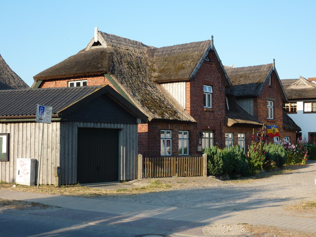
Ahrenshoop is a municipality in the Vorpommern-Rügen district, in Mecklenburg-Vorpommern, Germany on the Fischland-Darß-Zingst peninsula of the Baltic Sea. It used to be a small fishing village, but is today known for its tourism and as a holiday resort. Early history Ahrenshoop was first mentioned in 1311 as the defining point of the border of the town of Ribnitz´s property. In 1328 Duke Heinrich II of Mecklenburg donated the area east of this border to the monastery of Ribnitz. In 1395 forces of the City of Rostock destroyed a stronghold, built by Bogislaw VI. of Pomerania, and the harbour of Ahrenshoop. In 1591 the border between Mecklenburg and Pomerania was defined, which runs through the village, still existing today as the "Grenzweg" (border road). After the Treaty of Westphalia in 1648 the Eastern part of the village became part of Swedish Pomerania until 1815, when Sweden ceded Pomerania to Prussia. Until the Grand Duchy of Mecklenburg-Schwerin joined the German ... [...More Info...] [...Related Items...] OR: [Wikipedia] [Google] [Baidu] |
Saaler Bodden
The Saaler Bodden forms the southwestern part of the Darss-Zingst Bodden Chain and lies east of the Fischland peninsula about 30 kilometres northeast of Rostock.''Die General Karte No. 1 - Schwerin-Rostock-Rügen'', 1:200,000 scale, Mairs Geographische Verlag/Falk Verlag, Ostfildern, 2008. Its average depth is around two metres, which restricts angling and the use of pleasure craft. It is a lagoon-like stretch of water known as a ''bodden'', which is typical of this part of the Baltic coastline. South of the Saaler Bodden is the town of Ribnitz-Damgarten, which is divided into two by the mouth of the 72 kilometre long Recknitz river. This southern part of the ''bodden'' is called the Lake Ribnitz (''Ribnitzer See''). Apart from the Recknitz near Damgarten, the other streams that empty into the Ribnitzer See are the ''Klosterbach'' near Ribnitz and ''Körkwitzer Bach'' and ''Fischergraben'' near Körkwitz. A stream called the ''Saaler Bach'' (in its lower reaches known as the '' ... [...More Info...] [...Related Items...] OR: [Wikipedia] [Google] [Baidu] |
Baltic Sea
The Baltic Sea is an arm of the Atlantic Ocean that is enclosed by Denmark, Estonia, Finland, Germany, Latvia, Lithuania, Poland, Russia, Sweden and the North and Central European Plain. The sea stretches from 53°N to 66°N latitude and from 10°E to 30°E longitude. A marginal sea of the Atlantic, with limited water exchange between the two water bodies, the Baltic Sea drains through the Danish Straits into the Kattegat by way of the Øresund, Great Belt and Little Belt. It includes the Gulf of Bothnia, the Bay of Bothnia, the Gulf of Finland, the Gulf of Riga and the Bay of Gdańsk. The "Baltic Proper" is bordered on its northern edge, at latitude 60°N, by Åland and the Gulf of Bothnia, on its northeastern edge by the Gulf of Finland, on its eastern edge by the Gulf of Riga, and in the west by the Swedish part of the southern Scandinavian Peninsula. The Baltic Sea is connected by artificial waterways to the White Sea via the White Sea–Baltic Canal and to ... [...More Info...] [...Related Items...] OR: [Wikipedia] [Google] [Baidu] |
Ahrenshoop
Ahrenshoop is a municipality in the Vorpommern-Rügen district, in Mecklenburg-Vorpommern, Germany on the Fischland-Darß-Zingst peninsula of the Baltic Sea. It used to be a small fishing village, but is today known for its tourism and as a holiday resort. Early history Ahrenshoop was first mentioned in 1311 as the defining point of the border of the town of Ribnitz´s property. In 1328 Duke Heinrich II of Mecklenburg donated the area east of this border to the monastery of Ribnitz. In 1395 forces of the City of Rostock destroyed a stronghold, built by Bogislaw VI. of Pomerania, and the harbour of Ahrenshoop. In 1591 the border between Mecklenburg and Pomerania was defined, which runs through the village, still existing today as the "Grenzweg" (border road). After the Treaty of Westphalia in 1648 the Eastern part of the village became part of Swedish Pomerania until 1815, when Sweden ceded Pomerania to Prussia. Until the Grand Duchy of Mecklenburg-Schwerin joined the German Zo ... [...More Info...] [...Related Items...] OR: [Wikipedia] [Google] [Baidu] |
Fischland
Fischland (literally "fish land") is an isthmus on the southern Baltic Sea coast on the Bay of Mecklenburg in northeastern Germany. It is part of the peninsula of Fischland-Darß-Zingst. Fischland was an island until the 14th century and was bounded by the navigable estuarine branches of the River Recknitz: the Permin in the south and the Loop in the north. In more recent times its southern boundary has usually been considered to be the Recknitz Meadowland (''Recknitzer Stadtwiesen'') and the Rostock Heath (''Rostocker Heide''). To the west and east its boundaries are more obvious: on the one side is its active cliffed coast on the Baltic, and on the other the coastline alongside the Saaler Bodden, only a few centimetres above sea level. Fischland is about 5 km long, between 500 metres and 2 km wide and runs from southwest to northeast. The Pleistocene island core, which is subjected to marked changes as a result of water and wind action, consists of glacial san ... [...More Info...] [...Related Items...] OR: [Wikipedia] [Google] [Baidu] |
River Recknitz
The Recknitz (historically known as ''Raxa'') is a river in Mecklenburg-Vorpommern in northeastern Germany. The Recknitz's U-shaped valley, glacial valley stretches as far south as the heights at Glasewitz near Güstrow. The river has no definite source, but rather builds up from streams and drainage ditches. The ditches of the ''Schaalbeke'' and ''Pludderbach'' have their water flow split between Liessow and Laage, but most of the water flows north as the Recknitz, while the lesser flow, called the ''Augraben'', runs south to the river Nebel. The lower Recknitz (from Ribnitz-Damgarten to Bad Sülze) is the historic boundary between Mecklenburg and Vorpommern. Nowadays, however, it is only a boundary between the Mecklenburg Regional Evangelical-Lutheran Church and the Pomeranian Evangelical Church. Starting at Tessin, Germany, Tessin, the Recknitz is navigable by canoe the year round. A number of measures have been undertaken along the river's course to restore the natural environ ... [...More Info...] [...Related Items...] OR: [Wikipedia] [Google] [Baidu] |
Althagen
The village of Althagen on the peninsula of Fischland-Darß-Zingst in the German state of Mecklenburg-Vorpommern has been a part of the municipality of Ahrenshoop since 1950. Until 1945, the border between Mecklenburg and Pomerania ran between Althagen and Ahrenshoop along the border road, ''Grenzweg''. The Bakelberg knoll lies close to the steep coast of Althagen/ Niehagen. At 17.9 metres above sea level, it is the highest point on Fischland. Althagen has a port on the bodden coast. at www.ostseebad-ahrenshoop.de. Retrieved 20 Jun 2019 Well known residents of Althagen include the designer, (1875-1948), the writer, [...More Info...] [...Related Items...] OR: [Wikipedia] [Google] [Baidu] |
Pomerania
Pomerania ( pl, Pomorze; german: Pommern; Kashubian: ''Pòmòrskô''; sv, Pommern) is a historical region on the southern shore of the Baltic Sea in Central Europe, split between Poland and Germany. The western part of Pomerania belongs to the German states of Mecklenburg-Western Pomerania and Brandenburg, while the eastern part belongs to the West Pomeranian, Pomeranian and Kuyavian-Pomeranian voivodeships of Poland. Its historical border in the west is the Mecklenburg-Western Pomeranian border '' Urstromtal'' which now constitutes the border between the Mecklenburgian and Pomeranian part of Mecklenburg-Western Pomerania, while it is bounded by the Vistula River in the east. The easternmost part of Pomerania is alternatively known as Pomerelia, consisting of four sub-regions: Kashubia inhabited by ethnic Kashubians, Kociewie, Tuchola Forest and Chełmno Land. Pomerania has a relatively low population density, with its largest cities being Gdańsk and Szczecin. Ou ... [...More Info...] [...Related Items...] OR: [Wikipedia] [Google] [Baidu] |
Barnim VI
Barnim VI, Duke of Pomerania ( – 22 September 1405 in Pütnitz, near Ribnitz-Damgarten) was duke of Pomerania-Wolgast from 1394 to 1405. He was the son of Wartislaw VI of Pomerania-Wolgast. Barnim is known for his engagement in piracy. He erected a fort and a port for this purpose in Ahrenshoop, which was destroyed by Rostock in 1395. He allowed the Victual Brothers, a pirate organization assaulting vessels of the Hanseatic League in the Baltic Sea, to use the Peene river as a winter refuge and the Bay of Greifswald as a basis. In 1398, he signed a treaty with the Teutonic Knights not to further support the Victual Brothers (then also "Likedeelers"), but kept on engaging in piracy himself. On one of his expeditions, he was caught by the Hanseatic League in Kopenhagen's port. From 1400-1403, he aided the dukes of Mecklenburg-Werle in their campaigns against Lübeck. Barnim himself was wounded once at Lübeck's gates.Werner Buchholz (ed.), Pommern, Siedler, 1999, p.147 ... [...More Info...] [...Related Items...] OR: [Wikipedia] [Google] [Baidu] |
Victual Brothers
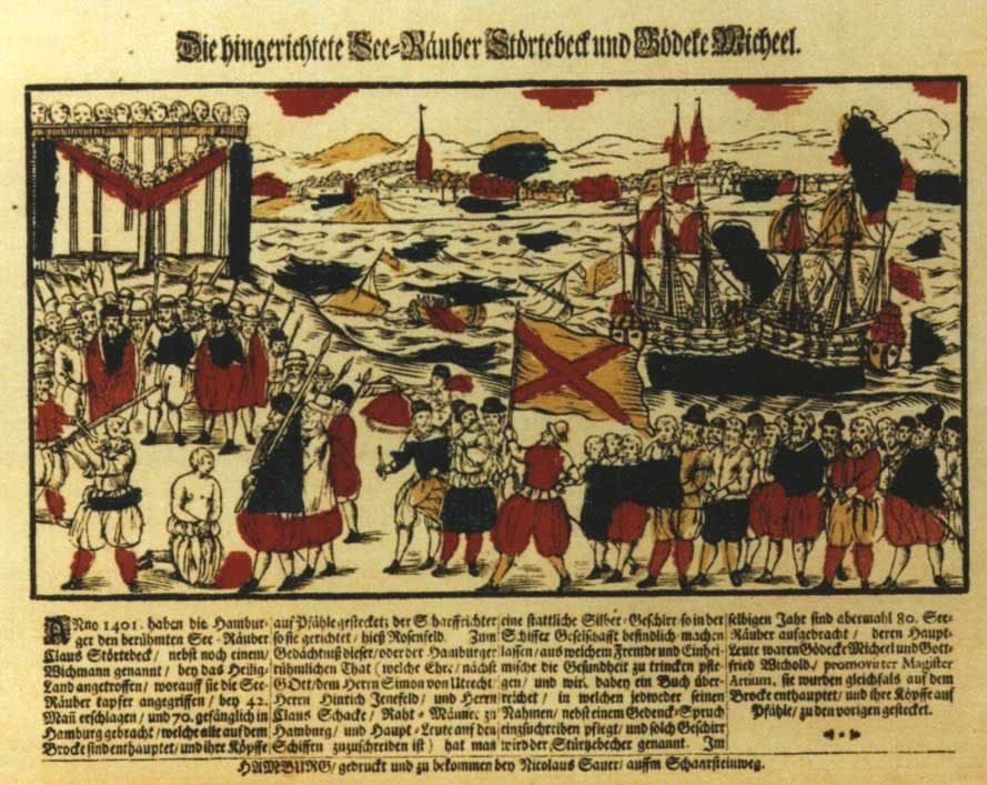
, native_name_lang = , named_after = french: vitailleurs (provisioners, Hundred Years' War) , image = Vitalienbrueder, Wandmalerei in d, Kirche zu Bunge auf Gotland, gemalt ca. 1405.JPG , image_size = 250px , alt = , caption = A contemporary representation of the ''Vitalienbrüder'' on a wall painting, Bunge church, Gotland, Sweden, , logo = , logo_size = , logo_alt = , logo_caption = , map = , map_size = , map_alt = , map_caption = , map2 = , map2_size = , map2_alt = , map2_caption = , abbreviation = , motto = , predecessor = , merged = , successor = , formation = ca. 1393 , founder = , founding_location = , dissolved = ca. 1440 , merger = ... [...More Info...] [...Related Items...] OR: [Wikipedia] [Google] [Baidu] |
Permin
The Permin is a bay in the Saaler Bodden lagoon south of Wustrow in northeast Germany. Originally, the Permin was a channel between the Saaler Bodden and the Baltic Sea and the southern estuarine channel of the River Recknitz. It borders on the Fischland in the south.''Seehäfen'' at fischland-darss-zingst.net. Retrieved 7 January 2022. Because the Permin was navigable in the 13th and 14th centuries with average water depths of around 2 to 3 metres, it formed an important waterway for trade to and from the towns of Ribnitz and Barth, although its navigability was frequently degraded by storms and silting u ... [...More Info...] [...Related Items...] OR: [Wikipedia] [Google] [Baidu] |
Wustrow (Fischland)
Wustrow () is a municipality in the Vorpommern-Rügen district, in Mecklenburg-Vorpommern, Germany. Notable residents * Klaus Praefcke (1933-2013), chemist * Uwe Stock Uwe Stock (born 5 December 1947) is a German judo athlete, who competed for the SC Dynamo Berlin / Sportvereinigung (SV) Dynamo The Sportvereinigung Dynamo () (''Dynamo Sports Association'') was the sport association of the security agenci ... (* 1947), judoka References Seaside resorts in Germany Cities and towns in Mecklenburg Populated coastal places in Germany (Baltic Sea) {{VorpommernRügen-geo-stub ... [...More Info...] [...Related Items...] OR: [Wikipedia] [Google] [Baidu] |


.jpg)

