|
Pennsylvania Route 868
Pennsylvania Route 868 (PA 868) is a state highway located in Bedford County in Pennsylvania. The southern terminus is at PA 36 in South Woodbury Township. The northern terminus is at PA 867 in Bloomfield Township. Route description PA 868 begins at an intersection with PA 36 in the community of Waterside in South Woodbury Township, heading northwest on two-lane undivided Potter Creek Road. The road heads through an agricultural valley with some woods and residences, passing through a corner of Woodbury Township before entering Bloomfield Township. The route passes through the community of Maria prior to continuing through more forested areas with some farm fields and homes. PA 868 curves to the north through open farmland and comes to its northern terminus at PA 867. Major intersections See also * * References External links {{commonscatPennsylvania Highways: PA 868 868 __NOTOC__ Year 868 ( DCCCLXVIII) was a leap year starting on Thursday (link will di ... [...More Info...] [...Related Items...] OR: [Wikipedia] [Google] [Baidu] |
Pennsylvania Department Of Transportation
The Pennsylvania Department of Transportation (PennDOT) oversees transportation issues in the Commonwealth of Pennsylvania. The administrator of PennDOT is the Pennsylvania Secretary of Transportation, currently Yassmin Gramian. Presently, PennDOT supports over of state roads and highways, about 25,000 bridges, as well as new roadway construction, the exception being the Pennsylvania Turnpike Commission, although they currently follow PennDOT policies and procedures. In addition, other modes of transportation are supervised or supported by PennDOT. These include aviation, rail traffic, mass transit, intrastate highway shipping traffic, motor vehicle safety & licensing, and driver licensing. PennDOT also supports the Ports of Philadelphia, Pittsburgh, and Erie. The current budget is approximately $3.8 billion in federal and state funds. The state budget is supported by the motor vehicle fuels tax which is dedicated solely to transportation issues. In recent years, Penn ... [...More Info...] [...Related Items...] OR: [Wikipedia] [Google] [Baidu] |
South Woodbury Township, Pennsylvania
South Woodbury Township is a township in Bedford County, Pennsylvania, United States. The population was 2,076 at the 2020 census. History The New Enterprise Public School was listed on the National Register of Historic Places in 1981. Geography South Woodbury Township is located in northern Bedford County and occupies the southern end of Morrison Cove, a mountain valley. The township's borders follow the ridgecrests of Dunning Mountain on the west, Evitts Mountain on the south, and Tussey Mountain on the east. According to the United States Census Bureau, the township has a total area of , of which , or 0.10%, is water. Recreation A portion of Pennsylvania State Game Lands Number 73 is located in the eastern end of the township.https://viewer.nationalmap.gov/advanced-viewer/ The National Map, retrieved 13 October 2018 [...More Info...] [...Related Items...] OR: [Wikipedia] [Google] [Baidu] |
Bloomfield Township, Bedford County, Pennsylvania
Bloomfield Township is a township in Bedford County, Pennsylvania, United States. The population was 1,036 at the 2020 census. Geography Bloomfield Township is located in northern Bedford County. It is bordered to the east by Woodbury Township, to the south by South Woodbury Township, at its southwestern corner by King Township, and to the west by Kimmel Township. The northern and part of the western borders of Bloomfield Township form the Bedford County line, with the Blair County townships of Greenfield and Taylor to the west and north, respectively. The western boundary of the township is formed by the ridgecrest of Dunning Mountain. According to the United States Census Bureau, Bloomfield Township has a total area of , of which , or 0.03%, is water. Recreation A portion of the Pennsylvania State Game Lands Number 41 is located in the township.https://viewer.nationalmap.gov/advanced-viewer/ The National Map, retrieved 3 October 2018 [...More Info...] [...Related Items...] OR: [Wikipedia] [Google] [Baidu] |
Bedford County, Pennsylvania
Bedford County is a county in the Commonwealth of Pennsylvania. As of the 2020 census, the population was 47,577. The county seat is Bedford. History In 1750 Robert MacRay, a Scots-Irish immigrant, opened the first trading post in Raystown (which is now Bedford) on the land that is now Bedford County. The early Anglo-American settlers had a difficult time dealing with raids from Native Americans. In 1754 fierce fighting erupted as Native Americans became allied with the British or French in the North American front, known as the French and Indian War, of the Seven Years' War between those nations in Europe. In 1759, after the capture of Fort Duquesne in Allegheny County, on the Allegheny and Monongahela rivers, English colonists built a road between the fort (which was renamed as Fort Pitt) to the newly built Fort Bedford in Raystown. The English defeated the French in the war and took over their territories in North America east of the Mississippi River. Treaties with th ... [...More Info...] [...Related Items...] OR: [Wikipedia] [Google] [Baidu] |
State Highway
A state highway, state road, or state route (and the equivalent provincial highway, provincial road, or provincial route) is usually a road that is either ''numbered'' or ''maintained'' by a sub-national state or province. A road numbered by a state or province falls below numbered national highways (Canada being a notable exception to this rule) in the hierarchy (route numbers are used to aid navigation, and may or may not indicate ownership or maintenance). Roads maintained by a state or province include both nationally numbered highways and un-numbered state highways. Depending on the state, "state highway" may be used for one meaning and "state road" or "state route" for the other. In some countries such as New Zealand, the word "state" is used in its sense of a sovereign state or country. By this meaning a state highway is a road maintained and numbered by the national government rather than local authorities. Countries Australia Australia's State Route system covers u ... [...More Info...] [...Related Items...] OR: [Wikipedia] [Google] [Baidu] |
Pennsylvania
Pennsylvania (; ( Pennsylvania Dutch: )), officially the Commonwealth of Pennsylvania, is a state spanning the Mid-Atlantic, Northeastern, Appalachian, and Great Lakes regions of the United States. It borders Delaware to its southeast, Maryland to its south, West Virginia to its southwest, Ohio to its west, Lake Erie and the Canadian province of Ontario to its northwest, New York to its north, and the Delaware River and New Jersey to its east. Pennsylvania is the fifth-most populous state in the nation with over 13 million residents as of 2020. It is the 33rd-largest state by area and ranks ninth among all states in population density. The southeastern Delaware Valley metropolitan area comprises and surrounds Philadelphia, the state's largest and nation's sixth most populous city. Another 2.37 million reside in Greater Pittsburgh in the southwest, centered around Pittsburgh, the state's second-largest and Western Pennsylvania's largest city. The state's su ... [...More Info...] [...Related Items...] OR: [Wikipedia] [Google] [Baidu] |
Pennsylvania Route 36
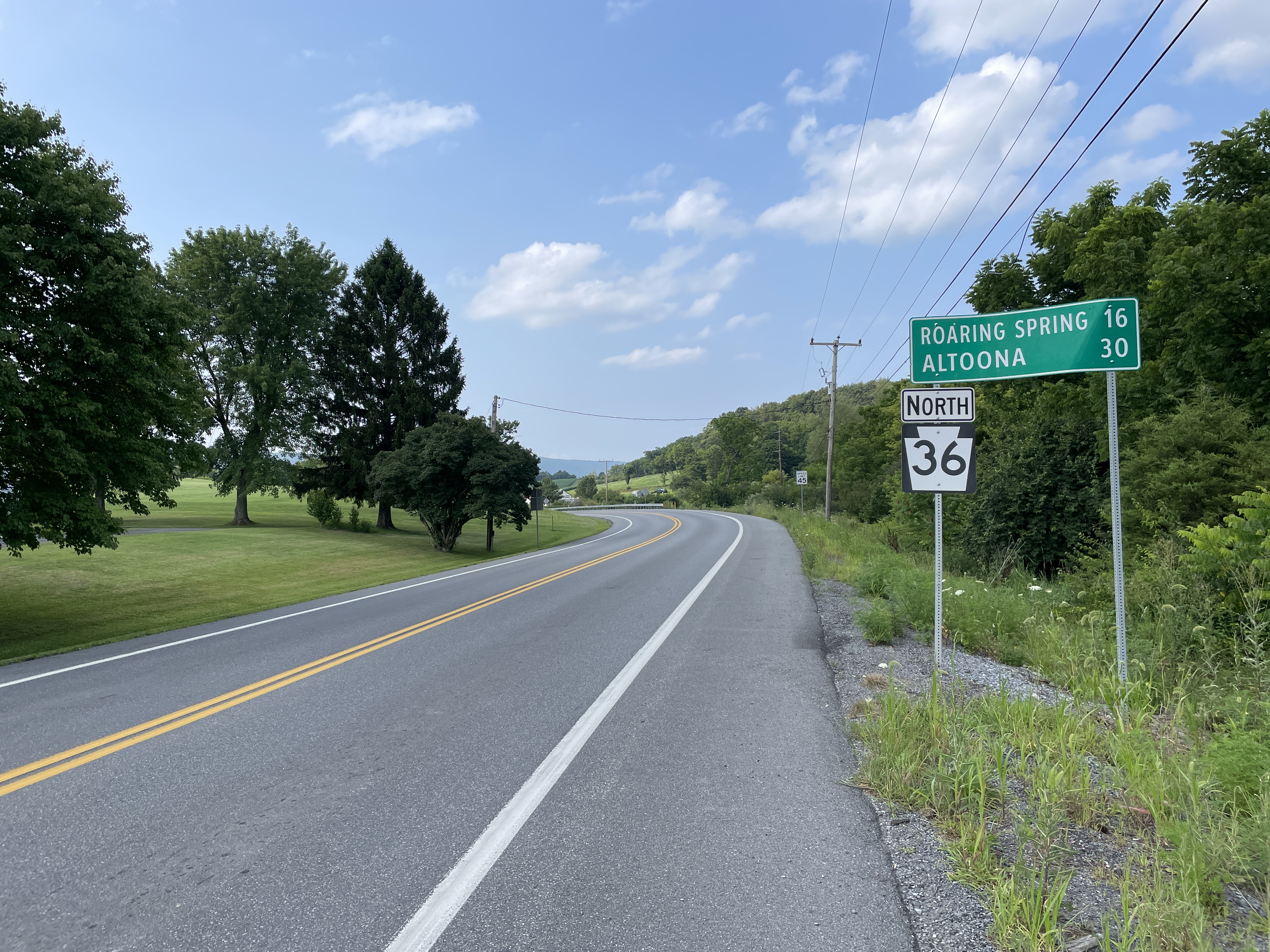
Pennsylvania Route 36 (PA 36) is a long state highway located in the U.S. state of Pennsylvania. The southern terminus is at Pennsylvania Route 26, PA 26 near the Hopewell Township, Bedford County, Pennsylvania, Hopewell Township community of Yellow Creek. The northern terminus is at Pennsylvania Route 27, PA 27 and Pennsylvania Route 227, PA 227 in Pleasantville, Venango County, Pennsylvania, Pleasantville. One of the longest and oldest highways in the commonwealth, PA 36 serves as a major connector between South Central Pennsylvania, South Central and northwest Pennsylvania, Northwestern Pennsylvania. In 1955, the highway was designated as the Colonel Drake Highway in honor of Edwin Drake. Route description Bedford and Blair counties PA 36 begins in the Bedford County, PA, Bedford County hamlet of Hopewell Township, Bedford County, Pennsylvania, Yellow Creek at Pennsylvania Route 26, PA 26 along the Tussey Mountain range. The distance in Bedford County is brief as the highw ... [...More Info...] [...Related Items...] OR: [Wikipedia] [Google] [Baidu] |
Pennsylvania Route 867
Pennsylvania Route 867 (PA 867) is a state highway located in Bedford County, Pennsylvania, Bedford and Blair County, Pennsylvania, Blair counties in Pennsylvania. The southern terminus is at Pennsylvania Route 869, PA 869 in South Woodbury Township, Pennsylvania, South Woodbury Township. The northern terminus is at Pennsylvania Route 36, PA 36/Pennsylvania Route 164, PA 164 outside of Roaring Spring, Pennsylvania, Roaring Spring. Route description PA 867 begins at an intersection with Pennsylvania Route 869, PA 869 in the community of Brumbaugh in South Woodbury Township, Pennsylvania, South Woodbury Township, Bedford County, Pennsylvania, Bedford County, heading northeast on two-lane undivided Lafayette Road. The road heads between forested Dunning Mountain to the west and farms to the east. The route passes through more agricultural areas in a valley with occasional homes, passing through Lafayetteville before crossing into Bloomfield Township, Bedford County, Pennsylvania, B ... [...More Info...] [...Related Items...] OR: [Wikipedia] [Google] [Baidu] |
2021-10-27 11 32 07 View North Along Pennsylvania State Route 868 (Potter Creek Road) At Cowan School Road In Bloomfield Township, Bedford County, Pennsylvania
1-1 may refer to: * New Year's Day, a public holiday in many countries, held annually on the first of January * Schweizer SGP 1-1, an American glider design * World 1-1, the first level of Nintendo's ''Super Mario Bros'' See also * One-to-one (other) One-to-one or one to one may refer to: Mathematics and communication *One-to-one function, also called an injective function *One-to-one correspondence, also called a bijective function *One-to-one (communication), the act of an individual comm ... {{numberdis ... [...More Info...] [...Related Items...] OR: [Wikipedia] [Google] [Baidu] |
Woodbury Township, Bedford County, Pennsylvania
Woodbury Township is a township that is located in Bedford County, Pennsylvania, United States. As of the 2020 census, the population was 1,181. Geography Woodbury Township is located in northern Bedford County and is bordered by Blair County to the north. It is part of the area known as Morrisons Cove. The township's eastern border follows the crest of Tussey Mountain. The borough of Woodbury is located near the center of the township but is separate from it. According to the United States Census Bureau, Woodbury Township has a total area of , of which , or 0.09%, is water. Recreation Portions of the Pennsylvania State Game Lands Number 41 are located along the western border of the township and portions of Game Lands Number 73 are located along the eastern end of the township..https://viewer.nationalmap.gov/advanced-viewer/ The National Map, retrieved 3 October 2018 [...More Info...] [...Related Items...] OR: [Wikipedia] [Google] [Baidu] |


