|
Pear Tree House
Pear Tree House was the former Civil Defence control centre for South-East London. It is a block of council flats in the Central Hill Estate of Upper Norwood with eight two-bedroom flats and the control centre in the basement. History In the early 1960s the Metropolitan Borough of Lambeth was grouped with the neighbouring boroughs of Southwark and Camberwell to make up civil defence region 53a. Negotiations took place between them for a site to build a control centre for the area during the heightened atmosphere in the era of the Cuban Missile Crisis. A large area of Gipsy Hill in Lambeth was designated for a new housing estate and, as it was in the extreme south of the borough and well protected by the local hills, a site at the junction of Lunham Road and Hawke Road in SE19 was chosen. Whilst the two-storey bunker was being designed and approved the structures of civil defence and London government were changing. Work on Pear Tree House started in 1963, but it was now merely ... [...More Info...] [...Related Items...] OR: [Wikipedia] [Google] [Baidu] |
Civil Defence Centre
Civil Defence centres are administration, communication and logistics command centres built in the United Kingdom by the British Government for use in the event of war or serious emergency. During World War II they were often called Air Raid Precautions (ARP) centres. During the Cold War they were also called controls or emergency centres, or popularly nuclear bunkers. They should not be confused with air raid shelters or fallout shelters. See also * Civil defence centres in London During the Cold War every London Borough was obliged to have a Civil Defence centre. These were controversial structures as it was widely believed that planning for the aftermath of Nuclear warfare, nuclear war was both expensive and pointless.{{ ... External linksSubterranea Britannica Emergency management in the United Kingdom ... [...More Info...] [...Related Items...] OR: [Wikipedia] [Google] [Baidu] |
Upper Norwood
Upper Norwood is an area of south London, England, within the London Boroughs of Bromley, Croydon, Lambeth and Southwark. It is north of Croydon and the eastern part of it is better known as the Crystal Palace area. Upper Norwood is situated along the London clay ridge known as Beulah Hill. Most housing dates from the 19th and 20th centuries, with large detached properties along the ridge and smaller, semi-detached and terraced dwellings on the slopes. There are some more modern areas of social housing that date from the 1970s. The hill offers panoramic views northward to central London and southward to central Croydon and the North Downs. History The area is one of the highest in the London area, and for centuries was occupied by the Great North Wood, an extensive area of natural oak forest which formed a wilderness close to the southern edge of the ever-expanding city of London. The name "Norwood" is a contraction of "North Wood". Local legend has it that Sir Francis Drak ... [...More Info...] [...Related Items...] OR: [Wikipedia] [Google] [Baidu] |
Metropolitan Borough Of Lambeth
Lambeth was a civil parish and metropolitan borough in south London, England. It was an ancient parish in the county of Surrey. The parish was included in the area of responsibility of the Metropolitan Board of Works in 1855 and became part of the County of London in 1889. The parish of Lambeth became a metropolitan borough in 1900, following the London Government Act 1899, with the parish vestry replaced by a borough council. Geography The ancient parish was divided into the six divisions of Bishop's Liberty, Prince's Liberty, Vauxhall Liberty, Marsh and Wall Liberty, Lambeth Dean and Stockwell Liberty. It covered an area 4,015 acres (recorded in 1851 census) and was north to south, but only at its widest east to west. In addition to the historic riverside area of Lambeth, this included Kennington, Vauxhall, Stockwell, Brixton, the western part of Herne Hill, Tulse Hill and West Norwood. As the population was increasing, in 1824 the ancient parish was subdivided into eccles ... [...More Info...] [...Related Items...] OR: [Wikipedia] [Google] [Baidu] |
Metropolitan Borough Of Southwark
The Metropolitan Borough of Southwark (''Br'' ˆsʌðɨk was a metropolitan borough in the County of London from 1900 to 1965. It was created to cover the western section of the ancient borough of Southwark and the parish of Newington. In common with the rest of inner London, the borough experienced a steady decline in population throughout its existence. The borough council made an unsuccessful attempt to gain city status in 1955. Its former area is now the northwestern part of the current London Borough of Southwark. Formation and boundaries The borough was formed from four civil parishes: St Mary Newington, Southwark Christchurch, Southwark St George the Martyr and Southwark St Saviour. In 1930 these four were combined into a single civil parish called Southwark, which was conterminous with the metropolitan borough. Previous to the borough's formation it had been administered by three separate local bodies: St Saviours District Board of Works, Newington Vestry and Southwar ... [...More Info...] [...Related Items...] OR: [Wikipedia] [Google] [Baidu] |
Metropolitan Borough Of Camberwell
Camberwell was a civil parish and metropolitan borough in south London, England. Camberwell was an ancient parish in the county of Surrey, governed by an administrative vestry from 1674. The parish was included in the area of responsibility of the Metropolitan Board of Works in 1855 and became part of the County of London in 1889. The parish of Camberwell became a metropolitan borough in 1900, following the London Government Act 1899, with the parish vestry replaced by a borough council. In 1965 the borough was abolished and its former area became part of the London Borough of Southwark in Greater London. Geography The original parish of Camberwell St Giles had three divisions. They were the Liberty of Peckham to the east, the Hamlet of Dulwich to the southwest and the central division of Camberwell proper. The liberty of Peckham stretched from north of Old Kent Road to Honor Oak, taking in Peckham and Nunhead. Camberwell stretched from what is now Burgess Park in the north ... [...More Info...] [...Related Items...] OR: [Wikipedia] [Google] [Baidu] |
Cuban Missile Crisis
The Cuban Missile Crisis, also known as the October Crisis (of 1962) ( es, Crisis de Octubre) in Cuba, the Caribbean Crisis () in Russia, or the Missile Scare, was a 35-day (16 October – 20 November 1962) confrontation between the United States and the Soviet Union, which escalated into an international crisis when American deployments of missiles in Italy and Turkey were matched by Soviet deployments of similar ballistic missiles in Cuba. Despite the short time frame, the Cuban Missile Crisis remains a defining moment in national security and nuclear war preparation. The confrontation is often considered the closest the Cold War came to escalating into a full-scale nuclear war. In response to the presence of American Jupiter ballistic missiles in Italy and Turkey, the failed Bay of Pigs Invasion of 1961, and Soviet fears of a Cuban drift towards China, Soviet First Secretary Nikita Khrushchev agreed to Cuba's request to place nuclear missiles on the island to deter a ... [...More Info...] [...Related Items...] OR: [Wikipedia] [Google] [Baidu] |
Gipsy Hill
Gipsy Hill in south London is a hilly neighbourhood spanning the southern parts of the London Boroughs of Lambeth and Southwark characterised for its great views of the City of London and Dulwich. Historically, north of its traditional Westow-Central Hill southern limit, it was split between the southern projections of the West Norwood daughter parish of Lambeth and the St Giles church daughter parish of Camberwell in Surrey until urban reforms of 1889 created the County of London. It takes in, due to a diagonal, slightly weaving border, somewhat less of the London Borough of Southwark, and it has a ridge-top border along the retail/services/leisure street Westow Hill and residential street Central Hill with Upper Norwood in the London Borough of Croydon. History and Geography Gipsy Hill is the name of the central road that runs south upwards from Gipsy Road, where it becomes Alleyn Park near the southern end of Croxted Road, up to Central Hill and Westow Hill (a brief eastern ... [...More Info...] [...Related Items...] OR: [Wikipedia] [Google] [Baidu] |
Brixton
Brixton is a district in south London, part of the London Borough of Lambeth, England. The area is identified in the London Plan as one of 35 major centres in Greater London. Brixton experienced a rapid rise in population during the 19th century as communications with central London improved. Brixton is mainly residential, though includes Brixton Market and a substantial retail sector. It is a multi-ethnic community, with a large percentage of its population of Afro-Caribbean descent. It lies within Inner London and is bordered by Stockwell, Clapham, Streatham, Camberwell, Tulse Hill, Balham and Herne Hill. The district houses the main offices of Lambeth London Borough Council. Brixton is south-southeast from the geographical centre of London (measuring to a point near Brixton Underground station on the Victoria Line). History Toponymy The name Brixton is thought to originate from Brixistane, meaning the stone of Brixi, a Saxon lord. Brixi is thought to have ere ... [...More Info...] [...Related Items...] OR: [Wikipedia] [Google] [Baidu] |
Greater London Council
The Greater London Council (GLC) was the top-tier local government administrative body for Greater London from 1965 to 1986. It replaced the earlier London County Council (LCC) which had covered a much smaller area. The GLC was dissolved in 1986 by the Local Government Act 1985 and its powers were devolved to the London boroughs and other entities. A new administrative body, known as the Greater London Authority (GLA), was established in 2000. Creation The GLC was established by the London Government Act 1963, which sought to create a new body covering more of London rather than just the inner part of the conurbation, additionally including and empowering newly created London boroughs within the overall administrative structure. In 1957 a Royal Commission on Local Government in Greater London had been set up under Edwin Herbert, Baron Tangley, Sir Edwin Herbert, and this reported in 1960, recommending the creation of 52 new London boroughs as the basis for local government. It ... [...More Info...] [...Related Items...] OR: [Wikipedia] [Google] [Baidu] |
Campaign For Nuclear Disarmament
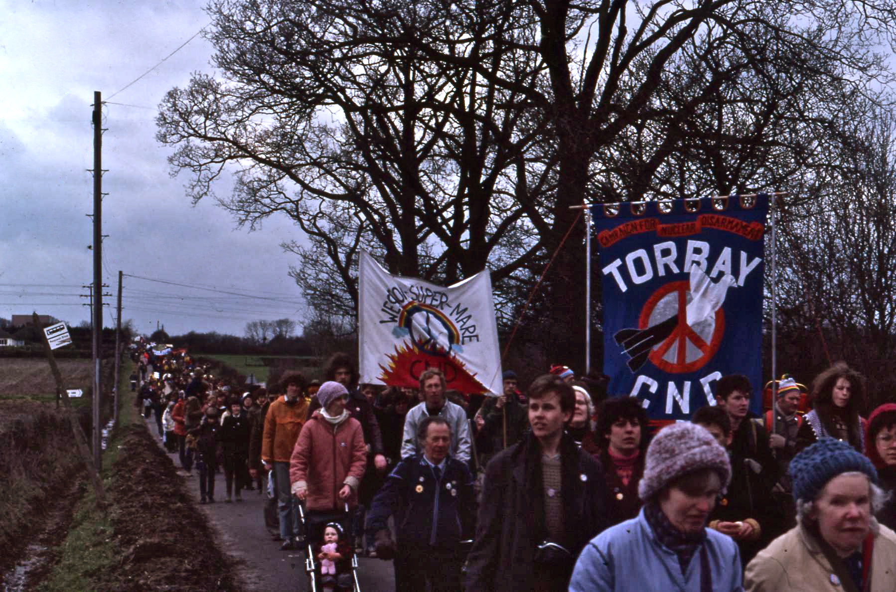
The Campaign for Nuclear Disarmament (CND) is an organisation that advocates unilateral nuclear disarmament by the United Kingdom, international nuclear disarmament and tighter international arms regulation through agreements such as the Nuclear Non-Proliferation Treaty. It opposes military action that may result in the use of Nuclear weapon, nuclear, Chemical warfare, chemical or Biological warfare, biological weapons and the building of nuclear power stations in the UK. CND began in November 1957 when a committee was formed, including Canon John Collins as chairman, Bertrand Russell as president and Peggy Duff as organising secretary. The committee organised CND's first public meeting at Methodist Central Hall, Westminster, on 17 February 1958. Since then, CND has periodically been at the forefront of the peace movement in the UK. It claims to be Europe's largest Single-issue politics, single-issue peace campaign. Between 1958 and 1965 it organised the Aldermaston Marches, Al ... [...More Info...] [...Related Items...] OR: [Wikipedia] [Google] [Baidu] |
Hard Rock (exercise)
Hard Rock (sometimes Operation Hard Rock or the Hard Rock exercise) was a British civil defence exercise planned by the Conservative government to take place in September–October 1982. One of a series of regular national civil defence exercises, it followed Square Leg in 1980. As the public reaction to the scale of devastation forecast in Square Leg was poor, the planner deliberately scaled down the number of warheads supposed for Hard Rock. Despite this, the Campaign for Nuclear Disarmament (CND), who opposed nuclear warfare and were against civil defence exercises, suggested that such an attack as Hard Rock anticipated would have led to the deaths of 12.5 million people. Since 1980, many British local authorities, who played key roles in civil defence planning, had become nuclear-free zones, opposed to nuclear weapons and nuclear power. Many of these authorities refused to take part in Hard Rock, although finance and the unofficial policy of the Labour Party also played a p ... [...More Info...] [...Related Items...] OR: [Wikipedia] [Google] [Baidu] |


