|
Parpan
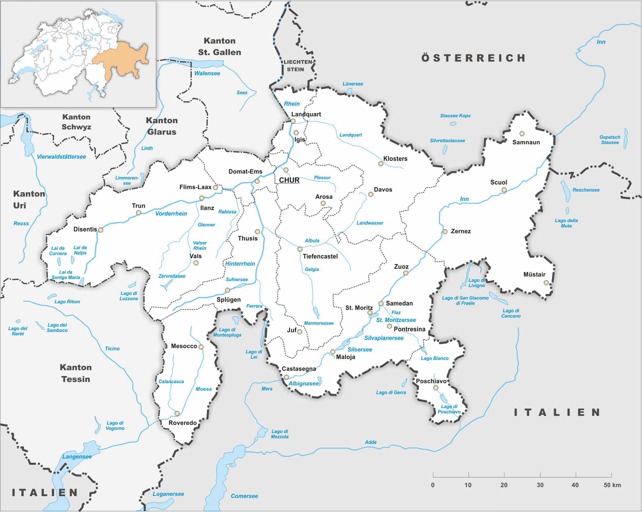
Parpan was a municipality in the district Plessur of the canton of Graubünden in Switzerland. On 1 January 2010 the municipalities of Malix and Parpan merged into Churwalden. History Parpan is first mentioned in 1208 as ''Partipan''. Formerly in Romansh it was known as ''Parpaun''. Origin of the name ''Parpan'' is a common surname in Graubünden. Etymologically "Parpan" originates from the French ''partis-pain'', meaning "bread-deliverer". Geography Parpan has an area, , of . Of this area, 64.9% is used for agricultural purposes, while 22.8% is forested. Of the rest of the land, 3.1% is settled (buildings or roads) and the remainder (9.1%) is non-productive (rivers, glaciers or mountains). The municipality is located in the Churwalden sub-district of the Plessur district in the Churwalden valley. The village lies in the valley between the cantonal capital Chur and the resort Lenzerheide. It offers access to the skiing area of Rothorn and mountain railways Danis St ... [...More Info...] [...Related Items...] OR: [Wikipedia] [Google] [Baidu] |
Parpaner Rothorn
The Parpaner Rothorn is a mountain of the Plessur Alps, overlooking Parpan in the canton of Graubünden. The summit is easily accessible with a cable car from Lenzerheide, the upper station being located 30 metres below the main summit. See also *List of mountains of Switzerland accessible by public transport This is a list of mountains of Switzerland above 800 metres whose summits are accessible by public transport. This list includes mountains with a topographic prominence of at least 30 metres that have a station above the height of their key col a ... References External links Parpaner Rothorn on Hikr Mountains of the Alps Mountains of Switzerland Mountains of Graubünden Arosa Vaz/Obervaz {{Graubünden-mountain-stub ... [...More Info...] [...Related Items...] OR: [Wikipedia] [Google] [Baidu] |
Arosa Lenzerheide
Arosa Lenzerheide is a ski area located in Arosa, Lenzerheide, Valbella, Parpan and Churwalden, Graubünden/ Switzerland. It originated 2013/14 by connecting the existing ski areas of Arosa and Lenzerheide. With a total of 225 kilometers (140 miles) of ski slopes and 43 cable cars it is the largest contiguous ski area in Graubünden. Location and description Arosa Lenzerheide is located in northern and central Grisons. It extends from the innermost Schanfigg via Urdental to the neighboring western valley with Lenzerheide, Parpan–Valbella and Churwalden. The ski area covers an altitudinal range of . Outstanding summits with aerial tramways and panoramic restaurants are the Weisshorn and the Parpaner Rothorn which also marks the highest point of the ski area. 60 per cent of the slopes are groomed with artificial snow. Arosa Lenzerheide also offers more than of cross-country skiing trails and 4 terrain parks («Park'n'Pipe Tschuggen», «Wood Ranch» and «Bärensnowpark ... [...More Info...] [...Related Items...] OR: [Wikipedia] [Google] [Baidu] |
Churwalden
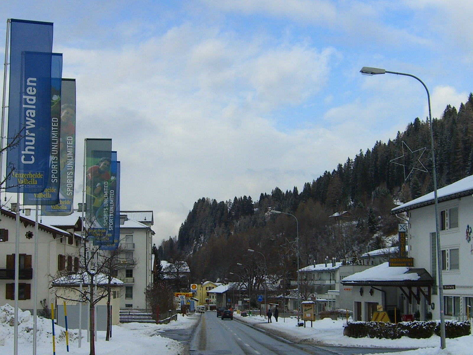
Churwalden is a municipality in the Plessur Region in the canton of Graubünden in Switzerland. It incorporates the former municipalities of Malix and Parpan. History Churwalden is first mentioned in 1149 as ''silva Augeria''. In 1191 it was mentioned as ''de Curwalde''. Geography Churwalden has an area, (as of the 2004/09 survey) of . Of this area, about 43.8% is used for agricultural purposes, while 39.6% is forested. Of the rest of the land, 3.7% is settled (buildings or roads) and 12.9% is unproductive land. In the 2004/09 survey a total of or about 2.6% of the total area was covered with buildings, an increase of over the 1984/85 amount. Of the agricultural land, is used for orchards and vineyards, is fields and grasslands and consists of alpine grazing areas. Since 1984/85 the amount of agricultural land has decreased by . Over the same time period the amount of forested land has increased by . Rivers and lakes cover in the municipality. [...More Info...] [...Related Items...] OR: [Wikipedia] [Google] [Baidu] |
Vaz/Obervaz
Vaz/Obervaz is a municipality in the Albula Region in the canton of Graubünden in Switzerland. The municipality of Vaz/Obervaz includes the following villages: Lain, Muldain, Zorten, Lenzerheide, and Valbella, as well as the hamlets of Nivaigl, Fuso, Trantermoira, Sporz, Tgantieni, Sartons, Creusen and Obersolis. Geography No town of the name Vaz/Obervaz actually exists. Commonly, Lain, Muldain and Zorten make up the Obervaz region. Until 1943 Vaz/Obervaz was known as Obervaz.Amtliches Gemeindeverzeichnis der Schweiz published by the Swiss Federal Statistical Office accessed 23 September 2009 The area of Vaz/Obervaz extends from in the ... [...More Info...] [...Related Items...] OR: [Wikipedia] [Google] [Baidu] |
Malix
Malix was a municipality in the district of Plessur in the canton of Graubünden in Switzerland. On 1 January 2010 the municipalities of Malix and Parpan merged into the municipality of Churwalden. History Malix is first mentioned in 1149 as ''in Umbilico''. Geography Malix has an area, , of . Of this area, 41.9% is used for agricultural purposes, while 46.7% is forested. Of the rest of the land, 4.8% is settled (buildings or roads) and the remainder (6.6%) is non-productive (rivers, glaciers or mountains). The municipality is located in the Churwalden sub-district of the Plessur district at the entrance to the Churwalden valley. It consists of the ''haufendorf'' village (an irregular, unplanned and quite closely packed village, built around a central square)of Malix and the sections of Kreuz and Spina. The municipalities of Malix and Parpan merged on 1 January 2010 into Churwalden. Demographics Malix has a population () of 709, of which 11.4% are foreign nationals. Ov ... [...More Info...] [...Related Items...] OR: [Wikipedia] [Google] [Baidu] |
Plessur (district)
Plessur District (german: Bezirk Plessur, rm, ) is a former administrative district in the canton of Graubünden, Switzerland. It had an area of and has a population of 40,707 in 2015. The former district is named after the river Plessur which crosses it. However, the region along the Plessur –and therefore the whole valley–is called Schanfigg. It was replaced with the Plessur Region on 1 January 2017 as part of a reorganization of the Canton. accessed 16 February 2017 Plessur District consisted of three '' ... [...More Info...] [...Related Items...] OR: [Wikipedia] [Google] [Baidu] |
Lenzerheide
Lenzerheide ( Romansh: ''Lai'') is a mountain resort in the canton of Graubünden, Switzerland at the foot of the Parpaner Rothorn. The village lies in the municipality Vaz/Obervaz in the district of Albula, sub-district Alvaschein. The village lies in a broadened section of the valley between the cantonal capital Chur to the north and Tiefencastel, beyond which are the Julier Pass and St Moritz. The high valley forms a pass of no official name, often referred to as Lenzerheide pass, with a culmination point located 5 km north of the village. Lenzerheide is popular as skiing resort and for its lake (Heidsee), which is frozen in winter. The Lenzerheide Bergbahnen AG offers access to the skiing areas of Stätzerhorn, Danis, Scalottas, and Rothorn. There are slopes approved for all FIS Alpine Ski World Cup races for women and men. At the end of 2013 the Lenzerheide ski resort was linked with Arosa by cable-car, creating the new ski resort of Arosa Lenzerheide. Since then ... [...More Info...] [...Related Items...] OR: [Wikipedia] [Google] [Baidu] |
Tschiertschen
Tschiertschen is a village in the municipality of Tschiertschen-Praden in the district of Plessur in the canton of Graubünden in Switzerland. The formerly independent municipality merged with Praden to form Tschiertschen-Praden on January 1, 2009.Amtliches Gemeindeverzeichnis der Schweiz published by the Swiss Federal Statistical Office accessed 23 September 2009 History Tschiertschen is first mentioned around the end of the 8th Century as ''in Cercene''.Geography Tschiertschen has an area, , of . Of this area, 52.6% is used for agricultural purposes, while 22.6% is forested. Of the rest of the land, 1.4% is settled (buildings or roads) and the remainder (23.4%) is non-productive (rivers, glaci ...[...More Info...] [...Related Items...] OR: [Wikipedia] [Google] [Baidu] |
Secondary Sector Of The Economy
In macroeconomics, the secondary sector of the economy is an economic sector in the three-sector theory that describes the role of manufacturing. It encompasses industries that produce a finished, usable product or are involved in construction. This sector generally takes the output of the primary sector (i.e. raw materials) and creates finished goods suitable for sale to domestic businesses or consumers and for export (via distribution through the tertiary sector). Many of these industries consume large quantities of energy, require factories and use machinery; they are often classified as light or heavy based on such quantities. This also produces waste materials and waste heat that may cause environmental problems or pollution (see negative externalities). Examples include textile production, car manufacturing, and handicraft. Manufacturing is an important activity in promoting economic growth and development. Nations that export manufactured products tend to generate highe ... [...More Info...] [...Related Items...] OR: [Wikipedia] [Google] [Baidu] |
Primary Sector Of The Economy
The primary sector of the economy includes any industry involved in the extraction and production of raw materials, such as farming, logging, fishing, forestry and mining. The primary sector tends to make up a larger portion of the economy in developing countries than it does in developed countries. For example, in 2018, agriculture, forestry, and fishing comprised more than 15% of GDP in sub-Saharan Africa but less than 1% of GDP in North America. In developed countries the primary sector has become more technologically advanced, enabling for example the mechanization of farming, as compared with lower-tech methods in poorer countries. More developed economies may invest additional capital in primary means of production: for example, in the United States corn belt, combine harvesters pick the corn, and sprayers spray large amounts of insecticides, herbicides and fungicides, producing a higher yield than is possible using less capital-intensive techniques. These technologic ... [...More Info...] [...Related Items...] OR: [Wikipedia] [Google] [Baidu] |
Fachhochschule
A ''Fachhochschule'' (; plural ''Fachhochschulen''), abbreviated FH, is a university of applied sciences (UAS), in other words a German tertiary education institution that provides professional education in many applied sciences and applied arts, such as engineering, technology, business, architecture, design, and industrial design. ''Fachhochschulen'' were first founded in Germany and were later adopted in Austria, Liechtenstein, Switzerland, Cyprus, and Greece. An increasing number of ''Fachhochschulen'' are abbreviated as ''Hochschule'', the generic term in Germany for institutions awarding academic degrees in higher education, or expanded as ''Hochschule für angewandte Wissenschaften (HAW)'', the German translation of "universities of applied sciences", which are primarily designed with a focus on teaching professional skills. Swiss law calls ''Fachhochschulen'' and universities "separate but equal". Due to the Bologna process, universities and ''Fachhochschulen'' award l ... [...More Info...] [...Related Items...] OR: [Wikipedia] [Google] [Baidu] |


