|
Parnitha
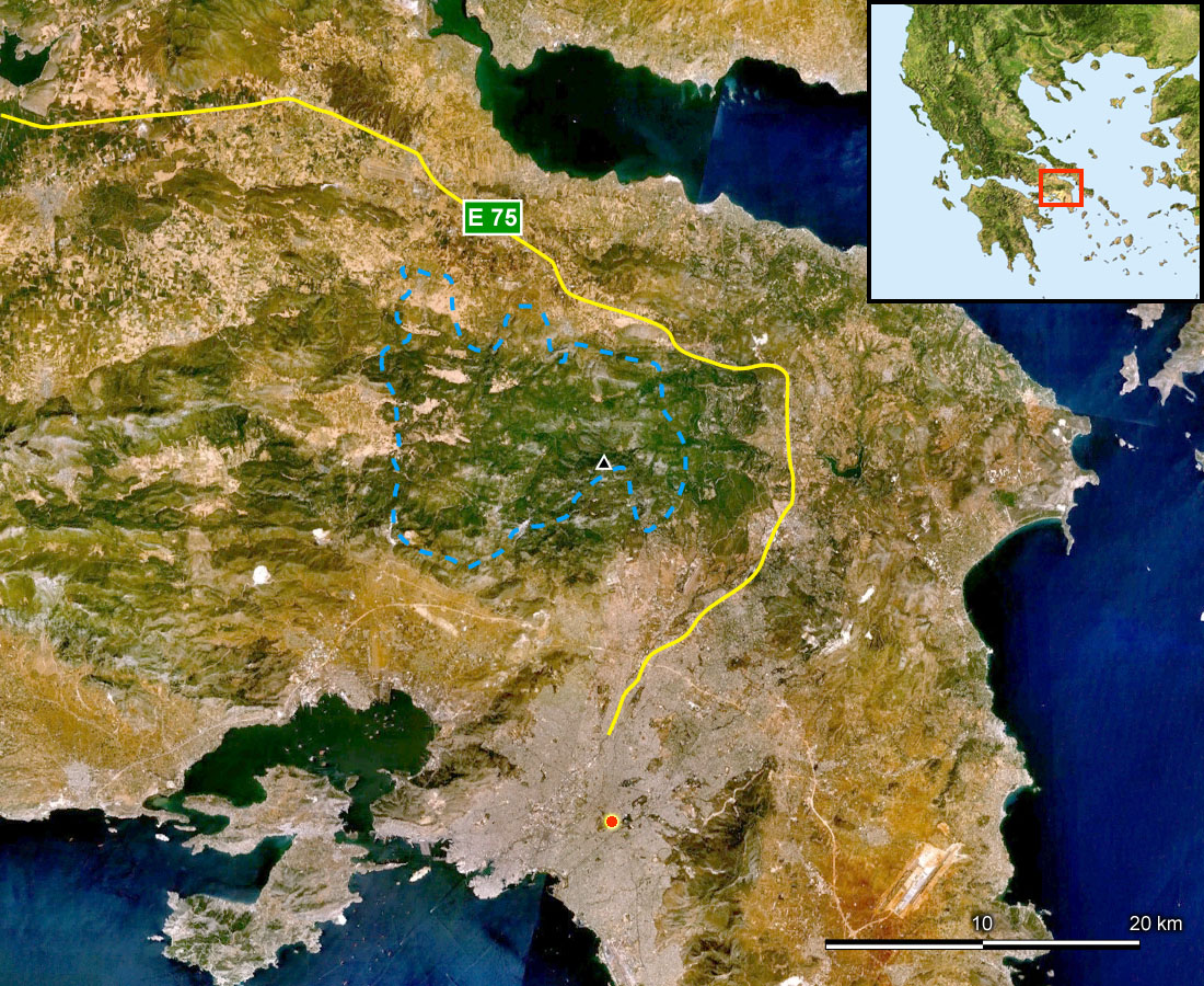
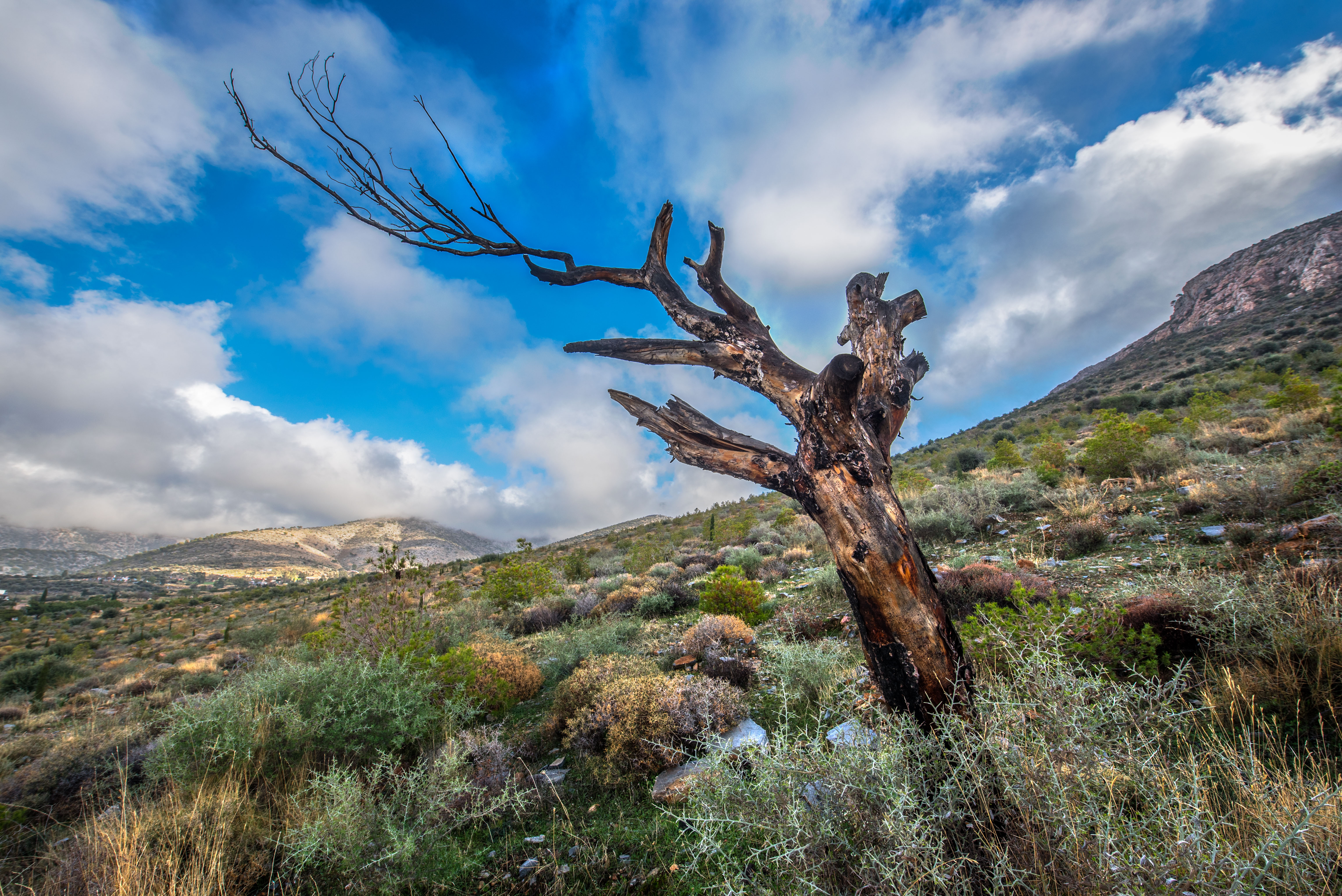
Mount Parnitha ( ell, Πάρνηθα, , Katharevousa and grc, Πάρνης ''Parnis''/''Parnes''; sometimes Parnetha) is a densely forested mountain range north of Athens, the highest on the peninsula of Attica, with an elevation of 1,413 m, and a summit known as Karavola (Καραβόλα). Much of the mountain is designated a national park, and is a protected habitat for wildfowl, first created in 1961. The summit is located 18 km north of Acharnes and about 30 km north of Athens city center, while the mountain covers approximately 250 km² of land. Other peaks include Mavrovouni (Μαυροβούνι), Ornio (1,350 m), Area (1,160 m), Avgo or Avgho (1,150 m), and Xerovouni (Ξεροβούνι, meaning "dry mountain": 1,120 m). It also has two shelters Mpafi and Flampouri.Parnitha National park official site. ... [...More Info...] [...Related Items...] OR: [Wikipedia] [Google] [Baidu] |
Attica
Attica ( el, Αττική, Ancient Greek ''Attikḗ'' or , or ), or the Attic Peninsula, is a historical region that encompasses the city of Athens, the capital of Greece and its countryside. It is a peninsula projecting into the Aegean Sea, bordering on Boeotia to the north and Megaris to the west. The southern tip of the peninsula, known as Laurion, was an important mining region. The history of Attica is tightly linked with that of Athens, and specifically the Golden Age of Athens during the classical period. Ancient Attica ( Athens city-state) was divided into demoi or municipalities from the reform of Cleisthenes in 508/7 BC, grouped into three zones: urban (''astu'') in the region of Athens main city and Piraeus (port of Athens), coastal (''paralia'') along the coastline and inland ('' mesogeia'') in the interior. The modern administrative region of Attica is more extensive than the historical region and includes Megaris as part of the regional unit West Att ... [...More Info...] [...Related Items...] OR: [Wikipedia] [Google] [Baidu] |
Athens
Athens ( ; el, Αθήνα, Athína ; grc, Ἀθῆναι, Athênai (pl.) ) is both the capital city, capital and List of cities and towns in Greece, largest city of Greece. With a population close to four million, it is also the seventh List of urban areas in the European Union, largest city in the European Union. Athens dominates and is the capital of the Attica (region), Attica region and is one of the List of oldest continuously inhabited cities, world's oldest cities, with its recorded history spanning over 3,400 years and its earliest human presence beginning somewhere between the 11th and 7th millennia BC. Classical Athens was a powerful Greek city-state, city-state. It was a centre for the arts, learning and philosophy, and the home of Plato's Platonic Academy, Academy and Aristotle's Lyceum (classical), Lyceum. It is widely referred to as the cradle of civilization, cradle of Western culture, Western civilization and the democracy#History, birthplace of democracy, larg ... [...More Info...] [...Related Items...] OR: [Wikipedia] [Google] [Baidu] |
Thrakomakedones
Thrakomakedones (Greek: Θρακομακεδόνες from Thrace and Macedonia), is a town in the regional unit East Attica, in Attica region, Greece. It is a northern suburb of Athens. Since the 2011 local government reform it is part of the municipality Acharnes, of which it is a municipal unit. The municipal unit has an area of 3.550 km2. Overview Thrakomakedones is situated in the southern foothills of the Parnitha mountains, at the northern edge of the Athens conurbation. It is 5 km northeast of Acharnes and 16 km north of Athens city centre. The 1999 Athens earthquake affected Thrakomakedones, causing severe damage to several houses and a school. During a heatwave, on 7 August 2021 wildfires affecting Greece were spreading towards Thrakomakedones; many people left their homes. File:Eksodos-thrakomakedones.jpg File:Parnitha-thrakomakedones.jpg File:Thrakomakedones2.png File:Kinotita Thrakomakedonon.png File:Aytokinito-aristotelous.jpg File:Pezodromos-aristotel ... [...More Info...] [...Related Items...] OR: [Wikipedia] [Google] [Baidu] |
Mpafi
The Bafi Refuge (also spelt Mpafi) belongs to the Greek Mountaineering Club, E.O.S. Athens founded in 1928 in the Mount Parnitha National Park, at an altitude of 1160m, roughly 2.5 km from Mont Parness, inside the national park A national park is a natural park in use for conservation purposes, created and protected by national governments. Often it is a reserve of natural, semi-natural, or developed land that a sovereign state declares or owns. Although individua .... Ιn April 1937 the refuge's foundation stone was laid. The first part was completed in Autumn of 1939 with money that was collected mainly by the members of the Mountaineering Club, but also other affiliated associations. Paths begin from the shelter leaving in all directions, which can offer small and easy walks of half and one hour or long and difficult walks for the fitter. Access to the refuge is from the street that goes up Parnitha to the casino “Mont Parness”, or from a marked path which b ... [...More Info...] [...Related Items...] OR: [Wikipedia] [Google] [Baidu] |
Cephissus (Athenian Plain)
Cephissus ( grc, Κήφισσος; el, Κηφισός, ''Kifisos'') is a river in the vicinity of Athens, Greece. Together with the neighbouring river Ilisos, it drains a catchment area of . The '' Bibliotheca'' (3.15.1) states that the legendary Erechtheus' wife Praxithea was daughter of Phrasimus (otherwise unknown to us) by Diogenia (otherwise unknown to us) daughter of Cephissus. The source of the river is in the saddle depression between the Parnitha and Penteli mountains. From there it flows generally southwest until it reaches the Phaleron Bay between Neo Faliro and Moschato Moschato ( el, Μοσχάτο) is a suburb in the southwestern part of the Athens agglomeration, Greece. Since the 2011 local government reform it is part of the municipality Moschato-Tavros, of which it is the seat and a municipal unit. Geograp .... Presently the river flows near or under the Motorway 1 linking Athens and Thessaloniki for much of its length. This section of Motorway 1 i ... [...More Info...] [...Related Items...] OR: [Wikipedia] [Google] [Baidu] |
Acharnes
Acharnes ( el, Αχαρνές, , before 1915: Μενίδι Menidi, ) is a northwestern suburb of Athens, Attica, Greece. With 106,943 inhabitants (2011 census), it is the most populous municipality in East Attica. It is part of the Athens Urban area. Geography The northern part of the municipality is covered by the forested Parnitha mountain. The southern part is in the plain of Athens, and is densely populated. The built-up area of Acharnes, in this southern part of the municipality, is continuous with that of the adjacent suburbs to the west, east and south. The centre of Acharnes is due north of Athens city centre. The two other settlements in the municipality, Thrakomakedones and Varympompi, are situated further north, in the foothills of Parnitha. Acharnes is crossed by several important roads and railways, including Motorway 6, the Piraeus–Platy railway and the Athens Airport–Patras railway. The Acharnes Railway Center is the main railway junction of Attica; tw ... [...More Info...] [...Related Items...] OR: [Wikipedia] [Google] [Baidu] |
Varymbombi
Varympompi or Varibobi ( el, Βαρυμπόμπη) is a suburb of Athens in the municipality of Acharnes, East Attica, Greece. Geography Varympompi is situated at the foot of the forested Parnitha mountains, 3 km east of Thrakomakedones, 4 km west of Kryoneri, 7 km northeast of Acharnes and about northeast of Athens city centre. The Olympic Village of the 2004 Summer Olympics is 3 km southwest of Varympompi. The Varympompi cliffs, northwest of the village, are a well-established rock climbing area. History Varympompi has historically been an Arvanite settlement. Historical population See also *Communities of Attica This is a list of settlements in the region of Attica, Greece. Mainland Attica * Acharnes * Afidnes * Agia Paraskevi * Agia Varvara * Agioi Anargyroi * Agios Dimitrios * Agios Ioannis Rentis * Agios Konstantinos * Agios Stefanos * Aigaleo * A ... References {{reflist External linksrockclimbing.com Populated places in East Attica Acharnes Arvanite sett ... [...More Info...] [...Related Items...] OR: [Wikipedia] [Google] [Baidu] |
Thriasian Plain
The Thriasio Plain ( el, Θριάσιο Πεδίο, translit=Thriasio Pedio) is a plain in western Attica, immediately to the west of Athens, in Greece. It is bounded by Mount Egaleo to the east, Mount Parnitha to the north, Mount Pateras to the west, and the Bay of Elefsina to the south. History The Thriasio Plain owes its name to the ancient deme of Thria ( el, Θρία), one the demes of ancient Athens. The largest town in the plain was Eleusis (modern-day Elefsina), location of the famous Eleusinian Mysteries. In Greek mythology, when the goddess Athena won the contest for control of Attica over Poseidon, Poseidon flooded the plain in wrath, until called to order by Zeus. In antiquity, as today, the area was connected to central Athens by two passes: the Sacred Way ( el, Ιερά Οδός) to the west, today used by the main Athens–Corinth highway, and another pass to the northwest nowadays used by the Attiki Odos highway. During the Peloponnesian War (431– ... [...More Info...] [...Related Items...] OR: [Wikipedia] [Google] [Baidu] |
Hymettus
Hymettus (), also Hymettos (; el, Υμηττός, translit=Ymittós, pronounced ), is a mountain range in the Athens area of Attica, East Central Greece. It is also colloquially known as ''Trellós'' (crazy) or ''Trellóvouno'' (crazy mountain); the latter originates from the French "très long" (very long) in awe of its winding length of 16 km, as used by French travelers during the occupation of Greece by the Ottomans. Hymettus was assigned the status of a protected area in the EU's Natura 2000 ecological network. Geography The highest point of the mountain range is Evzonas (Εύζωνας) with an elevation of and the length of Hymettus is from Athens to the Saronic Gulf and 6 to 7 km from east to west. In ancient times, the highest point was known as Megas Hymettos and the southern peaks as Elattona (Ελάττονα) and Anydros Hymettos (Ἄνυδρος Ὑμηττός, "waterless Hymettos"). Today the southern peaks are called Mavrovouni (Μαυροβού ... [...More Info...] [...Related Items...] OR: [Wikipedia] [Google] [Baidu] |
Agios Stefanos, Attica
Agios Stefanos ( el, Άγιος Στέφανος, meaning Saint Stephen) is a northern suburb in Athens, Greece. Since the 2011 local government reform it is part of the municipality of Dionysos, of which it is the seat and a municipal unit. The municipal unit has an area of 8.136 km2. Geography Agios Stefanos is situated in the hills in the northeastern part of the Athens conurbation, at about 350 m elevation. It lies east of the Parnitha mountains, northwest of the Penteliko Mountain, and 4 km southwest of the Marathon Reservoir. The source of the river Kifisos is near Agios Stefanos. It is 9 km west of Marathon and 21 km northeast of Athens city centre. Its built-up area is continuous with those of the neighbouring suburbs Anoixi and Stamata to the south. Motorway 1 (Athens - Lamia - Thessaloniki) passes west of the town. Agios Stefanos has a railway station on the railway from Athens to Thessaloniki. Athens ERA-1 transmitter, the second tallest man- ... [...More Info...] [...Related Items...] OR: [Wikipedia] [Google] [Baidu] |
Avlonas, Attica
Avlonas ( el, Αυλώνας, before 1927: Σάλεσι - ''Salesi'') is a town and a former municipality in Attica, Greece. Since the 2011 local government reform it is part of the municipality Oropos, of which it is a municipal unit. The municipal unit has an area of 106.092 km2. Geography Avlonas is situated in the northwestern part of East Attica, at the northern edge of the Parnitha mountain range and 10 km south of the South Euboean Gulf coast. It is 30 km north of Athens city center. Motorway 1 (Athens - Thessaloniki) passes north of the town. Avlonas has a station on the railway from Athens to Thessaloniki. The municipal unit Avlonas also includes the village Asprochori (pop. 151). Avlonas has three pre-school facilities, one elementary school, one lyceum/middle school and one gymnasio/high school. Name Avlonas (Greek: Αυλώνας) is often called Avlona (Αυλώνα), however the masculine ''Avlonas'' should be used rather than the feminine ''Avlona''. The anc ... [...More Info...] [...Related Items...] OR: [Wikipedia] [Google] [Baidu] |


