|
Pardi
Pardi is a town and a municipality in Valsad district in the Indian state of Gujarat. Historically, there is a Hill in the middle of the town facing the lake where it is said Shivaji built the Killa (Fort). It's from this Killa (Fort) that the town is also called Killa-Pardi. Roughly 14 km south of the district headquarters city of Valsad, has a rail station on the Mumbai-Vadodara line of Western Railway (India). National Highway 8 bisects the town in east and west regions. The town has a municipality office and a court. The town centre also known for the Bus Stop at the intersection of Roads from Chival (East), Umarsadi (West), Damni Zampa (South) and Valsadi Zampa (North). Pardi has a wonderful lake called Talav spread over 99 acres which is proposed to be made tourist place in the near future. The city of Vapi, a large industrial township for small-scale industries, Roughly 14 km south of Pardi town. Pardi has its own industrial zone which is governed by GIDC and ... [...More Info...] [...Related Items...] OR: [Wikipedia] [Google] [Baidu] |
Valsad District
Valsad district is one of the 33 districts in the Western Indian state of Gujarat. It is bound by Navsari district to the north, Nashik district of Maharashtra state to the east, and Dadra and Nagar Haveli district of the Dadra and Nagar Haveli and Daman and Diu (DNHDD) union territory and the Palghar district of Maharashtra to the south. The Arabian Sea lies west of the district. The coastal Daman enclave of DNHDD is bounded by Valsad district on the north, east, and south. The district's administrative capital is Valsad. The district's largest city is Vapi. The district covers 3008 square kilometres and is divided into six talukas: Valsad, Vapi, Pardi, Umargam, Kaparada and Dharampur. The population was 1,705,678 in 2011, up from 1,410,553 in 2001. Valsad is well known for its production of mangoes, sapodilla, and teak, and its chemical and industrial stretch based on Vapi and Atul. History On 1 June 1966, Valsad district was formed after Surat district was bifurcated into V ... [...More Info...] [...Related Items...] OR: [Wikipedia] [Google] [Baidu] |
Udvada
Udvada is a town situated in Pardi taluka in the Valsad district in the state of Gujarat, India. Udvada is a coastal town located around 24 km from the Valsad city. The Zoroastrian temple, Udvada Atash Behram is situated here. Etymology The name ''Udvada'' means the 'grazing ground of camels', which it used to be before it became a fishing town. Geography Udvada is situated on the mouth of Kolak River. It also has a hill on the outskirts of the town. It is neighbours with Daman and Diu and Dadra and Nagar haveli which is a Union Territory of India. Transport The town is served by Udvada railway station for passenger trains & Vapi Railway Station for mail exp & superfast trains including with tejas, Shatabdi, which lies on New Delhi–Mumbai main line. The nearest airport is Surat Airport in Surat. Mumbai is the biggest airport nearby. Zoroastrianism The Atash Behram The Udvada Atash Behram () is the most sacred of the Zoroastrian fire temples in India and the ol ... [...More Info...] [...Related Items...] OR: [Wikipedia] [Google] [Baidu] |
Vapi
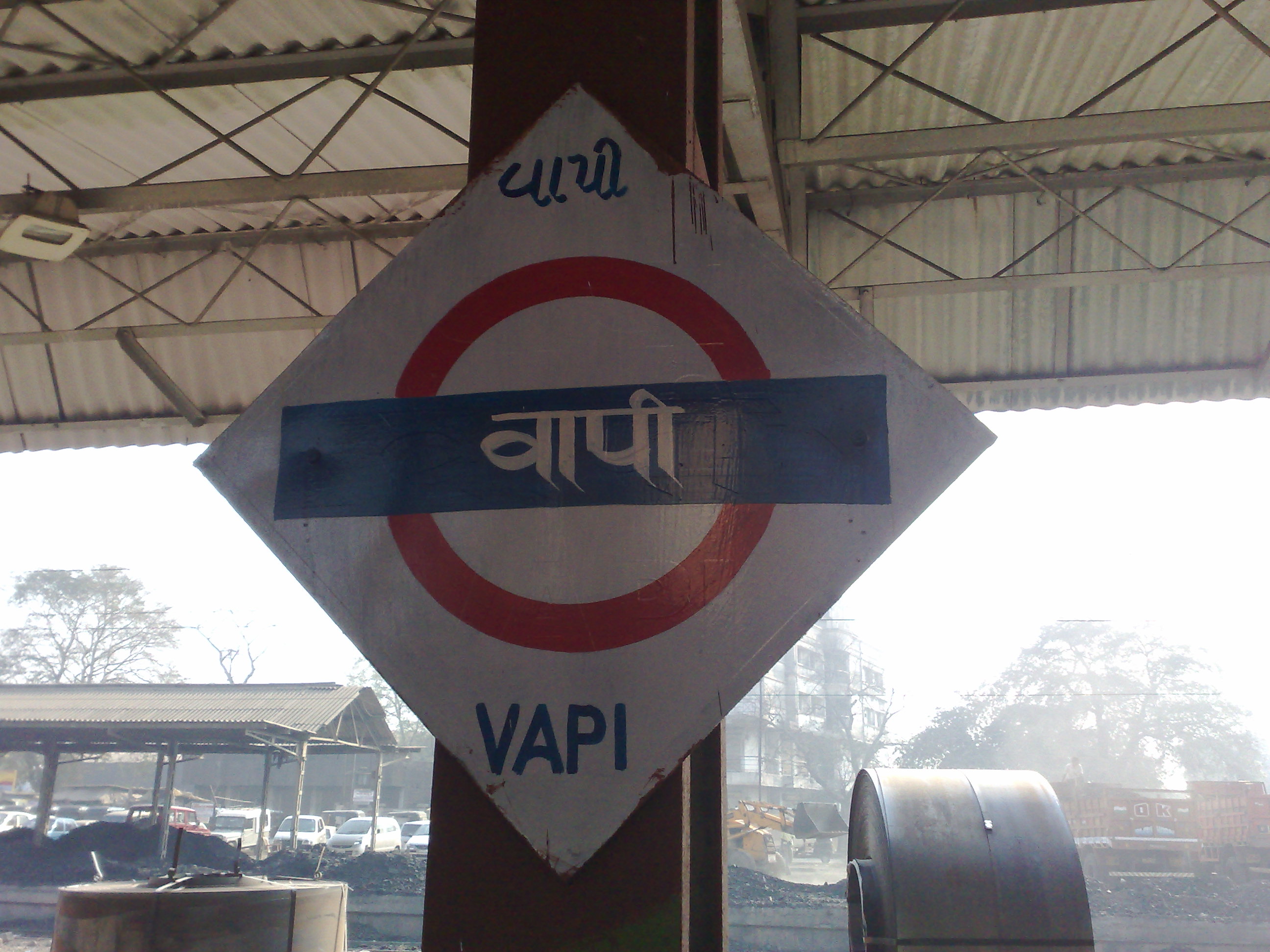
Vapi ( IAST: vāpī,), is a city and municipality in Valsad district in the state of Gujarat, India.It is situated near the banks of the Daman Ganga River, around 28 km south of the district headquarters in the city of Valsad, and it is surrounded by the Union Territory of Dadra and Nagar Haveli and Daman and Diu. It is believed that the city got its name from the old small stepwell situated near the Balitha area. The meaning of vapi (''वापी'') in sanskrit is a water reservoir or a water storage body. The town originally belonged to the Kshatriya Jagirdar family Palande during the Marathi Empire. After independence from the British Crown, the Jagirdar system was abolished by the Indian government in 1951 and the community of Anavil Brahmin who formerly acted as tax farmers during the era of the Maratha Empire received the land. Vapi is one of the largest industrial areas in Gujarat in terms of small-scale industries, dominated by the chemical industry. Geogra ... [...More Info...] [...Related Items...] OR: [Wikipedia] [Google] [Baidu] |
Valsad
Valsad (Pronunciation: �alsɑɖ (Gujarati: વલસાડ), historically known as Bulsar, is a city and a municipality in Valsad district of the Indian state of Gujarat. It is the district headquarters of Valsad district. The city of Valsad is located in the south of Navsari and Surat. Etymology The name "Valsad" derives from ''vad-saal'', a Gujarati language compound meaning "covered (''saal'') by banyan trees (''vad'')" (the area was naturally rich in banyan trees). During British Raj, it was historically known as "Bulsar". Geography Valsad is located at . It has an average elevation of 13 metres (42 feet). The old city is about 4 km inland from the Arabian sea. Climate Valsad has a tropical savanna climate (Aw) with little to no rainfall from October to May and very heavy to extremely heavy rainfall from June to September when it is under the direct influence of the Arabian Sea branch of the South-west monsoon. Demographics As of the 2011 Ind ... [...More Info...] [...Related Items...] OR: [Wikipedia] [Google] [Baidu] |
Western Railway (India)
The Western Railway (abbreviated WR) is one of the 19 zones of Indian Railways and is among the busiest railway networks in India, headquartered at Mumbai, Maharashtra. The major railway routes of Indian Railways which come under Western Railways are: Mumbai Central–Ratlam, Mumbai Central–Ahmedabad and Palanpur–Ahmedabad. The railway system is divided into six operating divisions: , , , , , and . Vadodara railway station, being the junction point for the Ahmedabad–Mumbai route and the Mumbai–Ratlam route towards New Delhi, is the busiest junction station in Western Railways and one of the busiest junctions of Indian Railways too, while Ahmedabad Division earns highest revenue followed by Mumbai Division and Vadodara Division. Surat railway station is one of the busiest railway station in Western Railway in non-junction category where more than 180 trains pass per day. Western Railway General Manager's official bungalow 'Bombarci' (abbreviation of Bombay, Baroda and Ce ... [...More Info...] [...Related Items...] OR: [Wikipedia] [Google] [Baidu] |
Mumbai
Mumbai (, ; also known as Bombay — the official name until 1995) is the capital city of the Indian state of Maharashtra and the ''de facto'' financial centre of India. According to the United Nations, as of 2018, Mumbai is the second-most populous city in India after Delhi and the eighth-most populous city in the world with a population of roughly 20 million (2 crore). As per the Indian government population census of 2011, Mumbai was the most populous city in India with an estimated city proper population of 12.5 million (1.25 crore) living under the Brihanmumbai Municipal Corporation. Mumbai is the centre of the Mumbai Metropolitan Region, the sixth most populous metropolitan area in the world with a population of over 23 million (2.3 crore). Mumbai lies on the Konkan coast on the west coast of India and has a deep natural harbour. In 2008, Mumbai was named an alpha world city. It has the highest number of millionaires and billionaires among all cities i ... [...More Info...] [...Related Items...] OR: [Wikipedia] [Google] [Baidu] |
Parsi People
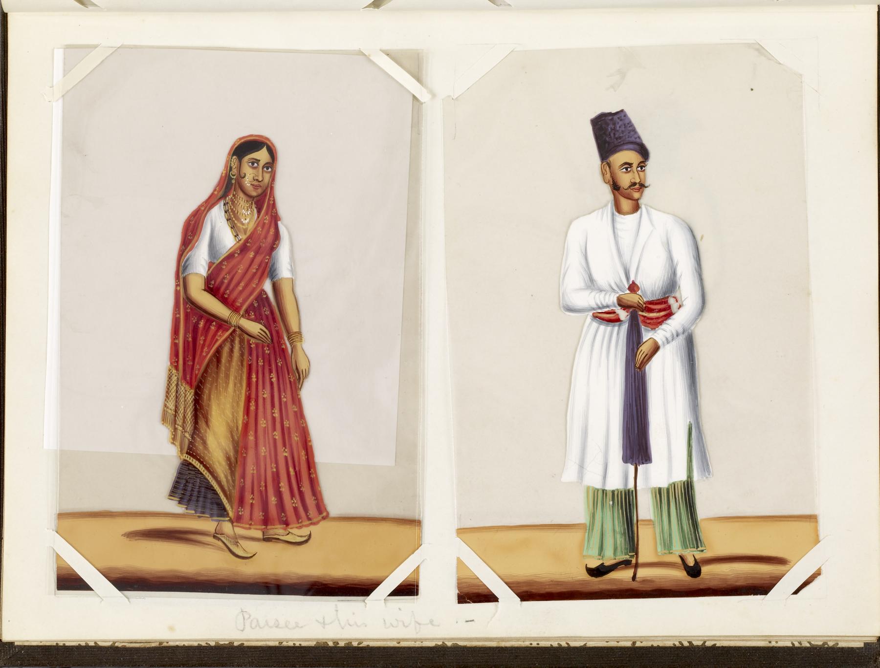
Parsis () or Parsees are an ethnoreligious group of the Indian subcontinent adhering to Zoroastrianism. They are descended from Persians who migrated to Medieval India during and after the Arab conquest of Iran (part of the early Muslim conquests) in order to preserve their Zoroastrian identity. The Parsi people comprise the older of the Indian subcontinent's two Zoroastrian communities vis-à-vis the Iranis, whose ancestors migrated to British-ruled India from Qajar-era Iran. According to a 16th-century Parsi epic, ''Qissa-i Sanjan'', Zoroastrian Persians continued to migrate to the Indian subcontinent from Greater Iran in between the 8th and 10th centuries, and ultimately settled in present-day Gujarat after being granted refuge by a local Hindu king. Prior to the 7th-century fall of the Sassanid Empire to the Rashidun Caliphate, the Iranian mainland (historically known as 'Persia') had a Zoroastrian majority, and Zoroastrianism had served as the Iranian state religion ... [...More Info...] [...Related Items...] OR: [Wikipedia] [Google] [Baidu] |
Textile Industry
The textile industry is primarily concerned with the design, production and distribution of yarn, cloth and clothing. The raw material may be natural, or synthetic using products of the chemical industry. Industry process Cotton manufacturing Cotton is the world's most important natural fibre. In the year 2007, the global yield was 25 million tons from 35 million hectares cultivated in more than 50 countries. There are five stages of cotton manufacturing: * Cultivating and Harvesting * Preparatory Processes * Spinning — giving yarn * Weaving — giving fabrics * Finishing — giving textiles Synthetic fibres Artificial fibres can be made by extruding a polymer, through a spinneret (polymers) into a medium where it hardens. Wet spinning (rayon) uses a coagulating medium. In dry spinning (acetate and triacetate), the polymer is contained in a solvent that evaporates in the heated exit chamber. In melt spinning (nylons and polyesters) the extruded polymer is cooled in gas or ... [...More Info...] [...Related Items...] OR: [Wikipedia] [Google] [Baidu] |
Gujarat Industrial Development Corporation
Gujarat Industrial Development Corporation (GIDC) was established under the ''Gujarat Industrial Development Act of 1962'', with a goal of accelerating industrialization in the state of Gujarat, India. Main role of the GIDC is to identify locations suitable for industrial development and create industrial estates with infrastructure such as roads, drainage, electricity, water supply, street lights, and ready-to-occupy factory sheds. The infrastructure of certain estates has been built for specific industries; there is an electronics estate at Gandhinagar, ceramics and manufacturing estates in Bhavnagar, chemical estates at Vapi, Ankleshwar, Panoli, Nandesari, Naroda. Some GIDC estates also have low-cost housing for workers and executives of tenant businesses, and many of the larger estates include amenities and commercial facilities such as banks, shopping complexes, schools, dispensaries, telecommunications centers, police stations, and community halls. As of February 2008, ... [...More Info...] [...Related Items...] OR: [Wikipedia] [Google] [Baidu] |
Vadodara
Vadodara (), also known as Baroda, is the second largest city in the Indian state of Gujarat. It serves as the administrative headquarters of the Vadodara district and is situated on the banks of the Vishwamitri River, from the state capital of Gandhinagar. The railway line and National Highway 8, which connect Delhi with Mumbai, pass through Vadodara. The city is named for its abundance of the Banyan (''Vad'') tree. Vadodara is also locally referred to as the ''Sanskari Nagari'' () and ''Kala Nagari'' () of India. The city is prominent for landmarks such as the Laxmi Vilas Palace, which served as the residence of the Maratha royal Gaekwad dynasty that ruled over Baroda State. It is also the home of the Maharaja Sayajirao University of Baroda. Etymology The city in one period was called Chandanavati after the rule of Chanda of the Dodiya Rajputs. The capital was also known as Virakshetra or Viravati (Land of Warriors). Later on, it was known as Vadpatraka or Vadodará, and ... [...More Info...] [...Related Items...] OR: [Wikipedia] [Google] [Baidu] |
States And Territories Of India
India is a federal union comprising 28 states and 8 union territories, with a total of 36 entities. The states and union territories are further subdivided into districts and smaller administrative divisions. History Pre-independence The Indian subcontinent has been ruled by many different ethnic groups throughout its history, each instituting their own policies of administrative division in the region. The British Raj mostly retained the administrative structure of the preceding Mughal Empire. India was divided into provinces (also called Presidencies), directly governed by the British, and princely states, which were nominally controlled by a local prince or raja loyal to the British Empire, which held ''de facto'' sovereignty ( suzerainty) over the princely states. 1947–1950 Between 1947 and 1950 the territories of the princely states were politically integrated into the Indian union. Most were merged into existing provinces; others were organised into ... [...More Info...] [...Related Items...] OR: [Wikipedia] [Google] [Baidu] |
Gujarat
Gujarat (, ) is a state along the western coast of India. Its coastline of about is the longest in the country, most of which lies on the Kathiawar peninsula. Gujarat is the fifth-largest Indian state by area, covering some ; and the ninth-most populous state, with a population of 60.4 million. It is bordered by Rajasthan to the northeast, Dadra and Nagar Haveli and Daman and Diu to the south, Maharashtra to the southeast, Madhya Pradesh to the east, and the Arabian Sea and the Pakistani province of Sindh to the west. Gujarat's capital city is Gandhinagar, while its largest city is Ahmedabad. The Gujaratis are indigenous to the state and their language, Gujarati, is the state's official language. The state encompasses 23 sites of the ancient Indus Valley civilisation (more than any other state). The most important sites are Lothal (the world's first dry dock), Dholavira (the fifth largest site), and Gola Dhoro (where 5 uncommon seals were found). Lothal i ... [...More Info...] [...Related Items...] OR: [Wikipedia] [Google] [Baidu] |


.jpg)
