|
Panchagarh District, Bangladesh
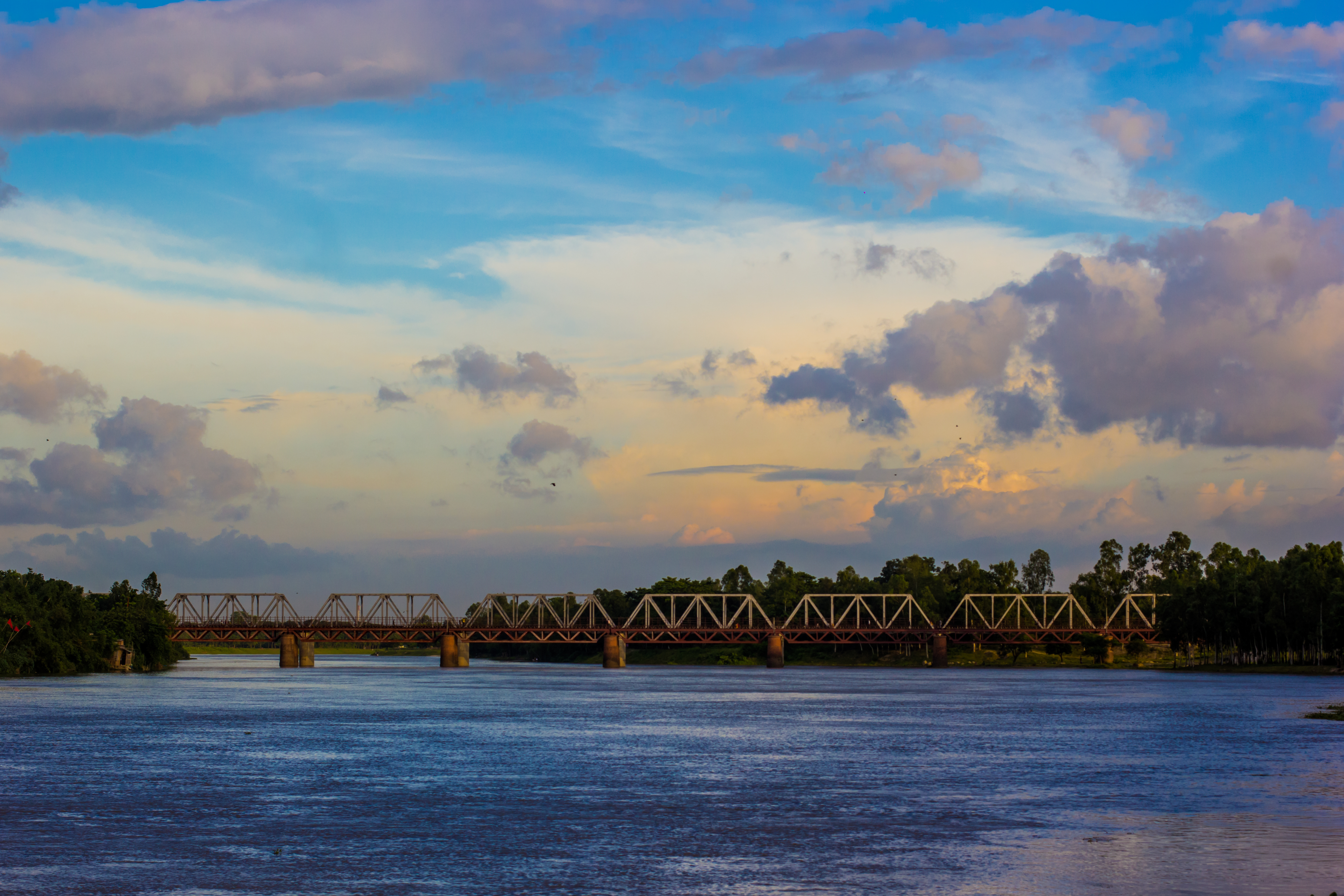
Panchagarh (; bn, পঞ্চগড়, 'five forts') is a district of the Rangpur division in Northern Bangladesh. Panchagarh is the northernmost district of Bangladesh. It lies between 26º00' and 26º38' north latitudes and between 88º19' and 88º49' east longitudes. It was established as a district on 1 February 1984. Etymology Panchagarh is also called pachagarh (which means 'rotten' in bengali) as a mockery term. There are two main beliefs associated with the name of the district. The first is that Panchargarh was named after an area called Pancha Nagari in the kingdom of Pundu Nagar. The second is that it was named for the five forts (or ) in the region. The forts were Bhitargarh, Hosaingarh, Mirgarh, Rajangarh and Devengarh, hence the name Panchagarh, meaning 'five forts'. History During the regime of the British Raj, Panchagarh was part of the Jalpaiguri district of undivided Bengal. In 1911, Jalpaiguri was fully established as a ''thana''. At that time, the headqua ... [...More Info...] [...Related Items...] OR: [Wikipedia] [Google] [Baidu] |
Jalpaiguri District
Jalpaiguri district () is a district of the Indian state of West Bengal. The district was established in 1869 during British Raj. The headquarters of the district are in the city of Jalpaiguri, which is also the divisional headquarters of North Bengal. History Jalpaiguri district comprises western Dooars and the major part of the eastern Morang and this area, according to Sailen Debnath, in the ancient time was a part of the kingdom of Kamarupa, and since the medieval period it became a part of Kamata kingdom.Sailen Debnath, The Dooars in Historical Transition, , N.L. Publishers Sailen writes that three of the five ancient capitals of Kamatapur were geographically in the district of Jalpaiguri; and the three capitals were at Chilapata, Mainaguri and Panchagarh in sequence. According to him, Hingulavas, the first capital of the next Koch kingdom as well was in Jalpaiguri district. Hingulavas has well been identified with Mahakalguri in Alipurduar Sub-Division. Geography ... [...More Info...] [...Related Items...] OR: [Wikipedia] [Google] [Baidu] |
Himalaya
The Himalayas, or Himalaya (; ; ), is a mountain range in Asia, separating the plains of the Indian subcontinent from the Tibetan Plateau. The range has some of the planet's highest peaks, including the very highest, Mount Everest. Over 100 peaks exceeding in elevation lie in the Himalayas. By contrast, the highest peak outside Asia (Aconcagua, in the Andes) is tall. The Himalayas abut or cross five countries: Bhutan, India, Nepal, China, and Pakistan. The sovereignty of the range in the Kashmir region is disputed among India, Pakistan, and China. The Himalayan range is bordered on the northwest by the Karakoram and Hindu Kush ranges, on the north by the Tibetan Plateau, and on the south by the Indo-Gangetic Plain. Some of the world's major rivers, the Indus, the Ganges, and the Tsangpo–Brahmaputra, rise in the vicinity of the Himalayas, and their combined drainage basin is home to some 600 million people; 53 million people live in the Himalayas. The Himalayas have ... [...More Info...] [...Related Items...] OR: [Wikipedia] [Google] [Baidu] |
Thakurgaon District
Thakurgaon ( bn, ঠাকুরগাঁও জেলা, ''Thakurgaon Jela'' also ''Thakurgaon Zila'') is a district in the north-western side of Bangladesh. It is a part of the Rangpur Division and borders India to the west. It was established as a mahakuma in 1860 consisting of 6 thanas named Thakurgaon sadar, Baliadangi, Pirganj, Ranishankail, Haripur and Ruhia. In 1947, it was re-established as a mahakuma including 3 thanas of Jalpaiguri and a thana of kochbihar of India. In 1981, Atoari was included in the new Panchagarh district and the area was shrunk in just 5 thanas. It was then established as a district on 1 February 1984. Subdistricts There are 5 upazilas, 6 thanas, 53 unions, 647 mouzas and 1016 villages in Thakurgaon. The Upazilas in this district are: #Thakurgaon Sadar Upazila #Baliadangi Upazila # Haripur Upazila #Ranisankail Upazila # Pirganj Upazila There is also another Pirganj upazila under Rangpur district The Thana in this district are: # Ruhea Thana Histo ... [...More Info...] [...Related Items...] OR: [Wikipedia] [Google] [Baidu] |
Dinajpur District, Bangladesh
Dinajpur district ( bn, দিনাজপুর জেলা) is a district in the Rangpur Division of northern Bangladesh. Dinajpur is the largest district among all sixteen northern districts of Bangladesh. History Dinajpur was once a part of the ancient state of Pundravardhana. Devkot (now in India) which rotated as the capital of Lakhnauti was located south of Dinajpur town. It is also called "City of Maharajas". An ancient engraved stone, believed to be from the Gupta era, was recovered from the bank of a pond near Sura Masjid in the Ghoraghat Upazila in Dinajpur in 8 October. British Colonial Period The British administrative control in Dinajpur was established in 1786. Dinajpur was the biggest administrative district of undivided Bengal. In 1765, the British got the Dewani of Bengal and in 1772 an English District Collector and Chief of Revenue was appointed in Dinajpur. The area was then notorious for lawlessness. Mr. Marriott was Collector in 1786. Next to him, Mr. ... [...More Info...] [...Related Items...] OR: [Wikipedia] [Google] [Baidu] |
Uttar Dinajpur District
Uttar Dinajpur () is a district of the Indian state of West Bengal. Created on 1 April 1992 by the division of the erstwhile West Dinajpur district, it comprises two subdivisions: Raiganj and Islampur. History Undivided Dinajpur district was part of the Pundra kingdom. The whole of Pundra was part of the Mauryan empire, and Jainism was spread in the region in the fourth century BCE. Their capital was at Pundrabardhan (now in Bangladesh), and two other ancient towns were Gourpur and Kotibarsha, now called Bangarh. Later multiple inscriptions show how the Guptas also controlled Pundra. The district was then under Pala rule from 750 CE. The Senas overthrew the Palas in 1143. In 1204, Bakhtiyar Khilji defeated the Senas and had Bangarh as its capital. After his murder, it was controlled by various governors sent by the Delhi Sultan from Gauda. In 1586, Mughal Emperor Akbar conquered Bengal and Dinajpur was controlled by the ''sarkars'' of Tajpur and Panjara. In 1765, it fell ... [...More Info...] [...Related Items...] OR: [Wikipedia] [Google] [Baidu] |
Cooch Behar District
Cooch Behar district () is a district of Indian state of West Bengal. Formerly part of the Kamarupa kingdom, the area became the heart of the Kamata Kingdom in the 12th century. During the British Raj, the district was known as Cooch Behar state ruled by the Koch dynasty until 1947, when it became part of India. The district consists of the flat plains of North Bengal and has several rivers: the most notable being the Teesta, Jaldhaka and Torsa. The district has the highest proportion of Scheduled Castes in the country, where they form a majority. Etymology The name ''Cooch Behar'' is derived from the name of the Koch or '' Rajbanshi'' community indigenous to this region. The word ''behar'' is derived from sa, विहार '' vihara''. History Early period Cooch Behar formed part of the Kamarupa Kingdom of Assam from the 4th to the 12th centuries. In the 12th century, the area became a part of the Kamata Kingdom, first ruled by the Khen dynasty from their capita ... [...More Info...] [...Related Items...] OR: [Wikipedia] [Google] [Baidu] |
Jalpaiguri
Jalpaiguri is a city in the Indian state of West Bengal. It is the headquarters of the Jalpaiguri district as well as of the Jalpaiguri division of West Bengal, covering the jurisdiction of the five districts of North Bengal. The city is located on the banks of the Teesta River which is the second largest river in West Bengal after the Ganges, on the foothills of the Himalayas. The city is the home to the circuit bench of the Kolkata High Court, the other seat being at Port Blair in the Andaman and Nicobar Islands. Jalpaiguri features the Jalpaiguri Government Engineering College, the second campus of the University of North Bengal and the Biswa Bangla Krirangan/ Jalpaiguri Sports Village. It lies east of its twin city, Siliguri. The merging of the two cities makes it the largest metropolis of the region. Etymology The name "Jalpaiguri" comes from the word "Jalpai''"'' meaning olive, which grew in the city and adjacent areas. And "Guri" means ''a'' place. Geography Jalpa ... [...More Info...] [...Related Items...] OR: [Wikipedia] [Google] [Baidu] |
Darjeeling
Darjeeling (, , ) is a town and municipality in the northernmost region of the Indian state of West Bengal. Located in the Eastern Himalayas, it has an average elevation of . To the west of Darjeeling lies the easternmost province of Nepal, to the east the Kingdom of Bhutan, to the north the Indian state of Sikkim, and farther north the Tibet Autonomous Region region of China. Bangladesh lies to the south and southeast, and most of the state of West Bengal lies to the south and southwest, connected to the Darjeeling region by a narrow tract. Kangchenjunga, the world's third-highest mountain, rises to the north and is prominently visible on clear days. In the early 19th century, during East India Company rule in India, Darjeeling was identified as a potential summer retreat for British officials, soldiers and their families. The narrow mountain ridge was leased from the Kingdom of Sikkim, and eventually annexed to British India. Experimentation with growing tea on the slop ... [...More Info...] [...Related Items...] OR: [Wikipedia] [Google] [Baidu] |
India
India, officially the Republic of India (Hindi: ), is a country in South Asia. It is the seventh-largest country by area, the second-most populous country, and the most populous democracy in the world. Bounded by the Indian Ocean on the south, the Arabian Sea on the southwest, and the Bay of Bengal on the southeast, it shares land borders with Pakistan to the west; China, Nepal, and Bhutan to the north; and Bangladesh and Myanmar to the east. In the Indian Ocean, India is in the vicinity of Sri Lanka and the Maldives; its Andaman and Nicobar Islands share a maritime border with Thailand, Myanmar, and Indonesia. Modern humans arrived on the Indian subcontinent from Africa no later than 55,000 years ago., "Y-Chromosome and Mt-DNA data support the colonization of South Asia by modern humans originating in Africa. ... Coalescence dates for most non-European populations average to between 73–55 ka.", "Modern human beings—''Homo sapiens''—originated in Africa. Then, int ... [...More Info...] [...Related Items...] OR: [Wikipedia] [Google] [Baidu] |
Karatoya River
Karatoya River (also spelt Korotoa River) is a small stream in Rajshahi Division of Bangladesh. Etymology The name of the river is formed of two Sanskrit words ''kar'' (hand) and ''toa'' (water). Course The Karatoya, known as Phuljhur rises in the Baikunthapur jungles in the extreme north-west of Jalpaiguri district (West Bengal, India) and forms for some distance the boundary between Dinajpur and Rangpur districts. It, then, meanders through Rangpur and Bogura. In the south of Bogura district, it receives the Halhalia and the united stream is then known as Phuljhur. It leaves Bogura at Chanda kona and flowing in a southerly direction past Raiganj and Shujapur is joined by the Ichhamati at Nalka. The Phuljhur then flows south past the important village of Ullapara, a few miles below which it joins the Hurasagar at Narnia after a course of about in this district. After this junction, it takes the name of Hurasagar and passing close by Shazadpur and Hera joins the Jamuna near ... [...More Info...] [...Related Items...] OR: [Wikipedia] [Google] [Baidu] |


