|
Palo Seco, Toa Baja, Puerto Rico
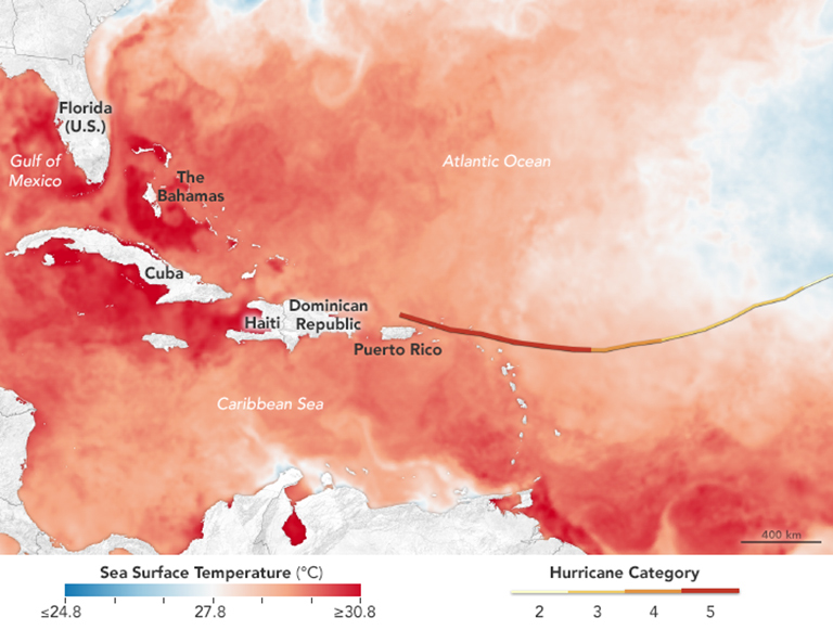
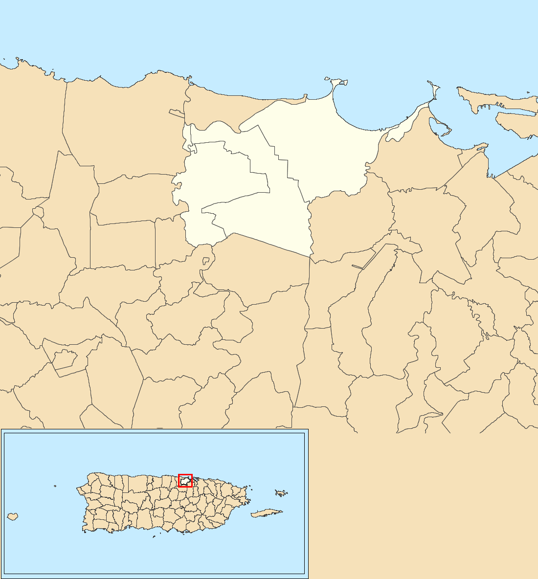
Palo Seco is a barrio in the municipality of Toa Baja, Puerto Rico. Its population in 2010 was 288. Palo Seco power plant One of the main power plants supplying power to Puerto Rico is the fuel oil power plant located near Palo Seco, Toa Baja. Before Hurricane Irma and Hurricane Maria struck Puerto Rico in September 2017, the Palo Seco plant was slated to close. Gallery Carretera PR-870, Toa Baja, Puerto Rico.jpg, PR-870 in Palo Seco Old sunken ship off the coast of Palo Seco, Toa Baja, Puerto Rico.jpg, Sunken ship off the coast of Palo Seco Staff Deligation Tours Palo Seco Power Plant, Puerto Rico.jpg, At the Palo Seco Power Plant after 2 hurricanes struck Puerto Rico in 2017 See also * List of communities in Puerto Rico * List of barrios and sectors of Toa Baja, Puerto Rico Like all municipalities of Puerto Rico, Toa Baja is subdivided into administrative units called barrios, which are, in contemporary times, roughly comparable to minor civil divisions, (and means '' ... [...More Info...] [...Related Items...] OR: [Wikipedia] [Google] [Baidu] |
Commonwealth (U
A commonwealth is a traditional English term for a political community founded for the common good. Historically, it has been synonymous with "republic". The noun "commonwealth", meaning "public welfare, general good or advantage", dates from the 15th century. Originally a phrase (the common-wealth or the common wealth – echoed in the modern synonym "public wealth"), it comes from the old meaning of "wealth", which is "well-being", and is itself a loose translation of the Latin res publica (republic). The term literally meant "common well-being". In the 17th century, the definition of "commonwealth" expanded from its original sense of "public welfare" or "wikt:commonweal, commonweal" to mean "a state in which the supreme power is vested in the people; a republic or democracy, democratic state". The term evolved to become a title to a number of political entities. Three countries – Australia, the Bahamas, and Dominica – have the official title "Commonwealth", as do four U.S. ... [...More Info...] [...Related Items...] OR: [Wikipedia] [Google] [Baidu] |
List Of Municipalities In Puerto Rico
The municipalities of Puerto Rico (Spanish: ''municipios de Puerto Rico'') are the second-level administrative divisions in the Commonwealth of Puerto Rico. There are 78 such administrative divisions covering all 78 incorporated towns and cities. Each municipality is led by a mayor and divided into barrios, third-level administrative divisions, though the latter are not vested with any political authority. Every municipality is governed as stated by the Autonomous Municipalities Act of 1991, which establishes that every municipality must have an elected strong mayor with a municipal legislature as the form of government. Each legislature must be unicameral, with the number of members related to adequate representation of the total population of the municipality. In contrast to other jurisdictions, both the mayors and the municipal legislators are elected on the same date and for the same term of four years in office. From a political and ekistic perspective, several difference ... [...More Info...] [...Related Items...] OR: [Wikipedia] [Google] [Baidu] |
Toa Baja, Puerto Rico
Toa Baja (, ) is a town and municipality of Puerto Rico located in the northern coast, north of Toa Alta and Bayamón; east of Dorado; and west of Cataño. Toa Baja is spread over five barrios, including Toa Baja Pueblo (the downtown area and the administrative center of the city). Toa Baja is part of the San Juan-Caguas-Guaynabo Metropolitan Statistical Area. Toa Baja is located fifteen minutes by car from San Juan and two hours from Ponce. History The region of what is now Toa Baja belonged to the Taíno region of Toa and Bayamón, which was located on the north coast of Puerto Rico. The regions were led by cacique Aramana and Majagua respectively. During the Spanish colonization, a farm was settled in the region around 1511 where Spanish settlers tried to learn from the Taínos how to grow fruits and vegetables. Some of the families who settled in the region were Marrero, Salgado, and Martínez, from the Canary Islands. In 1745, the town was officially organized, with ... [...More Info...] [...Related Items...] OR: [Wikipedia] [Google] [Baidu] |
Atlantic Time Zone
The Atlantic Time Zone is a geographical region that keeps standard time—called Atlantic Standard Time (AST)—by subtracting four hours from Coordinated Universal Time ( UTC), resulting in UTC−04:00. AST is observed in parts of North America and some Caribbean islands. During part of the year, some portions of the zone observe daylight saving time, referred to as Atlantic Daylight Time (ADT), by moving their clocks forward one hour to result in UTC−03:00. The clock time in this zone is based on the mean solar time of the 60th meridian west of the Greenwich Observatory. In Canada, the provinces of New Brunswick, Nova Scotia, and Prince Edward Island are in this zone, though legally they calculate time specifically as an offset of four hours from Greenwich Mean Time (GMT–4) rather than from UTC. Small portions of Quebec (eastern Côte-Nord and the Magdalen Islands) also observe Atlantic Time. Officially, the entirety of Newfoundland and Labrador observes Newfoundland Stand ... [...More Info...] [...Related Items...] OR: [Wikipedia] [Google] [Baidu] |
Barrios Of Puerto Rico
The barrios of Puerto Rico are the primary legal divisions of the seventy-eight municipalities of Puerto Rico. Puerto Rico's 78 ''municipios'' are divided into geographical sections called ''barrios'' (English: " wards") and, as of 2010, there were 902 of them. In the US Census a barrio sometimes includes a division called a or subbarrio. In Puerto Rico, barrios are composed of sectors. The types of sectors, (''sectores'') may vary, from normally ''sector'' to ''urbanización'' to ''reparto'' to ''barriada'' to ''residencial'', among others. History The history of the creation of the barrios of Puerto Rico can be traced to the 19th century, when historical documents first mention them. Historians have speculated that their creation may have been related to the Puerto Rican representation at the Cortes of Cádiz. The names of barrios in Puerto Rico come from various sources, mostly from Spanish or Indian origin. One barrio in each municipality (except for Florida, Ponce, and S ... [...More Info...] [...Related Items...] OR: [Wikipedia] [Google] [Baidu] |
Fuel Oil
Fuel oil is any of various fractions obtained from the distillation of petroleum (crude oil). Such oils include distillates (the lighter fractions) and residues (the heavier fractions). Fuel oils include heavy fuel oil, marine fuel oil (MFO), bunker fuel, furnace oil (FO), gas oil (gasoil), heating oils (such as home heating oil), diesel fuel and others. The term ''fuel oil'' generally includes any liquid fuel that is burned in a furnace or boiler to generate heat ( heating oils), or used in an engine to generate power (as motor fuels). However, it does not usually include other liquid oils, such as those with a flash point of approximately , or oils burned in cotton- or wool-wick burners. In a stricter sense, ''fuel oil'' refers only to the heaviest commercial fuels that crude oil can yield, that is, those fuels heavier than gasoline (petrol) and naphtha. Fuel oil consists of long-chain hydrocarbons, particularly alkanes, cycloalkanes, and aromatics. Small molecules, such as t ... [...More Info...] [...Related Items...] OR: [Wikipedia] [Google] [Baidu] |
Hurricane Irma
Hurricane Irma was an extremely powerful Cape Verde hurricane that caused widespread destruction across its path in September 2017. Irma was the first Category 5 hurricane to strike the Leeward Islands on record, followed by Maria two weeks later. At the time, it was considered as the most powerful hurricane on record in the open Atlantic region, outside of the Caribbean Sea and Gulf of Mexico until it was surpassed by Hurricane Dorian two years later. It was also the third strongest Atlantic hurricane at landfall ever recorded, just behind the 1935 Labor Day Hurricane and Dorian. The ninth named storm, fourth hurricane, second major hurricane, and first Category 5 hurricane of the 2017 season, Irma caused widespread and catastrophic damage throughout its long lifetime, particularly in the northeastern Caribbean and the Florida Keys. It was also the most intense hurricane to strike the continental United States since Katrina in 2005, the first major hurrican ... [...More Info...] [...Related Items...] OR: [Wikipedia] [Google] [Baidu] |
Hurricane Maria
Hurricane Maria was a deadly Saffir–Simpson scale#Category 5, Category 5 Tropical cyclone, hurricane that devastated the northeastern Caribbean in September 2017, particularly Dominica, Saint Croix, and Puerto Rico. It is regarded as the worst natural disaster in recorded history to affect those islands. The most intense tropical cyclone worldwide in Tropical cyclones in 2017, 2017, Maria was the thirteenth tropical cyclone naming, named storm, eighth consecutive hurricane, fourth major hurricane, second List of Category 5 Atlantic hurricanes, Category 5 hurricane, and deadliest storm of the extremely active 2017 Atlantic hurricane season. Maria was the List of deadliest Atlantic hurricanes, deadliest Atlantic hurricane since Hurricane Mitch, Mitch in 1998 Atlantic hurricane season, 1998, and the List of the most intense tropical cyclones#North Atlantic Ocean, tenth most intense Atlantic hurricane on record. Total monetary losses are estimated at upwards of $91.61 b ... [...More Info...] [...Related Items...] OR: [Wikipedia] [Google] [Baidu] |
Puerto Rico Highway 870
Puerto Rico Highway 870 (PR-870) is a road located entirely in the municipality of Toa Baja, Puerto Rico. With a length of , it begins at its intersection with PR-165 and ends at Isla de Cabras, passing through Palo Seco neighborhood. Carretera PR-870, Toa Baja, Puerto Rico.jpg, Puerto Rico Highway 870 north in Palo Seco Major intersections See also * * References External links * 870 __NOTOC__ Year 870 ( DCCCLXX) was a common year starting on Sunday (link will display the full calendar) of the Julian calendar. Events By place Europe * August 8 – Treaty of Meerssen: King Louis the German forces his half-brothe ... Toa Baja, Puerto Rico {{PuertoRico-road-stub ... [...More Info...] [...Related Items...] OR: [Wikipedia] [Google] [Baidu] |
List Of Communities In Puerto Rico
In Puerto Rico, there are 78 municipalities and 902 municipio subdivisions made up of 827 barrios and 75 barrios-pueblo. There are also a number of subbarrios and communities. The following is a list of the 902 barrios, some of the subbarrios, including the 40 subbarrios of Santurce, which is a barrio of San Juan and a few communities (, on the U.S. Census) arranged in alphabetical order. Barrios (which for US census purposes, are roughly comparable to minor civil divisions) in turn are further subdivided into smaller local populated place areas/units called sectores (''sectors'' in English). The types of ''sectores'' may vary, from normally ''sector'' to ''urbanización'' to ''reparto'' to ''barriada'' to ''residencial'', among others. ''Sectores'' are not on this list. __NOTOC__ A * Abra Honda, Camuy * Abras, Corozal * Aceitunas, Moca * Achiote, Naranjito * Adjuntas barrio-pueblo * Aguacate, Aguadilla * Aguacate, Yabucoa * Aguada barrio-pueblo * Aguadilla barri ... [...More Info...] [...Related Items...] OR: [Wikipedia] [Google] [Baidu] |
List Of Barrios And Sectors Of Toa Baja, Puerto Rico
Like all municipalities of Puerto Rico, Toa Baja is subdivided into administrative units called barrios, which are, in contemporary times, roughly comparable to minor civil divisions, (and means ''wards'' or ''boroughs'' or ''neighborhoods'' in English). The barrios and subbarrios, in turn, are further subdivided into smaller local populated place areas/units called sectores (''sectors'' in English). The types of ''sectores'' may vary, from normally ''sector'' to ''urbanización'' to ''reparto'' to ''barriada'' to ''residencial'', among others. Some sectors appear in two barrios. List of sectors by barrio Candelaria *Barriada Fidel Torres *Barriada Márquez *Barriada Popular *Barriada Aponte *Comunidad Candelaria Arenas *Comunidad Pájaros *Comunidad Villa Pangola *Condominio Quinta Real *Condominio Terrazas de Montecasino *Proyecto Pájaros *Reparto Anamar *Reparto Molina *Sector Albizu *Sector Alto El Cabro *Sector Azucena *Sector Barriada Rosa *Sector Buen Vecino *Sector Capi ... [...More Info...] [...Related Items...] OR: [Wikipedia] [Google] [Baidu] |


