|
Pagoda Festival
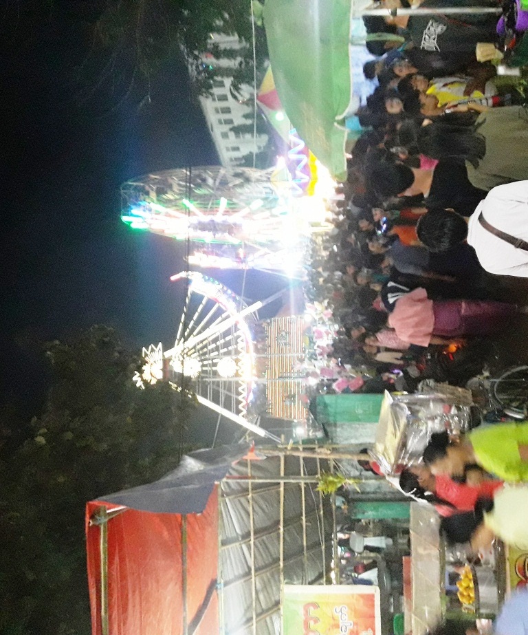
Pagoda festivals ( my, ဘုရားပွဲ; ''paya pwe'') are regular festivals found throughout Burma (Myanmar) that commemorate major religious events in pagoda's history, including the founding of a pagoda and the crowning of the pagoda's hti (umbrella). Pagoda festivals are dictated by the Burmese religious calendar and often are held several days at a time. Major events in a pagoda festival typically do not coincide with Uposatha (Buddhist Sabbath) days, during which pious Buddhists observe the Eight Precepts. The majority of pagoda festivals are held during the dry season, from the months of Tazaungmon (November) to Tabaung (March). During the full moon day of Tabaung (Magha Puja), Buddhist devotees in various parts of Myanmar also celebrate sand pagoda festivals. More well-known pagoda festivals often attract numerous pilgrims from throughout the country. Pagoda festivals are similar in nature to agricultural shows (country fairs) or carnivals, and form a signifi ... [...More Info...] [...Related Items...] OR: [Wikipedia] [Google] [Baidu] |
Tabodwe
Tabodwe ( my, တပို့တွဲ) is the eleventh month of the traditional Burmese calendar. Festivals and observances *Full moon of Tabodwe **Harvest Festival () **Mon National Day Rakhine tug of war festival, Yatha Hswe Pwe. *Pagoda festivals **Alaungdaw Kathapa Pagoda Festival (Sagaing Region) **Shwe Settaw Pagoda Festival (Minbu Township, Magwe Region) **Kyaikkhauk Pagoda Festival (Thanlyin Township, Yangon Region) Tabodwe symbols *Flower: '' Butea monosperma'' References See also *Burmese calendar *Festivals of Burma Burmese traditional festivals are based on the traditional Burmese calendar and dates are largely determined by the moon's phase. Burmese culture is most evident in villages where local festivals are held throughout the year, the most importan ... {{Burmese months Months of the Burmese calendar ... [...More Info...] [...Related Items...] OR: [Wikipedia] [Google] [Baidu] |
Thaton
Thaton (; mnw, သဓီု ) is a town in Mon State, in southern Myanmar on the Tenasserim plains. Thaton lies along the National Highway 8 and is also connected by the National Road 85. It is 230 km south east of Yangon and 70 km north of Mawlamyine. Thaton was the capital of Thaton Kingdom from at least the 4th century BC to the middle of the 11th century AD. Etymology Thaton is the Burmese name of Sadhuim (သဓီု) in Mon, which in turn is from Sudhammapura () in Pali, after Sudharma, the moot hall of the gods. History Thaton was the capital of the Thaton Kingdom, a Mon Kingdom which ruled present day Lower Burma between the 4th and 11th centuries. Like the Burmans and the Thais, some modern Mons have tried to identify their ethnicity and, specifically this kingdom at Thaton, with the semi-historical kingdom of Suwarnabhumi ("The Golden Land"); today, this claim is contested by many different ethnicities in south-east Asia, and contradicted by scholars ... [...More Info...] [...Related Items...] OR: [Wikipedia] [Google] [Baidu] |
Sagaing Region
Sagaing Region ( my, စစ်ကိုင်းတိုင်းဒေသကြီး, ; formerly Sagaing Division) is an administrative region of Myanmar, located in the north-western part of the country between latitude 21° 30' north and longitude 94° 97' east. It is bordered by India's Nagaland, Manipur, and Arunachal Pradesh States to the north, Kachin State, Shan State, and Mandalay Region to the east, Mandalay Region and Magway Region to the south, with the Ayeyarwady River forming a greater part of its eastern and also southern boundary, and Chin State and India to the west. The region has an area of . In 1996, it had a population of over 5,300,000 while its population in 2012 was 6,600,000. The urban population in 2012 was 1,230,000 and the rural population was 5,360,000. The capital city of Sagaing Region is Monywa. Capital city The Capital city of Sagaing Region is Monywa. History The Pyu were the first to in recorded history to populate the area of Sagaing Regio ... [...More Info...] [...Related Items...] OR: [Wikipedia] [Google] [Baidu] |
Yangon Region
Yangon Region(, ; formerly Rangoon Division and Yangon Division) is an administrative region of Myanmar. Located in the heart of Lower Myanmar, the division is bordered by Bago Region to the north and east, the Gulf of Martaban to the south, and Ayeyarwady Region to the west. Yangon Region is dominated by its capital city of Yangon, the former national capital and the largest city in the country. Other important cities are Thanlyin and Twante. The division is the most developed region of the country and the main international gateway. The division measures . History The region was historically populated by the Mon. Politically, the area was controlled by Mon kingdoms prior to 1057, and after 1057, with few exceptions, by Burman kingdoms from the north. The control of the region reverted to Pegu-based Mon kingdoms in the 13th to 16th centuries (1287–1539) and briefly in the 18th century (1740–57). The Portuguese were in control of Thanlyin (Syriam) and the surrounding ... [...More Info...] [...Related Items...] OR: [Wikipedia] [Google] [Baidu] |
Yangon
Yangon ( my, ရန်ကုန်; ; ), formerly spelled as Rangoon, is the capital of the Yangon Region and the largest city of Myanmar (also known as Burma). Yangon served as the capital of Myanmar until 2006, when the military government relocated the administrative functions to the purpose-built capital city of Naypyidaw in north central Myanmar. With over 7 million people, Yangon is Myanmar's most populous city and its most important commercial centre. Yangon boasts the largest number of colonial-era buildings in Southeast Asia, and has a unique colonial-era urban core that is remarkably intact. The colonial-era commercial core is centered around the Sule Pagoda, which is reputed to be over 2,000 years old. The city is also home to the gilded Shwedagon Pagoda – Myanmar's most sacred and famous Buddhist pagoda. Yangon suffers from deeply inadequate infrastructure, especially compared to other major cities in Southeast Asia, such as Jakarta, Bangkok or Hanoi. Though ... [...More Info...] [...Related Items...] OR: [Wikipedia] [Google] [Baidu] |
Shwedagon Pagoda
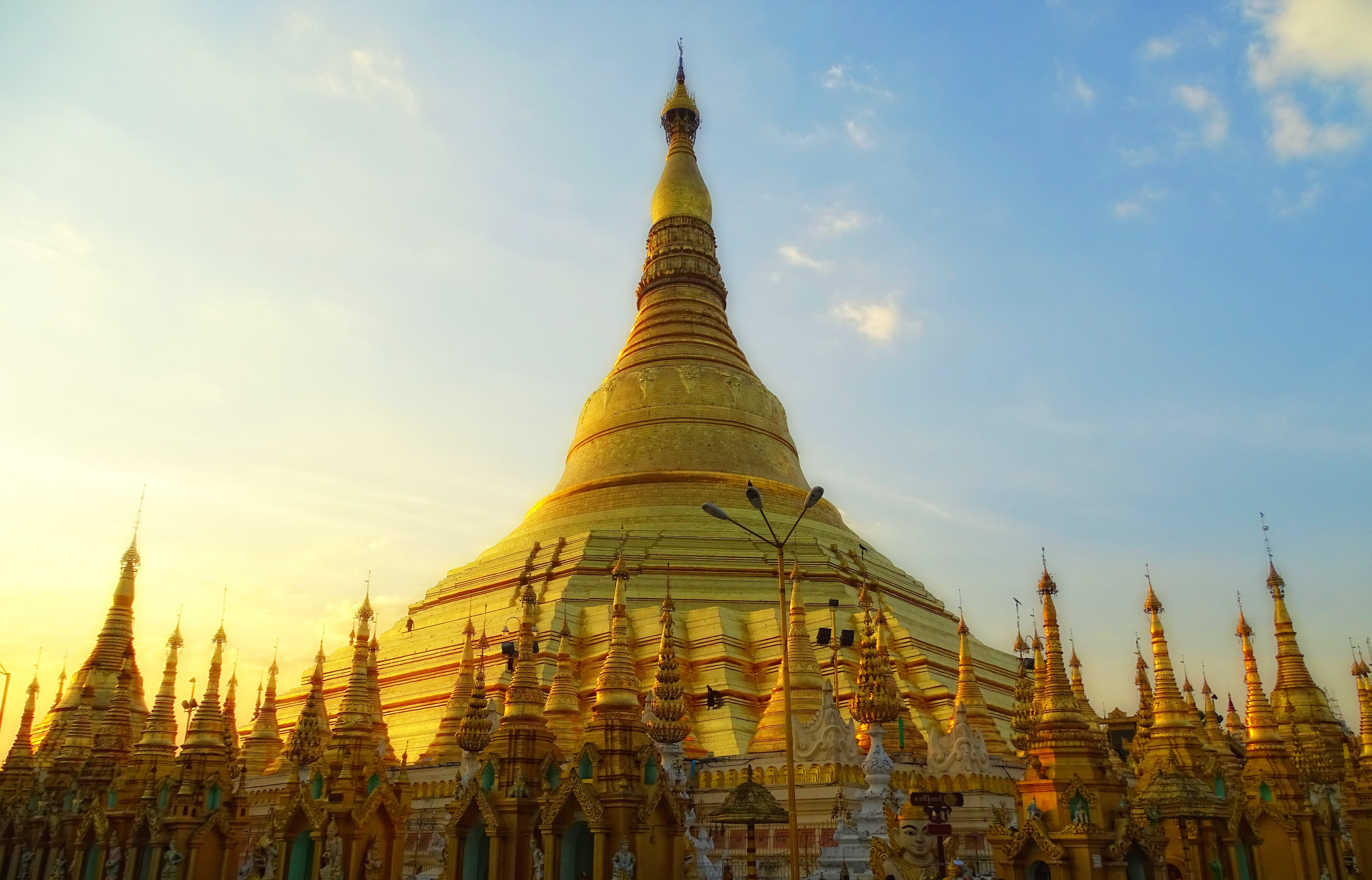
The Shwedagon Pagoda (, ); mnw, ကျာ်ဒဂုၚ်; officially named ''Shwedagon Zedi Daw'' ( my, ရွှေတိဂုံစေတီတော်, , ) and also known as the Great Dagon Pagoda and the Golden Pagoda is a gilded stupa located in Yangon, Myanmar. The Shwedagon is the most sacred Buddhist pagoda in Myanmar, as it is believed to contain relics of the four previous Buddhas of the present kalpa. These relics include the staff of Kakusandha, the water filter of Koṇāgamana, a piece of the robe of Kassapa, and eight strands of hair from the head of Gautama. Built on the high Singuttara Hill, the tall pagoda stands above sea level,The pagoda's pinnacle height (to the tip of its ''hti'') is tall per (UNESCO 2018), and is built on the Singuttara Hill, which is tall per , and tall above sea level per and dominates the Yangon skyline. Yangon's zoning regulations, which cap the maximum height of buildings to above sea level (75% of the pagoda's sea ... [...More Info...] [...Related Items...] OR: [Wikipedia] [Google] [Baidu] |
Nadaw
Nadaw ( my, နတ်တော်; also spelt Natdaw) is the ninth month of the traditional Burmese calendar. Festivals and observances *Mahagiri Nat Festival, Mount Popa *Literature and Arts Festival () *Pagoda festivals **Botahtaung Pagoda Festival (Yangon) Nadaw symbols *Flower: '' Bulbophyllum auricomum'' References See also *Burmese calendar *Festivals of Burma Burmese traditional festivals are based on the traditional Burmese calendar and dates are largely determined by the moon's phase. Burmese culture is most evident in villages where local festivals are held throughout the year, the most importan ... {{Burmese months Burmese culture Months of the Burmese calendar ... [...More Info...] [...Related Items...] OR: [Wikipedia] [Google] [Baidu] |
Mon State
Mon State ( my, မွန်ပြည်နယ်, ; mnw, တွဵုရးဍုင်မန်, italics=no) is an administrative division of Myanmar. It lies between Kayin State to the east, the Andaman Sea to the west, Bago Region to the north and Tanintharyi Region to the south, also having a short border with Thailand's Kanchanaburi Province at its south-eastern tip. The land area is . The Dawna Range, running along the eastern side of the state in a NNW–SSE direction, forms a natural border with Kayin State. Mon State includes some small islands, such as Kalegauk, Wa Kyun and Kyungyi Island, along its of coastline. The state's capital is Mawlamyine. History Mon tradition holds that the Suwarnabhumi mentioned in the Edicts of Ashoka and the ''Dîpavamsa'' was their first kingdom (pronounced Suvanna Bhoum), founded around the port of Thaton in about 300 BC, however, this is disputed by scholars. Oral tradition suggests that they had contact with Buddhism via s ... [...More Info...] [...Related Items...] OR: [Wikipedia] [Google] [Baidu] |
Kyaikhtiyo Pagoda
Kyaiktiyo Pagoda ( my, ကျိုက်ထီးရိုးဘုရား or ; mnw, ကျာ်သိယဵု ; also known as Golden Rock) is a well-known Buddhist pilgrimage site in Mon State, Myanmar. It is a small pagoda () built on the top of a granite boulder covered with gold leaves pasted on by its male worshippers. According to legend, the Golden Rock itself is precariously perched on a strand of Lord Buddha's hair. The balancing rock seems to defy gravity, as it perpetually appears to be on the verge of rolling down the hill. The rock and the pagoda are at the top of Mt. Kyaiktiyo. Another legend states that a Buddhist monk impressed the celestial king with his asceticism and the celestial king used his supernatural powers to carry the rock to its current place, specifically choosing the rock for its resemblance to the monk's head. It is the third most important Buddhist pilgrimage site in Burma after the Shwedagon Pagoda and the Mahamuni Pagoda. Etymology I ... [...More Info...] [...Related Items...] OR: [Wikipedia] [Google] [Baidu] |
Shwezigon Pagoda
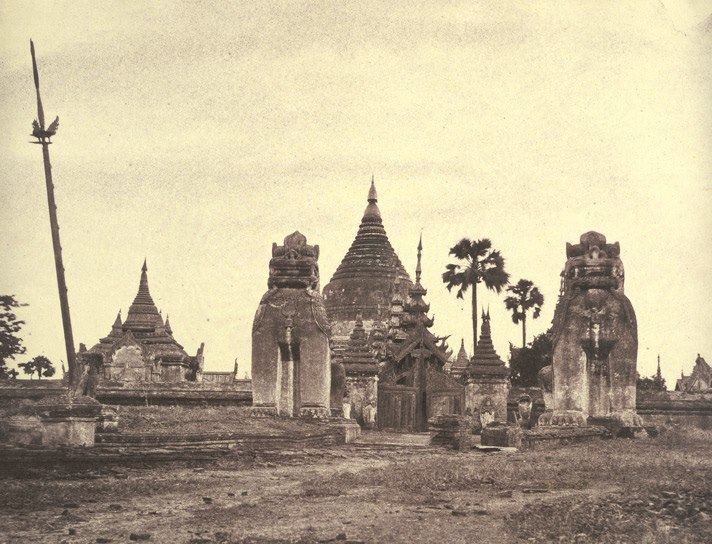
The Shwezigon Pagoda or Shwezigon Paya ( my-Mymr, ရွှေစည်းခုံဘုရား ) is a Buddhist stupa located in Nyaung-U, Myanmar. A prototype of Burmese stupas, it consists of a circular gold leaf-gilded stupa surrounded by smaller temples and shrines. Construction of the Shwezigon Pagoda began during the reign of King Anawrahta (r. 1044–1077), the founder of the Pagan Empire, in 1059–1060 and was completed in 1102, during the reign of his son King Kyansittha. Over the centuries the pagoda had been damaged by many earthquakes and other natural calamities, and has been refurbished several times. In recent renovations it has been covered by more than 30,000 copper plates. However, the lowest level terraces have remained as they were. This pagoda, a sacred Buddhist religious place, is believed to enshrine a bone and tooth of Gautama Buddha. The pagoda is in the form of a cone formed by five square terraces with a central solid core. There are footprints b ... [...More Info...] [...Related Items...] OR: [Wikipedia] [Google] [Baidu] |
Pyatho
Pyatho ( my, ပြာသို) is the tenth month of the traditional Burmese calendar. Festivals and observances *Karen New Year (first day of Pyatho) *Royal equestrianism, equestrian festivals () *Pagoda festivals **Ananda Pagoda Festival, Bagan Pyatho symbols *Flower: ''Clematis smilacifolia'' References See also *Burmese calendar *Festivals of Burma {{Burmese months Burmese culture Months of the Burmese calendar ... [...More Info...] [...Related Items...] OR: [Wikipedia] [Google] [Baidu] |


