|
Ohio State Route 344
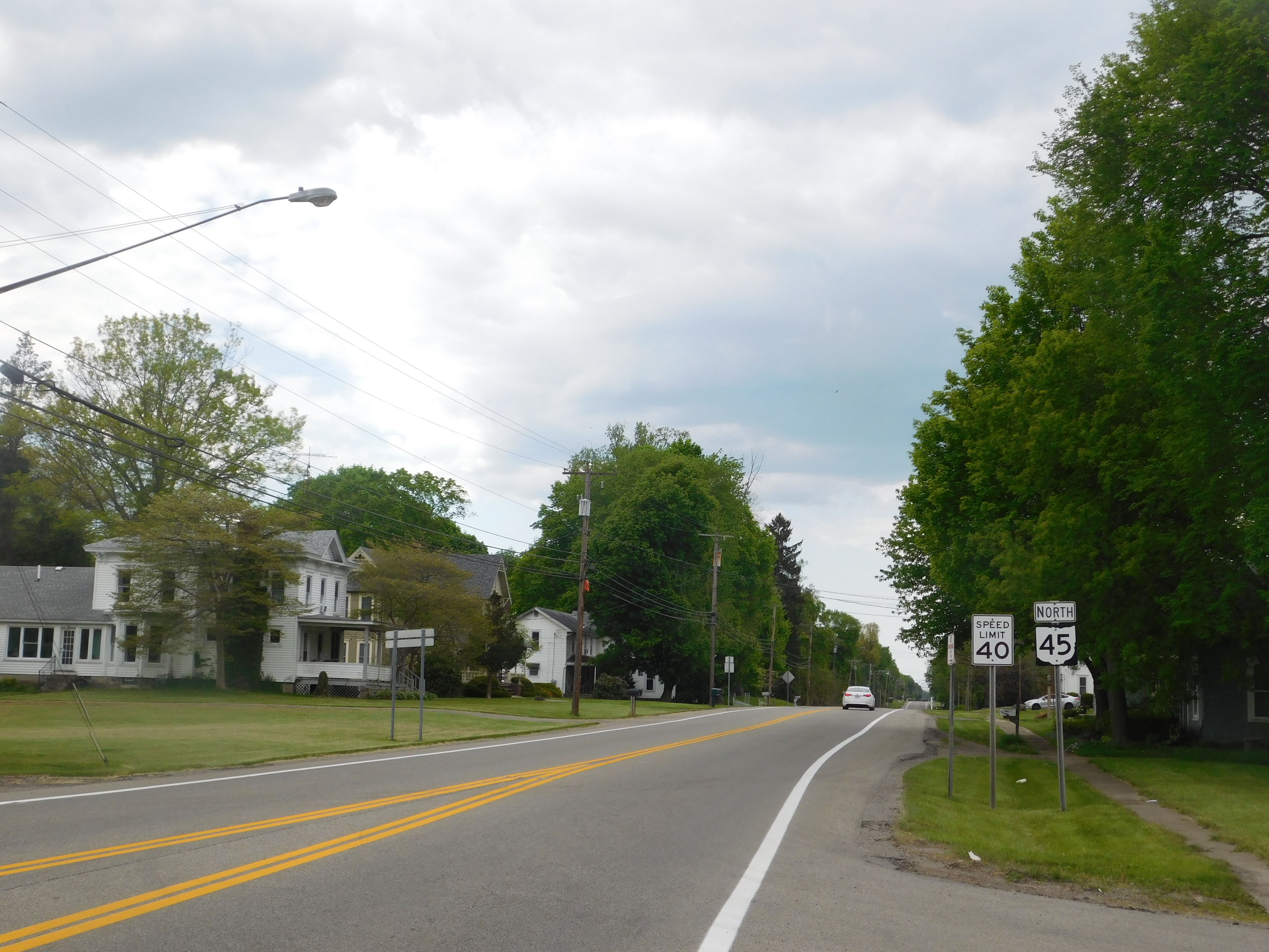
State Route 344 (SR 344) is an east-west state highway lying entirely in Columbiana County, Ohio. Its western terminus is at State Route 14 and State Route 9 in downtown Salem, and its eastern terminus is along a concurrency with State Route 164 in downtown Columbiana. History SR 344 was originally established, in 1935, originally routed from SR 45, west of Leetonia, to Columbiana. Between 1979 and 1981, the route was extended to Salem along what was SR 558, SR 558 was also rerouted to the south along some of the former SR 344. In that same year, the highway was rerouted between former SR 558 and Leetonia along a previously unnumbered road. No significant changes have taken place to this state route since 1981. Major intersection References {{Reflist 344 Year 344 ( CCCXLIV) was a leap year starting on Sunday (link will display the full calendar) of the Julian calendar. At the time, it was known as the Year of the Consulshi ... [...More Info...] [...Related Items...] OR: [Wikipedia] [Google] [Baidu] |
Ohio Department Of Transportation
The Ohio Department of Transportation (ODOT; ) is the administrative department of the Ohio state government responsible for developing and maintaining all state and U.S. roadways outside of municipalities and all Interstates except the Ohio Turnpike. In addition to highways, the department also helps develop public transportation and public aviation programs. ODOT is headquartered in Columbus, Ohio. Formerly, under the direction of Michael Massa, ODOT initiated a series of interstate-based Travel Information Centers, which were later transferred to local sectors. The Director of Transportation is part of the Governor's Cabinet. ODOT has divided the state into 12 regional districts to facilitate development. Each district is responsible for the planning, design, construction, and maintenance of the state and federal highways in its region. The department employs over 6,000 people and has an annual budget approaching $3 billion. It celebrated its 100th anniversary in 2005 and ... [...More Info...] [...Related Items...] OR: [Wikipedia] [Google] [Baidu] |
Salem, Ohio
Salem is the largest city in Columbiana County, Ohio, with a small district in southern Mahoning County. At the 2020 census, the city's population was 11,915. It is the principal city of the Salem micropolitan area in Northeast Ohio. It is 18 miles (28 km) southwest of Youngstown, 28 miles (45 km) east of Canton, and 60 miles (97 km) southeast of Cleveland. Founded by the Quaker society in 1806, Salem was notably active in the abolitionist movement of the early- to mid-19th century as a hub for the American Underground Railroad. Through the 20th century, Salem served as one of many industrial towns in Northeast Ohio's Mahoning Valley region. Today, the city is a commuter town and an economic center of Columbiana County, home to Allegheny Wesleyan College and Kent State University at Salem. History Salem was founded by a New Jersey clockmaker, Zadok Street, and a Pennsylvanian potter, John Straughan, in 1806. The city was named after Salem, New Jersey, Streetâ ... [...More Info...] [...Related Items...] OR: [Wikipedia] [Google] [Baidu] |
Leetonia, Ohio
Leetonia is a village in northern Columbiana County, Ohio, United States. The population was 1,833 at the 2020 census. It is part of the Salem micropolitan area, about south of Youngstown. History The Village of Leetonia was founded in 1869, following the American Civil War. Leetonia was named for William Lee of Randolph, New York. Lee was one of the founders of the Leetonia Iron and Coal Company which was laid out in the village in 1866-1867. Cherry Valley Coke Ovens Leetonia is home to one of the few remaining bee hive coke oven sites in America. In the early 1860s, Irish businessman William Lee discovered rich deposits of coal, ore and lime under the soil of today's Leetonia. Lee began to buy the surrounding land and established the company "The Leetonia Coal & Iron Company" which consisted of a coal mine, coke ovens, and a blast furnace. This company jumped into the iron and coal industry and soon turned the area into a thriving company town. The area went from housing ... [...More Info...] [...Related Items...] OR: [Wikipedia] [Google] [Baidu] |
Columbiana, Ohio
Columbiana is a city in northern Columbiana County, Ohio, Columbiana and southern Mahoning County, Ohio, Mahoning counties in the U.S. state of Ohio. The population was 6,559 at the 2020 United States Census, 2020 census. It is part of the Micropolitan statistical area, Salem micropolitan area and the Mahoning Valley, YoungstownâWarren metropolitan area. The childhood home of notable inventor and businessman Harvey S. Firestone, the city hosts the annual Shaker Woods Arts & Crafts Festival, which brings national attention to the city in the summer and fall seasons. It has historically been a regional transportation hub, lying along portions of Ohio State Route 7, Ohio State Route 14, 14, Ohio State Route 46, 46, and Ohio State Route 164, 164 as well as the Fort Wayne Line, Norfolk Southern Railway and the Youngstown and Southeastern Railroad. In addition to a traditional downtown, the city is home to the 1930s themed Firestone Farms shopping and business park. In 2019, Columbiana ... [...More Info...] [...Related Items...] OR: [Wikipedia] [Google] [Baidu] |
Columbiana County, Ohio
Columbiana County is a county located in the U.S. state of Ohio. As of the 2020 census, the population was 101,877. The county seat is Lisbon and its largest city is Salem. The county name is derived from the explorer of the Americas, Christopher Columbus. Columbiana County comprises the Salem, OH Micropolitan Statistical Area, which is also included in the larger Youngstown-Warren, OH-PA Combined Statistical Area. Due to its location, Columbiana County is traditionally considered a part of Appalachian Ohio. While northern communities are more associated with Northeast Ohio, southern communities generally share more in common culturally with Greater Pittsburgh and the Upper Ohio Valley. The largely rural county sits midway between the two urban clusters. Officially considered part of the Youngstown media market, the Steubenville market media stations regularly report in the area as well. History The principal historic Native American peoples in the area were the Lenape, M ... [...More Info...] [...Related Items...] OR: [Wikipedia] [Google] [Baidu] |
State Highway
A state highway, state road, or state route (and the equivalent provincial highway, provincial road, or provincial route) is usually a road that is either ''numbered'' or ''maintained'' by a sub-national state or province. A road numbered by a state or province falls below numbered national highways (Canada being a notable exception to this rule) in the hierarchy (route numbers are used to aid navigation, and may or may not indicate ownership or maintenance). Roads maintained by a state or province include both nationally numbered highways and un-numbered state highways. Depending on the state, "state highway" may be used for one meaning and "state road" or "state route" for the other. In some countries such as New Zealand, the word "state" is used in its sense of a sovereign state or country. By this meaning a state highway is a road maintained and numbered by the national government rather than local authorities. Countries Australia Australia's State Route system covers u ... [...More Info...] [...Related Items...] OR: [Wikipedia] [Google] [Baidu] |
Ohio
Ohio () is a state in the Midwestern region of the United States. Of the fifty U.S. states, it is the 34th-largest by area, and with a population of nearly 11.8 million, is the seventh-most populous and tenth-most densely populated. The state's capital and largest city is Columbus, with the Columbus metro area, Greater Cincinnati, and Greater Cleveland being the largest metropolitan areas. Ohio is bordered by Lake Erie to the north, Pennsylvania to the east, West Virginia to the southeast, Kentucky to the southwest, Indiana to the west, and Michigan to the northwest. Ohio is historically known as the "Buckeye State" after its Ohio buckeye trees, and Ohioans are also known as "Buckeyes". Its state flag is the only non-rectangular flag of all the U.S. states. Ohio takes its name from the Ohio River, which in turn originated from the Seneca word ''ohiËyo'', meaning "good river", "great river", or "large creek". The state arose from the lands west of the Appalachian Mountai ... [...More Info...] [...Related Items...] OR: [Wikipedia] [Google] [Baidu] |
State Route 14 (Ohio)
State Route 14, located in northeastern Ohio, runs from U.S. Route 6/ U.S. Route 42/ State Route 3 in Downtown Cleveland southeasterly to the Pennsylvania state line near East Palestine; Pennsylvania Route 51 continues southeasterly from there. History * 1924 â Original route established;Explanation of the Ohio State Highway System (The Unofficial Ohio State Highways Web Site) by John Simpson original alignment was along its current alignment from to Unity, SR 170âs current alignment from Unity to |
State Route 9 (Ohio)
State Route 9 (SR 9) is a north–south route running through four counties in east central Ohio. Its route is long. The southern terminus is at SR 148 in Armstrongs Mills and the northern terminus is with US 62 north of Salem. Route description History *before 1931 â Route 9 ran from Cincinnati to Michigan.Route 9 (The Unofficial Ohio State Highways Web Site) by John Simpson This highway followed the current U.S. Highway 127 from the at Cincinnati to just south of Bryan and followed current |
Ohio State Route 164
State Route 164 (SR 164) is a state highway passing through four counties in east-central Ohio. The route runs in a general southwest to northeast fashion, and is signed north–south accordingly. The southern terminus is at an intersection with State Route 212 south of Leesville, and the northern terminus is at Interstate 680 and Western Reserve Road on the Beaver and Boardman township boundary between North Lima and Boardman. The southern part of the route serves more rural areas while it makes its way through larger villages and cities toward its northern end. History SR 164 was commissioned in 1923, routed from Salineville to Youngstown. The highway was reroute from North Lima to Youngstown along previous Route 7, in 1926. In 1937 the route was extended south to SR 43 in Amsterdam. The route was extended southeast to the current intersection at SR 212, south of Leesville, in 1938. Between 1977 and 1979 the northern terminus was relocated to ... [...More Info...] [...Related Items...] OR: [Wikipedia] [Google] [Baidu] |
Ohio State Route 45
State Route 45 (SR 45) is a north–south state highway in the northeastern portion of the U.S. state of Ohio. Its southern terminus is at the State Route 7/ State Route 39 concurrency in Wellsville, and its northern terminus is at State Route 531 about west of Ashtabula. History *1924 â Original route established;Explanation of the Ohio State Highway System (The Unofficial Ohio State Highways Web Site) by John Simpson originally routed from to along its current route from Lisbon to 1½ miles south of [...More Info...] [...Related Items...] OR: [Wikipedia] [Google] [Baidu] |
Ohio State Route 558
State Route 558 (SR 558) is a state route that runs between Salem and East Palestine in the US state of Ohio. Most of the route is a rural two-lane highway and passes through farmland, woodland and residential properties. The highway was first signed in 1937 on much the same alignment as today. SR 558 replaced the SR 154 designation of the highway which dated back to 1923; SR 194 ran between Lisbon and East Palestine. Some of the highway was paved in 1937, with the rest of the route being paved by 1961. Route description SR 558 begins at an intersection with SR 45, in rural Columbiana County. The route heads northeast as a two-lane highway, passing through woodland. The road makes a sharp curve due east passing through woodland and farmland. The highway turns southeast and enters Franklin Square. In Franklin Square the route passes through residential properties. SR 558 has an intersection with SR 164 in rural Fairfield Township. Afte ... [...More Info...] [...Related Items...] OR: [Wikipedia] [Google] [Baidu] |


