|
Ohio Route 32
State Route 32 (SR 32), also known as the James A. Rhodes Appalachian Highway, is a major east–west highway across the southern portion of the U.S. state of Ohio. It is the eighth longest state route in Ohio, spanning southern Ohio from Cincinnati to Belpre, across the Ohio River from Parkersburg, West Virginia. Except in Belpre, leading up to the bridge into West Virginia, the entire route outside Cincinnati's beltway ( Interstate 275, I-275) is a high-speed four-lane divided highway, forming the Ohio portion of Corridor D of the Appalachian Development Highway System. Route description SR 32 begins at a junction with Columbia Parkway ( U.S. Route 50, US 50) in eastern Cincinnati, near the border between the neighborhoods of Linwood, Mount Lookout, and Columbia-Tusculum, in the area of Lunken Field. It follows Beechmont Avenue, running concurrently with SR 125, until it crosses the Little Miami River, where it turns north on Batavia Road ... [...More Info...] [...Related Items...] OR: [Wikipedia] [Google] [Baidu] |
Cincinnati
Cincinnati ( ) is a city in the U.S. state of Ohio and the county seat of Hamilton County. Settled in 1788, the city is located at the northern side of the confluence of the Licking and Ohio rivers, the latter of which marks the state line with Kentucky. The city is the economic and cultural hub of the Cincinnati metropolitan area. With an estimated population of 2,256,884, it is Ohio's largest metropolitan area and the nation's 30th-largest, and with a city population of 309,317, Cincinnati is the third-largest city in Ohio and 64th in the United States. Throughout much of the 19th century, it was among the top 10 U.S. cities by population, surpassed only by New Orleans and the older, established settlements of the United States eastern seaboard, as well as being the sixth-most populous city from 1840 until 1860. As a rivertown crossroads at the junction of the North, South, East, and West, Cincinnati developed with fewer immigrants and less influence from Europe than Ea ... [...More Info...] [...Related Items...] OR: [Wikipedia] [Google] [Baidu] |
Parkersburg, West Virginia
Parkersburg is a city in and the county seat of Wood County, West Virginia, Wood County, West Virginia. Located at the confluence of the Ohio River, Ohio and Little Kanawha River, Little Kanawha rivers, it is the state's fourth-largest city and the largest city in the Parkersburg-Marietta-Vienna metropolitan area. The population was 29,749 at the 2020 United States census, 2020 census. The city is about south of Marietta, Ohio. The Baltimore and Ohio Railroad reached Parkersburg in 1857, but lacked a crossing over the Ohio River until after the American Civil War. When the B&O completed the Parkersburg Bridge (CSX) 1868–1870 to Belpre, Ohio, Belpre, it was the longest railroad bridge in the world. The Bureau of the Public Debt, an agency of the U.S. Treasury Department, was relocated from the Washington, D.C. metropolitan area in the late 20th century and headquartered in Parkersburg. In October 2012, it was merged with the Financial Management Service to form the Bureau of ... [...More Info...] [...Related Items...] OR: [Wikipedia] [Google] [Baidu] |
Little Miami River
The Little Miami River ( sjw, Cakimiyamithiipi) is a Class I tributary of the Ohio River that flows U.S. Geological Survey. National Hydrography Dataset high-resolution flowline dataThe National Map, accessed May 26, 2011 through five counties in southwestern Ohio in the United States. The Little Miami joins the Ohio River east of Cincinnati. It forms parts of the borders between Hamilton and Clermont counties and between Hamilton and Warren counties. The Little Miami River is one of 156 American rivers designated by the U.S. Congress or the Secretary of the Interior as a National Wild and Scenic River and lends its name to the adjacent Little Miami Scenic Trail. Hydrography The Little Miami River is a tributary of the Ohio River. It is part of a watershed that drains a area in 11 southwestern Ohio counties: Clark, Montgomery, Madison, Greene, Warren, Butler, Clinton, Clermont, Brown, and Highland. The river discharges on average into the Ohio River. An average of flo ... [...More Info...] [...Related Items...] OR: [Wikipedia] [Google] [Baidu] |
Ohio State Route 125
State Route 125 (SR 125) is an east–west state highway in the southwestern portion of the U.S. state of Ohio. Its western terminus is within the Cincinnati, Ohio, Cincinnati city limits, about east of downtown, at U.S. Route 50 (Ohio), U.S. Route 50 – this is also the western terminus of State Route 32 (Ohio), State Route 32 and the southern terminus of State Route 561 (Ohio), State Route 561. The route’s eastern terminus is at U.S. Route 52 (Ohio), U.S. Route 52 approximately west of Portsmouth, Ohio, Portsmouth near the village of Friendship, Ohio, Friendship. Heading east from the Cincinnati neighborhoods of Mount Lookout, Linwood, and Mount Washington, State Route 125 passes through numerous subdivisions in Anderson Township, Hamilton County, Ohio, Anderson Township as a four lane road, Beechmont Avenue. After the Clermont County, Ohio, Clermont County line, State Route 125 becomes Ohio Pike, the old Ohio Turnpike, originally built in 1831 by E.G. Penn, [...More Info...] [...Related Items...] OR: [Wikipedia] [Google] [Baidu] |
Cincinnati Municipal Lunken Airport
Cincinnati Municipal Airport – Lunken Field (Cincinnati Municipal Lunken Airport) is a public airport in Cincinnati, Ohio, three miles (5 km) east of Downtown Cincinnati. It is owned by the city of Cincinnati and serves private aircraft and the fleets of local corporations. It serves a few commercial flights and is the second-largest airport serving Cincinnati after Cincinnati/Northern Kentucky International Airport which is the area’s primary airport. It is known as Lunken Airport or Lunken Field, after Eshelby Lunken. It is bounded by US Route 50 (historic Columbia Parkway and Eastern Avenue) to the west, US Route 52 (Kellogg Avenue) and the Ohio River to the south, the Little Miami River (which originally flowed through the airfield but was diverted) to the east, and Ohio Route 125 (Beechmont Avenue) to the north. The airport is headquarters and hub for Cincinnati-based public charter airline Ultimate Air Shuttle, serving 5 destinations in the eastern United Stat ... [...More Info...] [...Related Items...] OR: [Wikipedia] [Google] [Baidu] |
Columbia-Tusculum, Cincinnati
Columbia-Tusculum is the oldest neighborhood in Cincinnati, Ohio, and is located on the East Side of the city. The population was 1,523 at the 2020 census. Demographics Source - City of Cincinnati Statistical Database. Note - boundaries of neighborhood changed in 2010 - reflective of population decrease. History Columbia was founded in 1788 on the Little Miami River and predates Losantiville (which became Cincinnati) by a month. The first Protestant church (Baptist) in the Northwest Territory was erected in Columbia. The Cincinnati area's first school opened here in 1790. Many of the early settlers are buried in the former Columbia Baptist Cemetery, founded in 1790. The cemetery is now known as the Pioneer Memorial Cemetery. In 1791, Columbia became part of Columbia Township. From the early 1840s, it was included in Spencer Township, until Cincinnati annexed it in 1871. Tusculum was annexed in 1875. The neighborhood is noted for its Victorian era homes decorated in the ... [...More Info...] [...Related Items...] OR: [Wikipedia] [Google] [Baidu] |
Mount Lookout, Cincinnati
Mount Lookout, Ohio is one of the Eastern neighborhoods of Cincinnati, just northwest of Linwood and overlooking the Ohio River valley. The Mount Lookout Observatory moved to the neighborhood in 1873. The population was 4,814 at the 2010 census. Mount Lookout's several-block business district is referred to as Mount Lookout Square and contains restaurants, bars, a variety of shops and service providers, and one of the steps of Cincinnati. Mount Lookout Tavern anchors the east end of the Square and attracts college students from the several area universities (including the University of Cincinnati, Xavier University and Northern Kentucky University), as well as twenty and thirty-something working professionals. Zip's Cafe, established 1926, is one of the more well-known restaurants on the Square as its burger is continually ranked as a top burger in Cincinnati (5th best in 2015 by Cincinnati Magazine). Mount Lookout is considered by Hamilton County, Ohio as home to Alms Park ... [...More Info...] [...Related Items...] OR: [Wikipedia] [Google] [Baidu] |
Linwood, Cincinnati
Linwood is a neighborhood in Cincinnati, Ohio, United States. The population was 705 at the 2020 census. History Linwood was incorporated as a village in 1874. Originally part of Spencer Township, the east side village was annexed by the City of Cincinnati in 1893. In the 19th century, Linwood was situated on the Little Miami Railroad The Little Miami Railroad was a railway of southwestern Ohio, running from the eastern side of Cincinnati to Springfield, Ohio. By merging with the Columbus and Xenia Railroad in 1853, it created the first through-rail route from the important ma .... References Neighborhoods in Cincinnati Former municipalities in Ohio {{Cincinnati-stub ... [...More Info...] [...Related Items...] OR: [Wikipedia] [Google] [Baidu] |
Columbia Parkway
Columbia may refer to: * Columbia (personification), the historical female national personification of the United States, and a poetic name for America Places North America Natural features * Columbia Plateau, a geologic and geographic region in the U.S. Pacific Northwest * Columbia River, in Canada and the United States ** Columbia Bar, a sandbar in the estuary of the Columbia River ** Columbia Country, the region of British Columbia encompassing the northern portion of that river's upper reaches ***Columbia Valley, a region within the Columbia Country ** Columbia Lake, a lake at the head of the Columbia River *** Columbia Wetlands, a protected area near Columbia Lake ** Columbia Slough, along the Columbia watercourse near Portland, Oregon * Glacial Lake Columbia, a proglacial lake in Washington state * Columbia Icefield, in the Canadian Rockies * Columbia Island (District of Columbia), in the Potomac River * Columbia Island (New York), in Long Island Sound Populated places * Co ... [...More Info...] [...Related Items...] OR: [Wikipedia] [Google] [Baidu] |
Appalachian Development Highway System
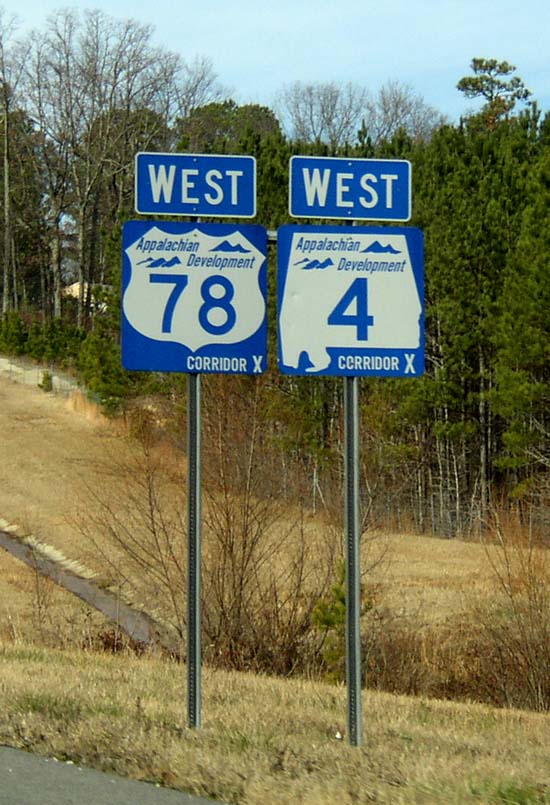
The Appalachian Development Highway System (ADHS) is a series of highway corridors in the Appalachia region of the eastern United States. The routes are designed as local and regional routes for improving economic development in the historically isolated region. It was established as part of the Appalachian Regional Development Act of 1965, and has been repeatedly supplemented by various federal and state legislative and regulatory actions. The system consists of a mixture of state, U.S., and Interstate routes. The routes are formally designated as "corridors" and assigned a letter. Signage of these corridors varies from place to place, but where signed are often done so with a distinctive blue-colored sign. A 2019 study found that the construction of the ADHS led to economic net gains of $54 billion (approximately 0.4 percent of national income) and boosted incomes in the Appalachian region by reducing the costs of trade. History In 1964, the President's Appalachian Re ... [...More Info...] [...Related Items...] OR: [Wikipedia] [Google] [Baidu] |
Corridor D
In the United States, Corridor D is part of the Appalachian Development Highway System. In Ohio, it follows State Route 32 from the eastern Cincinnati suburbs until a point west of Albany, where it becomes concurrent with U.S. Route 50. After crossing into West Virginia, it follows U.S. Route 50 until the Interstate 79 interchange in Clarksburg. The West Virginia portion was constructed during 1967–1977, and the Ohio portion during 2000–2008. ADHS Funding is separate from other Federal Highway funds. Route description Ohio Corridor D begins at the western edge of the Appalachian Regional Commission area at the Hamilton County– Clermont County border east of Cincinnati. It intersects Interstate 275, Cincinnati's beltway, and then U.S. Route 68 and U.S. Route 62 as it crosses the Ohio glacial till plain. Corridor D enters the Allegheny Plateau east of Peebles, crossing the Portage Escarpment near the summit of Tener Mountain before descending into the Scioto ... [...More Info...] [...Related Items...] OR: [Wikipedia] [Google] [Baidu] |
Divided Highway
A dual carriageway ( BE) or divided highway ( AE) is a class of highway with carriageways for traffic travelling in opposite directions separated by a central reservation (BrE) or median (AmE). Roads with two or more carriageways which are designed to higher standards with controlled access are generally classed as motorways, freeways, etc., rather than dual carriageways. A road without a central reservation is a single carriageway regardless of the number of lanes. Dual carriageways have improved road traffic safety over single carriageways and typically have higher speed limits as a result. In some places, express lanes and local/collector lanes are used within a local-express-lane system to provide more capacity and to smooth traffic flows for longer-distance travel. History A very early (perhaps the first) example of a dual carriageway was the ''Via Portuensis'', built in the first century by the Roman emperor Claudius between Rome and its port Ostia at the mouth of t ... [...More Info...] [...Related Items...] OR: [Wikipedia] [Google] [Baidu] |


_1.jpg)