|
Oberelsaß
Oberelsaß (or Upper Alsace, ) was the southern part of the historical region Alsace or Elsass, inhabited originally by locals speaking Alemannic German. From 1871 to 1918, ''Bezirk Oberelsaß'' was a region (''Bezirk'') in the southern part of the province of Elsaß-Lothringen in the German Empire. The region corresponds exactly to the current French department of Haut-Rhin. Its capital was Colmar. It was divided into the districts (''Kreise'') of: * Altkirch within the Sundgau * Colmar * Gebweiler (Guebwiller) * Mülhausen (Mulhouse) * Rappoltsweiler (Ribeauvillé) * Thann The flag of Oberelsaß is a yellow bar on a red field decorated on each side with three crowns. The combination of this flag with that of Unterelsaß forms the flag of modern Alsace Alsace (, ; ; Low Alemannic German/ gsw-FR, Elsàss ; german: Elsass ; la, Alsatia) is a cultural region and a territorial collectivity in eastern France, on the west bank of the upper Rhine next to Germany and Swit ... [...More Info...] [...Related Items...] OR: [Wikipedia] [Google] [Baidu] |
Unterelsaß
Unterelsaß (also spelled ''Unterelsass'', , meaning Lower Alsace) was the northern part of the historical region Alsace or Elsass, inhabited originally by locals speaking Alemannic German. From 1871 to 1918, ''Bezirk Unterelsaß'' was the name for the central district (''Bezirk'') of the imperial territory of Elsaß-Lothringen (Alsace-Lorraine) in the German Empire. Administrative and political organization According to the census 1886 the district of Lower Alsace comprised: * 8 subdistricts ("Kreise") * 31 cantons * 560 municipalities * area * 612.078 inhabitants (Males 299.456 Females 312.622) * Catholics 381.748 Protestants 209.199 Jews 19.848 Other faiths 1.220 Capital and subdistricts The capital of the district was Straßburg. There were the 8 subdistricts ("Kreise") of # Erstein # Hagenau (Haguenau) # Molsheim # Schlettstadt (Sélestat) # Straßburg, Land (county of Straßburg) (Strasbourg) # Weißenburg (Wissembourg) # Zabern (Saverne) # Stadtkreis Stra� ... [...More Info...] [...Related Items...] OR: [Wikipedia] [Google] [Baidu] |
Reichsland Elsaß-Lothringen
The German word Reichsland (imperial country, or reich country) can refer to several entities in German constitutional history: * the territory of the Holy Roman Empire * Alsace-Lorraine as part of the ''Reichsgebiet'' (Germany) between 1871 and 1918 * a concept for Prussia in reform plans for the Weimar Republic The Weimar Republic (german: link=no, Weimarer Republik ), officially named the German Reich, was the government of Germany from 1918 to 1933, during which it was a constitutional federal republic for the first time in history; hence it is ..., transforming the member state Prussia into a territory directly controlled by the federal level (Reich) * ''Reichsland Saarland'', the Saar territory governed by a German commissioner from 1935 to 1945 {{disambiguation ... [...More Info...] [...Related Items...] OR: [Wikipedia] [Google] [Baidu] |
Altkirch
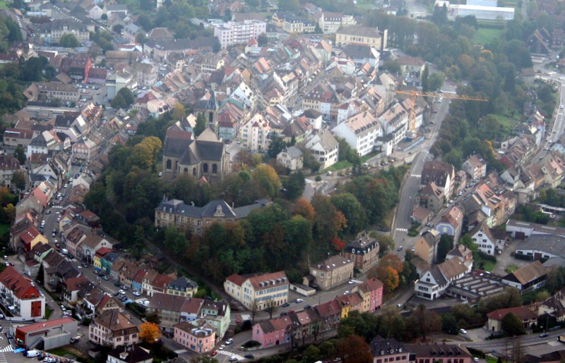
Altkirch (, ; gsw, label= Alsatian, Àltkìrech) is a commune in the Haut-Rhin department in Alsace in north-eastern France. The town is traditionally regarded as the capital of Sundgau. Etymology The name of the commune means ''old church'' ( gsw-FR, Àlta Kìrch or ''Àlta Kìrech''; german: Alte Kirche). History In the 1370s, the citizens of Altkirch made battle and won against a company of Gugler mercenaries. Demography Its inhabitants are known as ''Altkirchois''. The resident population number of 5500 is rather deceptive as some 15,500 people will be in town on a typical working day (4500 working, 3000 studying, 3000 for medical treatment and another 5000 divided between shopping, administrative offices, cultural and sporting activities). Sister cities *Azerbaijan (Nagorno-Karabakh) Füzuli (2016) See also * Château d'Altkirch - destroyed castle in the town. * Communes of the Haut-Rhin department The following is a list of the 366 communes of the French depar ... [...More Info...] [...Related Items...] OR: [Wikipedia] [Google] [Baidu] |
History Of Alsace
The History of Alsace begins when the area was inhabited by nomadic hunters in paleolithic times. Later, control of Alsace shifted among competing European powers, including most recently the Holy Roman Empire and Germany, on the one hand, and France, on the other. Paleolithic and Mesolithic Alsace The earliest evidence of hominids in Alsace dates to 700,000 BP. Neanderthals are established in the region by 250,000 BP. Important Neanderthal archaeological sites are found near the town of Mutzig west of Strasbourg and elsewhere in the valley of the Bruche. By 35,000 BP Aurignacian early modern humans begin to arrive in Alsace, as evidenced by scattered remains throughout the region. The later Mannlefelsen cave near Oberlarg in southern Alsace contains more substantial traces of occupation, dating from 13,000 BP (late Upper Paleolithic) to as late as 5,500 BP (end of Mesolithic). Upper Paleolithic remains at Mannlefelsen include stone scrapers, chisels, projectile weapons, and e ... [...More Info...] [...Related Items...] OR: [Wikipedia] [Google] [Baidu] |
Thann, Haut-Rhin
Thann (; Alsatian: ''Dànn'', , german: Thann) is a commune in the northeastern French department of Haut-Rhin, in Grand Est.Commune de Thann (68334) INSEE It is the '''' of the and part of the canton of Cernay. Its inhabitants are known as ''Thannois''. Geography Thann is situated at the foot of the |
Ribeauvillé
Ribeauvillé (; Alsatian language, Alsatian: ''Rappschwihr''; ) is a Communes of France, commune in the Haut-Rhin Departments of France, department in Grand Est in north-eastern France. It was a Subprefectures in France, sub-prefecture of the department until 2015. Its inhabitants are called ''Ribeauvillois''. Geography The town is located around north of Colmar and south of Strasbourg. It lies at the base of the Vosges Mountains. Climate Ribeauvillé has a oceanic climate (Köppen climate classification ''Cfb''). The average annual temperature in Ribeauvillé is . The average annual rainfall is with August as the wettest month. The temperatures are highest on average in July, at around , and lowest in January, at around . The highest temperature ever recorded in Ribeauvillé was on 25 July 2019; the coldest temperature ever recorded was on 20 December 2009. History Known in the 8th century as ''Rathaldovilare'', the town passed from the Bishops of Basel to the Lords o ... [...More Info...] [...Related Items...] OR: [Wikipedia] [Google] [Baidu] |
Mulhouse
Mulhouse (; Alsatian language, Alsatian: or , ; ; meaning ''Mill (grinding), mill house'') is a city of the Haut-Rhin Departments of France, department, in the Grand Est Regions of France, region, eastern France, close to the France–Switzerland border, Swiss and France–Germany border, German borders. It is the largest city in Haut-Rhin and second largest in Alsace after Strasbourg. Mulhouse is famous for its museums, especially the (also known as the , 'National Museum of the Automobile') and the (also known as , 'French Museum of the Railway'), respectively the largest automobile and railway museums in the world. An industrial town nicknamed "the French Manchester", Mulhouse is also the main seat of the Upper Alsace University, where the secretariat of the European Physical Society is found. Administration Mulhouse is a Communes of France, commune with a population of 108,312 in 2019. [...More Info...] [...Related Items...] OR: [Wikipedia] [Google] [Baidu] |
Guebwiller
Guebwiller (french: Guebwiller, ; Alsatian language, Alsatian: ''Gàwiller'' ; ) is a Communes of France, commune in the Haut-Rhin Departments of France, department in Grand Est currently in north-eastern France. It was a Subprefectures in France, sub-prefecture of the department until 2015. It is situated northwest of Mulhouse at the foot of the Vosges mountains. The ''Ballon de Guebwiller'', the highest point in the Vosges, lies to the west of the town. In 2018, Guebwiller had a population of 11,022 and its urban unit, urban area had a population of 28,662. History Guebweiler, as Gebweiler, is mentioned as early as 774. It belonged to the religious foundation of Murbach Abbey, Murbach, and in 1759 the abbots chose it for their residence. In 1789, at the outbreak of the French Revolution, the monastic buildings were laid in ruins, and, though the archives were rescued and removed to Colmar, the library perished. Geography Climate Guebwiller has a oceanic climate (Köppen c ... [...More Info...] [...Related Items...] OR: [Wikipedia] [Google] [Baidu] |
Sundgau
Sundgau ( or ; ) is a geographical territory in the southern Alsace region (Haut Rhin and Belfort), on the eastern edge of France. The name is derived from Alemannic German ''Sunt- gowe'' ("South shire"), denoting an Alemannic county in the Old High German period. The principal city and historical capital is Altkirch. The considerably smaller French pays of Sundgau, implemented by the 1999 Loi Voynet, roughly corresponds to the arrondissement of Altkirch, comprising four cantons and 112 communes in the south of the larger Sundgau region. Geography The hilly region is bounded on the south by the Swiss border and the foothills of the Jura, in the east by the valley of the Rhine in the vicinity of Basel, to the north by Mulhouse and the potassium-rich basin of Alsace, and to the west by the Belfort Gap. It comprises parts of the modern Department of Haut-Rhin and the Territory of Belfort in the regions of Alsace and the Franche-Comté. The fertile loess soil has traditionally f ... [...More Info...] [...Related Items...] OR: [Wikipedia] [Google] [Baidu] |
Districts Of Germany
In all German states, except for the three city states, the primary administrative subdivision higher than a '' Gemeinde'' (municipality) is the (official term in all but two states) or (official term in the states of North Rhine-Westphalia and Schleswig-Holstein). Most major cities in Germany are not part of any ''Kreis'', but instead combine the functions of a municipality and a ''Kreis''; such a city is referred to as a (literally "district-free city"; official term in all but one state) or (literally "urban district"; official term in Baden-Württemberg). ''(Land-)Kreise'' stand at an intermediate level of administration between each German state (, plural ) and the municipal governments (, plural ) within it. These correspond to level-3 administrative units in the Nomenclature of Territorial Units for Statistics (NUTS 3). Previously, the similar title ( Imperial Circle) referred to groups of states in the Holy Roman Empire. The related term was used for similar a ... [...More Info...] [...Related Items...] OR: [Wikipedia] [Google] [Baidu] |
Colmar
Colmar (, ; Alsatian: ' ; German during 1871–1918 and 1940–1945: ') is a city and commune in the Haut-Rhin department and Grand Est region of north-eastern France. The third-largest commune in Alsace (after Strasbourg and Mulhouse), it is the seat of the prefecture of the Haut-Rhin department and of the subprefecture of the Colmar-Ribeauvillé arrondissement. The city is renowned for its well-preserved old town, its numerous architectural landmarks, and its museums, among which is the Unterlinden Museum, which houses the ''Isenheim Altarpiece''. Colmar is situated on the Alsatian Wine Route and considers itself to be the "capital of Alsatian wine" ('). History Colmar was first mentioned by Charlemagne in his chronicle about Saxon wars. This was the location where the Carolingian Emperor Charles the Fat held a diet in 884. Colmar was granted the status of a free imperial city by Emperor Frederick II in 1226. In 1354 it joined the Décapole city league.G. Köbler, ''H ... [...More Info...] [...Related Items...] OR: [Wikipedia] [Google] [Baidu] |
Haut-Rhin
Haut-Rhin (, ; Alsatian: ''Owerelsàss'' or '; german: Oberelsass, ) is a department in the Grand Est region of France, bordering both Germany and Switzerland. It is named after the river Rhine. Its name means ''Upper Rhine''. Haut-Rhin is the smaller and less populated of the two departments of the former administrative Alsace region, the other being the Bas-Rhin (Lower Rhine). Especially after the 1871 cession of the southern territory known since 1922 as Territoire de Belfort, although it is still densely populated compared to the rest of metropolitan France. It had a population of 767,086 in 2019.Populations légales 2019: 68 Haut-Rhin INSEE On 1 January 2021, the departments of |


.jpg)