|
Ottenby
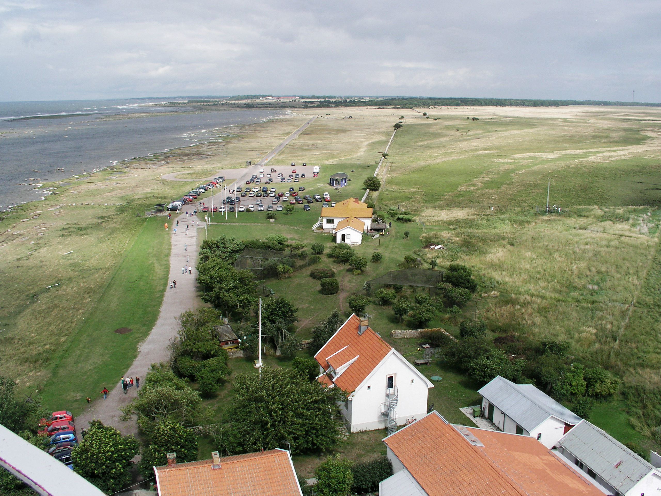
Ottenby () is a town on the island of Öland, Sweden, located in Ås parish, Mörbylånga Municipality in Kalmar County. Ottenby is located just north of the southern tip of Öland, over thirty km south of the area's main town, Mörbylånga. Ottenby is also the name of the mansion and a royal demesne, now a nature reserve. Sweden's tallest lighthouse, Långe Jan, is just south of Ottenby. Reserve and demesne Ottenby is the name of a mansion (see Ottenby kungsgård) and the nearby nature reserve, formerly a royal game reserve stocked with fallow deer, and King Charles X Gustav of Sweden built a drystone wall to confine the native deer. The reserve is situated at the southern edge of the Stora Alvaret, a unique limestone pavement ecosystem designated as a World Heritage Site comprising most of the southern half of the island of Öland. Ottenby offers diverse habitats including coastal marsh, marine, woodland and alvar. Nearest villages include Alby, Hulterstad, Gettlinge, and ... [...More Info...] [...Related Items...] OR: [Wikipedia] [Google] [Baidu] |
Öland
Öland (, ; ; sometimes written ''Øland'' in other Scandinavian languages, and often ''Oland'' internationally; la, Oelandia) is the second-largest Swedish island and the smallest of the traditional provinces of Sweden. Öland has an area of and is located in the Baltic Sea just off the coast of Småland. The island has 26,000 inhabitants. It is separated from the mainland by the Kalmar Strait and connected to it by the Öland Bridge, which opened on 30 September 1972. The county seat Kalmar is on the mainland at the other end of the bridge and is an important commercial centre related to the Öland economy. The island's two municipalities are Borgholm and Mörbylånga named after their municipal seats. Much of the island is farmland, with fertile plains aided by the mild and sunny weather during summer. Öland does not have separate political representation at the national level, and is fully integrated into Sweden as part of Kalmar County. Administration The trad ... [...More Info...] [...Related Items...] OR: [Wikipedia] [Google] [Baidu] |
Långe Jan
Långe Jan ("Tall John") is a Swedish lighthouse located at the south cape of Öland in the Baltic Sea, Sweden's second largest island. It is one of Sweden's most famous lighthouses along with Kullen, Vinga and Landsort, and also the tallest lighthouse in Sweden. The lighthouse was built in 1785, probably by Russian prisoners of war. The tower was built of stone from an old chapel. Originally the light was an open fire, and the tower was unpainted. It was painted white in 1845, and the same year the tower's lantern was installed, to house a colza oil lamp. A couple of years later a black band was added to the tower. The lighthouse remains in use and is remote-controlled by the Swedish Maritime Administration in Norrköping. During the summer season, visitors may climb the tower for a small fee. The buildings surrounding the tower form Ottenby birding station. See also * List of lighthouses and lightvessels in Sweden This is a list of lighthouses and lightvessels in Sweden. ... [...More Info...] [...Related Items...] OR: [Wikipedia] [Google] [Baidu] |
Alby, Öland
Alby is a village on the Baltic Sea in the Hulterstad district at the western fringe of the Stora Alvaret on the island of Öland, Sweden. Archaeological evidence indicates this settlement to have been one of the oldest on the island of Öland, with excavations, dating to the paleolithic era, showing the presence of hunter-gatherers.C. Michael Hogan, ''The Stora Alvaret of Öland'', Lumina Technologies, Aberdeen Library Archives, July 9, 2006 The village prehistory dates to the early Stone Age when settlers from the mainland migrated across the ice bridge connecting the island via the Kalmar Strait about 6000 to 7000 BC. These early inhabitants are known in the archaeological literature as the Alby People. In the earliest times villagers subsisted by hunting, fishing and gathering, but by 4000 BC farming supplanted that lifestyle, and continued to be the primary livelihood until 2006. The village lies atop the low-lying north-south coastal ridge that defines the separation o ... [...More Info...] [...Related Items...] OR: [Wikipedia] [Google] [Baidu] |
Stora Alvaret
Stora Alvaret (; "the Great Alvar") is an alvar, a barren limestone terrace, in the southern half of the island of Öland, Sweden. Stora Alvaret is a dagger shaped expanse almost long and about at the widest north end. The area of this formation exceeds , making it the largest such expanse in Europe and comprising over one fourth of the land area of the island. Because of the thin soil mantle and high pH levels, a great assortment of vegetation is found including numerous rare species. Stora Alvaret is not devoid of trees, contrary to a common misconception; in fact, it holds a variety of sparse stunted trees akin to a pygmy forest. Stora Alvaret falls within UNESCO's Agricultural Landscape of Southern Öland, , which was designated World Heritage Site due to its extraordinary prehistory. Geological origins The limestone plain was created by glacial action from earlier ice age advances. The limestone formation itself was created about 500 million years ago in more southerl ... [...More Info...] [...Related Items...] OR: [Wikipedia] [Google] [Baidu] |
Mörbylånga Municipality
Mörbylånga Municipality (''Mörbylånga kommun'') is a municipality in Kalmar County, in south-eastern Sweden, located on the island of Öland in the Baltic Sea. The seat is located in the town of Mörbylånga, while the largest town is Färjestaden. The present municipality, making up the southern part of Öland, was formed in 1974. The eighteen original entities (as of 1863) had during the nationwide subdivision reform of 1952 been regrouped into three larger units. ''Ottenby'' was amalgamated with Mörbylånga in 1967 and 1974 ''Torslunda'' was added. Mörbylånga Municipality contains several ancient remains, just like the northern Öland municipality of Borgholm. All in all, there are about 20 hillforts on Öland. The most notable in southern Öland is the fortress Eketorp. The southern parts of Öland contain certain wildlife areas. Many migratory birds halt here on their way north or south. Especially the southernmost outpost, the lighthouse ''Långe Jan'' (Tall John) is ... [...More Info...] [...Related Items...] OR: [Wikipedia] [Google] [Baidu] |
Kalmar County
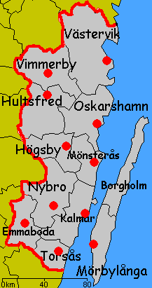
Kalmar County () is a county or '' län'' in southern Sweden. It borders the counties of Kronoberg, Jönköping, Blekinge and Östergötland. To the east in the Baltic Sea is the island Gotland. The counties are mainly administrative units. Geographically Kalmar County covers the eastern part in the Småland province, and the entire island of Öland. Culture Much of Öland's present day landscape known as the Stora Alvaret has been designated as a World Heritage Site by UNESCO. This southern part of Öland is known for a large number of rare species; early paleolithic settlement at Alby; other prehistoric remains such as the Gettlinge Gravefield and Eketorp Fortress; and the Ottenby Nature Preserve. Administration Kalmar County was integrated with Kronoberg County until 1672. Blekinge was a part of Kalmar County between 1680 and 1683, due to the foundation of the naval base at Karlskrona. The seat of residence for the Governor or ''Landshövding'' is Kalmar. The Govern ... [...More Info...] [...Related Items...] OR: [Wikipedia] [Google] [Baidu] |
Hulterstad
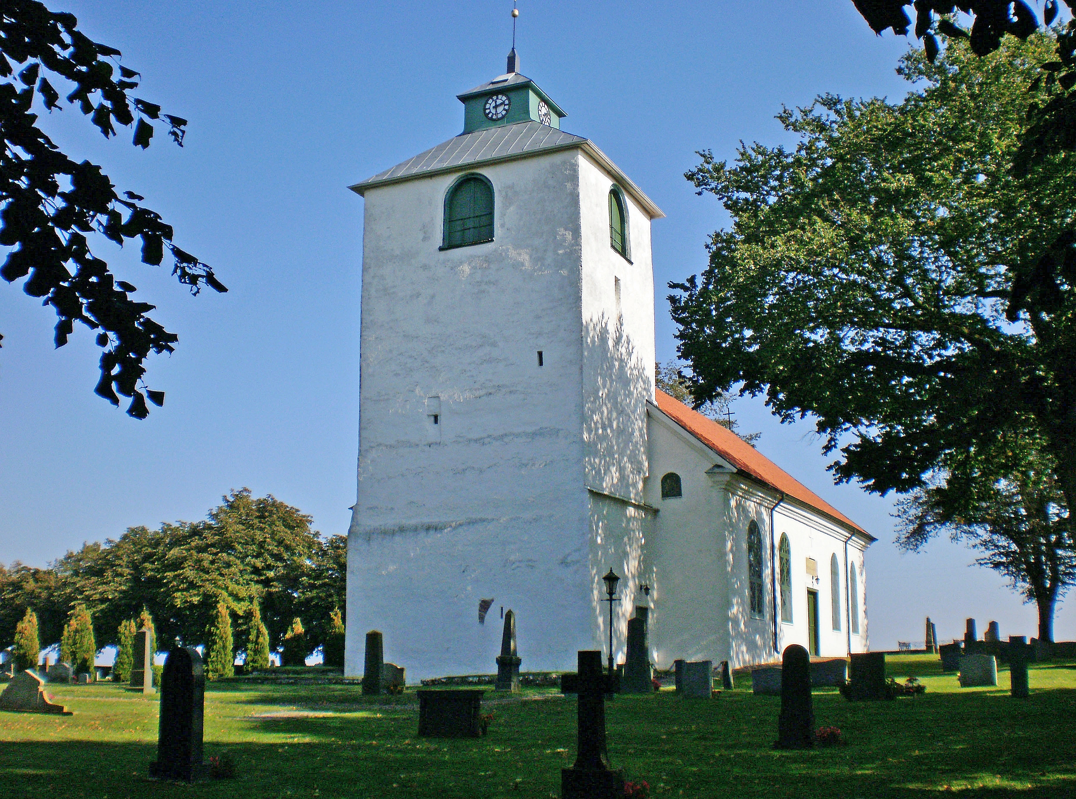
Hulterstad is a small coastal town on the southeastern part of the island of Öland, Sweden. Hulterstad is situated at the eastern fringe of the Stora Alvaret, a limestone pavement habitat which hosts a diversity of rare plants and has been designated a World Heritage Site by UNESCO. Hulterstad is the municipal government center for this district and central records for centuries were kept at the Hulterstad Church. Significant gravefields and a Viking stone burial ship structure are located immediately south of Hulterstad. To the north is located the village of Alby, where a mesolithic village of early human settlement has been found, and to the south is the Ottenby Nature Reserve. Across the alvar to the west is the village of Gettlinge Gettlinge is a village in the southwest portion of the island of Öland, Sweden. It is known for its impressive Viking stone ship burial ground. Gettlinge is situated on the western fringe of the Stora Alvaret, a World Heritage Site d ... [...More Info...] [...Related Items...] OR: [Wikipedia] [Google] [Baidu] |
Charles X Gustav Of Sweden
Charles X Gustav, also Carl Gustav ( sv, Karl X Gustav; 8 November 1622 – 13 February 1660), was King of Sweden from 1654 until his death. He was the son of John Casimir, Count Palatine of Zweibrücken-Kleeburg and Catherine of Sweden. After his father's death he also succeeded him as Pfalzgraf. He was married to Hedwig Eleonora of Holstein-Gottorp, who bore his son and successor, Charles XI. Charles X Gustav was the second Wittelsbach king of Sweden after the childless king Christopher of Bavaria (1441–1448) and he was the first king of the Swedish ''Caroline era'', which had its peak during the end of the reign of his son, Charles XI. He led Sweden during the Second Northern War, enlarging the Swedish Empire. By his predecessor Christina, he was considered ''de facto'' Duke of Eyland (Öland), before ascending to the Swedish throne. His numbering as ''Charles X'' derives from a 16th-century invention. The Swedish king Charles IX (1604–1611) chose his numeral after ... [...More Info...] [...Related Items...] OR: [Wikipedia] [Google] [Baidu] |
Drystone Wall
Dry stone, sometimes called drystack or, in Scotland, drystane, is a building method by which structures are constructed from Rock (geology), stones without any Mortar (masonry), mortar to bind them together. Dry stone structures are stable because of their construction method, which is characterized by the presence of a load-bearing façade of carefully selected interlocking stones. Dry stone construction is best known in the context of stone walls, traditionally used for the boundaries of fields and churchyards, or as retaining walls for terracing, but dry stone sculptures, buildings, bridges, and other structures also exist. The term tends not to be used for the many historic styles which used precisely-shaped stone, but did not use mortar, for example the Greek temple and Inca architecture. The art of dry stone walling was inscribed in 2018 on the UNESCO representative UNESCO Intangible Cultural Heritage Lists, list of the intangible cultural heritage of humanity, fo ... [...More Info...] [...Related Items...] OR: [Wikipedia] [Google] [Baidu] |
Gettlinge
Gettlinge is a village in the southwest portion of the island of Öland, Sweden. It is known for its impressive Viking stone ship burial ground. Gettlinge is situated on the western fringe of the Stora Alvaret, a World Heritage Site designated by UNESCO. The site is readily visible from the perimeter highway, Route 136. Gettlinge, as most prehistoric burial sites on Öland, is established on the low-lying ridge, described by Hogan as a geological formation of thickened soil in this alvar region of otherwise extremely thin soil mantle. This ridge was one of the few places on the southern part of the island that had sufficient soil depth for creation of burial mounds. Situated at the fringe of the Stora Alvaret, the Gettlinge site and environs contains a number of rare and endangered species of both plants and animals, but most of these species are seasonally blooming wildflowers that flower in the late spring and summer. Beneath the soil layer where burials are placed is an ... [...More Info...] [...Related Items...] OR: [Wikipedia] [Google] [Baidu] |
Triberga
Triberga is a village on the island of Öland in the kingdom of Sweden. For many years Triberga has been investigated for its unusual flora and fauna including littoral species.Göran Wahlenberg, ''Flora Svecica enumerans plantas Sveciæ indigenas'', 1826, Palmblad & C. See also *Hulterstad *Eketorp Eketorp is an Iron Age fort, located on southeastern Öland, Sweden, and extensively reconstructed and enlarged in the Middle Ages. Throughout the ages the fortification has served a variety of somewhat differing uses: from defensive ringfort, to m ... References Populated places in Kalmar County Öland {{Kalmar-geo-stub ... [...More Info...] [...Related Items...] OR: [Wikipedia] [Google] [Baidu] |
Nydala Abbey
Nydala Abbey ( sv, Nydala kloster) was a Cistercian monastery in the province of Småland, Sweden, near the lake Rusken. Although the abbey ceased to operate in the 16th century, its church was renovated and converted into a Protestant church during the 17th century and is still in use. The church belongs to the Church of Sweden and is part of the Diocese of Växjö. History Nydala (from Swedish ''ny'', meaning ''new'', and ''dal'', meaning ''valley'') was called ''Sancta Maria de Nova Valle'' or just ''Nova Vallis'' in Latin. It was founded in 1143 by Cistercian monks sent out from Clairvaux Abbey in France. Together with Alvastra and Roma Abbey, it is one of the oldest Cistercian abbeys in Sweden. It is furthermore unique in Sweden in that the Cistercian ideal of almost complete isolation was respected: the abbey was built in an area away from any settlement. The abbey took slightly over a hundred years to complete, and the church was not inaugurated until 1266. Rather little is ... [...More Info...] [...Related Items...] OR: [Wikipedia] [Google] [Baidu] |


