|
Oste-Hamme Canal
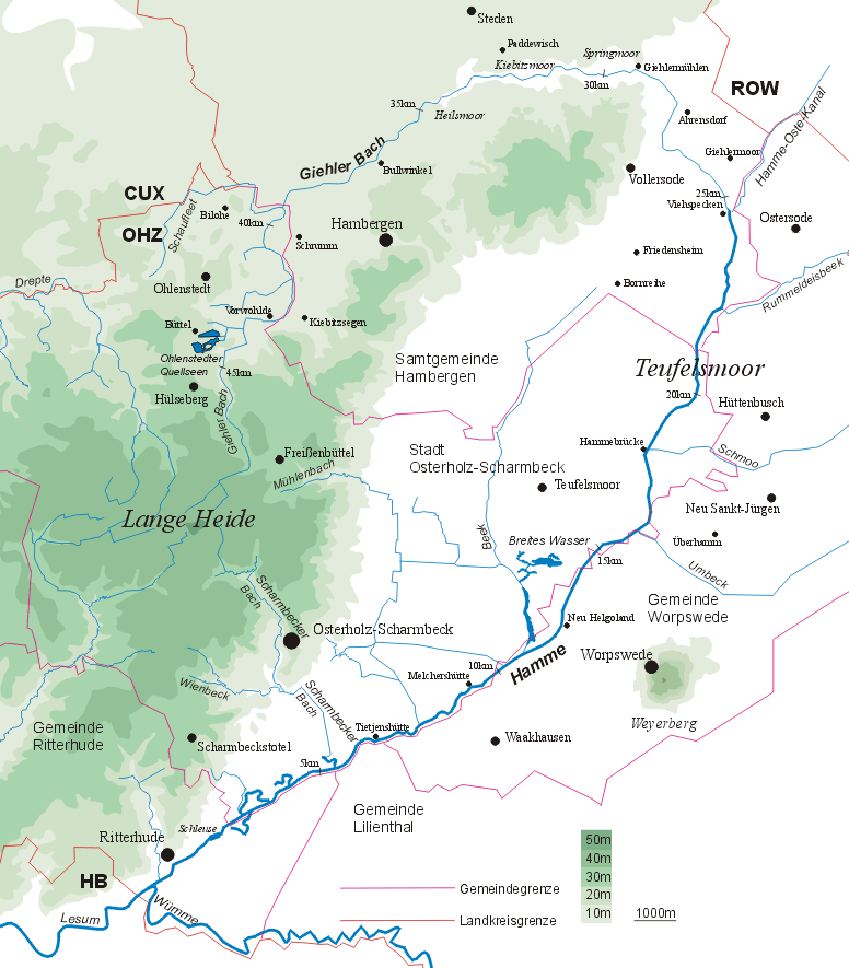
The Oste-Hamme Canal or Hamme-Oste Canal is a canal in north Germany, that links the rivers Oste and Hamme (river), Hamme. It runs from the Oste near Spreckens four kilometres above Bremervörde through the former Teufelsmoor ("Devil's Moor") and Gnarrenburg, until it reaches the Hamme near Viehspecken. The part of the canal near its mouth into the Hamme is also known as ''Kollbeck''. History The canal was built between 1769 and 1790 by Jürgen Christian Findorff and was used to drain the Teufelsmoor and to transport freight (mainly peat to Bremen and Hamburg) in small barges (''Bullen''). Its long construction time was due to the difficulties caused by the soft peat soil which repeatedly collapsed and meant that the channel had to be re-excavated. From the 1860s numerous flap gates (''Klappstaue'') and double sluice gates were installed, that made it easier for the Torfschiffswerft Schlussdorf#Turf boats, peat barges, such as those built in the yard in Schlussdorf. Significa ... [...More Info...] [...Related Items...] OR: [Wikipedia] [Google] [Baidu] |
Lower Saxony
Lower Saxony (german: Niedersachsen ; nds, Neddersassen; stq, Läichsaksen) is a German state (') in northwestern Germany. It is the second-largest state by land area, with , and fourth-largest in population (8 million in 2021) among the 16 ' federated as the Federal Republic of Germany. In rural areas, Northern Low Saxon and Saterland Frisian are still spoken, albeit in declining numbers. Lower Saxony borders on (from north and clockwise) the North Sea, the states of Schleswig-Holstein, Hamburg, , Brandenburg, Saxony-Anhalt, Thuringia, Hesse and North Rhine-Westphalia, and the Netherlands. Furthermore, the state of Bremen forms two enclaves within Lower Saxony, one being the city of Bremen, the other its seaport, Bremerhaven (which is a semi-enclave, as it has a coastline). Lower Saxony thus borders more neighbours than any other single '. The state's largest cities are state capital Hanover, Braunschweig (Brunswick), Lüneburg, Osnabrück, Oldenburg, Hildesheim, Salzgitt ... [...More Info...] [...Related Items...] OR: [Wikipedia] [Google] [Baidu] |
Teufelsmoor
The Teufelsmoor is a region of bog and moorland north of Bremen, Germany. It forms a large part of the district of Osterholz, and extends into the neighbouring districts of Rotenburg (Gnarrenburg municipality). Geography The depression is drained by the rivers Hamme, Wümme and Wörpe. The Teufelsmoor extends over an area of about and is bordered in the west by the Wesermünde Geest and in the east by the Zeven Geest. The eponymous Teufelsmoor itself is an ombrotrophic raised bog that becomes a fen in the vicinity of the streams that drain it. It is one of the largest contiguous areas of bog in northwest Germany. Its largest extent is about 20 by 20 km. The oldest parts of the terrain in Grasberg have layers of peat eleven metres deep or more. In the centre of the moor is the Worpswede artists' colony, made famous by many landscape artists, which is near the sandy hill of the Weyerberg. Also well-known is the 'moor metropolis' of Gnarrenburg in the heart of the ... [...More Info...] [...Related Items...] OR: [Wikipedia] [Google] [Baidu] |
Canals In Lower Saxony
Canals or artificial waterways are waterways or engineered channels built for drainage management (e.g. flood control and irrigation) or for conveyancing water transport vehicles (e.g. water taxi). They carry free, calm surface flow under atmospheric pressure, and can be thought of as artificial rivers. In most cases, a canal has a series of dams and locks that create reservoirs of low speed current flow. These reservoirs are referred to as ''slack water levels'', often just called ''levels''. A canal can be called a ''navigation canal'' when it parallels a natural river and shares part of the latter's discharges and drainage basin, and leverages its resources by building dams and locks to increase and lengthen its stretches of slack water levels while staying in its valley. A canal can cut across a drainage divide atop a ridge, generally requiring an external water source above the highest elevation. The best-known example of such a canal is the Panama Canal. Many ca ... [...More Info...] [...Related Items...] OR: [Wikipedia] [Google] [Baidu] |
Lesum Basin
The Lesum is a river in northern Germany, right tributary of the Weser, navigable for Class III ships. Bundesministerium für Verkehr und digitale Infrastruktur It is formed at the confluence of the rivers and , near , northwest of |
Oste Basin
Oste () is a river in northern Lower Saxony, Germany with a length of . It is a left tributary of the Elbe. The Oste flows through the districts of Harburg, Rotenburg, Stade and Cuxhaven and empties into the Elbe river near Otterndorf. Its drainage area is and the decline between the source and the estuary is . Tributaries are Ramme, Aue, Twiste, Bade, Bever and Mehe. The Oste is part of the Deutsche Fährstraße, an institution similar to the American National Scenic Byways. It connects various places between Bremervörde and Kiel with relation to the history of ferries and crossing of rivers, like the historic transporter bridges in Rendsburg and Osten. Also at the Oste there are two pram ferries in Gräpel and Brobergen. The ferry in Gräpel is actually manually operated. Although recognized as an official waterway the Oste does not have much shipping traffic. The river has its source near Tostedt at the border of the Lüneburg Heath, flowing to the west passing ... [...More Info...] [...Related Items...] OR: [Wikipedia] [Google] [Baidu] |
Weser
The Weser () is a river of Lower Saxony in north-west Germany. It begins at Hannoversch Münden through the confluence of the Werra and Fulda. It passes through the Hanseatic city of Bremen. Its mouth is further north against the ports of Bremerhaven and Nordenham. The latter is on the Butjadingen Peninsula. It then merges into the North Sea via two highly saline, estuarine mouths. It connects to the canal network running east-west across the North German Plain. The river, when combined with the Werra (a dialectal form of "Weser"), is long and thus, the longest river entirely situated within Germany (the Main, however, is the longest if the Weser and Werra are not combined). The Weser itself is long. The Werra rises in Thuringia, the German state south of the main projection (tongue) of Lower Saxony. Etymology "Weser" and "Werra" are the same words in different dialects. The difference reflects the old linguistic border between Central and Low German, passing through H ... [...More Info...] [...Related Items...] OR: [Wikipedia] [Google] [Baidu] |
Torfschiffswerft Schlussdorf
The Turf Shipyard (german: Torfschiffswerft) in , Lower Saxony, Germany, is a former boat builder's yard now used as an open-air museum. The yard, operating from 1850 to 1954, was specialised on barges to transport turf, that is dried peat used as fuel. In 1975 the (i.e. Schlussdorf Traditions Club) started to rescue the dilapidated shipyard buildings and reopened the site as a museum in 1977. The Turf Shipyard is about north of Worpswede's outskirts.Barbara Pannewick, „Worpswede, Heimat der Kunst“, in: ''Bremen: Entdeckerhandbuch für Stadt und Umland'', Sabine Gorsemann (ed.), (=Peter Meyer Reiseführer), Frankfurt am Main: Peter Meyer, 22005, pp. 171–177, here p. 176. . The Turf Shipyard is the only of its kind preserved in Northern Germany. As a museum it is undoubtedly in the front row of Worpswede's tourist sights.Michael Schön„Café im Torfschiffswerft-Museum: Kaffee und Kuchen sollen Besucher locken“ in: ''Wümme-Zeitung'', 11 March 2015, re ... [...More Info...] [...Related Items...] OR: [Wikipedia] [Google] [Baidu] |
Hamburg
(male), (female) en, Hamburger(s), Hamburgian(s) , timezone1 = Central (CET) , utc_offset1 = +1 , timezone1_DST = Central (CEST) , utc_offset1_DST = +2 , postal_code_type = Postal code(s) , postal_code = 20001–21149, 22001–22769 , area_code_type = Area code(s) , area_code = 040 , registration_plate = , blank_name_sec1 = GRP (nominal) , blank_info_sec1 = €123 billion (2019) , blank1_name_sec1 = GRP per capita , blank1_info_sec1 = €67,000 (2019) , blank1_name_sec2 = HDI (2018) , blank1_info_sec2 = 0.976 · 1st of 16 , iso_code = DE-HH , blank_name_sec2 = NUTS Region , blank_info_sec2 = DE6 , website = , footnotes ... [...More Info...] [...Related Items...] OR: [Wikipedia] [Google] [Baidu] |
Bremen
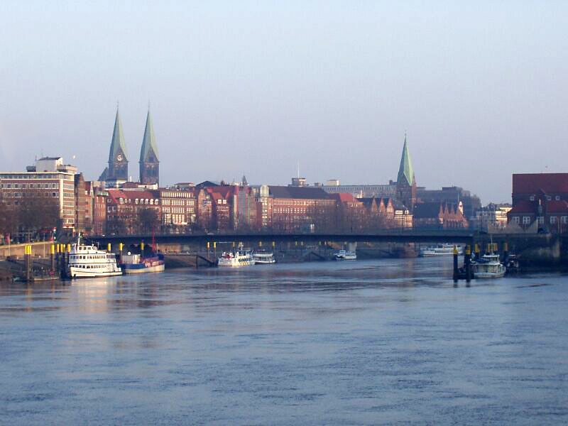
Bremen (Low German also: ''Breem'' or ''Bräm''), officially the City Municipality of Bremen (german: Stadtgemeinde Bremen, ), is the capital of the German state Free Hanseatic City of Bremen (''Freie Hansestadt Bremen''), a two-city-state consisting of the cities of Bremen and Bremerhaven. With about 570,000 inhabitants, the Hanseatic city is the 11th largest city of Germany and the second largest city in Northern Germany after Hamburg. Bremen is the largest city on the River Weser, the longest river flowing entirely in Germany, lying some upstream from its mouth into the North Sea, and is surrounded by the state of Lower Saxony. A commercial and industrial city, Bremen is, together with Oldenburg and Bremerhaven, part of the Bremen/Oldenburg Metropolitan Region, with 2.5 million people. Bremen is contiguous with the Lower Saxon towns of Delmenhorst, Stuhr, Achim, Weyhe, Schwanewede and Lilienthal. There is an exclave of Bremen in Bremerhaven, the "Citybremian Overseas Port ... [...More Info...] [...Related Items...] OR: [Wikipedia] [Google] [Baidu] |
Peat
Peat (), also known as turf (), is an accumulation of partially decayed vegetation or organic matter. It is unique to natural areas called peatlands, bogs, mires, moors, or muskegs. The peatland ecosystem covers and is the most efficient carbon sink on the planet, because peatland plants capture carbon dioxide (CO2) naturally released from the peat, maintaining an equilibrium. In natural peatlands, the "annual rate of biomass production is greater than the rate of decomposition", but it takes "thousands of years for peatlands to develop the deposits of , which is the average depth of the boreal orthernpeatlands", which store around 415 gigatonnes (Gt) of carbon (about 46 times 2019 global CO2 emissions). Globally, peat stores up to 550 Gt of carbon, 42% of all soil carbon, which exceeds the carbon stored in all other vegetation types, including the world's forests, although it covers just 3% of the land's surface. ''Sphagnum'' moss, also called peat moss, is one of th ... [...More Info...] [...Related Items...] OR: [Wikipedia] [Google] [Baidu] |
Jürgen Christian Findorff
Jürgen or Jurgen is a popular masculine given name in Germany, Estonia, Belgium and the Netherlands. It is cognate with George. Notable people named Jürgen include: A *Jürgen Ahrend (born 1930), German organ builder * Jürgen Alzen (born 1962), German race car driver * Jürgen Arndt, East German rower * Jürgen Aschoff (1913–1998), German physician and biologist B *Jürgen Barth (born 1947), German engineer and racecar driver *Jürgen Bartsch (1946–1976), German serial killer *Jürgen von Beckerath (1920–2016), German Egyptologist *Jürgen Berghahn (born 1960), German politician * Jürgen Bertow (born 1950), East German rower *Jürgen Blin (born 1943), West German boxer * Jürgen Bogs (born 1947), German football manager *Jürgen Brähmer (born 1978), German boxer * Jürgen Bräuninger, South African composer and professor * Jürgen Budday (born 1948), German conductor C * Jürgen Cain Külbel (born 1956), German journalist and investigator * Jürgen Chrobog (bor ... [...More Info...] [...Related Items...] OR: [Wikipedia] [Google] [Baidu] |


.jpg)