|
Oslo Lysverker
E-CO Energi is a Norwegian power company and after Statkraft the second largest producer of electricity in Norway. Structure E-CO is wholly owned by the City of Oslo. Operations are divided into E-CO Vannkraft, E-CO Norne and Oslo Lysverker. E-CO also holds partial ownership of Oppland Energi, Opplandskraft, Øvre Otta, Vinstra Kraftselskap, Embretsfosskraftverkene and Norsk Grønnkraft. Total annual production is 9.7 TWh. E-CO has its own production plants in Aurland, Hallingdal and Nedre Glomma. Partially owned plants are located throughout Southern Norway, with main focus on Oppland, Hedmark and Buskerud. All in all E-CO owns, operates wholly and partially, more than 70 hydroelectric power plants, including the third largest in Norway, Aurland 1. E-CO is also the largest owner of the Øvre Otta construction, that is one of the most extensive in Norway in later years. History Christiania Elektricitetesværk was founded in 1892, with Hammeren power plant in Maridalen in O ... [...More Info...] [...Related Items...] OR: [Wikipedia] [Google] [Baidu] |
Government-owned Corporation
A state-owned enterprise (SOE) is a government entity which is established or nationalised by the ''national government'' or ''provincial government'' by an executive order or an act of legislation in order to earn profit for the government, control monopoly of the private sector entities, provide products and services to citizens at a lower price and for the achievement of overall financial goals & developmental objectives in a particular country. The national government or provincial government has majority ownership over these ''state owned enterprises''. These ''state owned enterprises'' are also known as public sector undertakings in some countries. Defining characteristics of SOEs are their distinct legal form and possession of financial goals & developmental objectives (e.g., a state railway company may aim to make transportation more accessible and earn profit for the government), SOEs are government entities established to pursue financial objectives and devel ... [...More Info...] [...Related Items...] OR: [Wikipedia] [Google] [Baidu] |
Maridalen
Maridalen is a valley situated just north of Oslo, Norway, just above the suburb of Kjelsås. Considering that Maridalen is within the Oslo city limits, Maridalen has a very low population density. The valley consists of forests, lakes and agricultural land. Most of the valley is made up of the lake Maridalsvannet, which serves as the primary source of drinking water for 90% of Oslo's population. The only hydroelectric powerplant within the City of Oslo, Hammeren Hydroelectric Power Station is located at Brekke in Maridalen. The valley is a popular recreational area with many hiking trails and cycling tracks for summer usage, and groomed cross-country trails in winter. Both the lake and valley are protected. Maridalen Church and the church ruins of the ancient St. Margaret's Church are located north of Maridalsvannet. A bus route runs along Maridalen, starting at Nydalen Subway Station. [...More Info...] [...Related Items...] OR: [Wikipedia] [Google] [Baidu] |
Hammeren Power Plant
Hammeren (also Hammerknuden; meaning, "hammerhead-shaped crag of granite") is a protected area and promontory in Denmark on the northernmost point of Bornholm island. It projects into Sæne Bugt bay in the Baltic Sea. The area includes Hammersø, the largest lake on the island and the only tarn in Denmark, and a hill, in height, named Stejlebjerg (or Stieleberg). It is steep to the southwest but slopes gradually to the northeast, and is separated from the rest of the land by a valley. Geography Bornholm has varied natural features, such as Almindingen, Jons Kapel, Paradisbakkerne, Rytterknægten, and Dueodde. Hammeren has cliffs towering from the Baltic Sea and a rift valley separating it from the surroundings. It covers a rocky area of granite formations (considered one of the best examples of the kind) extending over and including a number of caves. The area, which was once covered with heather and bracken, was laid bare by heavy grazing. Hammeren features a large lake, ... [...More Info...] [...Related Items...] OR: [Wikipedia] [Google] [Baidu] |
Aurland 1
Aurland () is a municipality in the county of Vestland, Norway. It is located on the south side of the Sognefjorden in the traditional district of Sogn. The administrative center is the village of Aurlandsvangen. Other villages include Bakka, Flåm, Undredal, and Gudvangen. The municipality is the 60th largest by area out of the 356 municipalities in Norway. Aurland is the 293rd most populous municipality in Norway with a population of 1,766. The municipality's population density is and its population has increased by 3.2% over the previous 10-year period. In 2016, the chief of police for Vestlandet formally suggested a reconfiguration of police districts and stations. He proposed that the police station in Aurland be closed. General information Aurland was established as a municipality on 1 January 1838 (see formannskapsdistrikt law). The original municipality was identical to the Aurland parish ''(prestegjeld)'' with the sub-parishes () of Aurlandsvangen, Flåm, and Un ... [...More Info...] [...Related Items...] OR: [Wikipedia] [Google] [Baidu] |
Hydroelectricity
Hydroelectricity, or hydroelectric power, is Electricity generation, electricity generated from hydropower (water power). Hydropower supplies one sixth of the world's electricity, almost 4500 TWh in 2020, which is more than all other Renewable energy, renewable sources combined and also more than nuclear power. Hydropower can provide large amounts of Low-carbon power, low-carbon electricity on demand, making it a key element for creating secure and clean electricity supply systems. A hydroelectric power station that has a dam and reservoir is a flexible source, since the amount of electricity produced can be increased or decreased in seconds or minutes in response to varying electricity demand. Once a hydroelectric complex is constructed, it produces no direct waste, and almost always emits considerably less greenhouse gas than fossil fuel-powered energy plants. [...More Info...] [...Related Items...] OR: [Wikipedia] [Google] [Baidu] |
Buskerud
Buskerud () is a former county and a current electoral district in Norway, bordering Akershus, Oslo, Oppland, Sogn og Fjordane, Hordaland, Telemark and Vestfold. The region extends from the Oslofjord and Drammensfjorden in the southeast to Hardangervidda mountain range in the northwest. The county administration was in modern times located in Drammen. Buskerud was merged with Akershus and Østfold into the newly created Viken County on 1 January 2020. On the 23 February 2022 Viken County Council voted in a 49 against 38 decision to submit an application to the Norwegian government for a county demerger. Etymology The county was named after the old manor Buskerud ( non, Biskupsruð) (Biskopsrøysa) located on the west side of the Drammen River in Åmot, Modum municipality. The first element is the genitive case of ', 'bishop' (referring to the Bishop of Hamar), the last element is ' n 'clearing, farm'. The farm was one of the largest in Buskerud, and the original name of the farm ... [...More Info...] [...Related Items...] OR: [Wikipedia] [Google] [Baidu] |
Hedmark
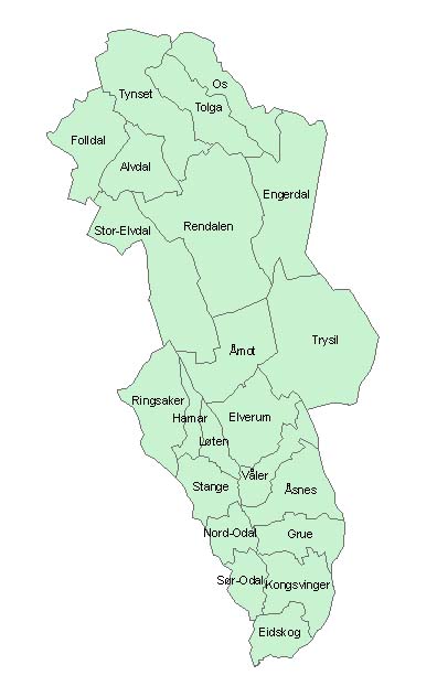
Hedmark () was a county in Norway before 1 January 2020, bordering Trøndelag to the north, Oppland to the west, Akershus to the south, and Sweden to the east. The county administration is in Hamar. Hedmark and Oppland counties were merged into Innlandet county on 1 January 2020, when Norway's former 19 counties became 10 bigger counties / regions Hedmark made up the northeastern part of Østlandet, the southeastern part of the country. It had a long border with Sweden to the east (Dalarna County and Värmland County). The largest lakes were Femunden and Mjøsa, the largest lake in Norway. Parts of Glomma, Norway's longest river, flowed through Hedmark. Geographically, Hedmark was traditionally divided into: Hedemarken (east of the lake Mjøsa), Østerdalen ("East Valley" north of the town Elverum), and Solør / Glåmdalen (south of Elverum) and Odal in the very south. Hedmark and Oppland were the only Norwegian counties with no coastline. Hedmark also hosted some event ... [...More Info...] [...Related Items...] OR: [Wikipedia] [Google] [Baidu] |
Oppland
Oppland is a former county in Norway which existed from 1781 until its dissolution on 1 January 2020. The old Oppland county bordered the counties of Trøndelag, Møre og Romsdal, Sogn og Fjordane, Buskerud, Akershus, Oslo and Hedmark. The county administration was located in the town of Lillehammer. Merger On 1 January 2020, the neighboring counties of Oppland and Hedmark were merged to form the new Innlandet county. Both Oppland and Hedmark were the only landlocked counties of Norway, and the new Innlandet county is the only landlocked county in Norway. The two counties had historically been one county that was divided in 1781. Historically, the region was commonly known as "Opplandene". In 1781, the government split the area into two: Hedemarkens amt and Kristians amt (later renamed Hedmark and Oppland. In 2017, the government approved the merger of the two counties. There were several names debated, but the government settled on ''Innlandet''. Geography Oppland extend ... [...More Info...] [...Related Items...] OR: [Wikipedia] [Google] [Baidu] |
Southern Norway
Southern Norway ( no, Sørlandet; lit. "The Southland") is the geographical region (''landsdel'') along the Skagerrak coast of southern Norway. The region is an informal description since it does not have any governmental function. It roughly corresponds to the old petty kingdom of Agder as well as the two former counties of Vest-Agder and Aust-Agder. From New Year 2020, the two counties have been merged into one county, Agder. The total combined area of Vest-Agder and Aust-Agder counties is . The name is relatively new, having first been used in Norway around 1900. The region includes coastal areas along the Skagerrak and extends inland to the Setesdalsheiene mountains. There are many large valleys running from the mountains to the south and east to the sea. The highest point in the region is Sæbyggjenuten at . Etymology ''Sørlandet'' refers to the region along the Skaggerak in southeastern Norway. This name should not be confused with the Norwegian term ''Sør-Norg ... [...More Info...] [...Related Items...] OR: [Wikipedia] [Google] [Baidu] |
Glomma
The Glomma, or Glåma, is Norway's longest and most voluminous river. With a total length of , it has a drainage basin that covers fully 13% of Norway's surface area, all in the southern part of the country. Geography At its fullest length, the river runs from the lake Aursund near Røros in Trøndelag and runs into the Oslofjord at Fredrikstad. Major tributaries include the Vorma River, which drains Lake Mjøsa, joining the Glomma River at Årnes in Nes. The Lågen drains into Lake Mjøsa, collecting drainage from the large Gudbrandsdalen and significantly increasing the Glomma's flow. Because it flows through some of the richest forest districts, it has historically been Norway's leading log-floating river. The combination of raw materials, water power, and easy transport has over the centuries encouraged industry along the Glomma. Some of the country's largest manufacturing and processing concerns are found around its mouth, where supplies of timber and hydropower have been ... [...More Info...] [...Related Items...] OR: [Wikipedia] [Google] [Baidu] |
Hallingdal
Hallingdal ( en, Halling Valley) is a valley as well as a traditional district located in the traditional and electoral district Buskerud in Viken county in Norway. It consists of six municipalities: Flå, Nes, Gol, Hemsedal, Ål and Hol. Hallingdal is one of the major valleys of eastern Norway, on an area of 5,830 square kilometers. Hallingdal lies in the northern part of the county of Buskerud. The valley stretches from Gulsvik by Lake Krøderen to the border with Hordaland and Sogn og Fjordane. Central to the geography is relatively flat mountain area which lies above sea level. The valley is V-shaped and is drained by the Hallingdal River which originates in the western parts of Hardangervidda and flows eastwards later southwards through Hallingdal. Etymology The Old Norse form of the name was ''Haddingjadalr''. The first recorded case beginning with ''Hall-'' is from 1443. The first element seems to be the genitive case of the name of the people ''Haddingjar'' or of th ... [...More Info...] [...Related Items...] OR: [Wikipedia] [Google] [Baidu] |


