|
Opuwo Airport
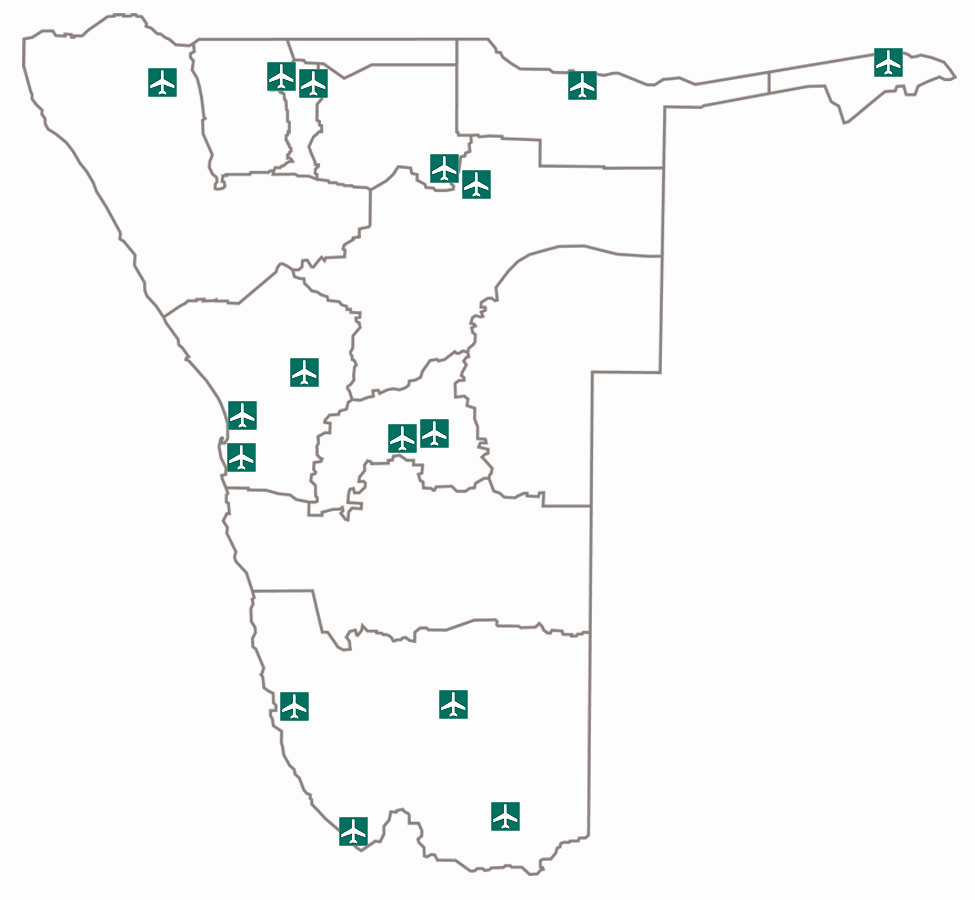
Opuwo Airport is an airport serving Opuwo, Namibia. The Opuwa non-directional beacon (Ident: OP) is located west of Rwy 03/21 mid-field. See also * * *List of airports in Namibia *Transport in Namibia This article deals with the system of transport in Namibia, both public and private. General History The beginnings of organised travel and transport routes in the territory of South West Africa, today Namibia, have not yet been established. This ... References External links OurAirports - FYOPOpenStreetMap - Opuwo* Google Earth Airports in Namibia {{Namibia-airport-stub ... [...More Info...] [...Related Items...] OR: [Wikipedia] [Google] [Baidu] |
Opuwo
Opuwo is the capital of the Kunene Region in north-western Namibia. The town is situated about 720 km north-northwest from the capital Windhoek, and has a population of 20,000. It is the commercial hub of the Kunene Region. Economy and infrastructure Opuwo is situated at the intersection of the C41 and C43. There is a small airfield in town, Opuwo Airport. Putuavanga Senior Secondary School in town is among the best government schools in Kunene Region. There is also the ''Opuwo Primary School'' 39 teachers and 1,200 learners. There are the following organizations and offices in the town: Opuwo Police Station, Opuwo District Hospital, Ministry of Home Affairs (Department of Civic Affairs / Regional Civic Registration Office / Kunene Region) and Opuwo Department of Works. There is a Christian church. Politics Opuwo is governed by a town council that has seven seats. The 2015 local authority election was narrowly won by the SWAPO party, which gained four seats (1,593 v ... [...More Info...] [...Related Items...] OR: [Wikipedia] [Google] [Baidu] |
Namibia
Namibia (, ), officially the Republic of Namibia, is a country in Southern Africa. Its western border is the Atlantic Ocean. It shares land borders with Zambia and Angola to the north, Botswana to the east and South Africa to the south and east. Although Kazungula, it does not border Zimbabwe, less than 200 metres (660 feet) of the Botswanan right bank of the Zambezi, Zambezi River separates the two countries. Namibia gained independence from South Africa on 21 March 1990, following the Namibian War of Independence. Its capital and largest city is Windhoek. Namibia is a member state of the United Nations (UN), the Southern African Development Community (SADC), the African Union (AU) and the Commonwealth of Nations. The driest country in sub-Saharan Africa, Namibia has been inhabited since pre-historic times by the San people, San, Damara people, Damara and Nama people. Around the 14th century, immigration, immigrating Bantu peoples arrived as part of the Bantu expansion. Since ... [...More Info...] [...Related Items...] OR: [Wikipedia] [Google] [Baidu] |
Non-directional Beacon
A non-directional beacon (NDB) or non-directional radio beacon is a radio beacon which does not include directional information. Radio beacons are radio transmitters at a known location, used as an aviation or marine navigational aid. NDB are in contrast to directional radio beacons and other navigational aids, such as low-frequency radio range, VHF omnidirectional range (VOR) and tactical air navigation system (TACAN). NDB signals follow the curvature of the Earth, so they can be received at much greater distances at lower altitudes, a major advantage over VOR. However, NDB signals are also affected more by atmospheric conditions, mountainous terrain, coastal refraction and electrical storms, particularly at long range. The system, developed by United States Air Force (USAF) Captain Albert Francis Hegenberger, was used to fly the world's first instrument approach on May 9, 1932. Types of NDBs NDBs used for aviation are standardised by International Civil Aviation Organizat ... [...More Info...] [...Related Items...] OR: [Wikipedia] [Google] [Baidu] |
List Of Airports In Namibia ...
This is a list of airports in Namibia, sorted by location. List of airports Airport names shown in bold indicate the airport has scheduled service on commercial airlines. See also * Transport in Namibia * List of airports by ICAO code: F#FY – Namibia * Wikipedia: WikiProject Aviation/Airline destination lists: Africa#Namibia References * * External links Namibia Airports CompanyGreat Circle Mapper {{Africa in topic, List of airports in Namibia Airports Airports Namibia Namibia (, ), officially the Republic of Namibia, is a country in Southern Africa. Its western border is the Atlantic Ocean. It shares land borders with Zambia and Angola to the north, Botswana to the east and South Africa to the south and ea ... [...More Info...] [...Related Items...] OR: [Wikipedia] [Google] [Baidu] |
Transport In Namibia
This article deals with the system of transport in Namibia, both public and private. General History The beginnings of organised travel and transport routes in the territory of South West Africa, today Namibia, have not yet been established. This is due to the lack of any written records relating to roads prior to the twilight of the 19th century. Archaeological work has dated one stretch of road in the south-western Brandberg Massif to 1250 AD. Although no other such early examples have been found, it is certain that this road was not the only one of its kind. The first permanent road, established for ox wagons, was built at the initiative of Heinrich Schmelen, Rhenish missionary in Bethanie in the early 19th century. It led from Bethanie to Angra Pequeña, today the town of Lüderitz, and was intended to serve the natural harbour there in order to become independent of the Cape Colony. Road Namibia's road network is regarded as one of the best on the continent; road con ... [...More Info...] [...Related Items...] OR: [Wikipedia] [Google] [Baidu] |


