|
Omolon (rural Locality)
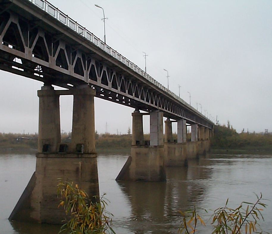
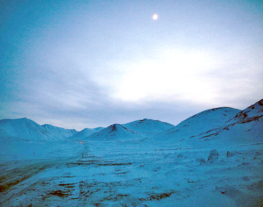
Omolon (russian: Омолон) is a rural locality (a '' selo'') in Bilibinsky District of Chukotka Autonomous Okrug, Russia. It is situated in the far southwest of the district near the border with Magadan Oblast. Population: Municipally, Omolon is subordinated to Bilibinsky Municipal District and is incorporated as Omolon Rural Settlement. History Omolon was the headquarters for the sovkhoz (state farm) ''Omolon'' until 1992The Obshchina in Chukotka - Land Property and Local Autonomy , Gray P.A. (2001), Max Planck Institute for Social Anthropology. p.11 Prior to 1992, the Sovkhoz had 15 separate herds of reindeer under its control. From 1992 onwards, the Sovkhoz structure was dismantled bit by bit in line with the wider course of Russian privatisation. [...More Info...] [...Related Items...] OR: [Wikipedia] [Google] [Baidu] |
Chukotka Autonomous Okrug
Chukotka (russian: Чуко́тка), officially the Chukotka Autonomous Okrug,, ''Čukotkakèn avtonomnykèn okrug'', is the easternmost federal subjects of Russia, federal subject of Russia. It is an autonomous okrug situated in the Russian Far East, and shares a border with the Sakha, Sakha Republic to the west, Magadan Oblast to the south-west, and Kamchatka Krai to the south. Anadyr (town), Anadyr is the largest types of inhabited localities in Russia, town and the administrative center, capital, and the easternmost settlement to have town status in Russia. Chukotka is primarily populated by ethnic Russians, Chukchi people, Chukchi, and other Indigenous peoples of Siberia, indigenous peoples. It is the only autonomous okrug in Russia that is not included in, or subordinate to, another federal subject, having separated from Magadan Oblast in 1992. It is home to Lake Elgygytgyn, an impact crater lake, and Anyuyskiy, an extinct volcano. The village of Uelen is the easternmos ... [...More Info...] [...Related Items...] OR: [Wikipedia] [Google] [Baidu] |
Chukchi People
The Chukchi, or Chukchee ( ckt, Ԓыгъоравэтԓьэт, О'равэтԓьэт, ''Ḷygʺoravètḷʹèt, O'ravètḷʹèt''), are a Siberian indigenous people native to the Chukchi Peninsula, the shores of the Chukchi Sea and the Bering Sea region of the Arctic Ocean all within modern Russia. They speak the Chukchi language. The Chukchi originated from the people living around the Okhotsk Sea. According to several studies on genomic research conduct from 2014 to 2018, the Chukchi are one of the Indigenous peoples of Siberia, they are also the closest Asiatic relatives of the indigenous peoples of the Americas as well as of the Ainu people and other East Asian people, being the descendants of settlers who did not cross the Bering Strait or settled the Japanese archipelago. Cultural history The majority of Chukchi reside within Chukotka Autonomous Okrug, but some also reside in the neighboring Sakha Republic to the west, Magadan Oblast to the southwest, and Kamchatka K ... [...More Info...] [...Related Items...] OR: [Wikipedia] [Google] [Baidu] |
Köppen Climate Classification
The Köppen climate classification is one of the most widely used climate classification systems. It was first published by German-Russian climatologist Wladimir Köppen (1846–1940) in 1884, with several later modifications by Köppen, notably in 1918 and 1936. Later, the climatologist Rudolf Geiger (1894–1981) introduced some changes to the classification system, which is thus sometimes called the Köppen–Geiger climate classification system. The Köppen climate classification divides climates into five main climate groups, with each group being divided based on seasonal precipitation and temperature patterns. The five main groups are ''A'' (tropical), ''B'' (arid), ''C'' (temperate), ''D'' (continental), and ''E'' (polar). Each group and subgroup is represented by a letter. All climates are assigned a main group (the first letter). All climates except for those in the ''E'' group are assigned a seasonal precipitation subgroup (the second letter). For example, ''Af'' indi ... [...More Info...] [...Related Items...] OR: [Wikipedia] [Google] [Baidu] |
Subarctic Climate
The subarctic climate (also called subpolar climate, or boreal climate) is a climate with long, cold (often very cold) winters, and short, warm to cool summers. It is found on large landmasses, often away from the moderating effects of an ocean, generally at latitudes from 50° to 70°N, poleward of the humid continental climates. Subarctic or boreal climates are the source regions for the cold air that affects temperate latitudes to the south in winter. These climates represent Köppen climate classification ''Dfc'', ''Dwc'', ''Dsc'', ''Dfd'', ''Dwd'' and ''Dsd''. Description This type of climate offers some of the most extreme seasonal temperature variations found on the planet: in winter, temperatures can drop to below and in summer, the temperature may exceed . However, the summers are short; no more than three months of the year (but at least one month) must have a 24-hour average temperature of at least to fall into this category of climate, and the coldest month should ave ... [...More Info...] [...Related Items...] OR: [Wikipedia] [Google] [Baidu] |
Omolon Airport
Omolon Airport is a minor airport built 1 km north of Omolon in Chukotka Autonomous Okrug, Russia Russia (, , ), or the Russian Federation, is a List of transcontinental countries, transcontinental country spanning Eastern Europe and North Asia, Northern Asia. It is the List of countries and dependencies by area, largest country in the .... Airlines and destinations References Airports in Chukotka Autonomous Okrug {{Russia-airport-stub ... [...More Info...] [...Related Items...] OR: [Wikipedia] [Google] [Baidu] |
Airport Omolon
An airport is an aerodrome with extended facilities, mostly for commercial air transport. Airports usually consists of a landing area, which comprises an aerially accessible open space including at least one operationally active surface such as a runway for a plane to take off and to land or a helipad, and often includes adjacent utility buildings such as control towers, hangars and terminals, to maintain and monitor aircraft. Larger airports may have airport aprons, taxiway bridges, air traffic control centres, passenger facilities such as restaurants and lounges, and emergency services. In some countries, the US in particular, airports also typically have one or more fixed-base operators, serving general aviation. Operating airports is extremely complicated, with a complex system of aircraft support services, passenger services, and aircraft control services contained within the operation. Thus airports can be major employers, as well as important hubs for tourism and ... [...More Info...] [...Related Items...] OR: [Wikipedia] [Google] [Baidu] |
Magadan
Magadan ( rus, Магадан, p=məɡɐˈdan) is a port town and the administrative center of Magadan Oblast, Russia, located on the Sea of Okhotsk in Nagayev Bay (within Taui Bay) and serving as a gateway to the Kolyma region. History Magadan was founded in 1930 in the Ola (river) valley,Vazhenin, p. 4 near the settlement of Nagayevo. During the Stalin era, Magadan was a major transit center for political prisoners sent to forced labour camps. From 1932 to 1953, it was the administrative centre of the Dalstroy organisation—a vast forced-labour gold-mining operation and forced-labour camp system. The first director of Dalstroy was Eduard Berzin, who between 1932 and 1937 established the infrastructure of the forced labour camps in Magadan. Berzin was executed in 1938 by Stalin, towards the end of the Great Purge. The town later served as a port for exporting gold and other metals mined in the Kolyma region. Its size and population grew quickly as facilities were ra ... [...More Info...] [...Related Items...] OR: [Wikipedia] [Google] [Baidu] |
R504 Kolyma Highway
The R504 Kolyma Highway (russian: Федеральная автомобильная дорога «Колыма», ''Federal'naya Avtomobil'naya Doroga «Kolyma»,'' "Federal Automobile Highway 'Kolyma'"), part of the M56 route, is a road through the Russian Far East. It connects Magadan with the town of Nizhny Bestyakh, located on the eastern bank of Lena River, opposite of Yakutsk. At Nizhny Bestyakh the Kolyma Highway connects to the Lena Highway. The Kolyma Highway is colloquially known as the Road of Bones (Russian: Дорога Костей, transliteration: ''Doróga Kostyéy''), in reference to the hundreds of thousands of forced laborers who were interred in the pavement after dying during its construction. Locally, the road is known as the Kolyma Route (Russian: Колымская трасса, transliteration: ''Kolýmskaya trássa''). History The Dalstroy construction directorate built the Kolyma Highway during the Soviet Union's Stalinist era. Inmates of the ... [...More Info...] [...Related Items...] OR: [Wikipedia] [Google] [Baidu] |
Anadyr Highway
The Anadyr Highway is a highway on the territory of Magadan Oblast and the Chukotka Autonomous Okrug from the R504 Kolyma Highway to the city of Anadyr with branches to Bilibino, Komsomolsky and Egvekinot. In the Magadan Region it is numbered 44H-3; in Chukotka the existing segments have the number 77K-022. The new highway will ensure the year-round connection of the Chukotka Autonomous District with the rest of Russia. Construction of the road in the Chukotka Autonomous District began in 2012. Construction in the Magadan Region began in 2015. Route The route starts from the R504 Kolyma Highway, revitalizing the old road to Omsukchan, then passes through Omolon, Ilirney, Palyavaam, then along the existing extended winter road to Valunistoye mine, where it turns south towards Anadyr. The total length is about , of which pass through the Magadan Region, and about through Chukotka. Features The road has the lowest technical category, without asphalt. The roadway will be tr ... [...More Info...] [...Related Items...] OR: [Wikipedia] [Google] [Baidu] |
Kupol Gold Mine
Kupol Gold Mine is a combination underground and open pit gold and silver mine located in the Bilibinsky District of the Chukotka Autonomous Okrug of Russia, at the eastern end of the Anyuy Range. The mine, which produces gold and silver doré bars, is 100% owned by Toronto based Kinross Gold. The name Kupol (russian: купол), literally means "dome". History Development of the mine began in 2005 on a property owned by the Bema Gold Corporation. Bema Gold financed construction through a series of loans totaling $425 million. Bayerische Hypo und Vereinsbank and Société Générale provided $250 million, and $150 million was provided by an international consortium made up of Caterpillar, Export Development Canada, International Finance Corporation, and others. Bema Gold's corporate office loaned the remaining $25 million. In addition to the loans, the government of Chukotka Autonomous Okrug provided an additional $18 million to support construction. In 2007, Kinross purchased ... [...More Info...] [...Related Items...] OR: [Wikipedia] [Google] [Baidu] |
Ukrainian People
Ukrainians ( uk, Українці, Ukraintsi, ) are an East Slavic ethnic group native to Ukraine. They are the seventh-largest nation in Europe. The native language of the Ukrainians is Ukrainian. The majority of Ukrainians are Eastern Orthodox Christians. While under the Polish–Lithuanian Commonwealth, the Austrian Empire, and then Austria-Hungary, the East Slavic population who lived in the territories of modern-day Ukraine were historically known as Ruthenians, referring to the territory of Ruthenia, and to distinguish them with the Ukrainians living under the Russian Empire, who were known as Little Russians, named after the territory of Little Russia. Cossack heritage is especially emphasized, for example in the Ukrainian national anthem. Ethnonym The ethnonym ''Ukrainians'' came into wide use only in the 20th century after the territory of Ukraine obtained distinctive statehood in 1917. From the 14th to the 16th centuries the western portions of the European part ... [...More Info...] [...Related Items...] OR: [Wikipedia] [Google] [Baidu] |
Russian People
, native_name_lang = ru , image = , caption = , population = , popplace = 118 million Russians in the Russian Federation (2002 ''Winkler Prins'' estimate) , region1 = , pop1 = approx. 7,500,000 (including Russian Jews and Russian Germans) , ref1 = , region2 = , pop2 = 7,170,000 (2018) ''including Crimea'' , ref2 = , region3 = , pop3 = 3,512,925 (2020) , ref3 = , region4 = , pop4 = 3,072,756 (2009)(including Russian Jews and Russian Germans) , ref4 = , region5 = , pop5 = 1,800,000 (2010)(Russian ancestry and Russian Germans and Jews) , ref5 = 35,000 (2018)(born in Russia) , region6 = , pop6 = 938,500 (2011)(including Russian Jews) , ref6 = , region7 = , pop7 = 809,530 (2019) , ref7 ... [...More Info...] [...Related Items...] OR: [Wikipedia] [Google] [Baidu] |


